Genealogy research by Mark Humphrys.
Genealogy research by Mark Humphrys.
|
Proof that the Flanagan farm is plot 15
|
The Flanagan farm - Valuation Lists
The Flanagan farm - The site today Other properties in Greenhills
|
The Flanagan farm at Green Hills, Kilnamanagh.
His son
William Flanagan
inherited the farm.
[Deed, 1825]
is about the family property in Kilnamanagh.
It refers to
[Deed, 1803].
[Deed, 1825]
says the
William Flanagan property in Kilnamanagh
is
bounded on N and E by the property of "Michael Flanagan"
(would be William's brother).
It is bounded on S and W by the property of Patrick Reynolds.
William Flanagan
is listed here
with a farm of 21 acres
in
[Tithe Survey, 1826].
He
is listed here
with a farm of 15 acres (with a modest house)
in [Griffiths Valuation, 1847]
and later.
The plot is always listed as 15 acres in size in the
Valuation Lists, 1855 to 1952.
William Flanagan
died 1874.
His son
William Flanagan the younger
apparently
inherited the Greenhills farm.
He died 1886.
Alderman Michael Flanagan
inherited the Greenhills farm.
Alderman Michael Flanagan
still held it
at his death in 1931.
Valuation Lists
show it as still 15 acres.
The
[VO]
records say the house was
in ruins in 1939.
Kavanagh took over the farm from the Flanagan family in 1940.
Liam Cosgrave
and
Deirdre and Finola Flanagan
saw the house in the 1940s-50s
and do not remember it in ruins.
Perhaps Kavanagh did it up again.
The old maps clearly show that the Flanagan house was at the roadside.
The farm stretched behind it, down in a valley, down the slope off the
E side of the Greenhills Road.
The Flanagan house was modest, much smaller than its two neighbours to the N and S.
The house was "beautifully thatched"
[Frank Flanagan's memoirs].
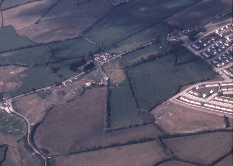
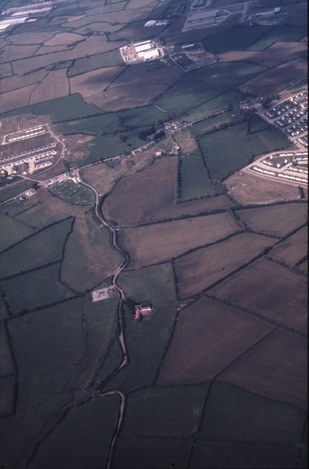
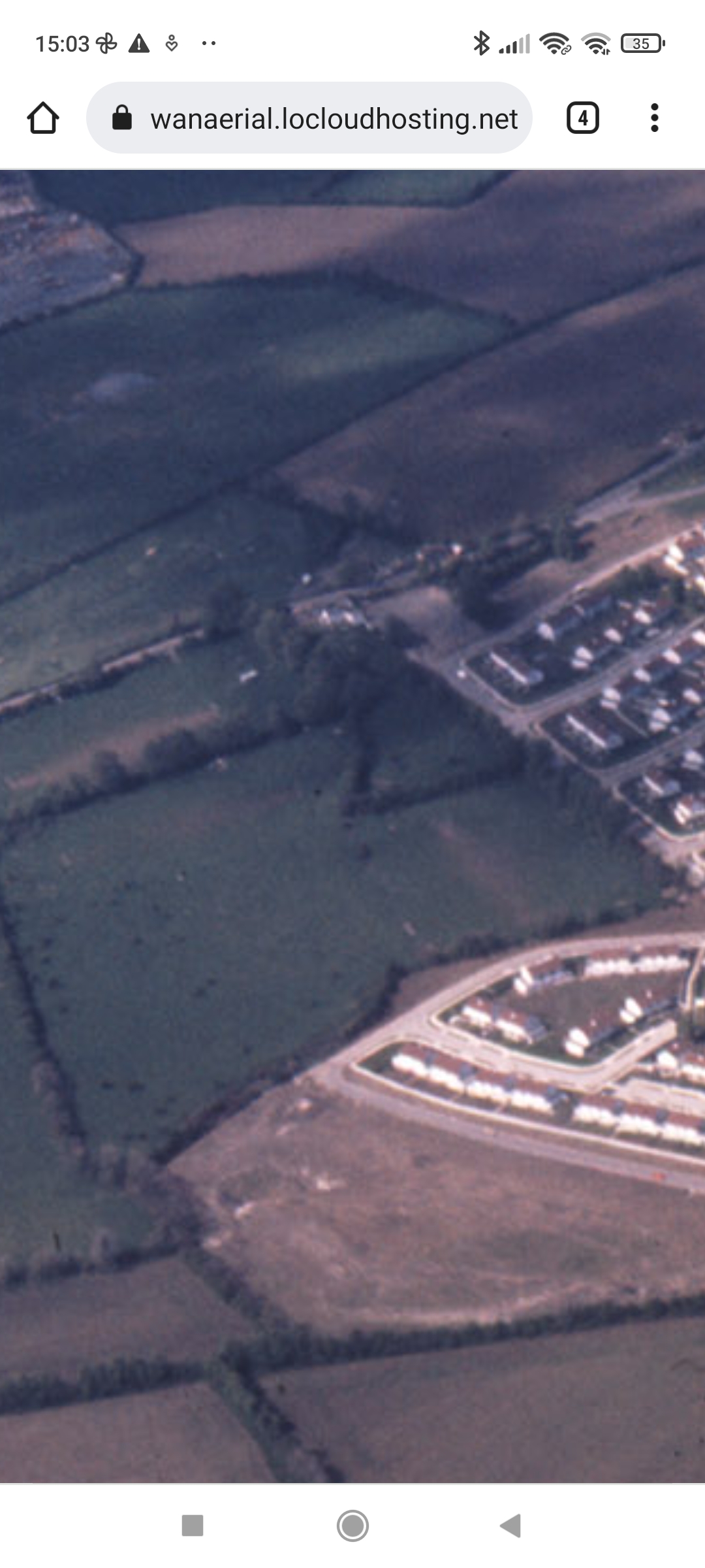
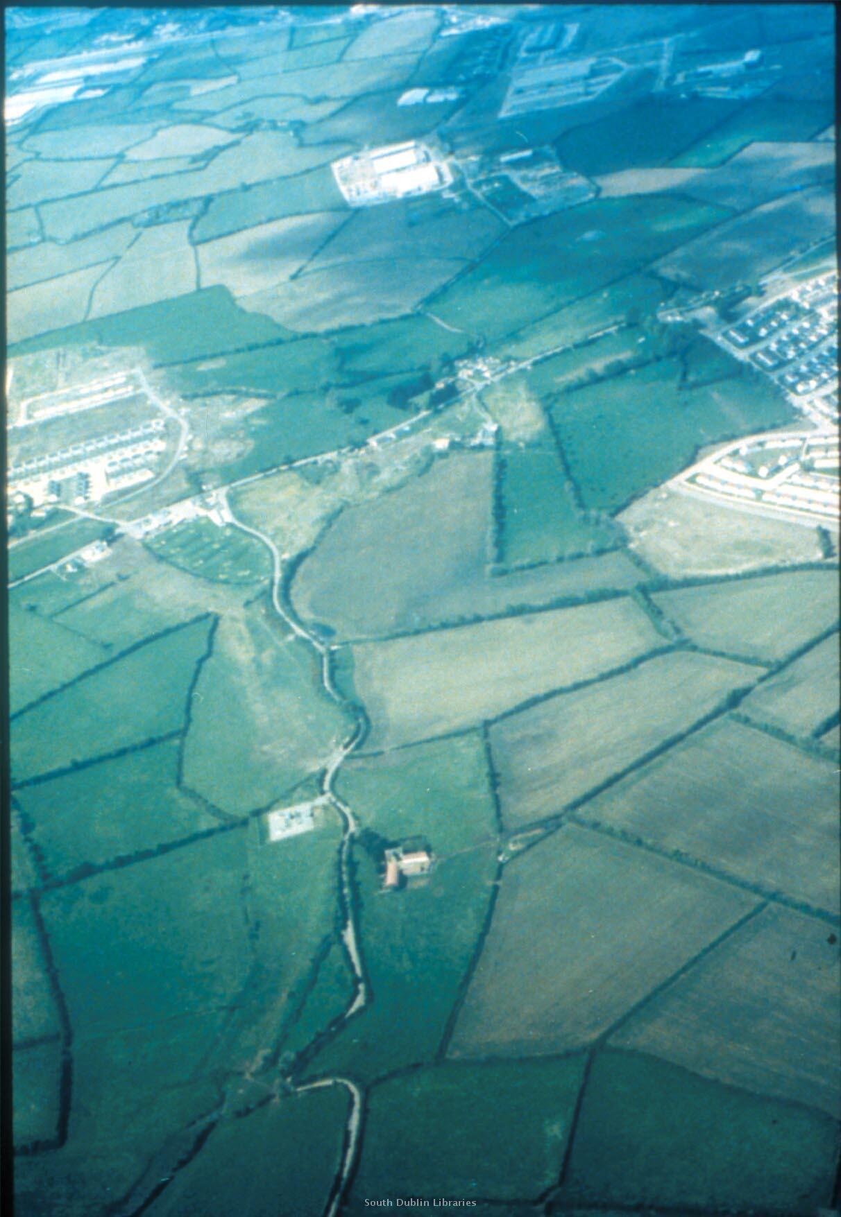
The house still exists on aerial photo when the first houses of the housing estate are built.
It was demolished in late 20th century.
The house is now gone. No trace of it.
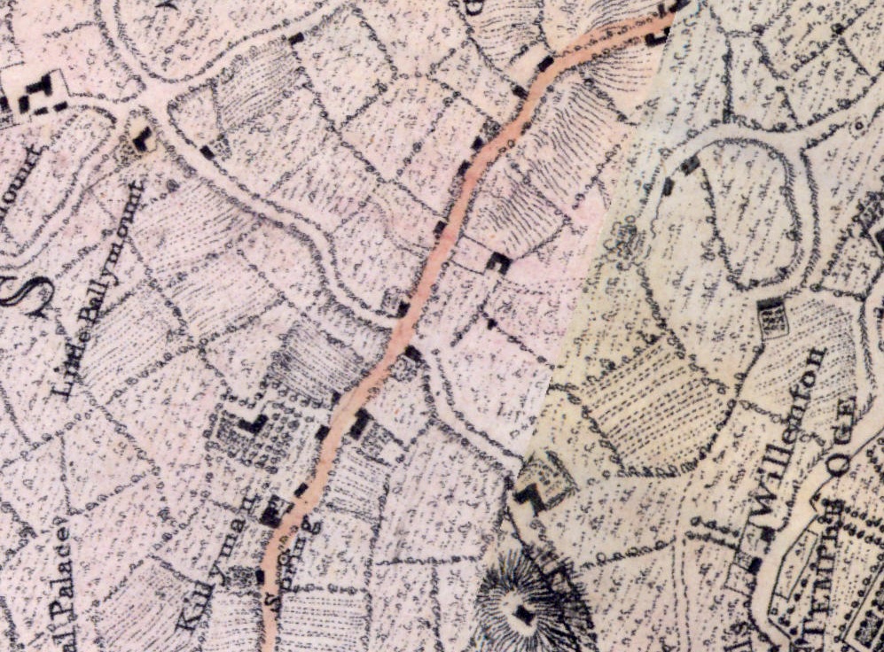
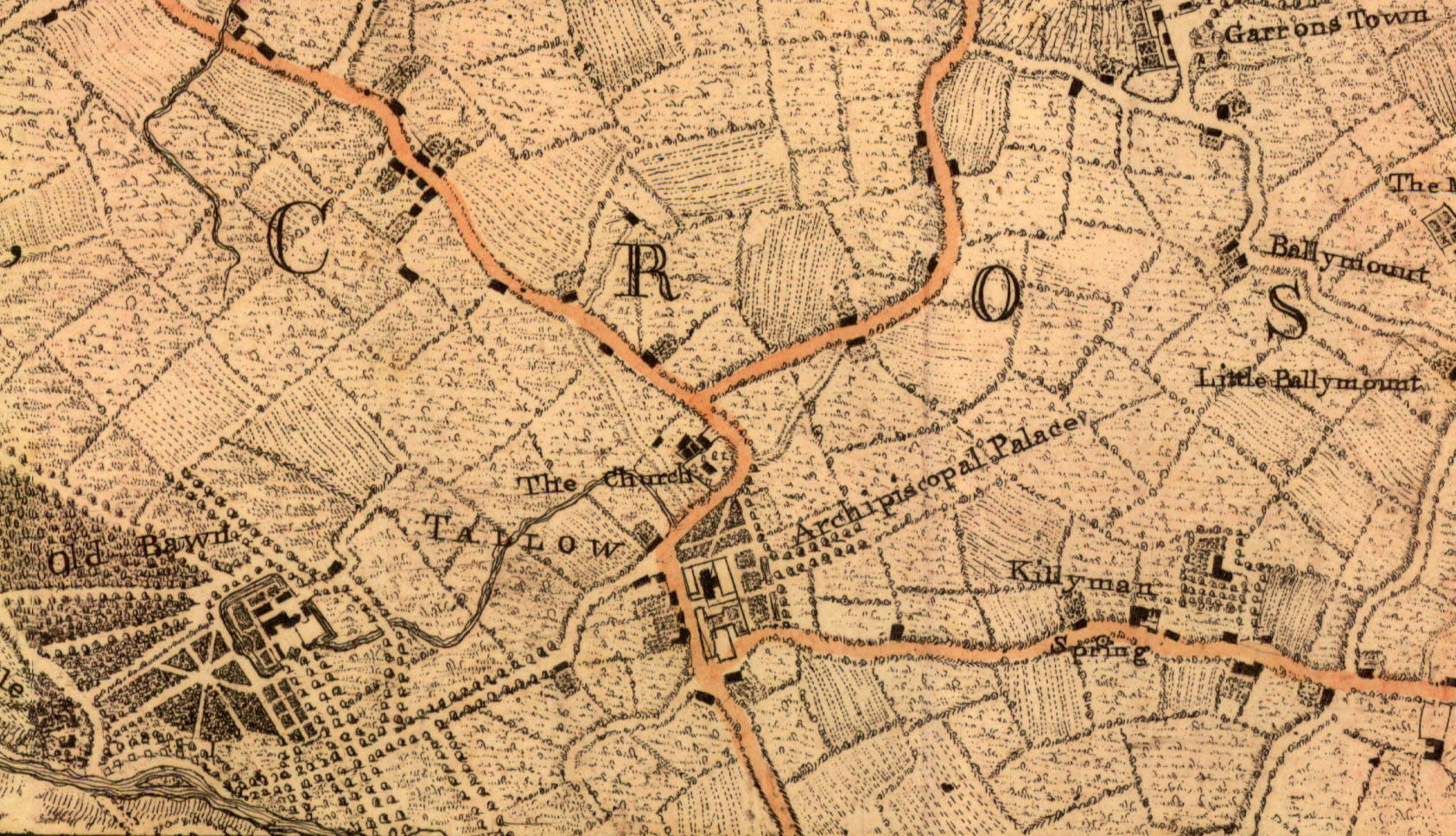
The Green Hills road,
Kilnamanagh, on Taylor's map of 1816.
From South Dublin Historical Mapping.
The Flanagan farm would be just above "Gayfield", on the E side of the road. Not marked here. Below the houses that are marked.
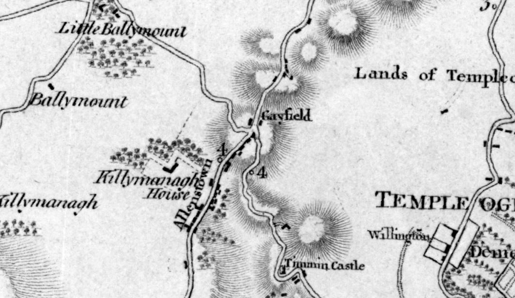
The Green Hills road,
Kilnamanagh, on Duncan's map of 1821.
From South Dublin Historical Mapping.
The Flanagan farm would be the house marked at the roadside on the E side of the road, just above "Gayfield".
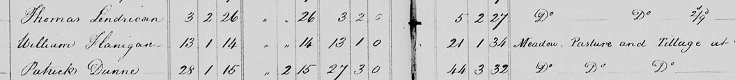
"William Flanigan" is listed
at "Killamana" (Kilnamanagh)
in
[Tithe Survey, 1826].
See p.1
and p.2.
He is
holding 21 acres
of "Meadow, Pasture and Tillage".
The holding is 21 English acres or 13 Irish acres
("Plantation Measure").
In Kilnamanagh
he is the only Flanagan listed.
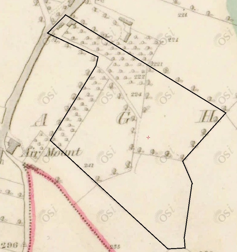
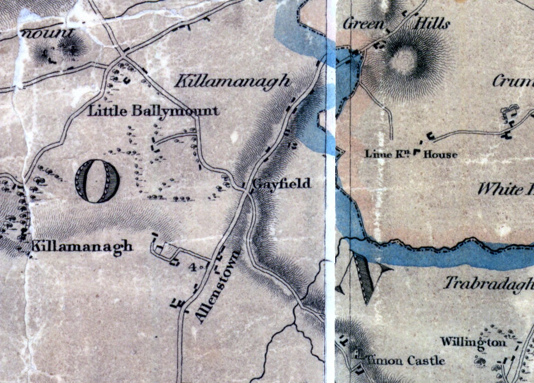
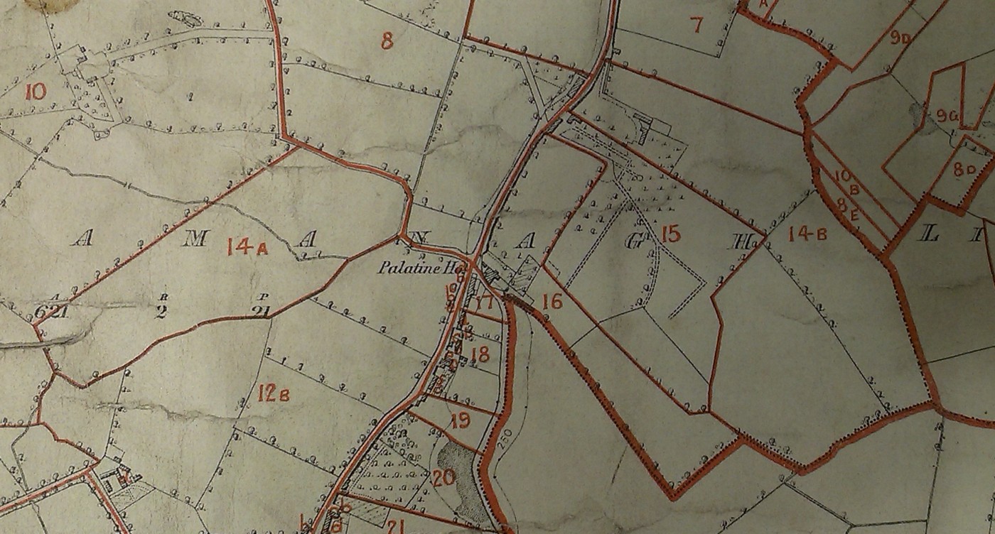
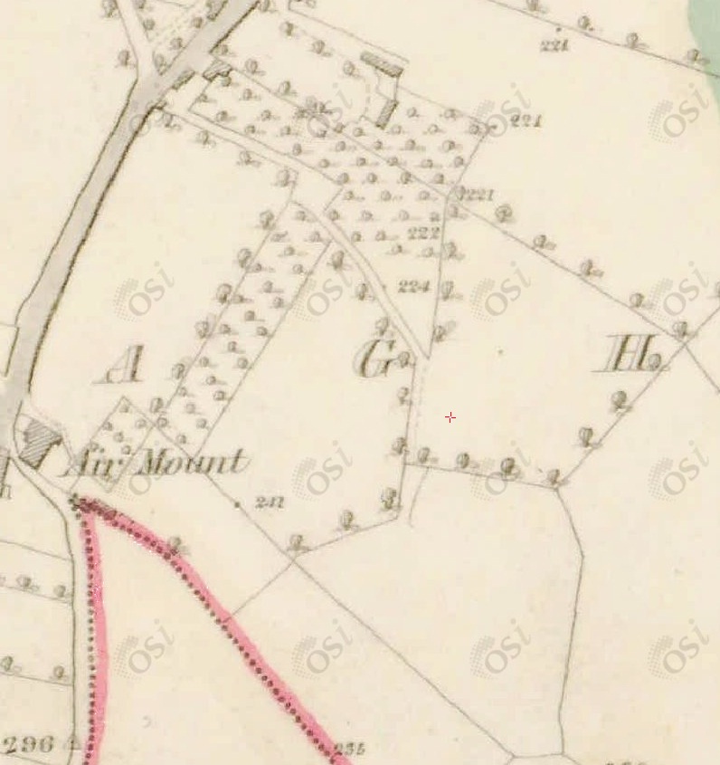
The Flanagan farm
(Plot 15 in the numbering below)
highlighted on
1829 to 1842 map.
See unhighlighted.
[Deed, 1825]
says the William Flanagan
property in Kilnamanagh
is
bounded on N and E by property of "Michael Flanagan", who would be his brother.
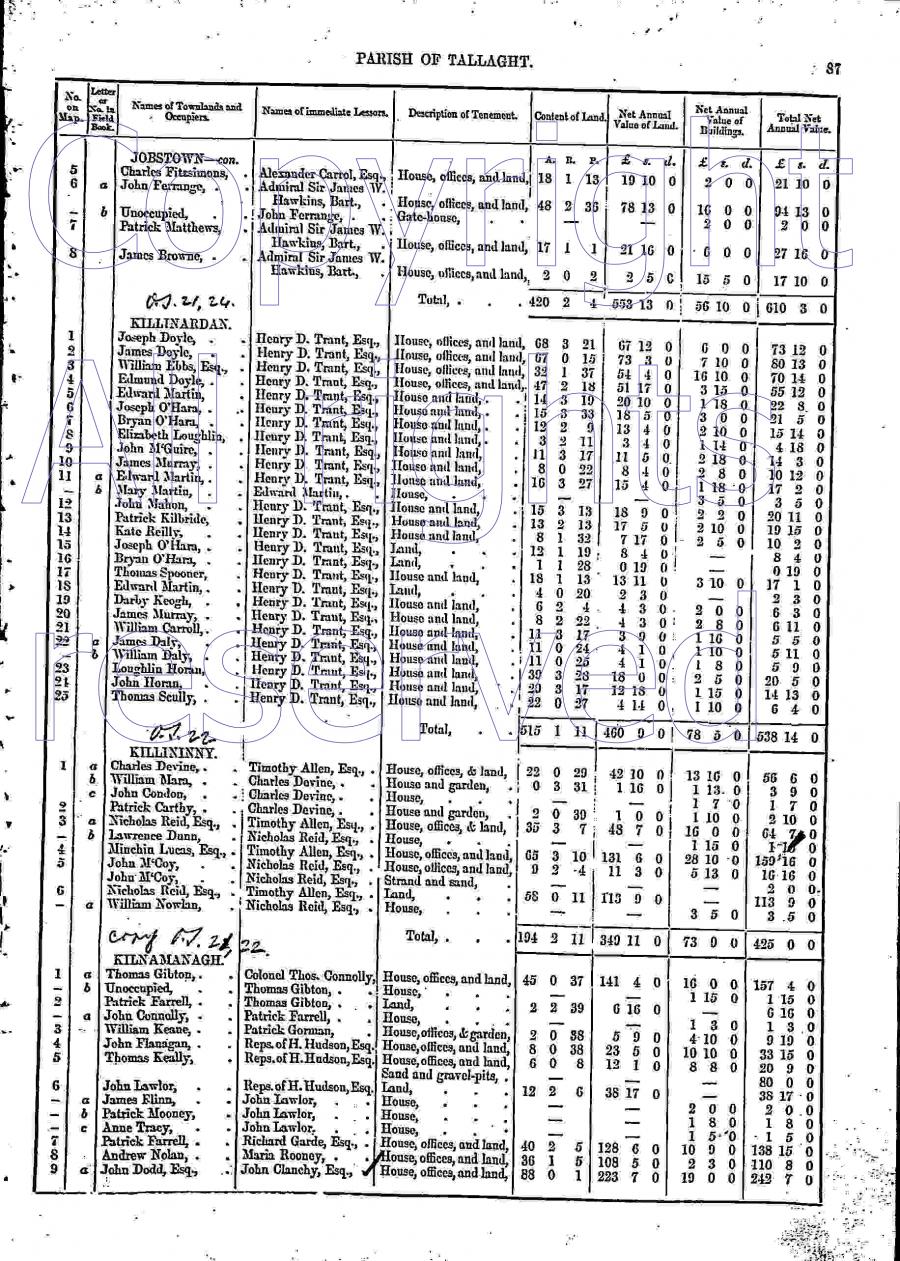
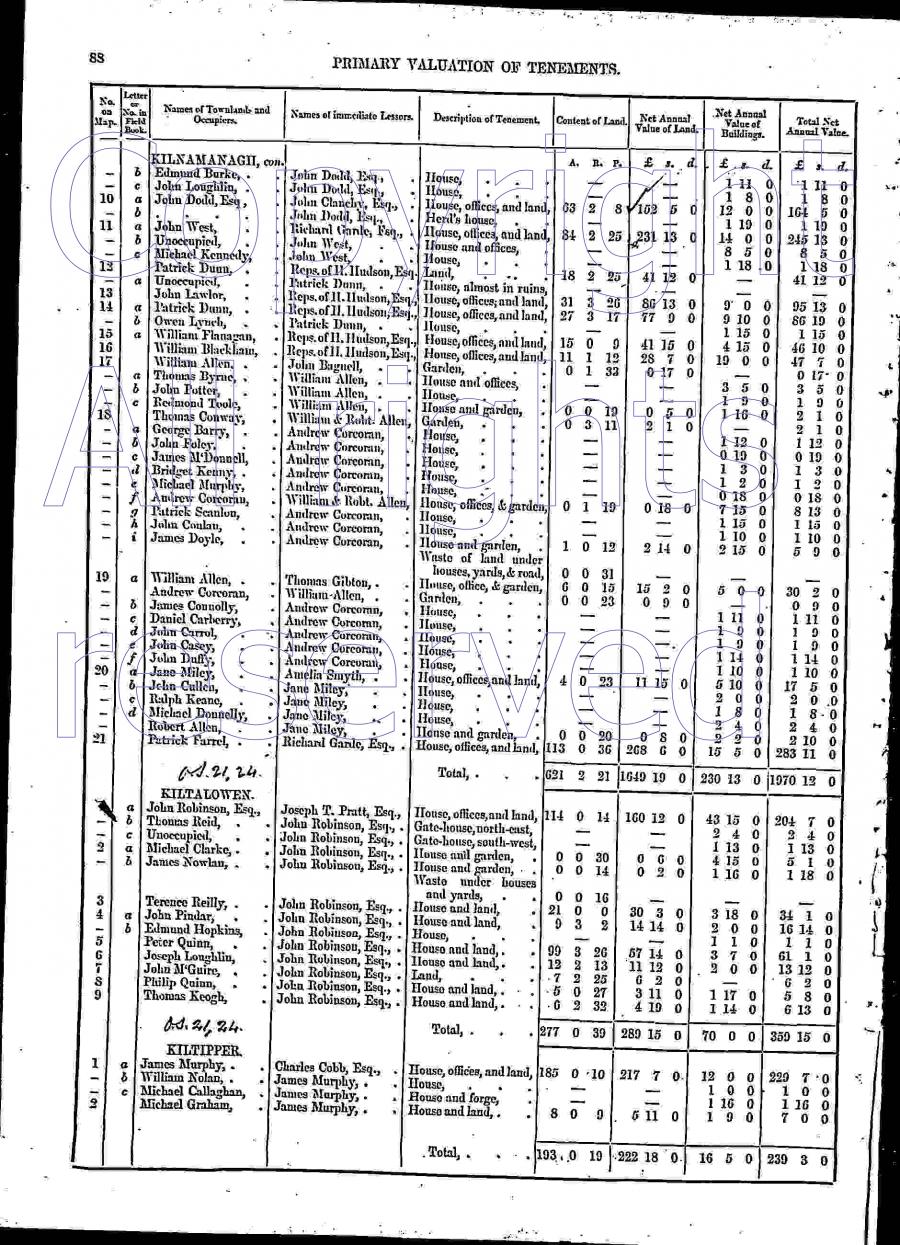
William Flanagan is listed
at Kilnamanagh
in [Griffiths Valuation, 1847].
See p.87
and p.88.
William Flanagan
is occupying 15 acres (with a modest house).
Leasing from "Reps. of H. Hudson, Esq."
(i.e. the heirs of
Hartley Hodson who died 1839).
Shows the Flanagan house at plot 15
as much smaller (buildings value £4) than its two neighbours at plots 14 and 16
(£9 and £19).

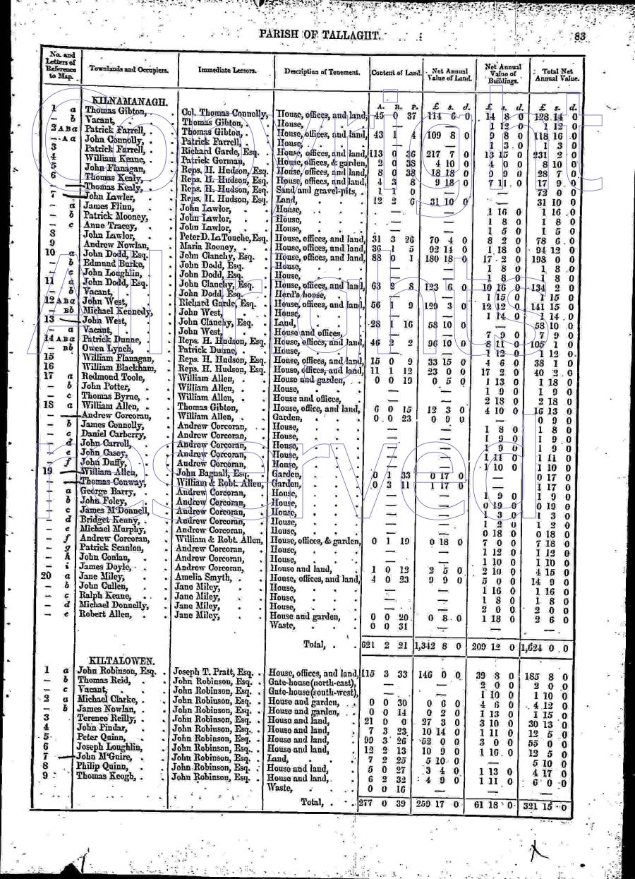
William Flanagan is listed
at Kilnamanagh
in [Griffiths Valuation, 1850].
See p.83.
William Flanagan is occupying 15 acres (with a modest house).
Leasing from "Reps. H. Hudson, Esq.".
Shows the Flanagan house
as much smaller (buildings value £4) than its two neighbours
(£8 and £17).
[VO] Griffiths Valuation maps, Dublin county, map 22.
See full size.
Plot numbers exactly match
[Griffiths Valuation, 1850].
Can't see any mis-match.
William Flanagan
is listed
in [Griffiths Valuation, 1850]
as occupying 15 acres (with a modest house)
at
plot 15.
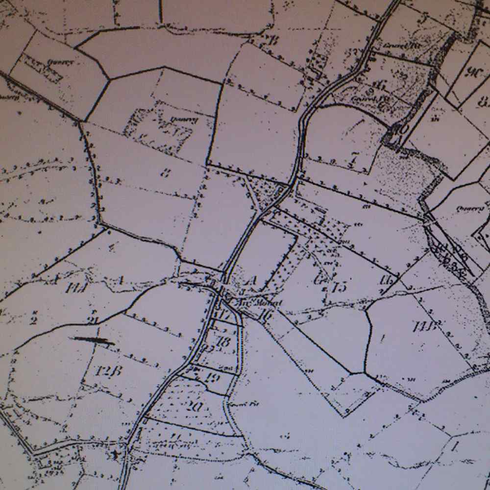
Plots 14A, 14B, 15 and 16 on map in
[VO]
of unclear date.
See full size.
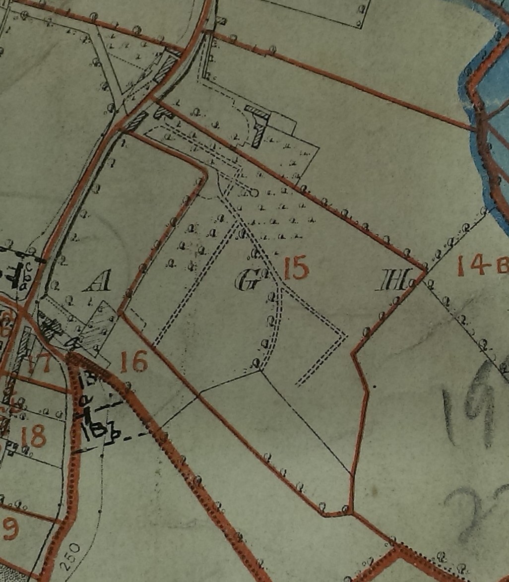
Close-up of Flanagan farm.
Similar map to above, of uncertain date.
See full size.
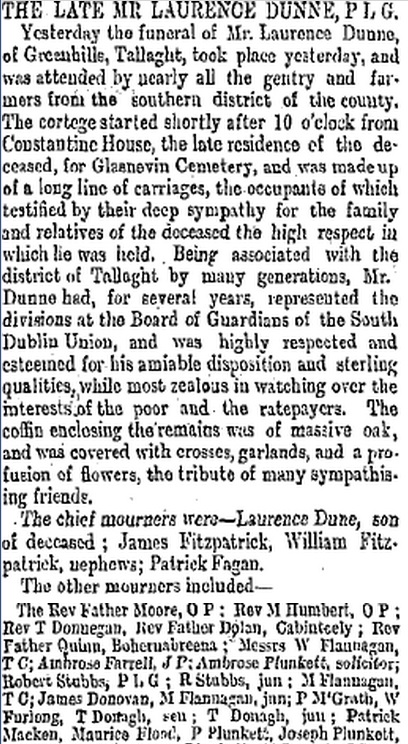
Proof that
Constantine House was the Dunne house (plot 14).
Above is from
Freemans Journal,
April 24, 1886.
At Laurence Dunne's funeral were his neighbours
Michael Flanagan, TC
and teenage
Michael Flanagan, junior
and
Robert Stubbs, PLG
and
Robert Stubbs, junior.
"W. Flannagan, TC"
may be
William Flanagan (PLG, not a TC)
or may be
a Dublin Corporation councillor
called
William Fanagan, TC.
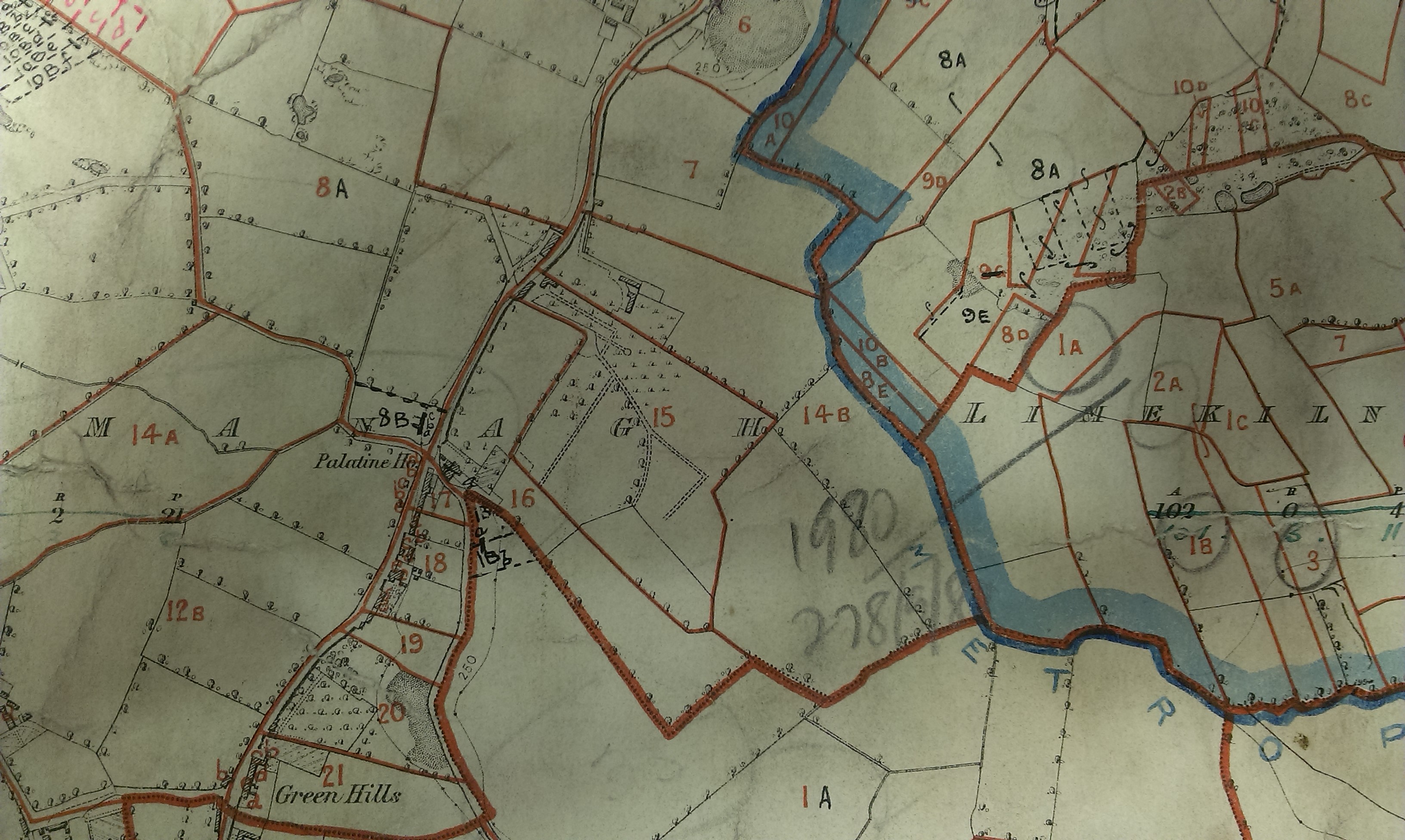
The Flanagan farm highlighted on
1887 to 1913 map.
See unhighlighted.
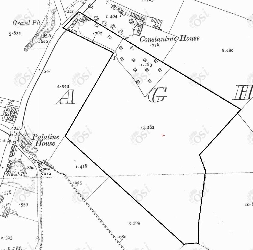
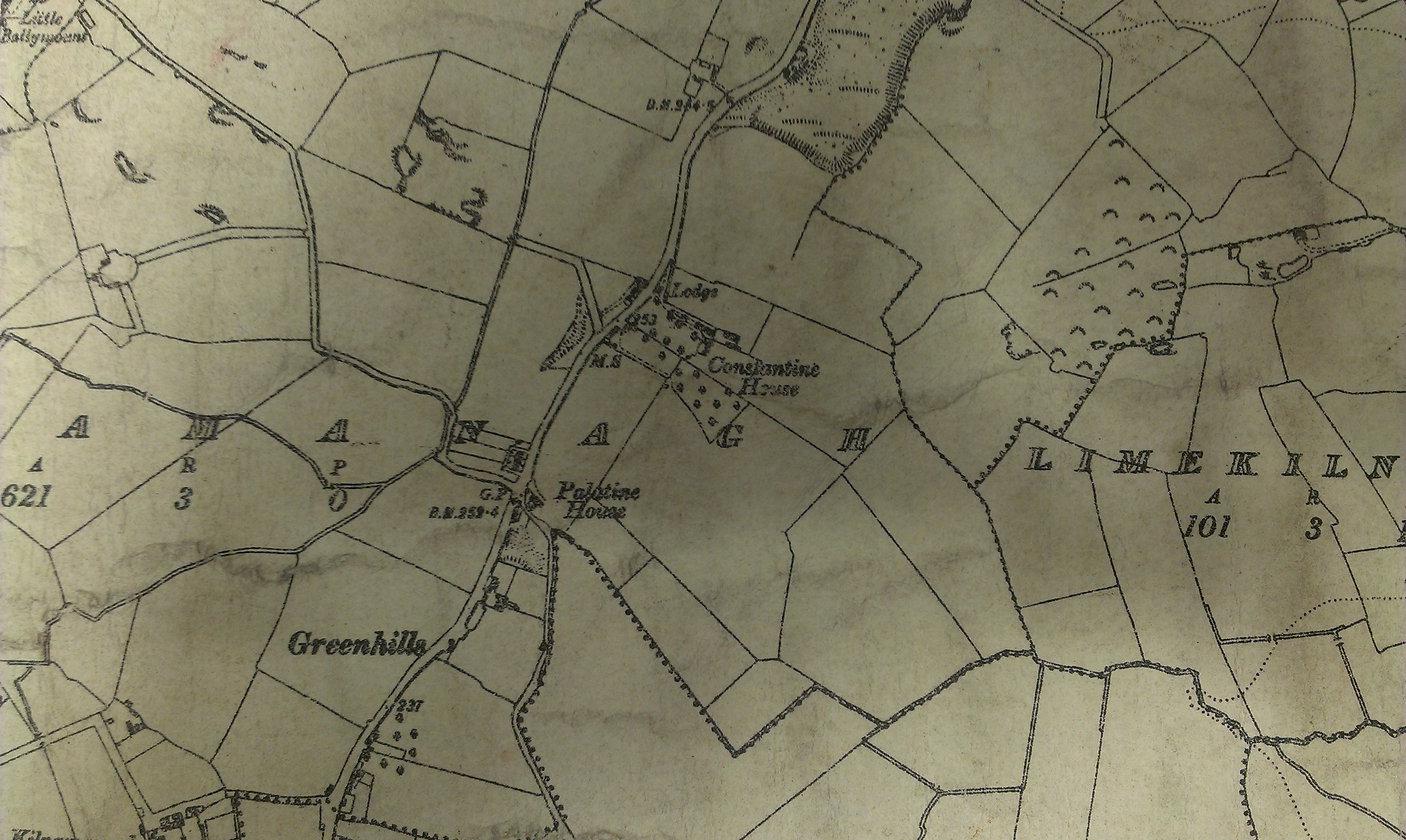
The Dunne house (Plot 14) is now called "Constantine House".
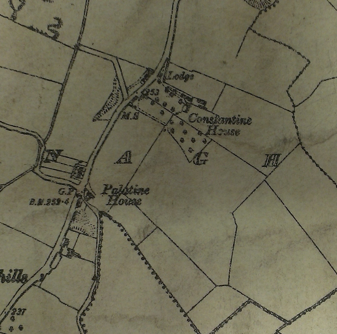
Map in
[VO]
of unclear date.
Showing "Constantine House".
See full size.
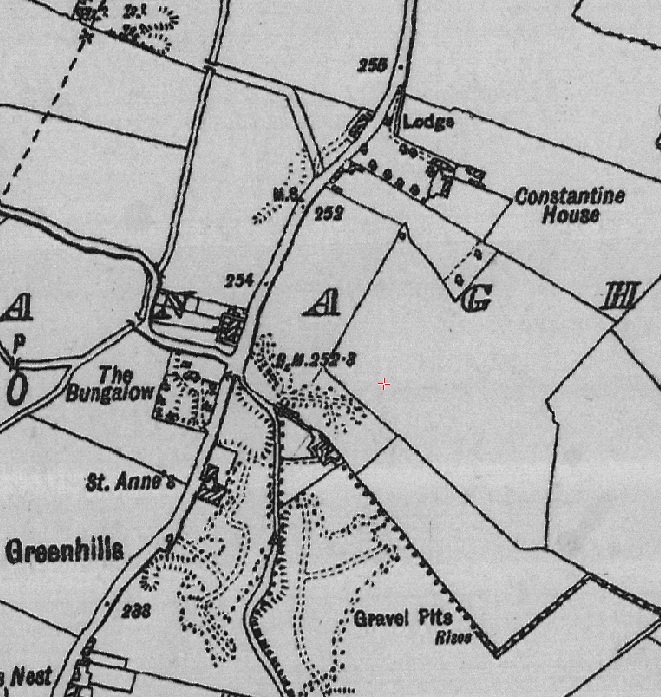
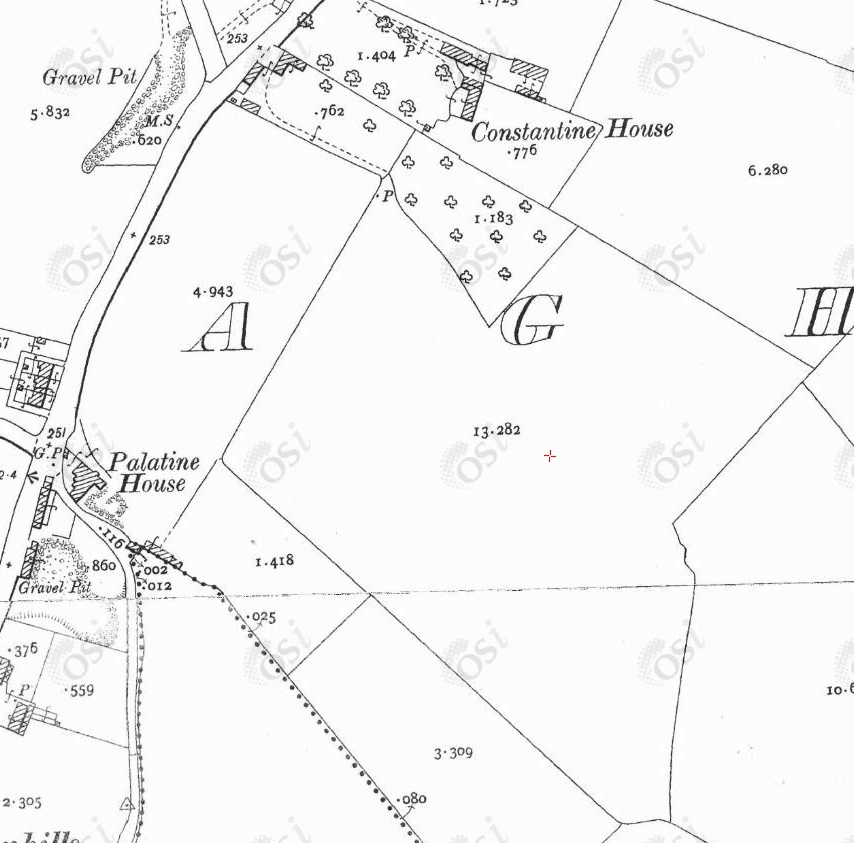
The area on 1935-1938 map.
From South Dublin Historical Mapping.
Note there is no house downhill except
Constantine House.
[Watchorn, 1985, p.164]
has a map of c.1948 showing
"Constantine House".
Therefore the Flanagan house was at the roadside. There was no house downhill in the Flanagan farm.
But it is clear from the late 20th century aerial photo that there was no house downhill.
Perhaps people confused the house with Constantine House next door, which is a bit downhill.
Please donate to support this site.
I have spent a great deal of time and money on this research.
Research involves travel and many expenses.
Some research "things to do"
are not done for years, because I do not have the money to do them.
Please Donate Here
to support the ongoing research and
to keep this website free.
