The Noltie house
is on the SE side of the small hill of Gallow Hill (or Gallowhill),
W of Alford
(pron. "Afford"), Aberdeenshire.
See map.
The road into the Noltie house
used to continue on towards Mid Mill and the old Alford church,
but is now a dead end.
The road beyond the house is now blocked off and overgrown.
The Noltie house was the only house at East Gallowhill in the 19th century.
The house at East Gallowhill is a listed building.
Henry Noltie of Germany
and his son
Henry Noltie
both came to the Alford area
through their service to
Farquharson of
Haughton House
on the NE side of Alford.
In 1822
Henry Noltie
settled at East Gallowhill to farm,
and he left Farquharson's service.
East Gallowhill was on the Farquharson estate
and Noltie got a long-term lease from Farquharson.
The lease ended 1898, so it seems it was a 75 year lease 1823-98.
The Noltie account book for East Gallowhill starts in 1822,
though Henry Noltie writes as if he did not
leave Farquharson's service
until his marriage 1823.
Thereafter
it is sometimes listed as just "Gallowhill"
but it is clear that the family is living in East Gallowhill all this time.
The will of
Henry Noltie (died 1892)
shows he was leasing the farm from
"Mrs. Farquharson" of Haughton.
The last sighting of Noltie in East Gallowhill is the death of
Henry Noltie's widow there
in 1894.
Their children left the place soon after.
Their dau
Agnes was married 1896 not from East Gallowhill
but from
Airlie, Keig, nr Alford
(where her brother Hugh lived).
Her brother
Henry Noltie did not stay at Alford
- he was not a farmer but rather a carpenter,
and he had moved to England by the time of his marriage 1897.
The 2 other sisters were married and gone before 1894.
It became a listed building 1971.
The house was in bad repair around 1995,
but has been nicely restored since.
It was for sale as at 2007
(formerly
here
and here).
It is described as a
"converted traditional
B Listed
Georgian
coachouse".
Postcode given as
AB33 8NE,
grid reference
NJ 564 158.
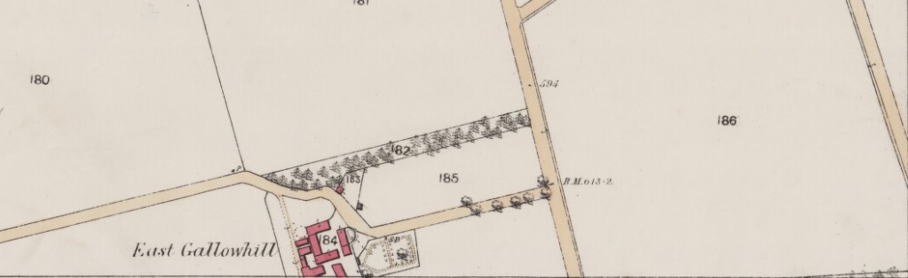
The Noltie house at East Gallowhill.
From map of c.1869 at old-maps.co.uk.
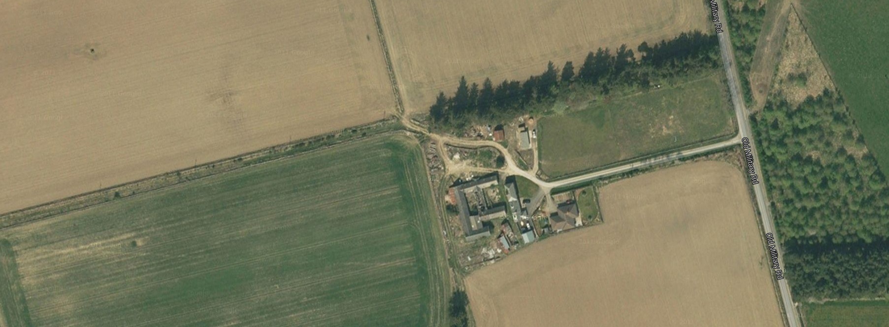
Screenshot from modern
satellite view.
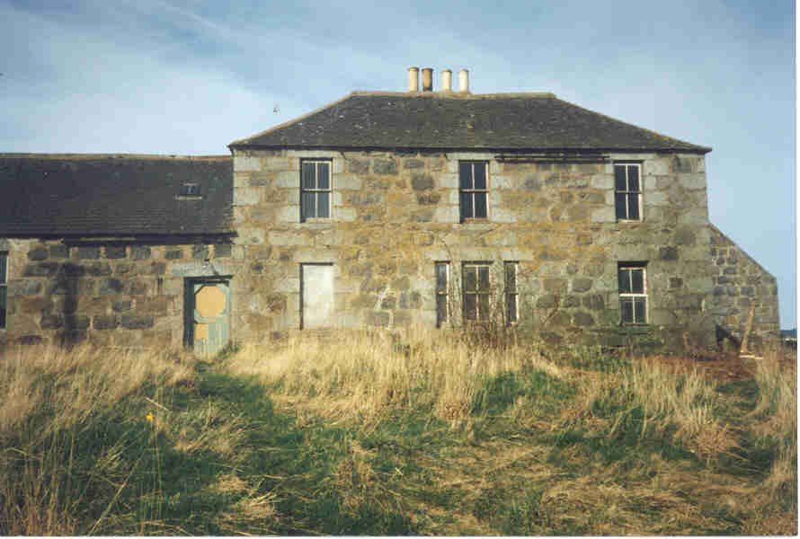
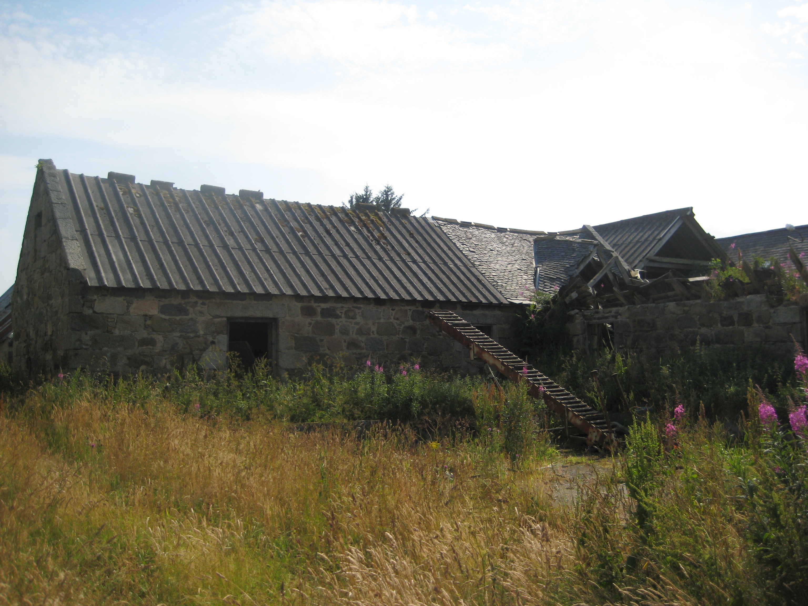
The Noltie house in bad repair in 1995.
Photo from Kirstine Holmes.
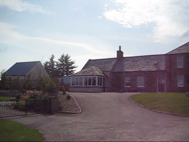
The house has been nicely restored
since.
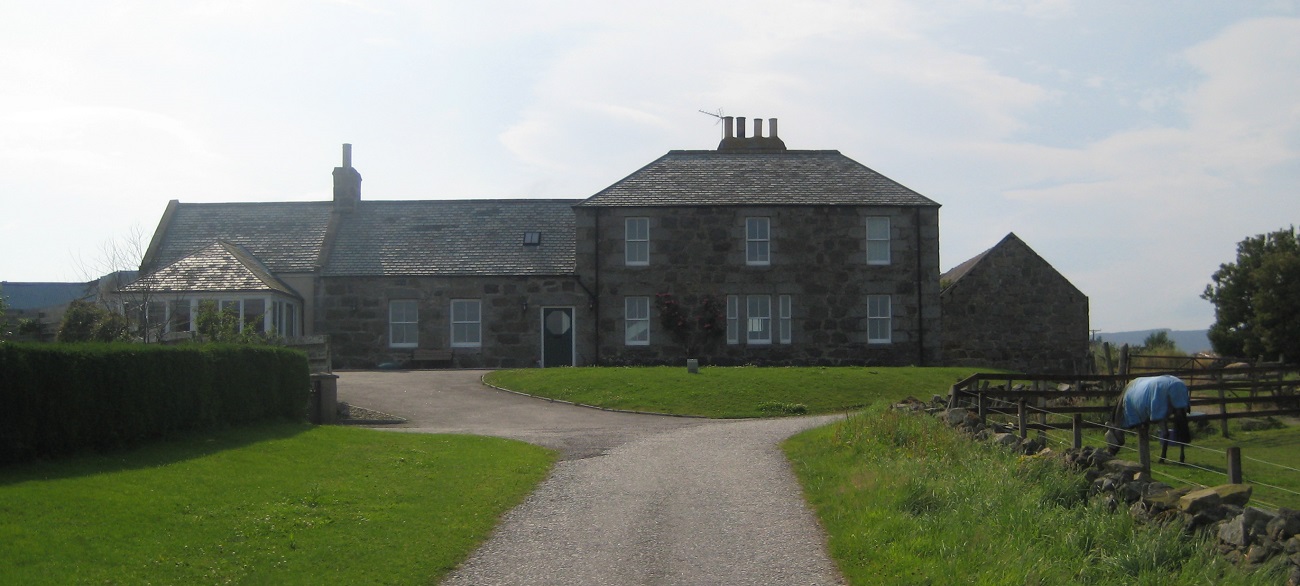
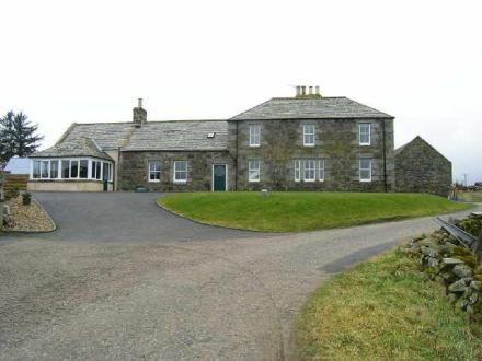
The house for sale as at 2007.
Formerly here.
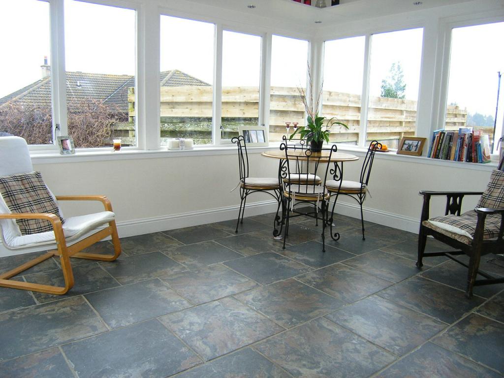
Inside the new front porch, 2007.
Formerly here.
See full size.

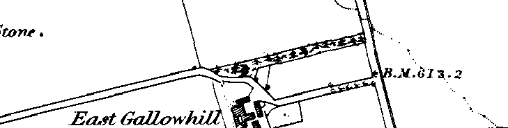
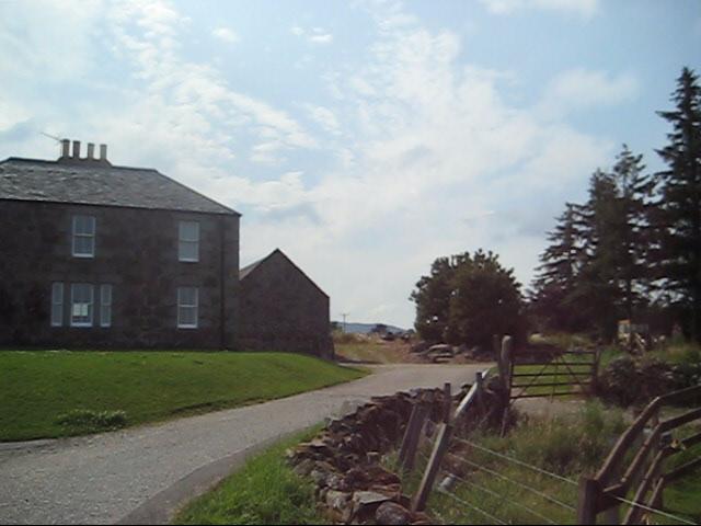
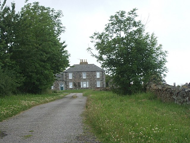
The road up to the Noltie house (from the Alford side or E side).
This was once a through road (so an inn or coach house could be located on it)
but is now a dead end.
Photo 2008.
See larger
and full size.
See other shot.
See 2008 shot
from Geograph.

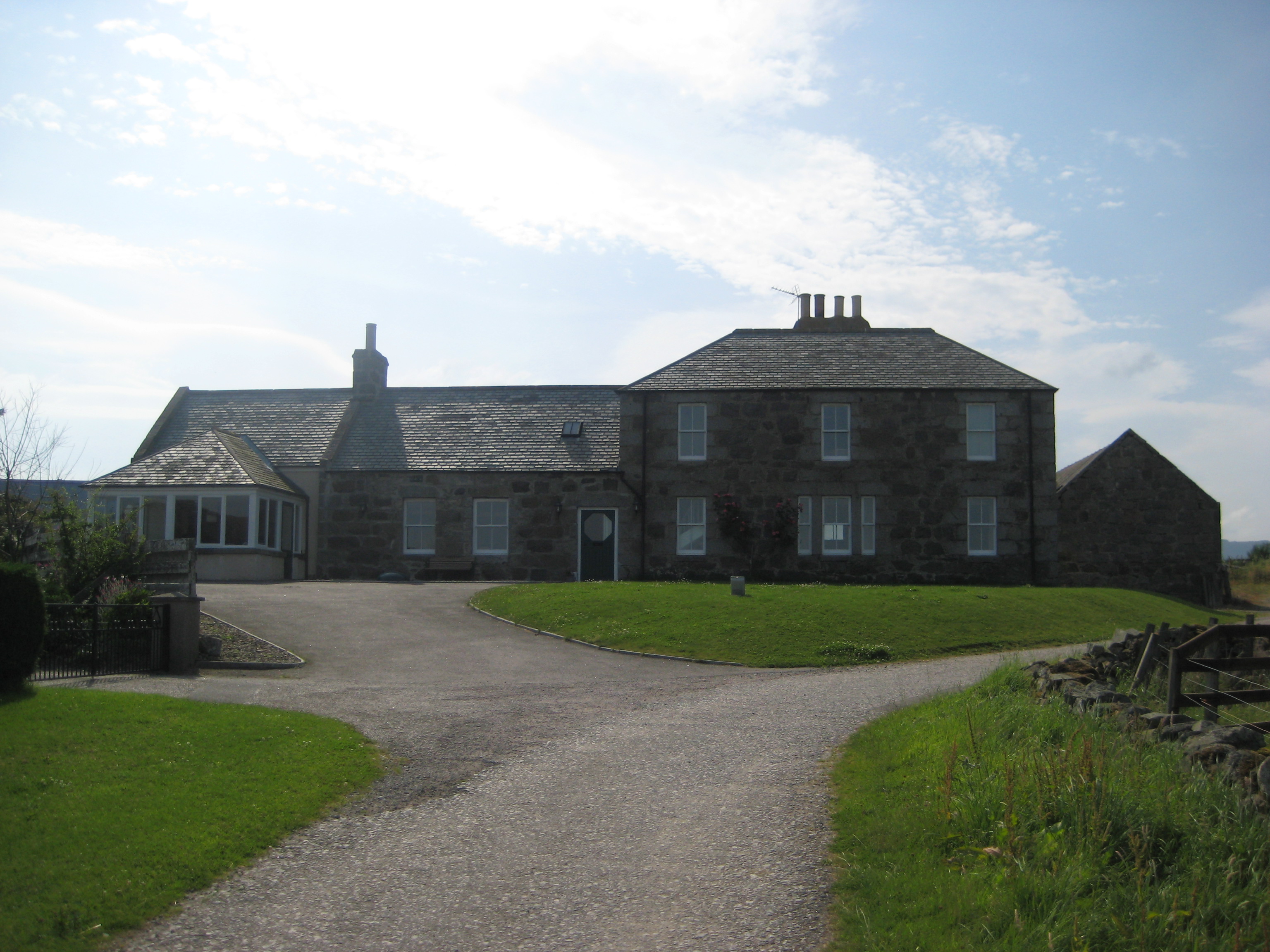
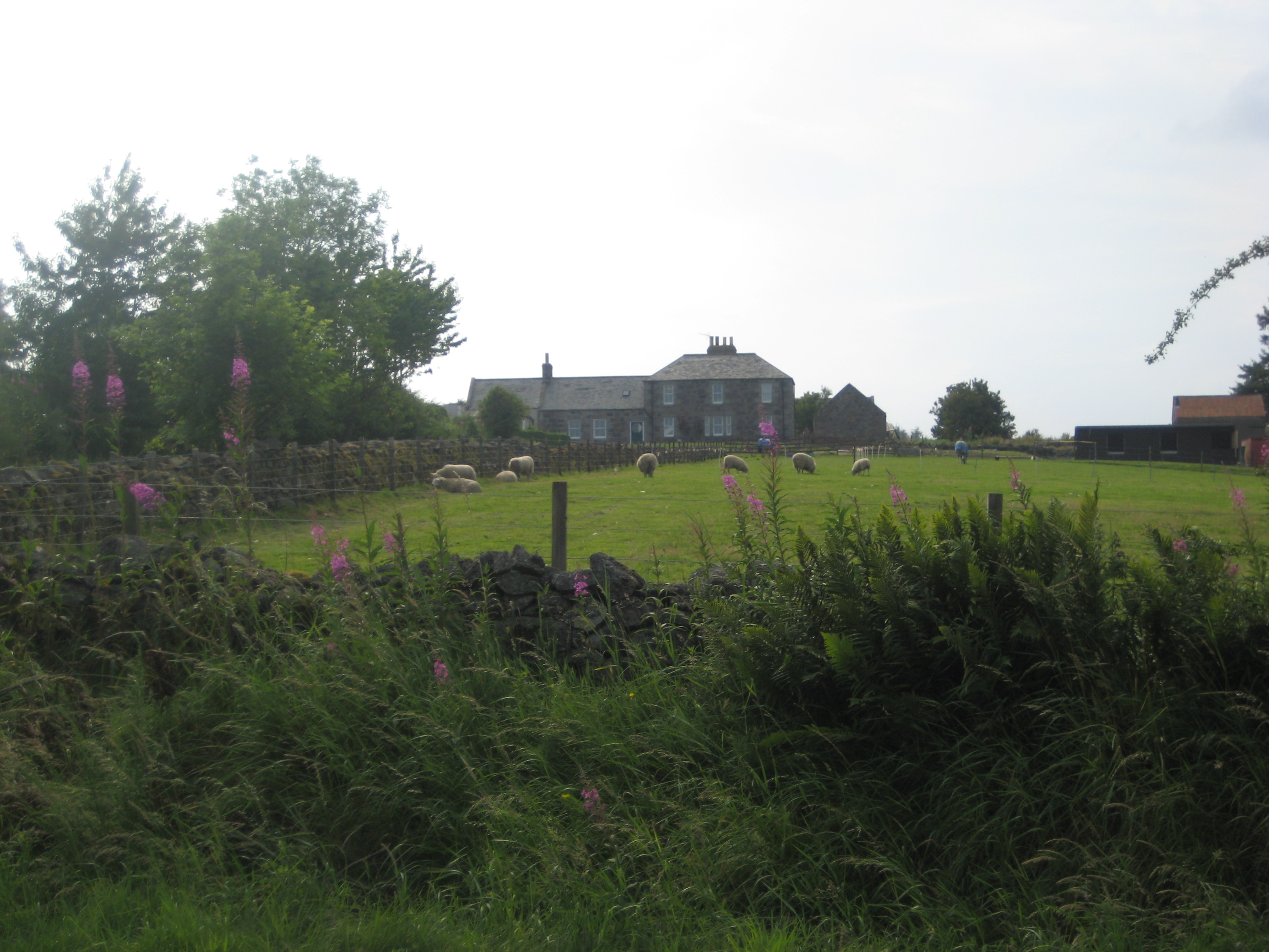
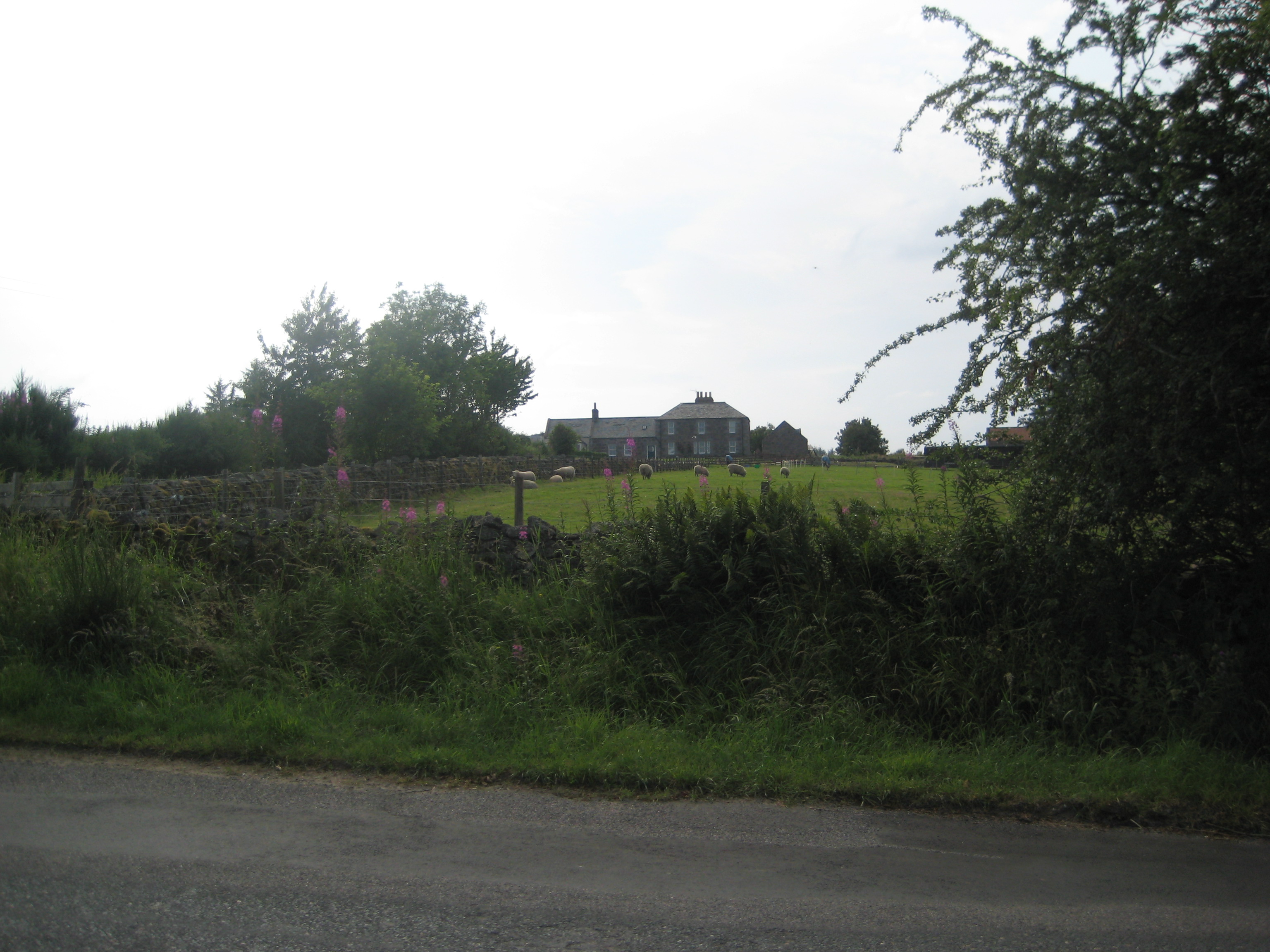
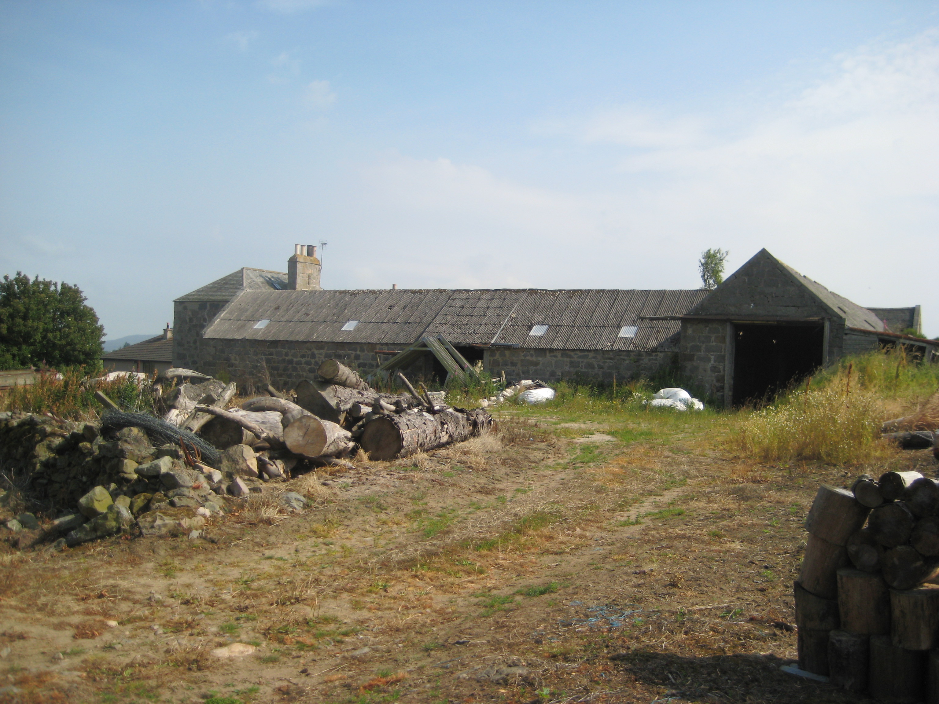
The Noltie house (from the E side).
Photo 2008.
See larger
and full size.
See other shot.
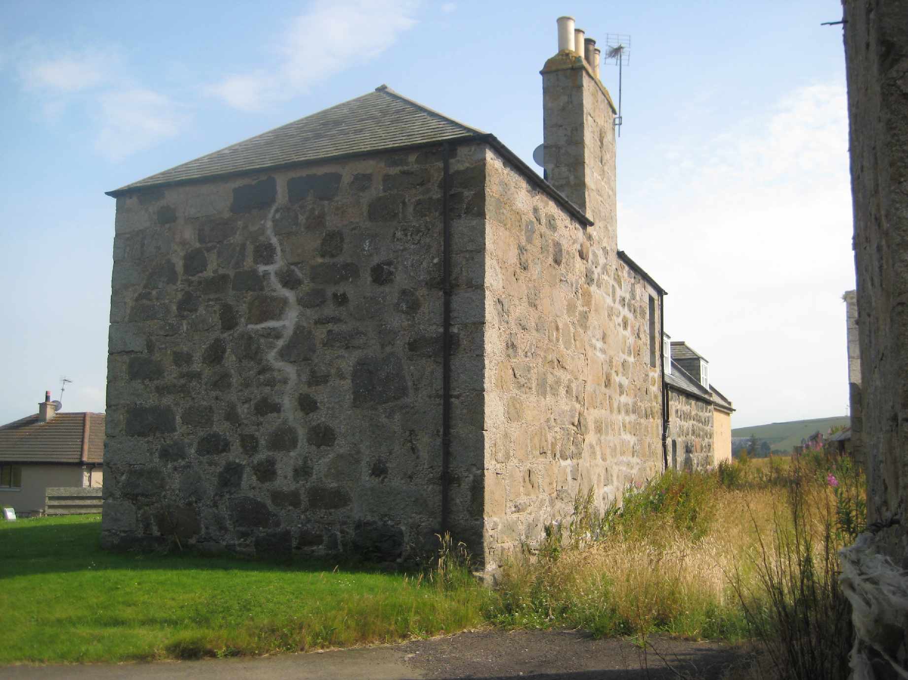
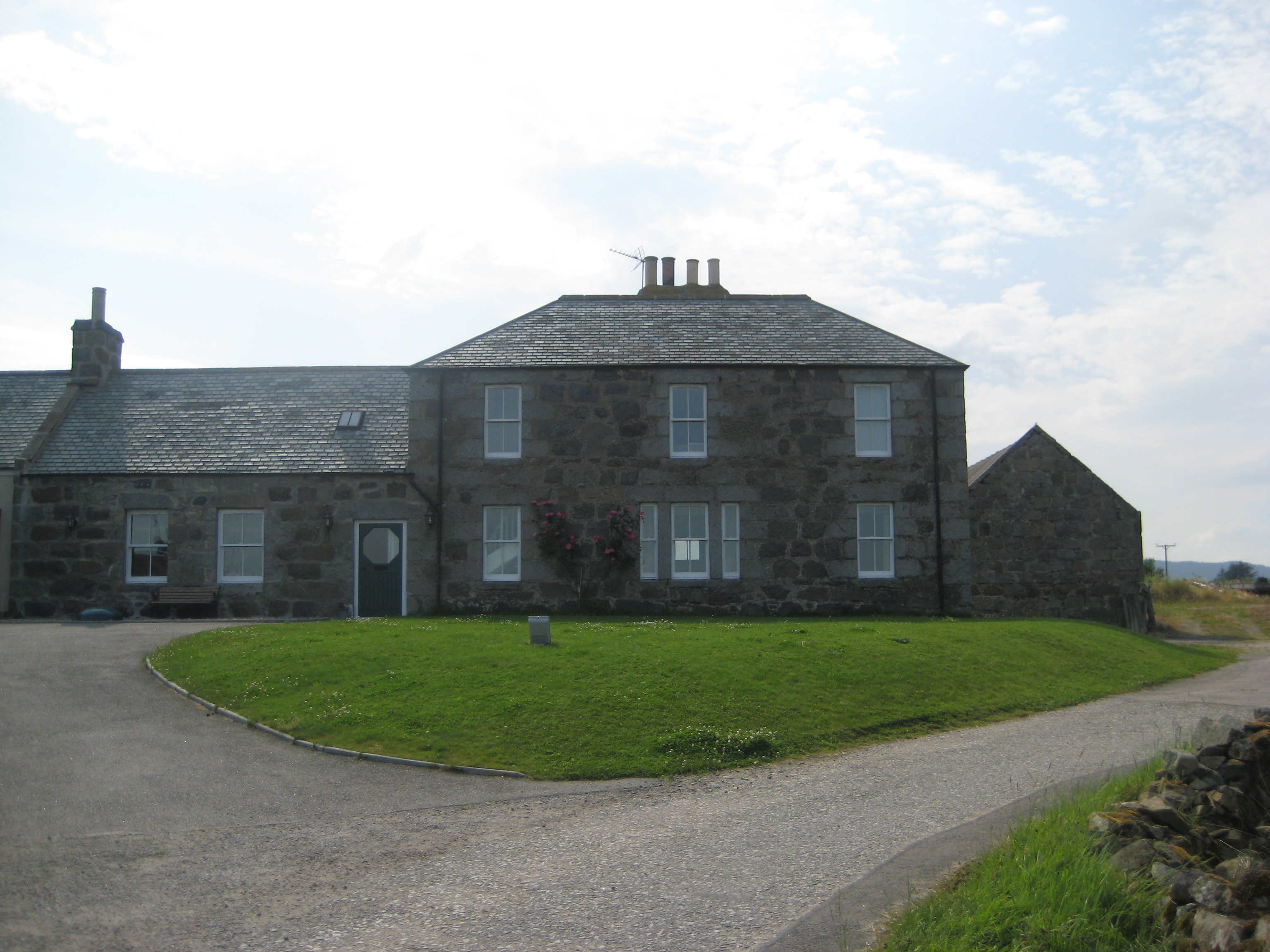
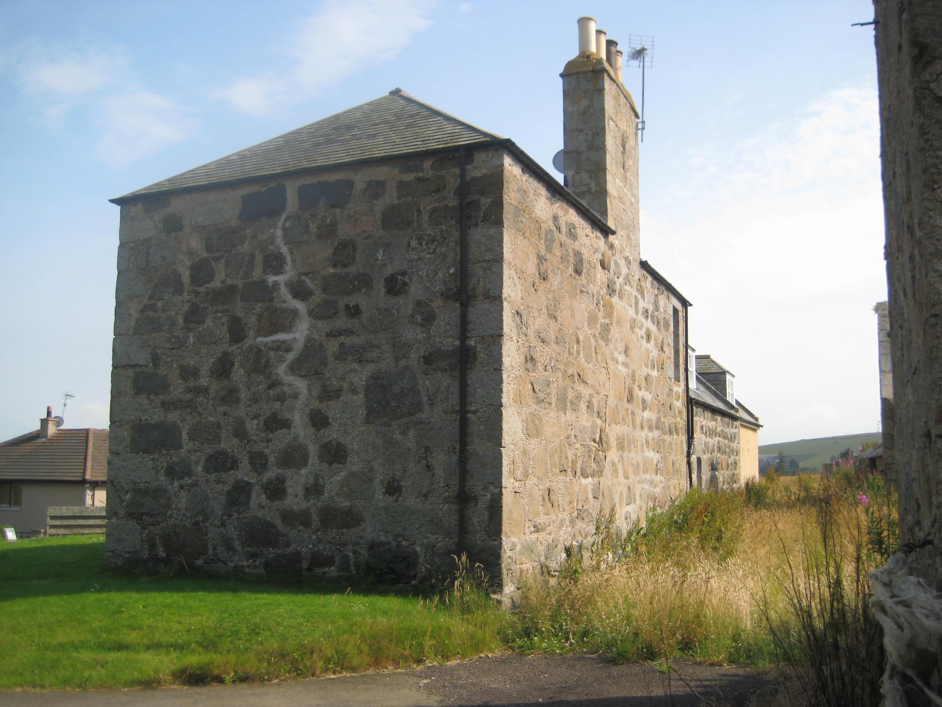
The N side of the Noltie house.
Odd that there are almost no windows at the side
or the rear.
Visible in background LHS is a new house that has been built adjacent.
Photo 2008.
See larger
and full size.
Still from above.
The old road. Still from above.
From NW side.
Pan from E to W.
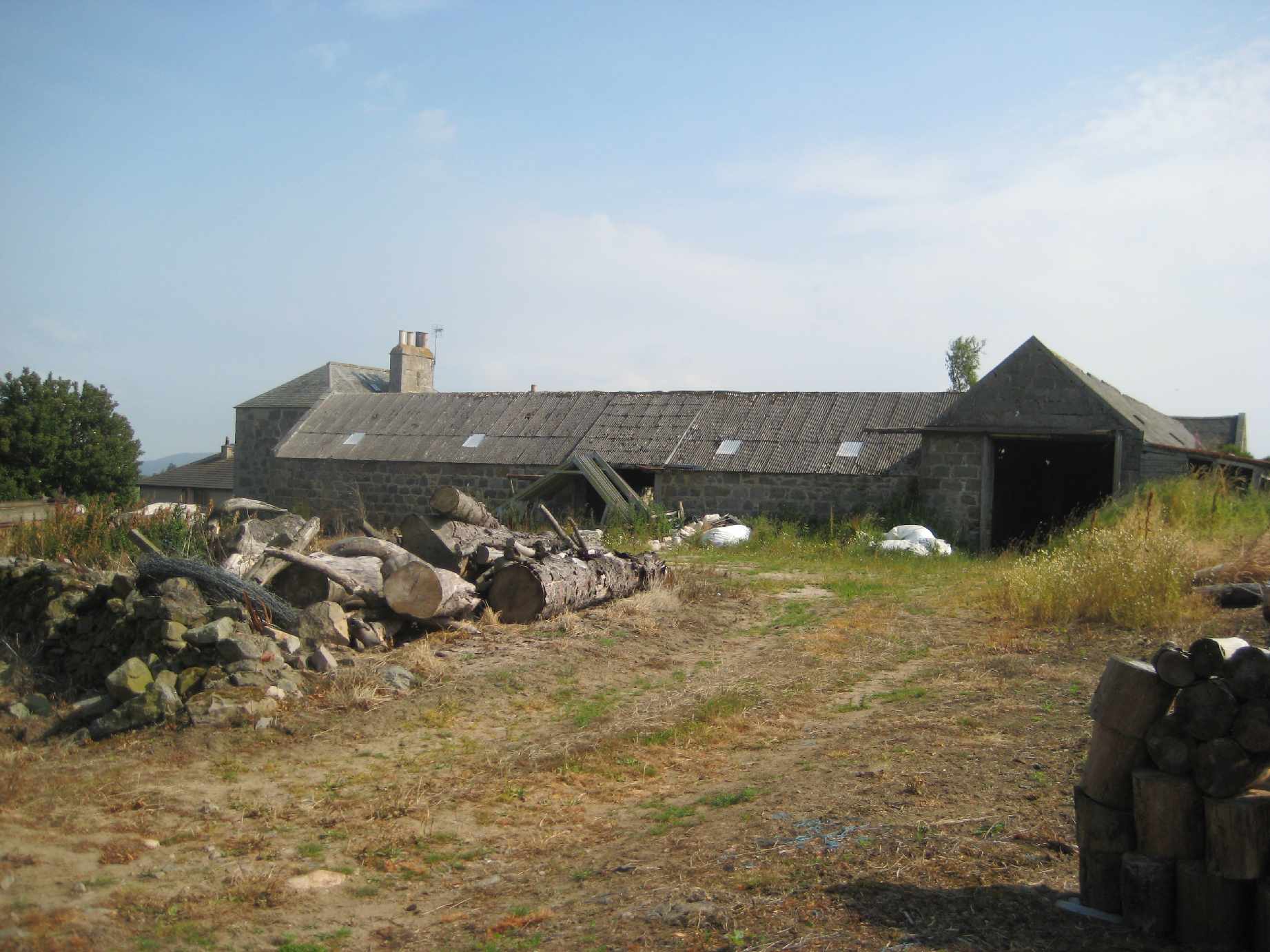
Showing the outbuildings.
From here.
Hosted at my YouTube account.
Download AVI file.
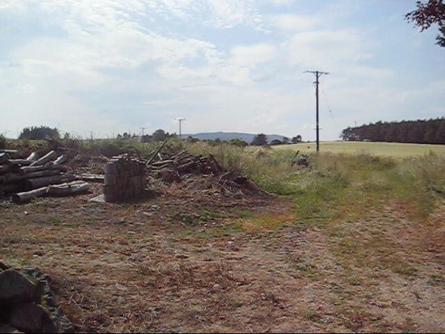
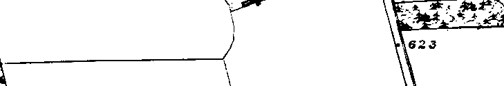
The old road going W followed the line of utility poles
here, and is now overgrown.
Still from above.
Please donate to support this site.
I have spent a great deal of time and money on this research.
Research involves travel and many expenses.
Some research "things to do"
are not done for years, because I do not have the money to do them.
Please Donate Here
to support the ongoing research and
to keep this website free.
