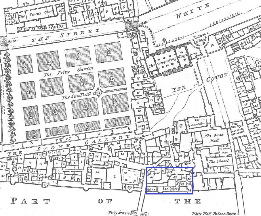
Part of
Whitehall Palace, from the river, before the fire of 1698.
Engraved by Wenceslaus Hollar
(died 1677).
The Banqueting House
is the large building in the centre background.
From University of Massachusetts.
Image credit
University of Toronto.
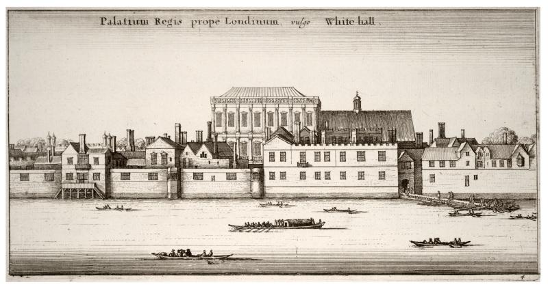
View of
Whitehall from the river, late 17th century.
From University of Massachusetts.
Image credit
Yale Center for British Art, Paul Mellon Collection.
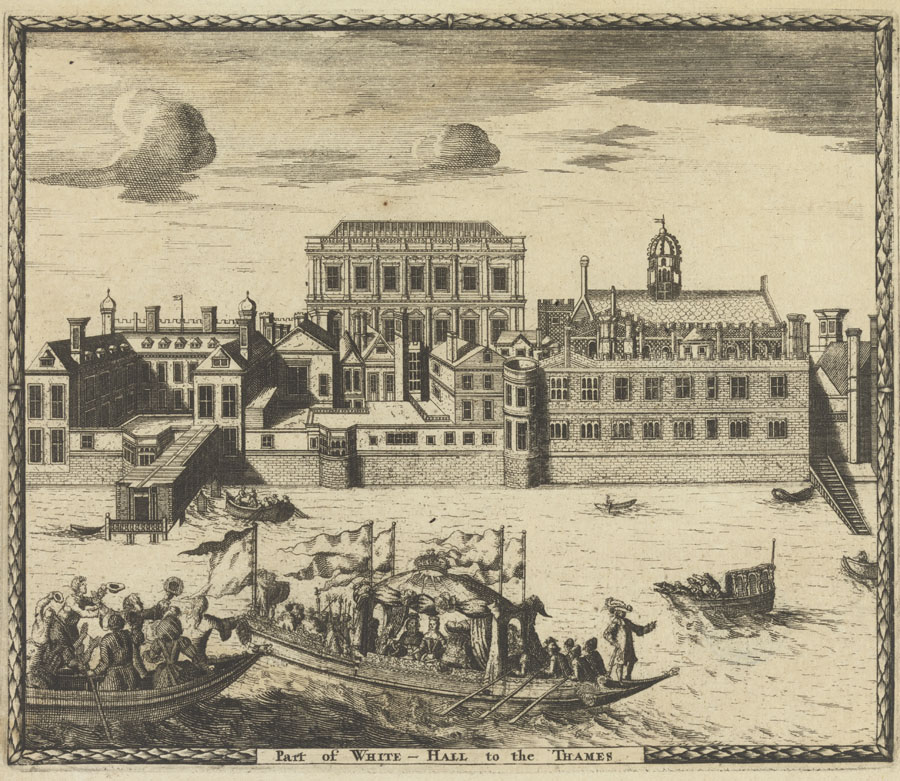
View of
Whitehall from the river, early 18th century.
It is unclear if the building in front of the
Banqueting House
is Pembroke House or
Malmesbury House.
From University of Massachusetts.
Image credit
Yale Center for British Art, Paul Mellon Collection.
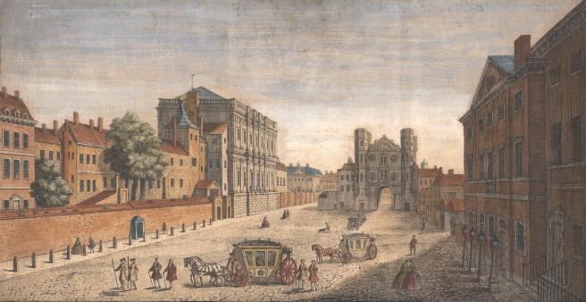
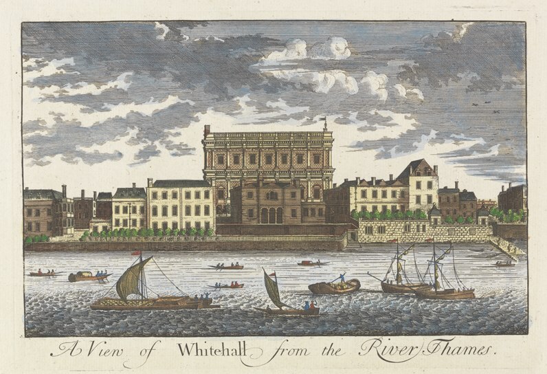
A view of Whitehall, looking south, in 1740.
From Wikipedia.
The Banqueting House
is the massive grey building on the left.
Pembroke House is now built, and would be behind the Banqueting House, not visible from this view.
See modern
street view
of same location.
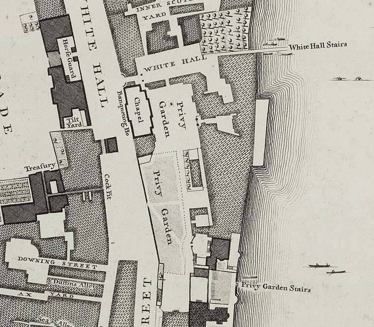
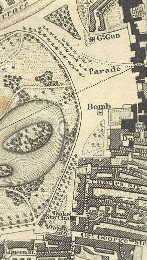
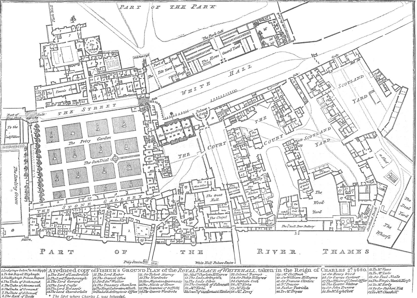
The Privy Garden on map of 1746.
From
section 7
of Sheet C2
of
Rocque's Map of London, 1746.
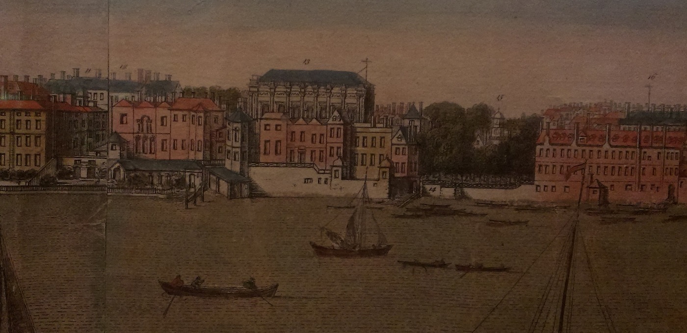
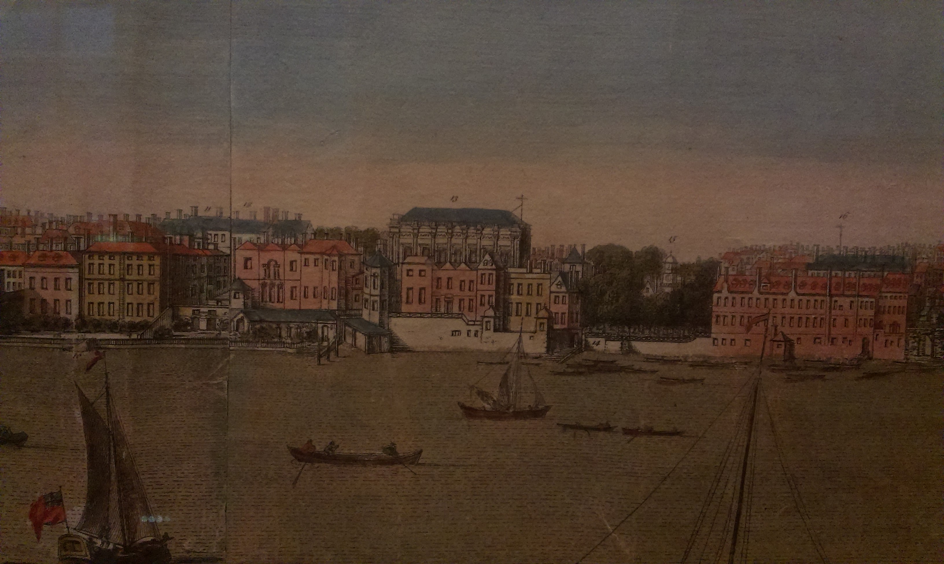
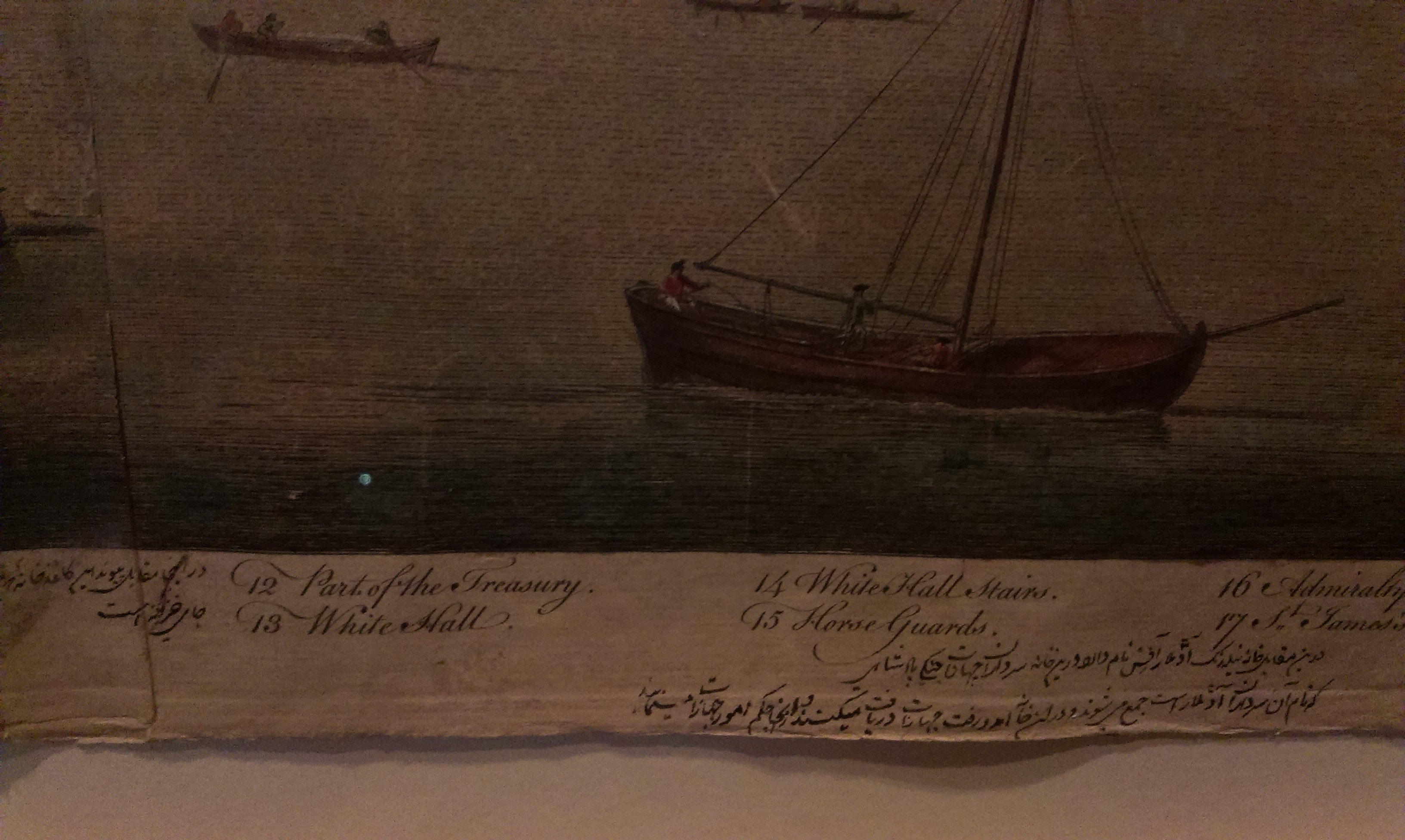
"White Hall" (13)
and "White Hall stairs" (14)
on View of London by Buck, 1777 (first pub 1748).
See larger
and full size
and plan.
On display at
Museum of London.
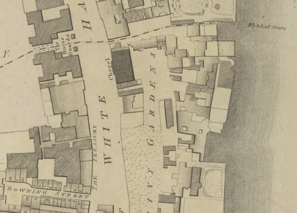
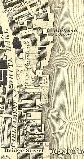
Privy Gardens on map of 1792-1799.
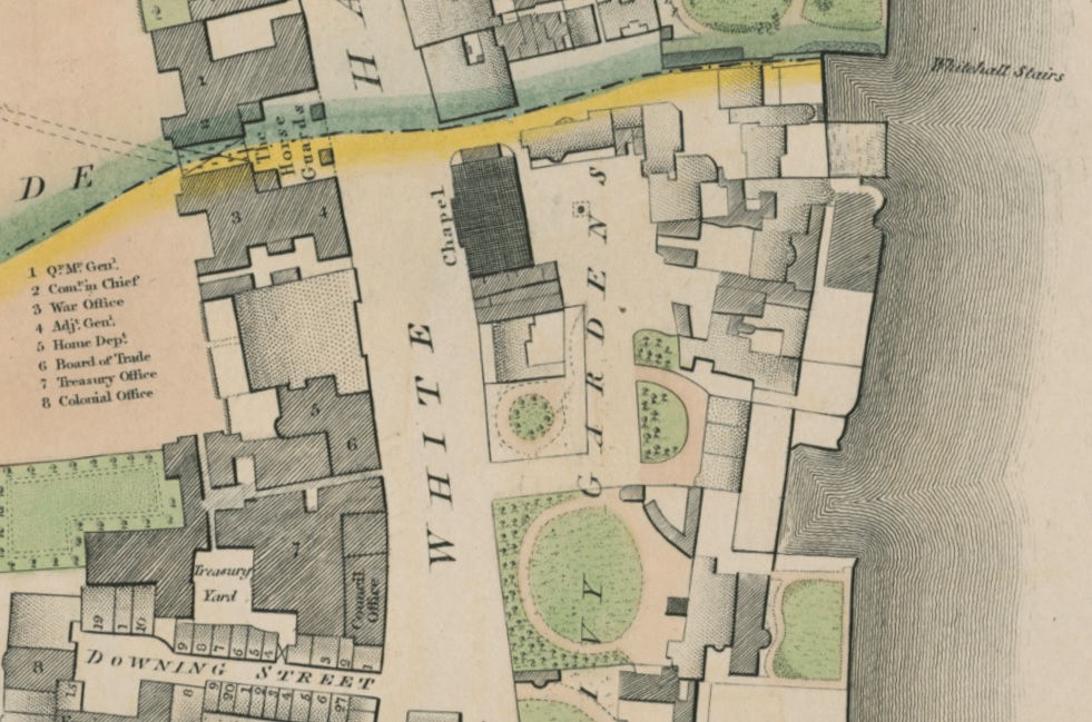
Privy Gardens on map of 1819.
|
|
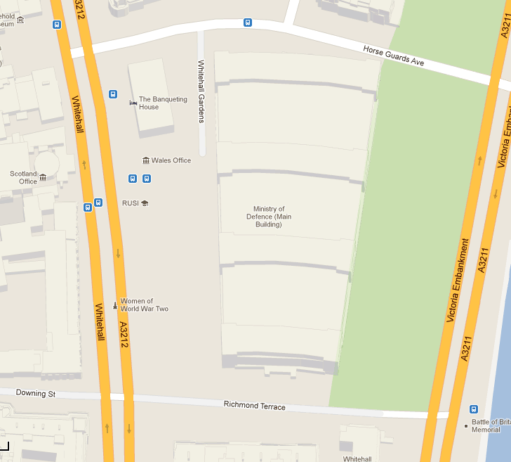
Privy Gardens was entirely cleared
for the massive
Ministry of Defence
building, built between 1938 and 1959.
Nothing remains of Pembroke House or its entrance lodge.
The Banqueting House
survives.
See Google maps
(has satellite view
and street view).
Please donate to support this site.
I have spent a great deal of time and money on this research.
Research involves travel and many expenses.
Some research "things to do"
are not done for years, because I do not have the money to do them.
Please Donate Here
to support the ongoing research and
to keep this website free.
