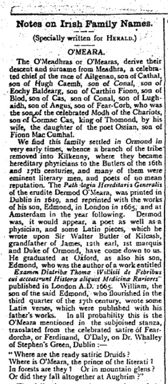
O'Meara of Toomevara, Co.Tipperary
A sketch of the family of O'Meara of
Toomevara, Co.Tipperary, and
neighbourhood.
Our family,
O'Mara of Limerick,
had a tradition that they were originally O'Meara of Toomevara.
Research however shows our O'Mara family came from
Clonmel, Co.Tipperary (nowhere near Toomevara).
References
- Nenagh and its neighbourhood, Edward H. Sheehan, 1949 edn.
- Ballymackey and Toomevara on pp.47-49.
O'Meara on pp.51-52.
- "Churches in the Deanery of Ormond part II"
by Dermot F. Gleeson,
North Munster Antiquarian Journal, 1952, pp.130-135.
- "The O'Mearas of Toomevara", Tim Boland, unknown local publication, 1980s.
-
Gravestone inscriptions: Parish of Aghnameadle,
Ormond Historical Society, 1988.
- "The O'Mearas of Lissinisky"
by John O'Meara.
Tipperary Historical Journal 1996, pp.117-135.
-
"The M7 motorway historical landscape: studies in the history of Ormond",
Paul MacCotter,
Tipperary Historical Journal 2018, pp.66-87.
The Cronnelly material seems to be reprinted in O'Hart and in the Tuam Herald:
Sources yet to be consulted
- History of the Ely O'Carroll territory or Ancient Ormond,
Rev. J. Gleeson, 1915
- Reprint 1982, 2 vols. with additions by George Cunningham.
-
Toomevara wall plaque is on p.469 of 1982 reprint.
-
The last lords of Ormond,
by Dermot F. Gleeson, 1938.
-
New edition 2001 with revisions by Donal A. Murphy.
-
O'Meara is on pp. 28-30, 59-61, 127-132, 220-222, 256, 260-263 of 2001 edn.
- Irish medieval figure sculpture 1200-1600, J. Hunt, 1974.
-
Toomevara tombstone is in vol. 1, 94, 96, 231.
- Toomevara: the unbroken chain,
by Tom Shanahan, Joseph Kennedy and Tim Boland, 1981.
[NLI] 8B 773.
- Toomevara in
The Archaeological Inventory of County Tipperary. Vol. 1 - North Tipperary,
compiled by Jean Farrelly and Caimin O'Brien (Dublin: Stationery Office, 2002).
The old Irish
O'Meara family
(O'Meadhra in Irish)
had lands in the
Barony of Upper Ormond, N Co.Tipperary.
The chief town of the Barony was
Toomevara.
Toomevara is also spelled "Toomyvara",
but I will use the former since the O'Maras always did.
In Irish the town is Tuaim ui Mheadhra
(or Tuaim ui Mheara), "Tomb of the O'Mearas".
Toomevara is in
Aghnameadle par, E of
Nenagh
(on the Dublin road),
N Co.Tipperary
(see
map).

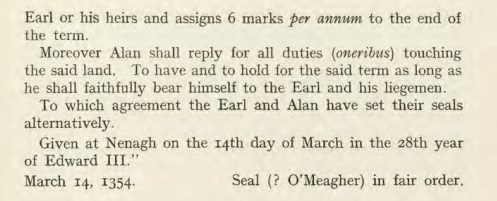
1354 grant of land to "Alan O'Maghra"
from
James Butler, 2nd Earl of Ormond.
Signed at Nenagh, March 14, 1354.
Deed no.22 in
Calendar of Ormond Deeds,
Irish Manuscripts Commission,
vol. ii
(1934),
pp.10-11.
The original deeds were then at
Kilkenny Castle.
Now in
[NLI].
-
This deed grants to O'Maghra
the property of "les Rathyns" in "Clandonoal".
- [MacCotter, 2018]
provides considerable evidence
that Clandonoal (various spellings) is the old name for
Ballymackey parish.
And that "les Rathyns"
is probably the grant of Lissanisky (various spellings),
Ballymackey par.
- There emerged two O'Meara seats:
The main one at
Lissanisky Castle in Lissanisky townland,
and (maybe not until the 18th century) Ballymackey Castle in Ballymackey townland.
-
Both of these are in Ballymackey parish,
Barony of Upper Ormond, Co.Tipperary
(NW of Toomevara,
between Toomevara and Nenagh).
- There was also a small O'Meara castle at Toomevara.
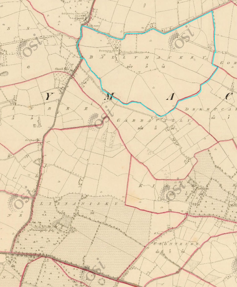
Location of
Ballymackey (marked in blue)
and to the S of it, Lissanisky.
From
1829 to 1842 map.
See
modern map.
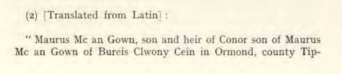
Extract from two deeds of 1578 and 1585 involving
O'Meara of Lissanisky.
Entry no.307 in
Calendar of Ormond Deeds,
Irish Manuscripts Commission,
vol. v
(1941),
pp.294-296.
O'Meara of Lissanisky became Protestant
and held onto their property through the 17th century confiscations,
when almost every family in the Barony was dispossessed,
including other branches of O'Meara.
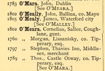
Complete list of O'Mara and O'Meara wills in
[Vicars' index of wills 1536-1810].
Shows Morgan O'Meara of Lissanisky, will pr 1760.
All of these wills were burnt in 1922.
- Around 1770,
a new Lissanisky House was built
on the site of the old Lissanisky Castle.
- In the list of
Freeholders of Co.Tipperary 1776,
Morgan O'Meara (born 1752, died 1829, son of the above Morgan) is listed as
living at Ballymackey and having freehold of Lissanisky.
- Morgan O'Meara "gambled his estate away" before his death without issue in 1829.
-
Simon Pepper is listed at Lissanisky ("Lisanisk"), Nenagh, in
[Leet's Directory, 1814, p.266].
The Pepper family is found there after that.
- It has been claimed that
Dr. Barry O'Meara (died 1836)
lived for a time at Lissanisky.
But [O'Meara, 1996]
thinks that is false.
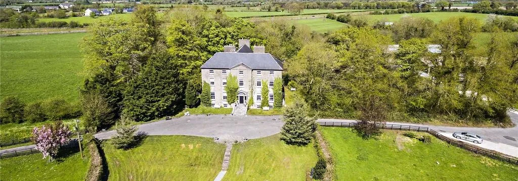
Lissanisky House.
From
lissaniskyhouse.com.
It
is now a guesthouse.
The old Lissanisky Castle is gone.
See modern
satellite view.
And
street view
of entrance.
O'Meara may not have lived at Ballymackey until the 18th century.
At some point,
a new
Ballymackey House was built
beside the old Ballymackey Castle.
It is unclear if O'Meara ever lived in the old castle.
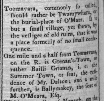
Toomevara and Ballymackey in
[Wilson, 1786, p.168].
Ballymackey is listed as the seat of Morgan O'Meara.
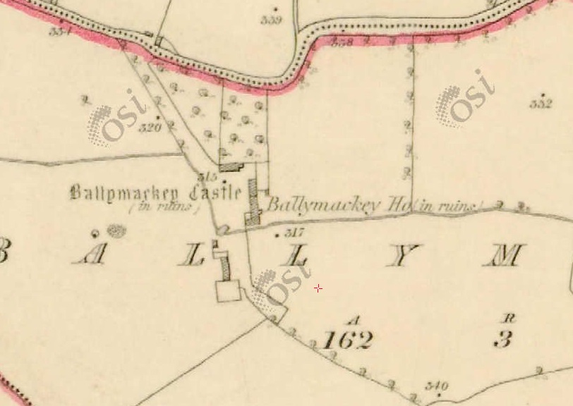
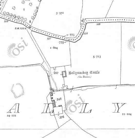
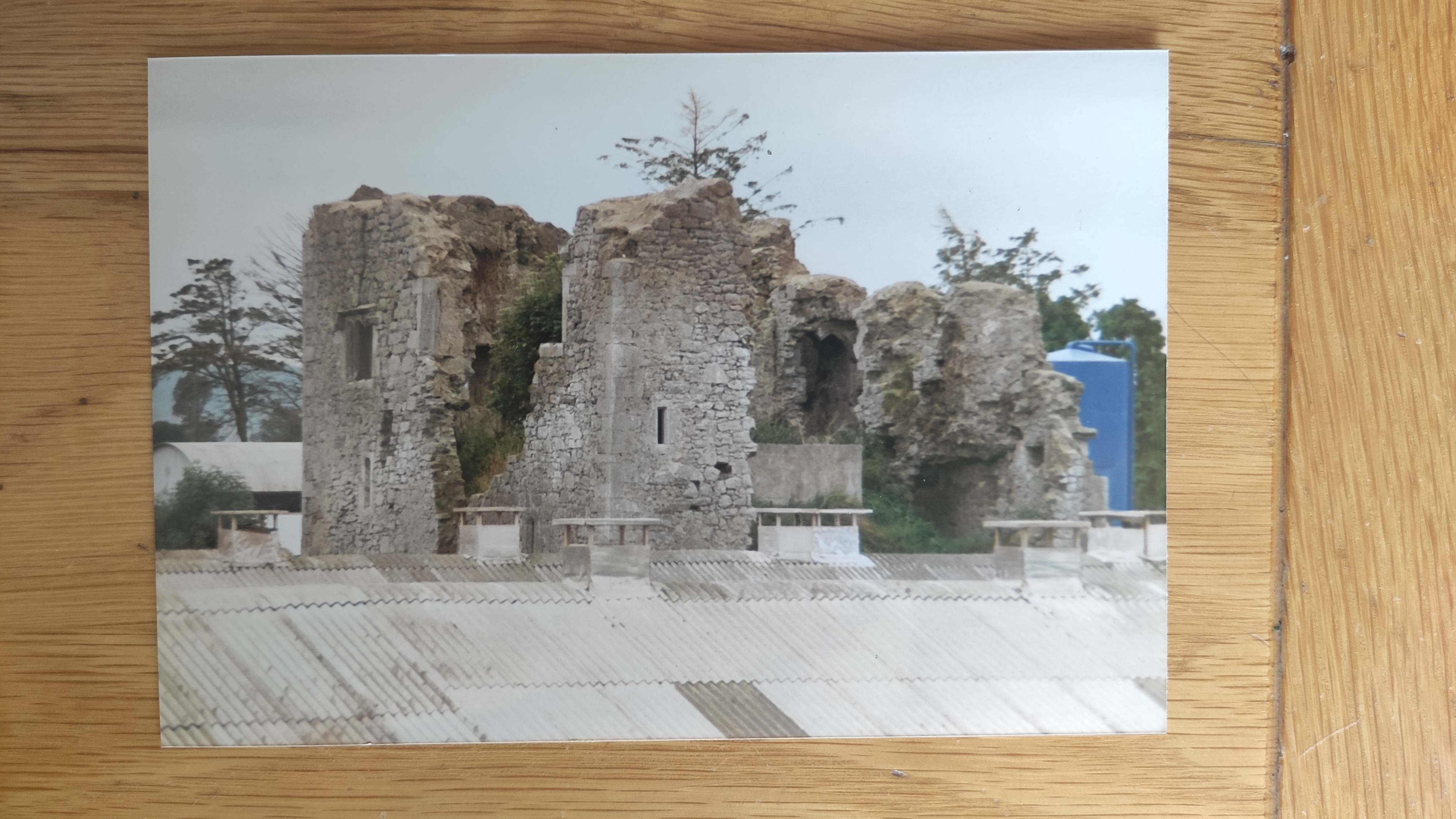
Ballymackey on the first Ordnance Survey map in the 1830s.
Ballymackey Castle
and Ballymackey House are both now in ruins.
Ballymackey on
1887 to 1913 map.
The ruin of Ballymackey House is removed.
The ruin of Ballymackey Castle survives.
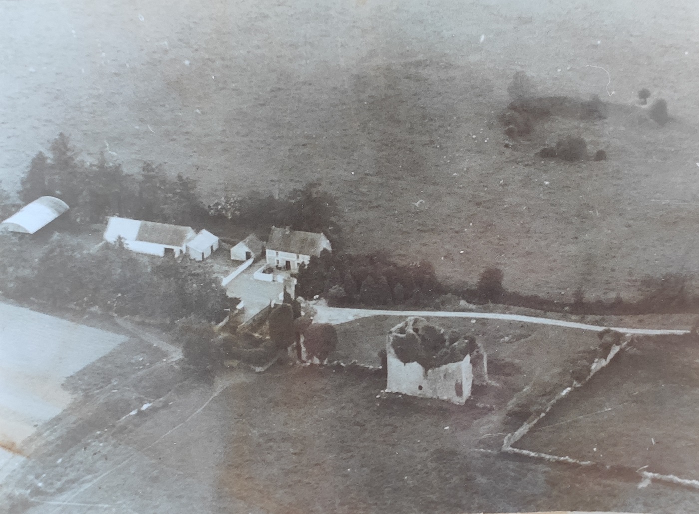
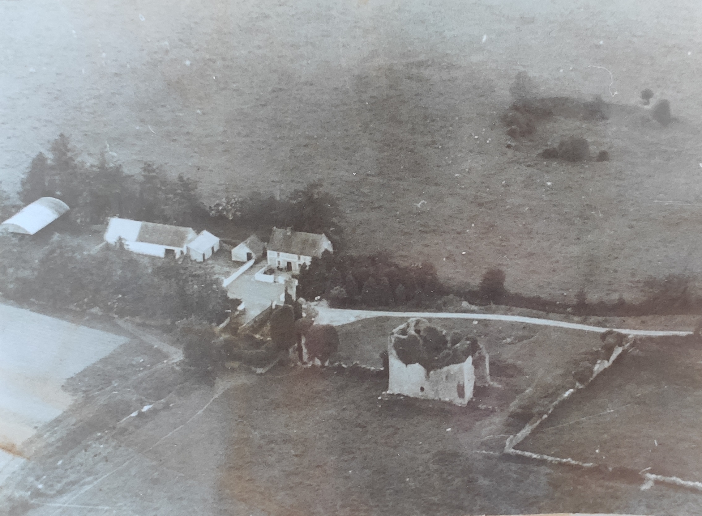
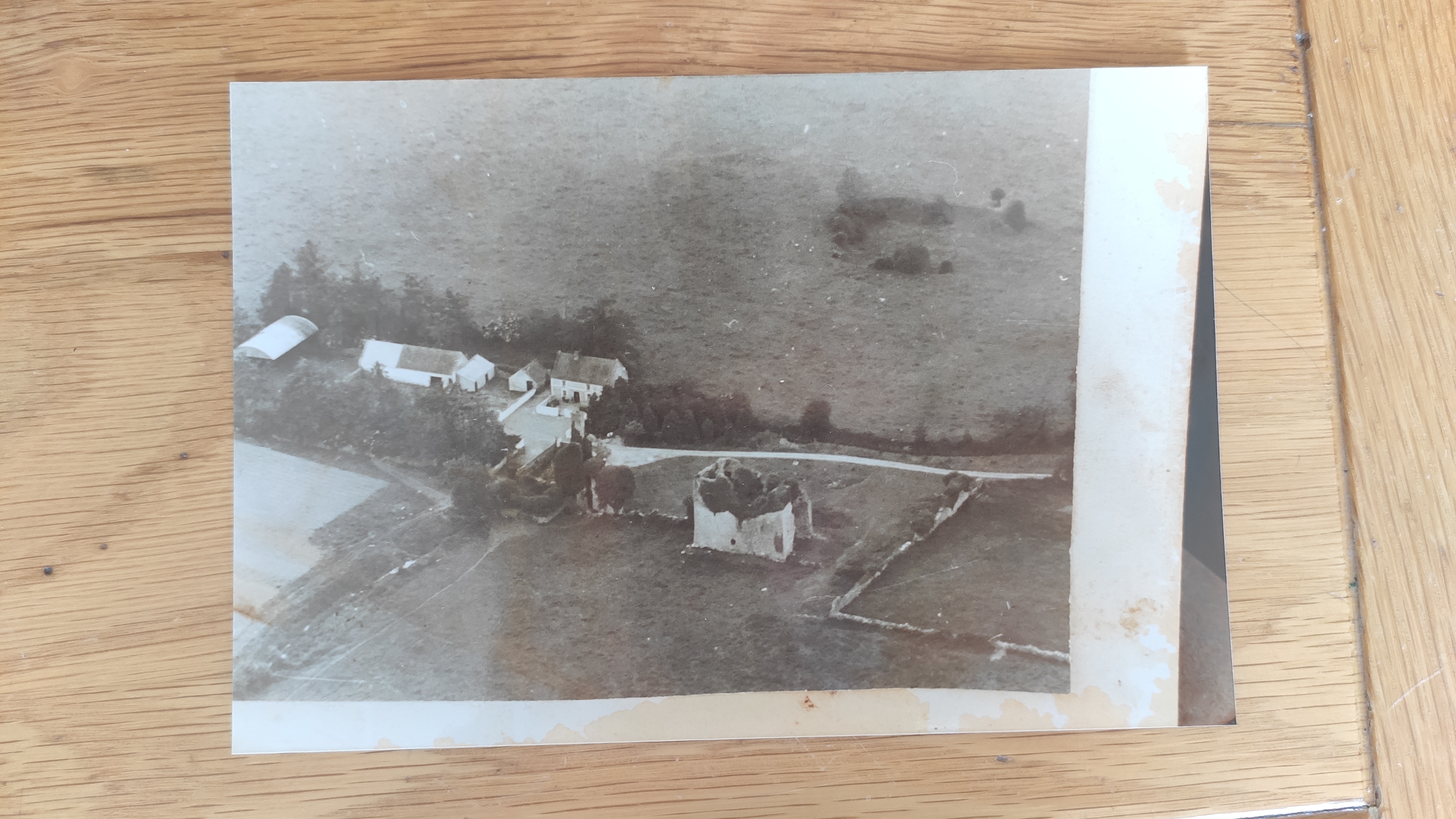
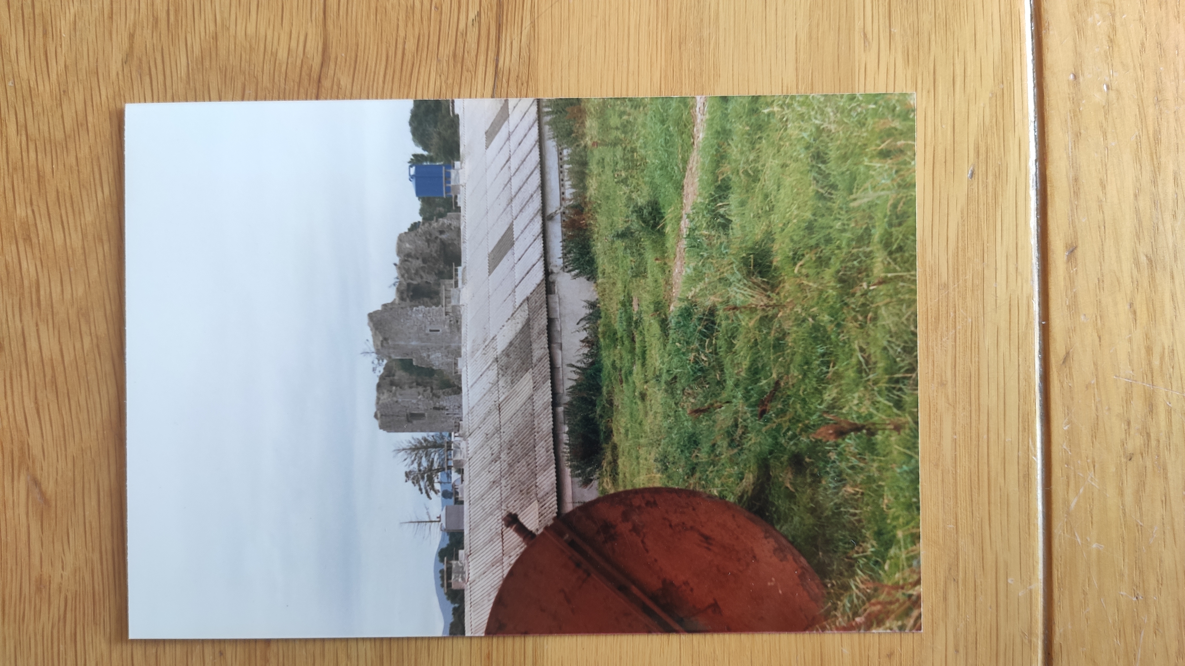
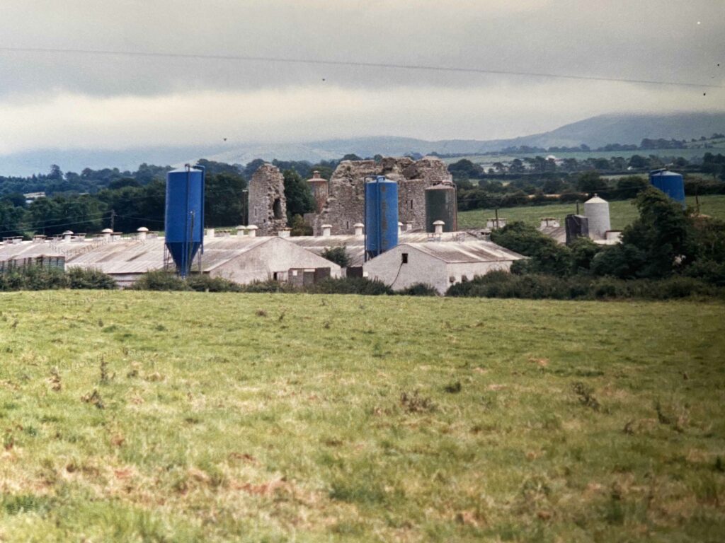
Aerial photo of Ballymackey before the build-up of the pig farm.
View from E, looking W.
Centre RHS is the road coming down from the main road, which is off screen to the RHS.
Photo from Jim Gleeson.
See larger
and full size.
See other copy.
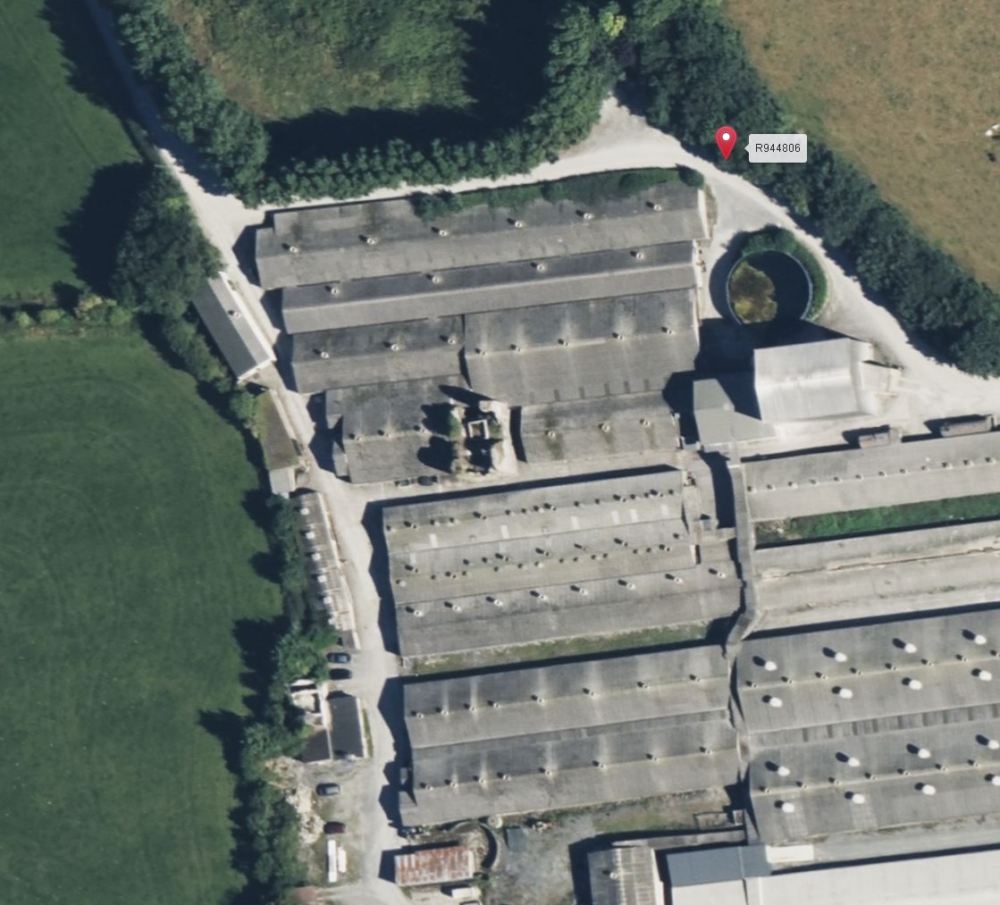
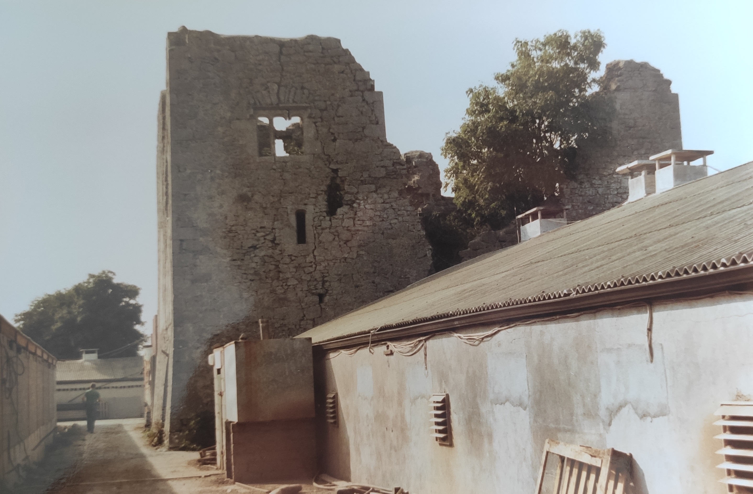
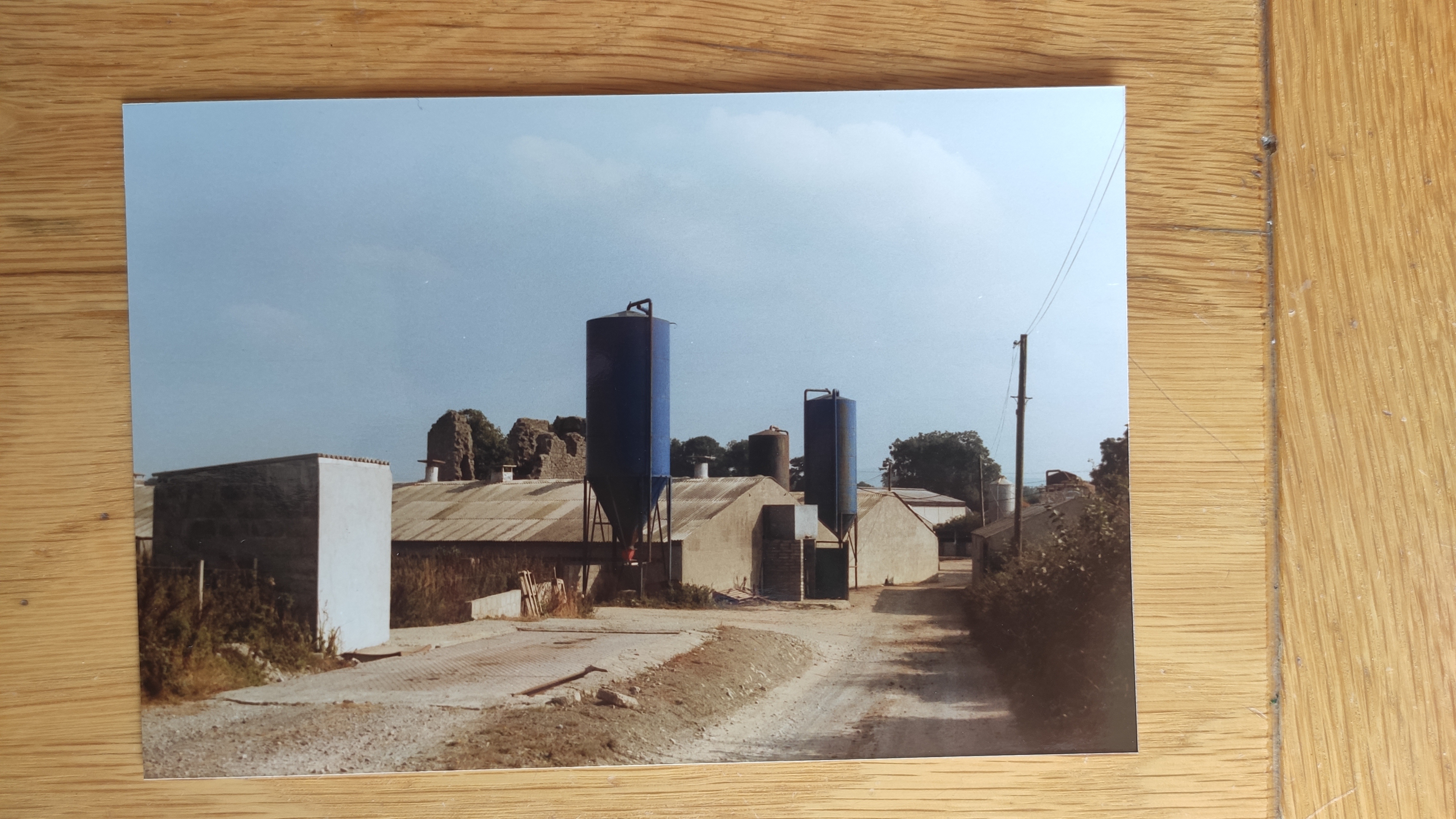
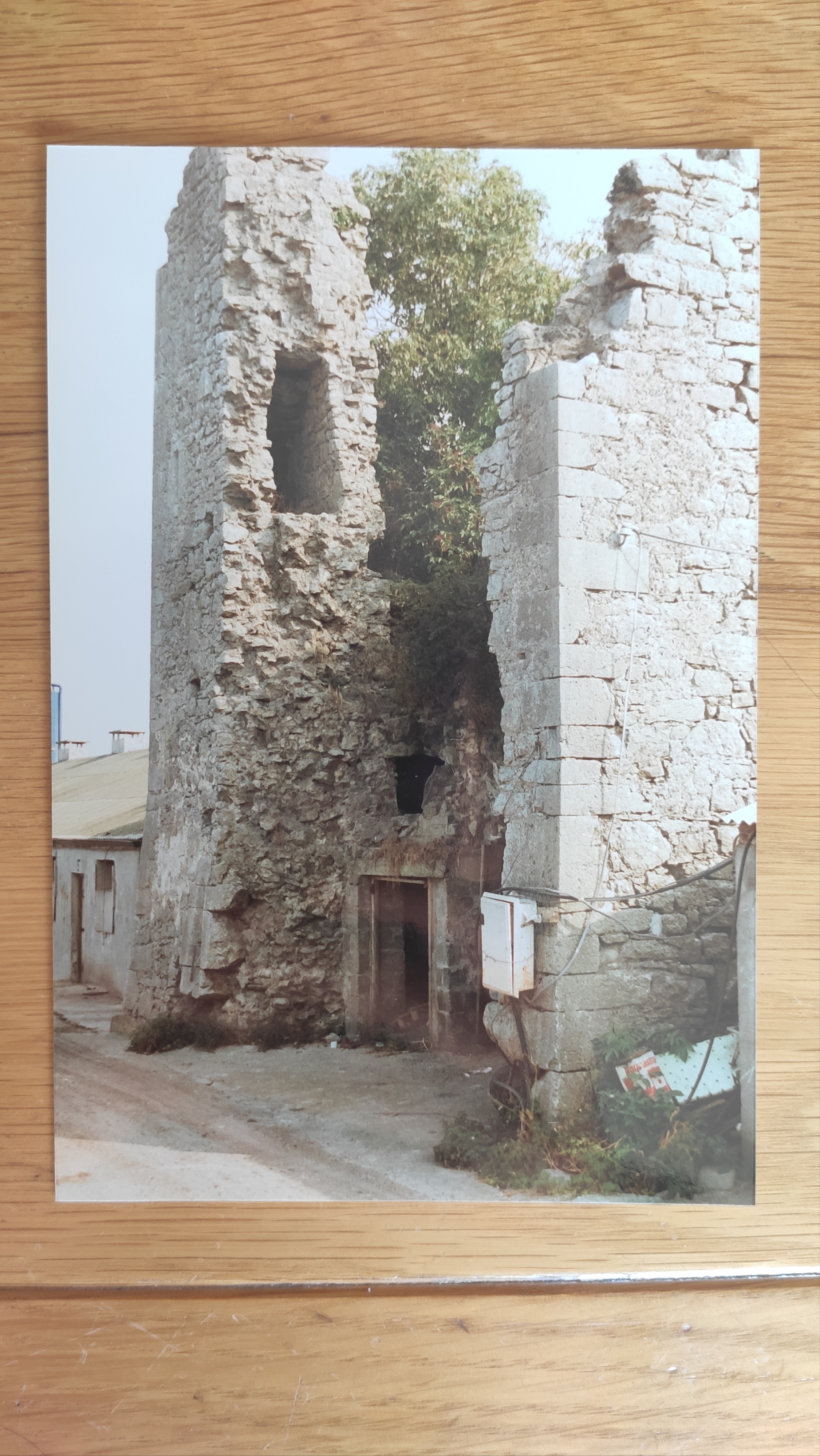
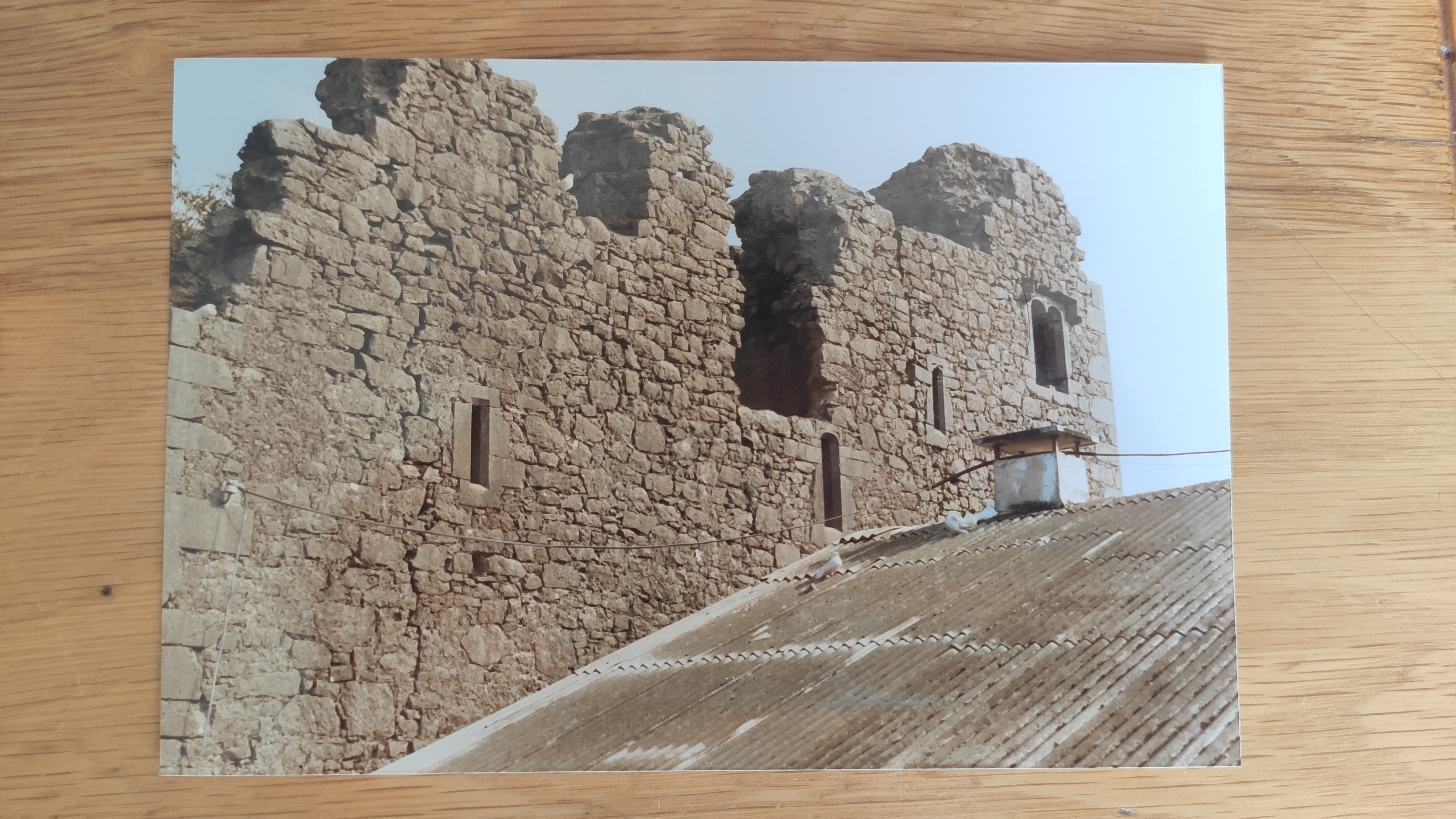
The ruin of Ballymackey Castle survives today,
in the middle of a piggery.
See small square block in the middle here.
It is actually more impressive on the ground since it is higher than the other buildings.
Satellite view from
gridreferencefinder.com.
See Google
satellite view.
And
street view
of entrance.
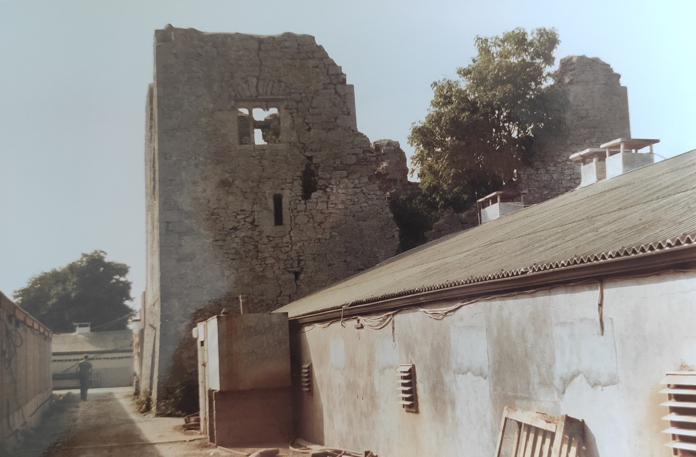
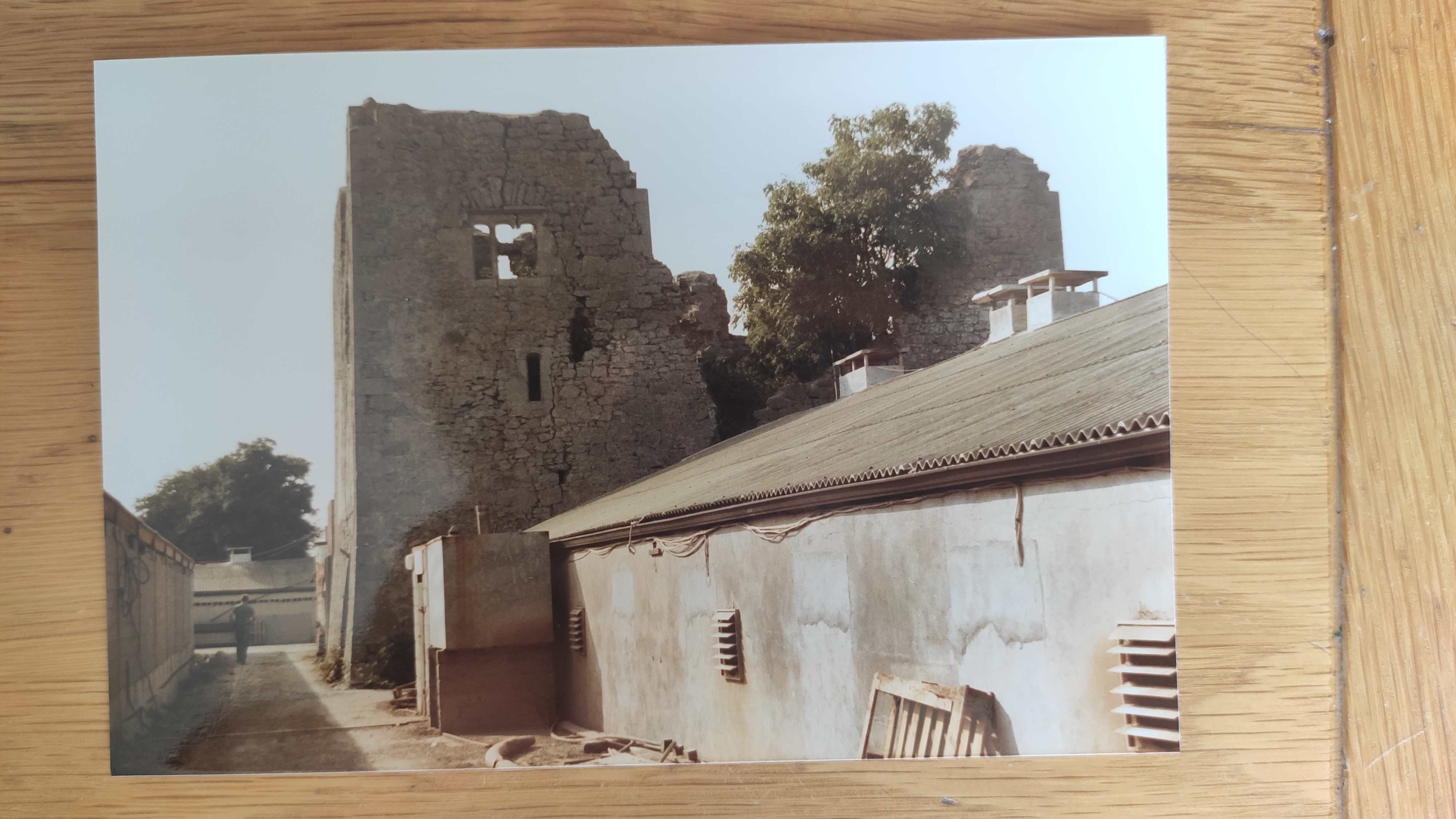
Ballymackey Castle.
Photo 1991.
See larger
and full size.
See other 1991 photos:
distance and
wall and
wall.
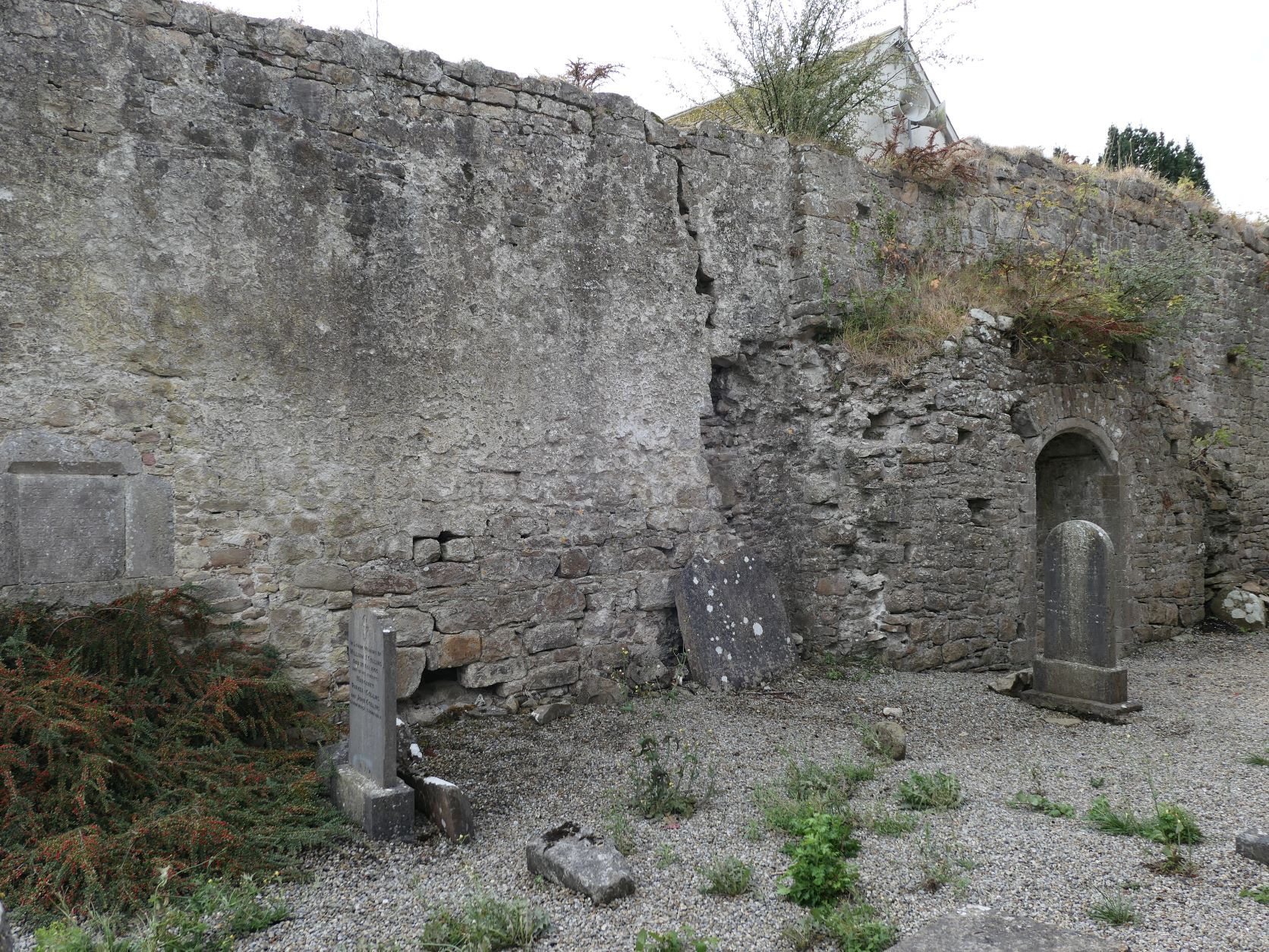
There are two surviving O'Meara memorials
in the ruined Abbey at Toomevara village.
There was also an O'Meara castle at Toomevara.
Part of this may survive.
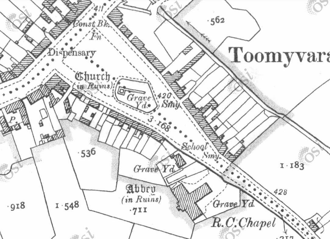
Toomevara (they use "Toomyvara")
on
1887 to 1913 map.
To the NW side here is the
old Dublin-Limerick road, running right past the "Church (in ruins)".
Lower down is the "Abbey (in ruins)".
[Gleeson, 1952]
thinks the "Church" is wrongly labelled by the Ordnance Survey,
and is not actually a church but may be the old O'Meara castle.
Street view of Toomevara.
View from SE side.
On the left is the ruined abbey.
On the right is the ruined "church" (maybe the old castle).
Click to move and rotate.
From here.
See also
satellite view.
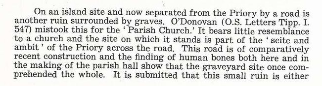
Extract from
[Gleeson, 1952].
Discussing the ruin on the island site.
He thinks this may be the old O'Meara castle of Toomevara.
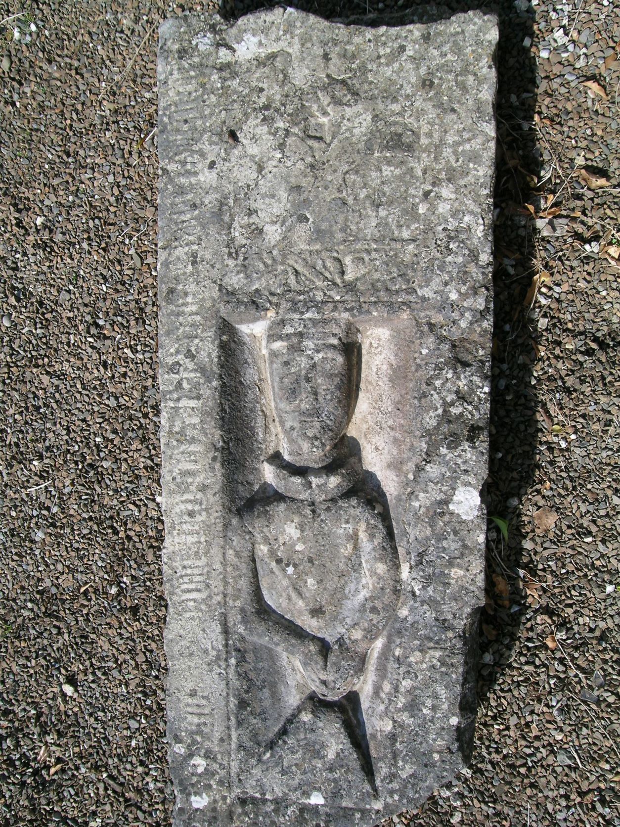
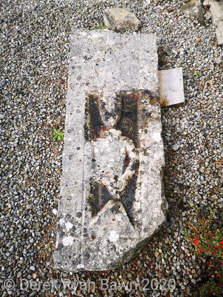
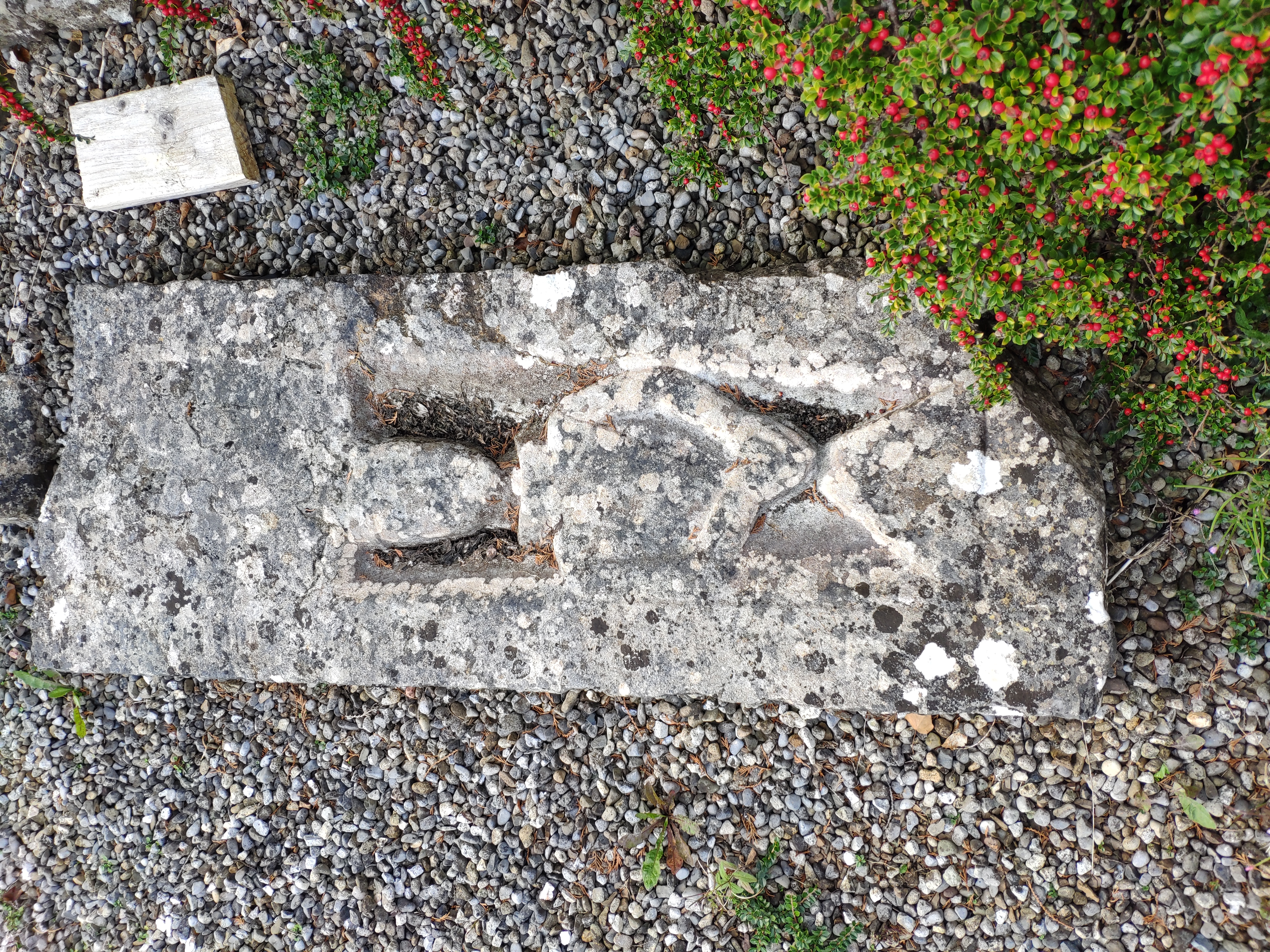
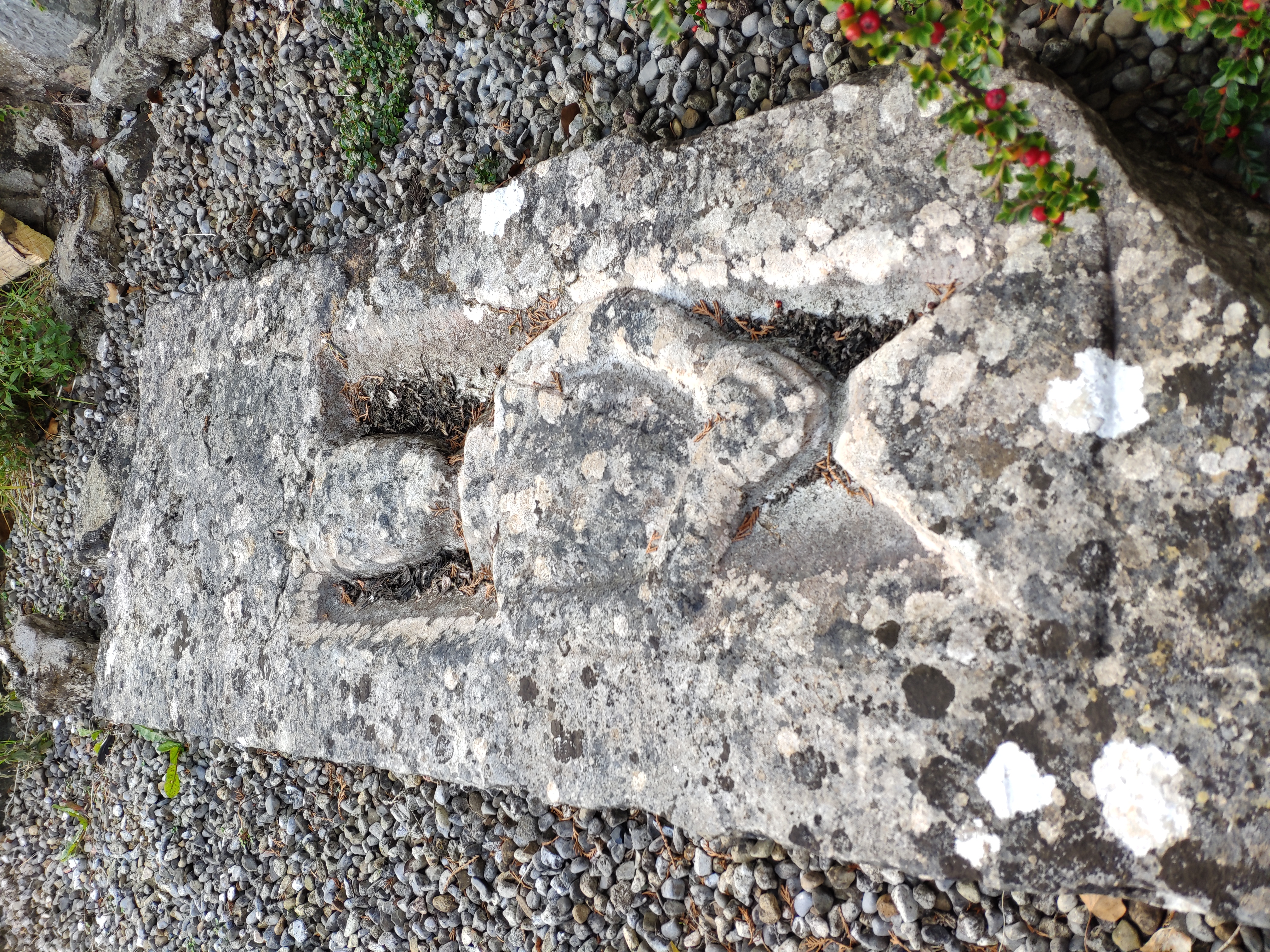
The ruined Abbey at Toomevara has a late 15th century
tombstone of a
"Joannes O'Meara".
It lies outside the S wall at the E end of the church, with the more modern priests' graves.
See
Archaeology.ie.
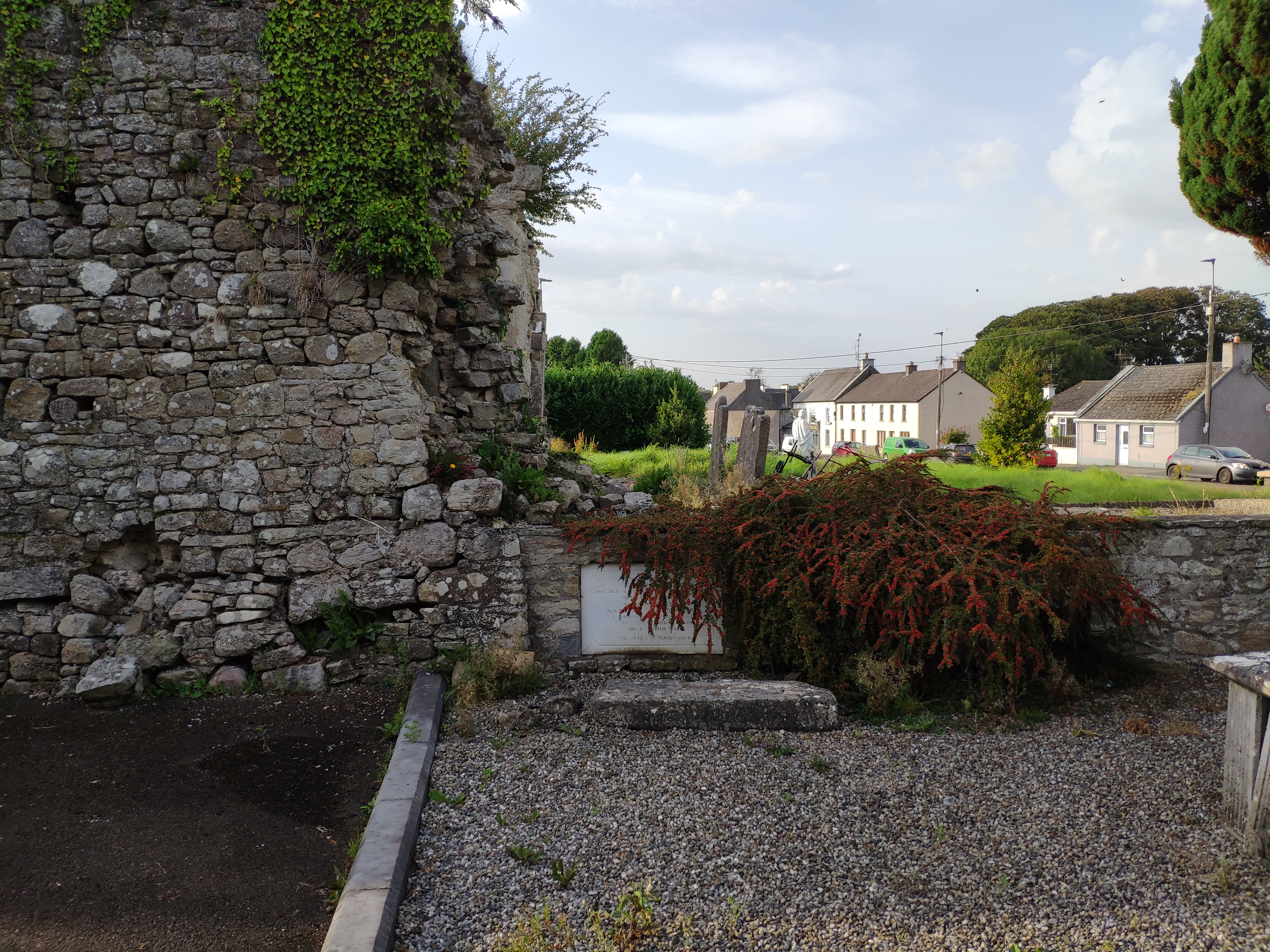
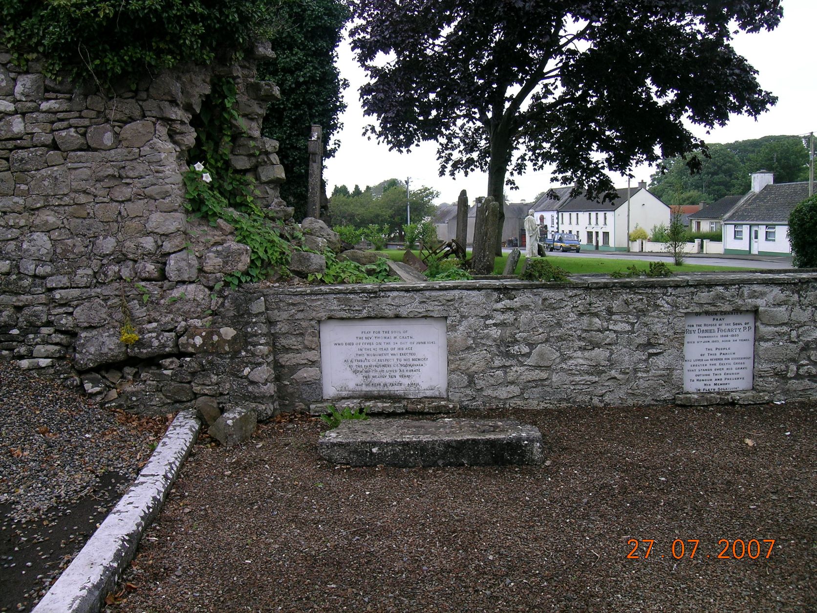
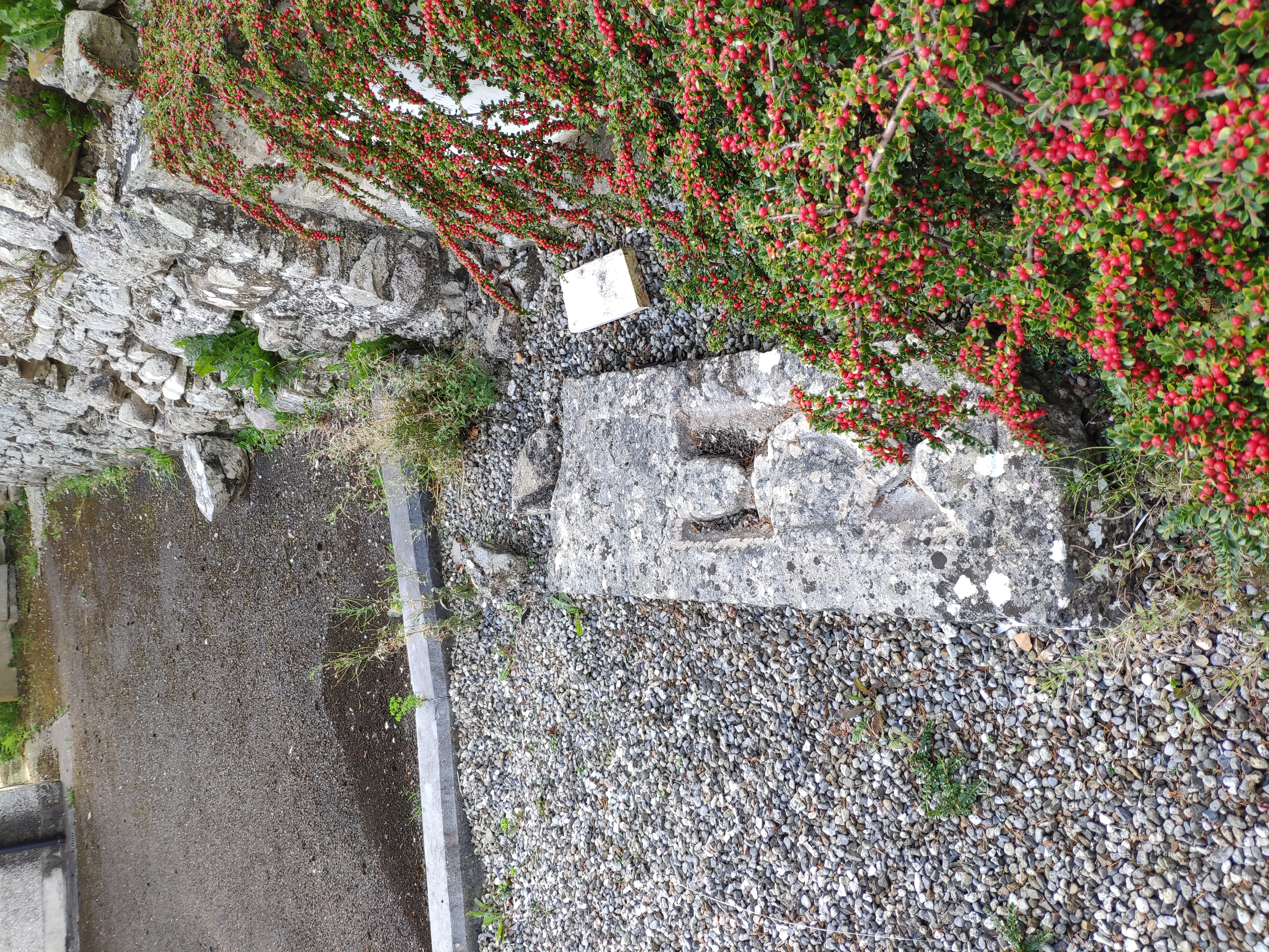
Location of the tombstone.
It is lying down in front of the grave of Rev. Thomas McGrath (died 1843).
Photo 2023.
See
larger
and
full size.
See
wider shot.
See
closer shot.
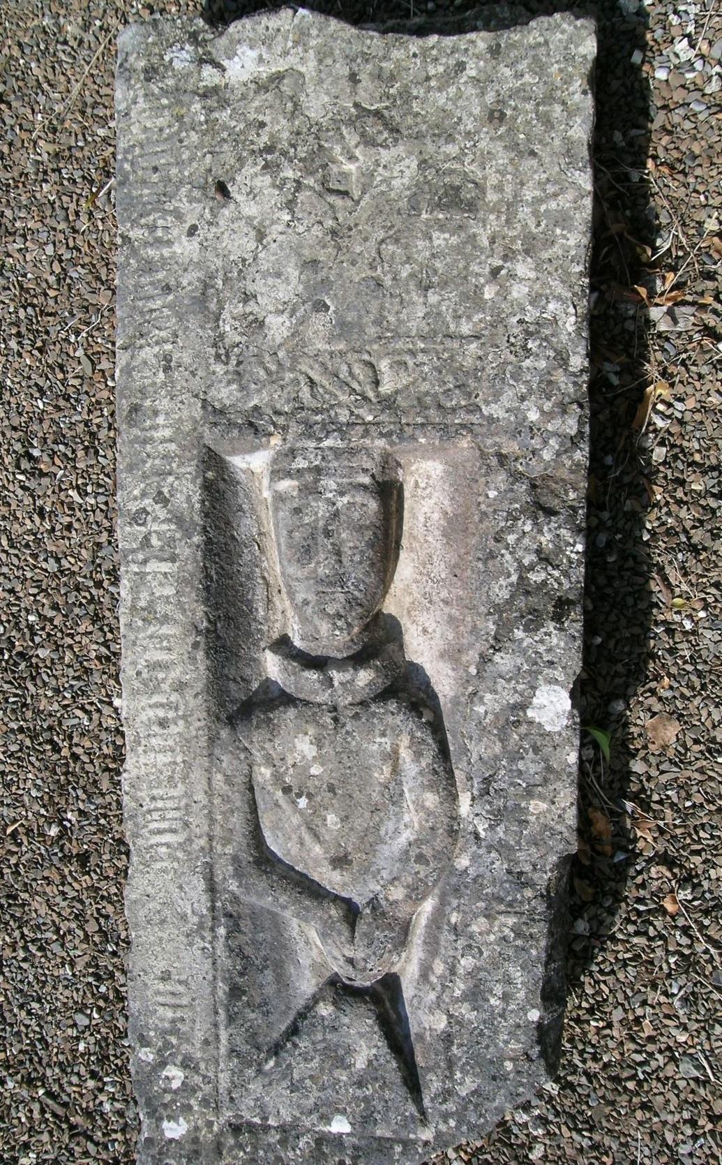
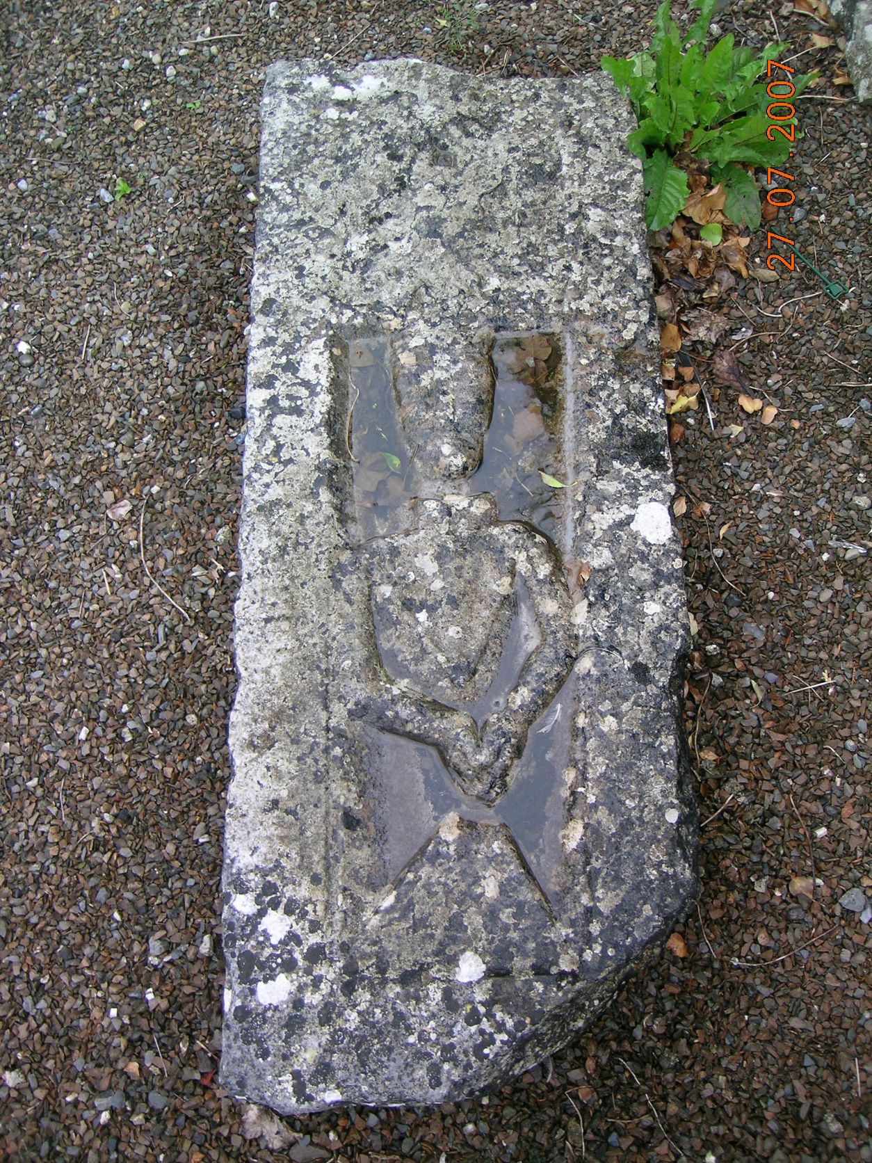
The O'Meara tombstone.
It fills up with water. This is it when cleaned out.
See
full size.
See
2007 picture
filled with water.
Both from
Archaeology.ie,
which has more pictures.

Extract from
[Gleeson, 1952].
He says the stone was then at the N wall of the Abbey (or Priory).
It has clearly been moved.
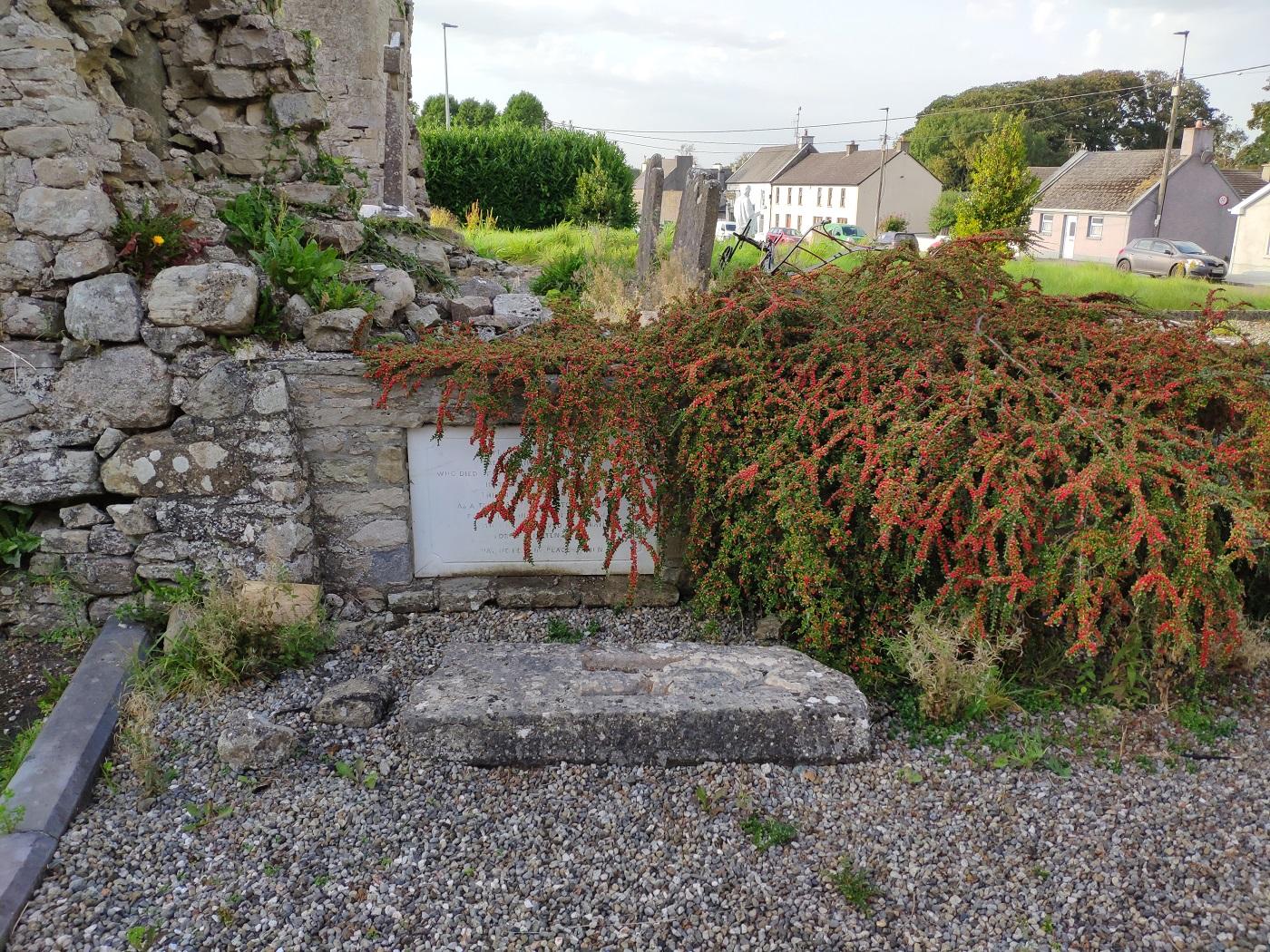
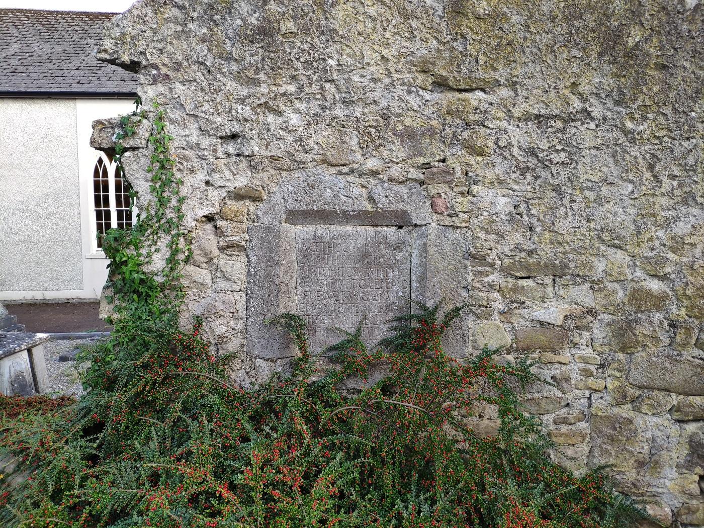
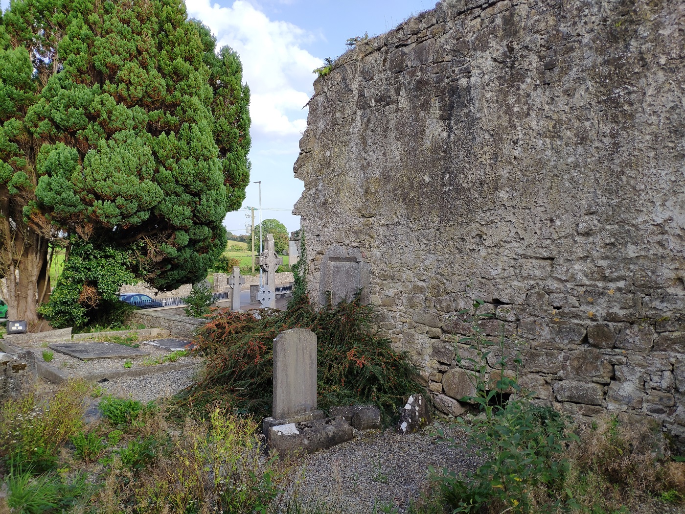
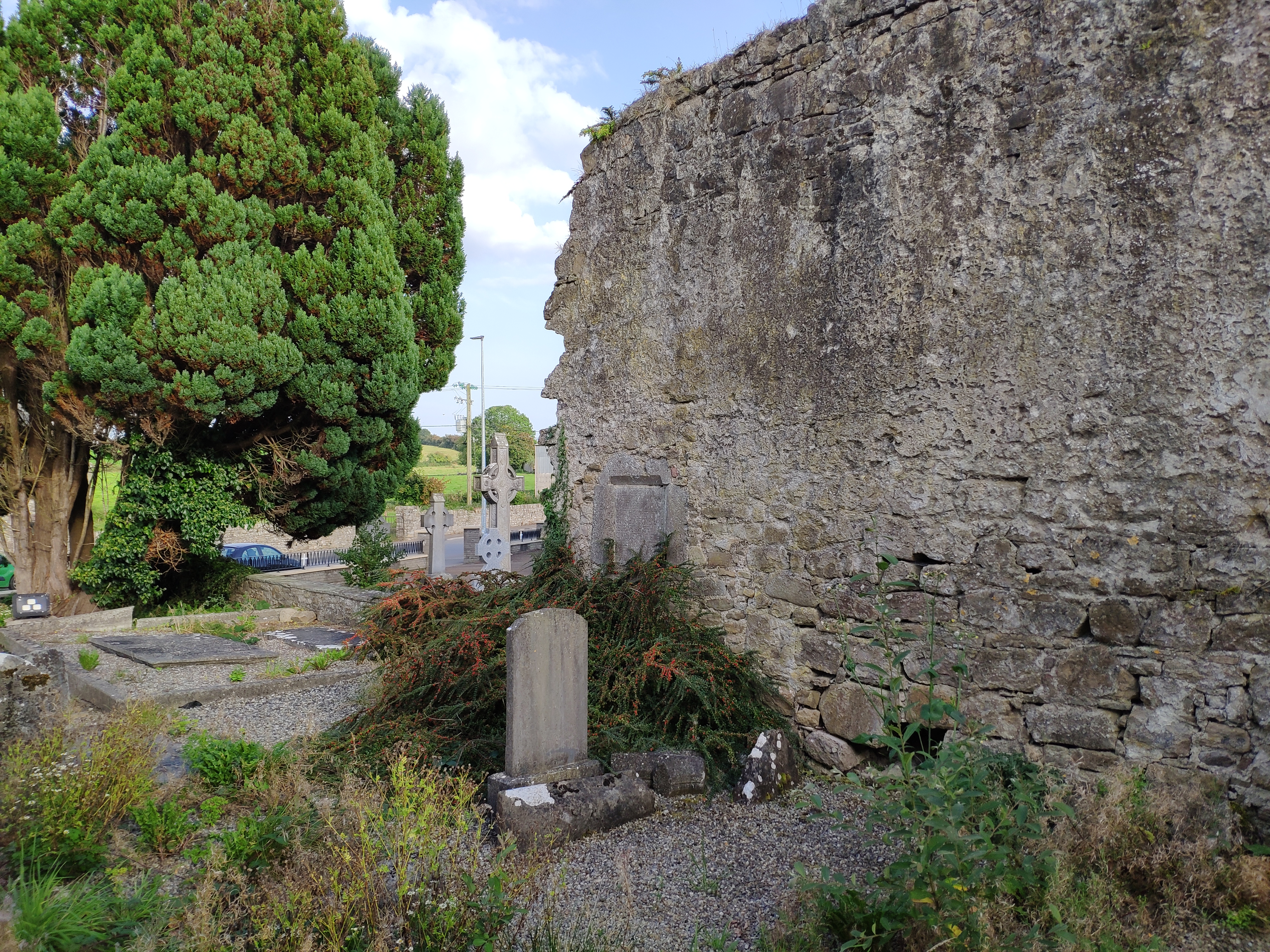
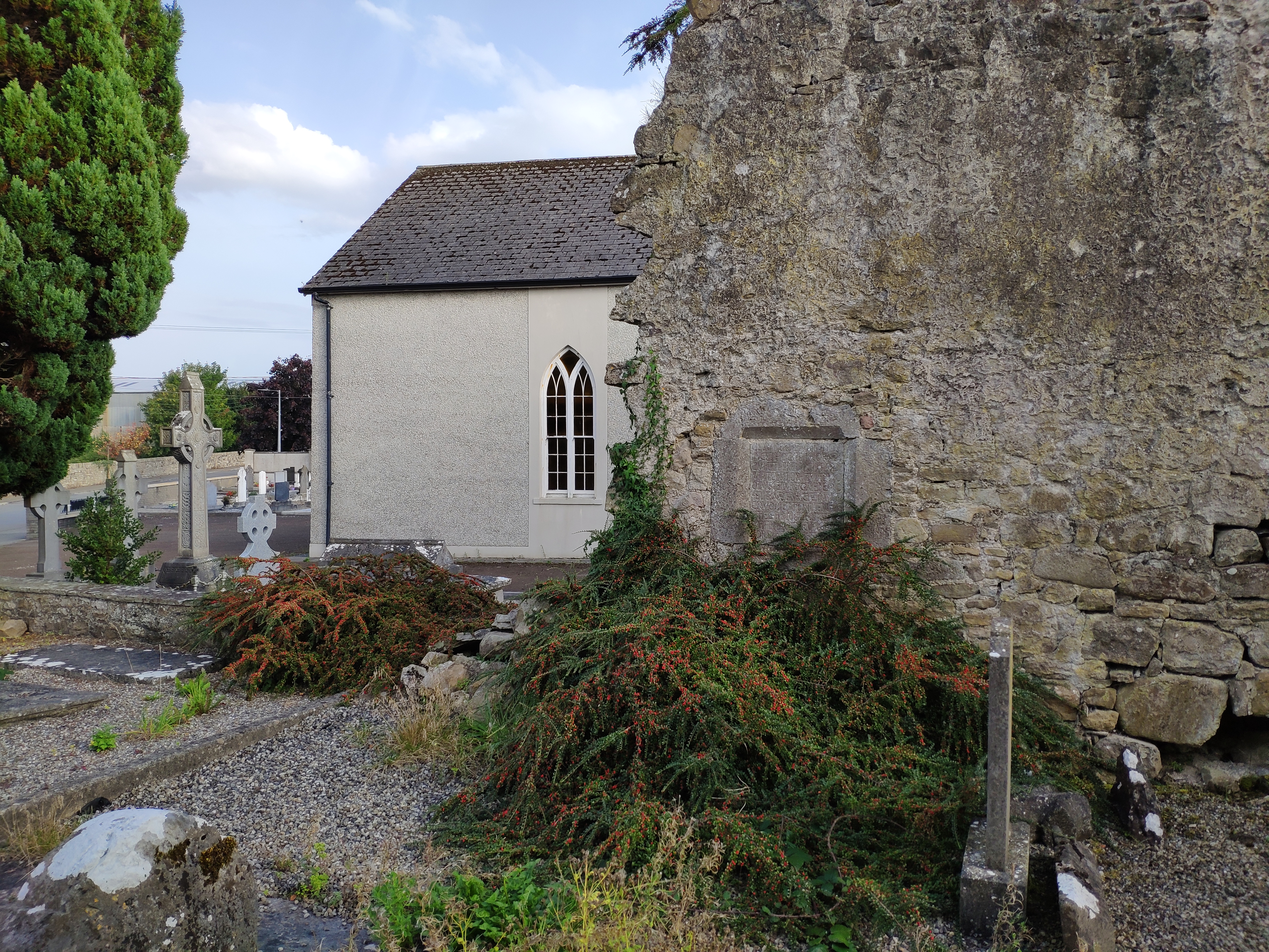
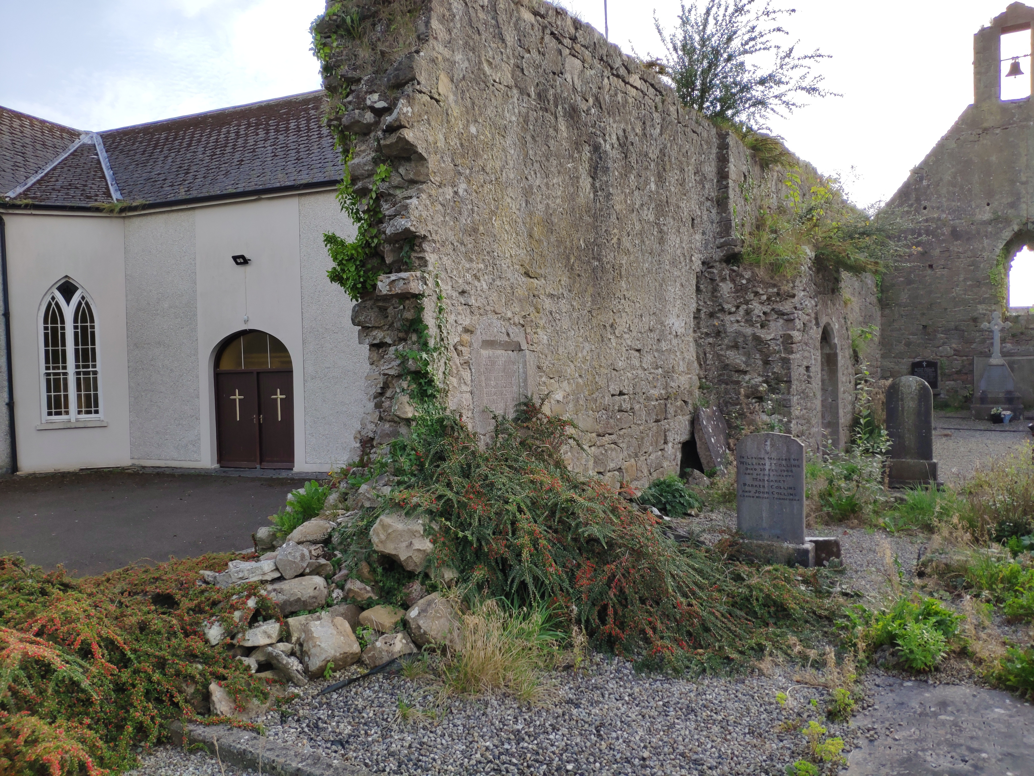
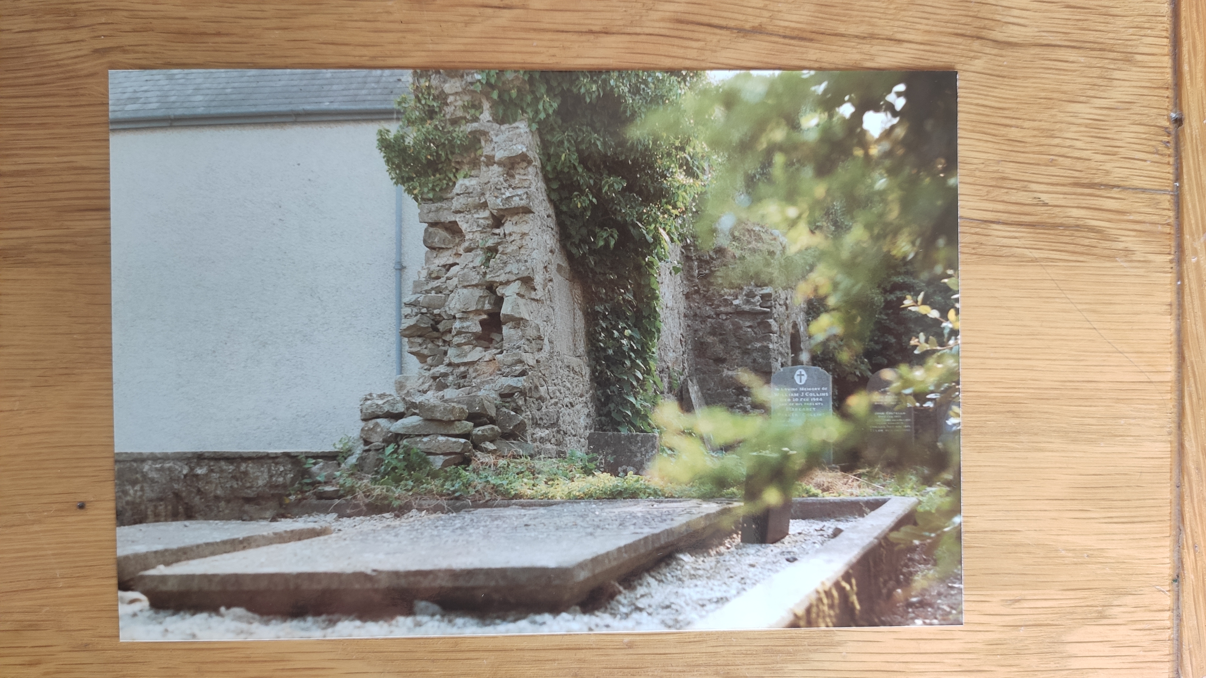
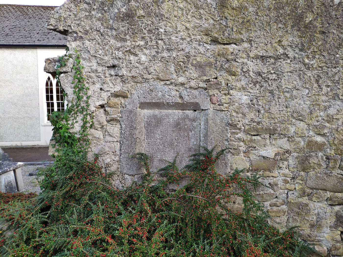
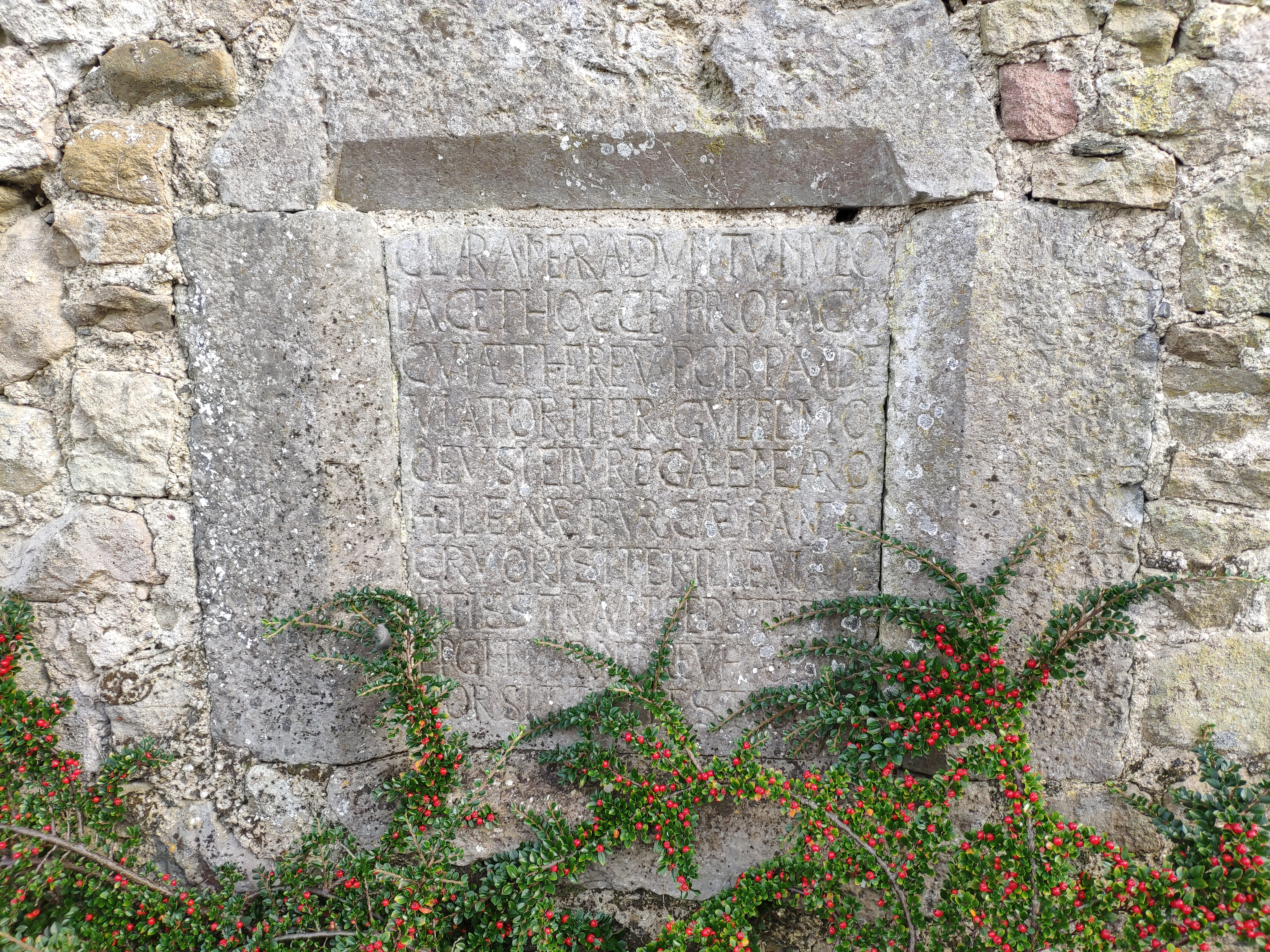
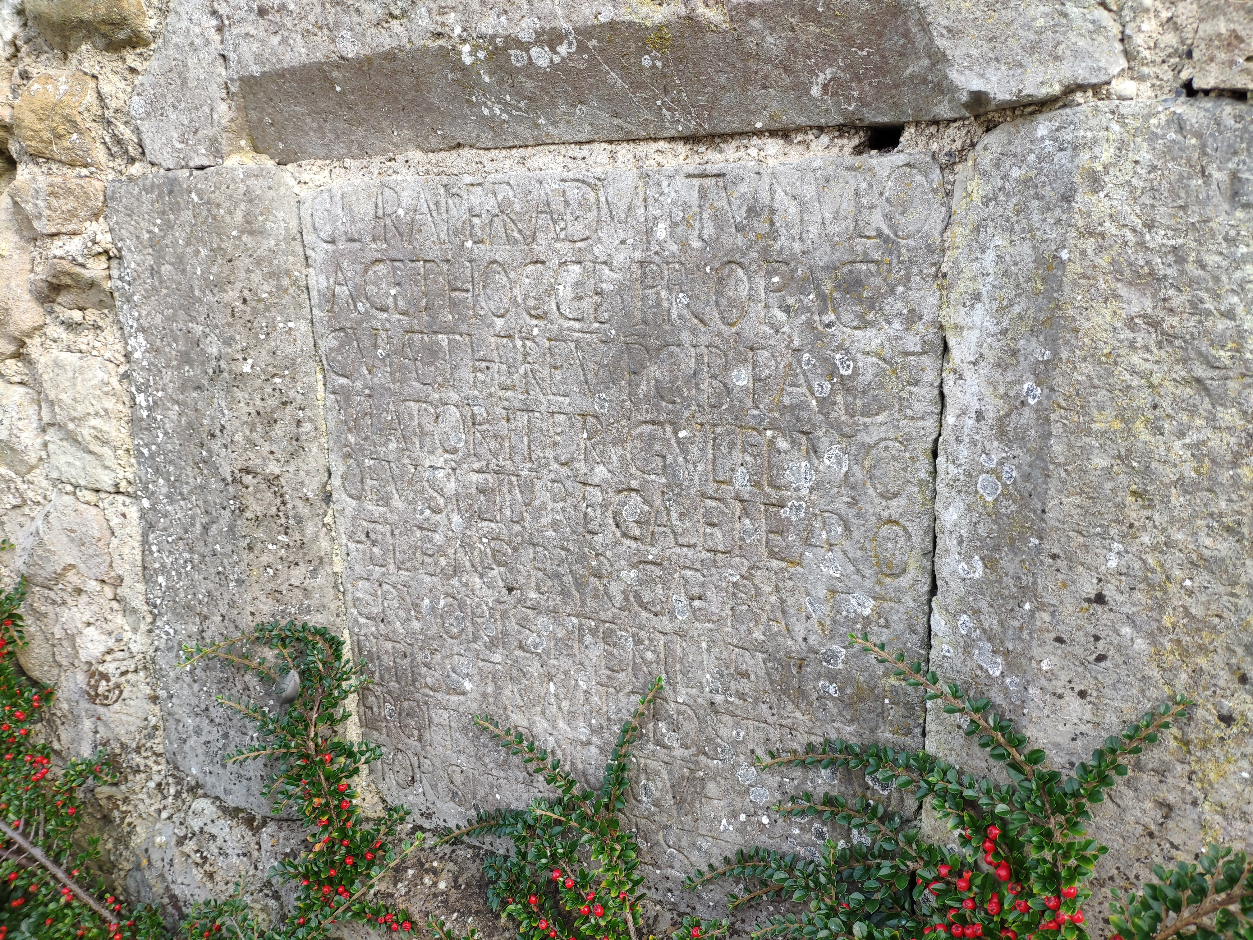
At the ruined Abbey (or Priory)
at Toomevara is an O'Meara wall plaque with a Latin inscription dated 1624.
It is on the inner face of the S wall.
This is the memorial of
William O'Meara of Lissanisky.
The inscription was
composed by
Dermod O'Meara,
physician and poet.
See
Archaeology.ie.

Location of the wall plaque (on end of wall).
Photo 2023.
See
larger
and
full size.
See
closer shot.
See
other angle.
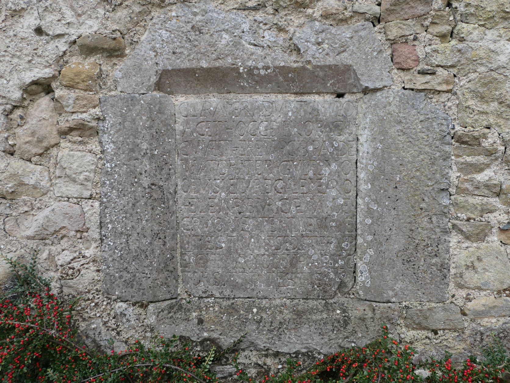
Closer shot of the wall plaque.
Photo 2023.
See
larger
and
full size.
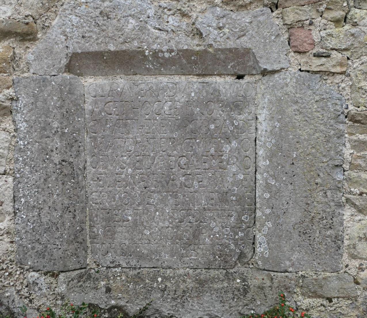
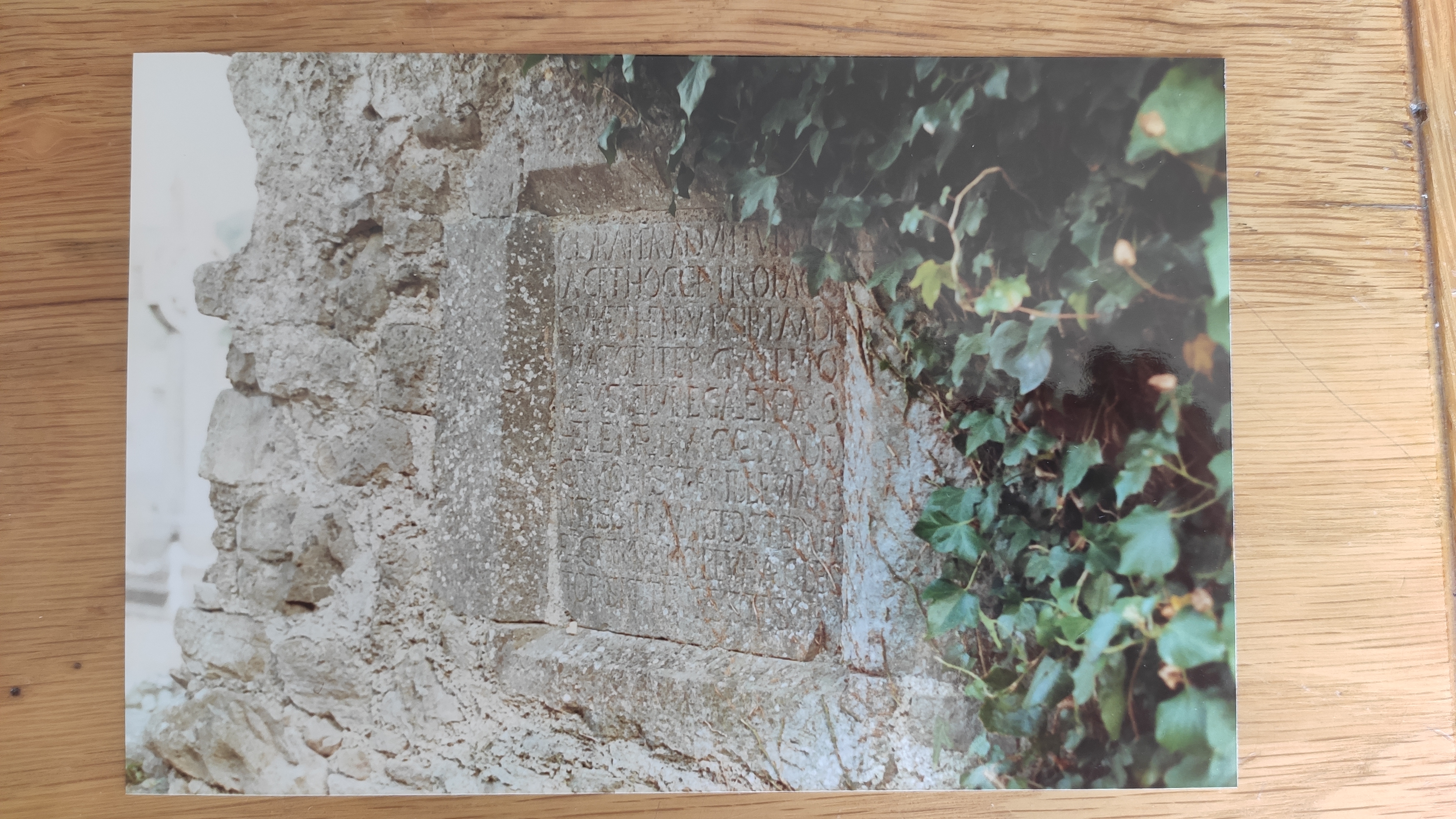
The 1624 wall plaque.
See full size.
From Archaeology.ie.

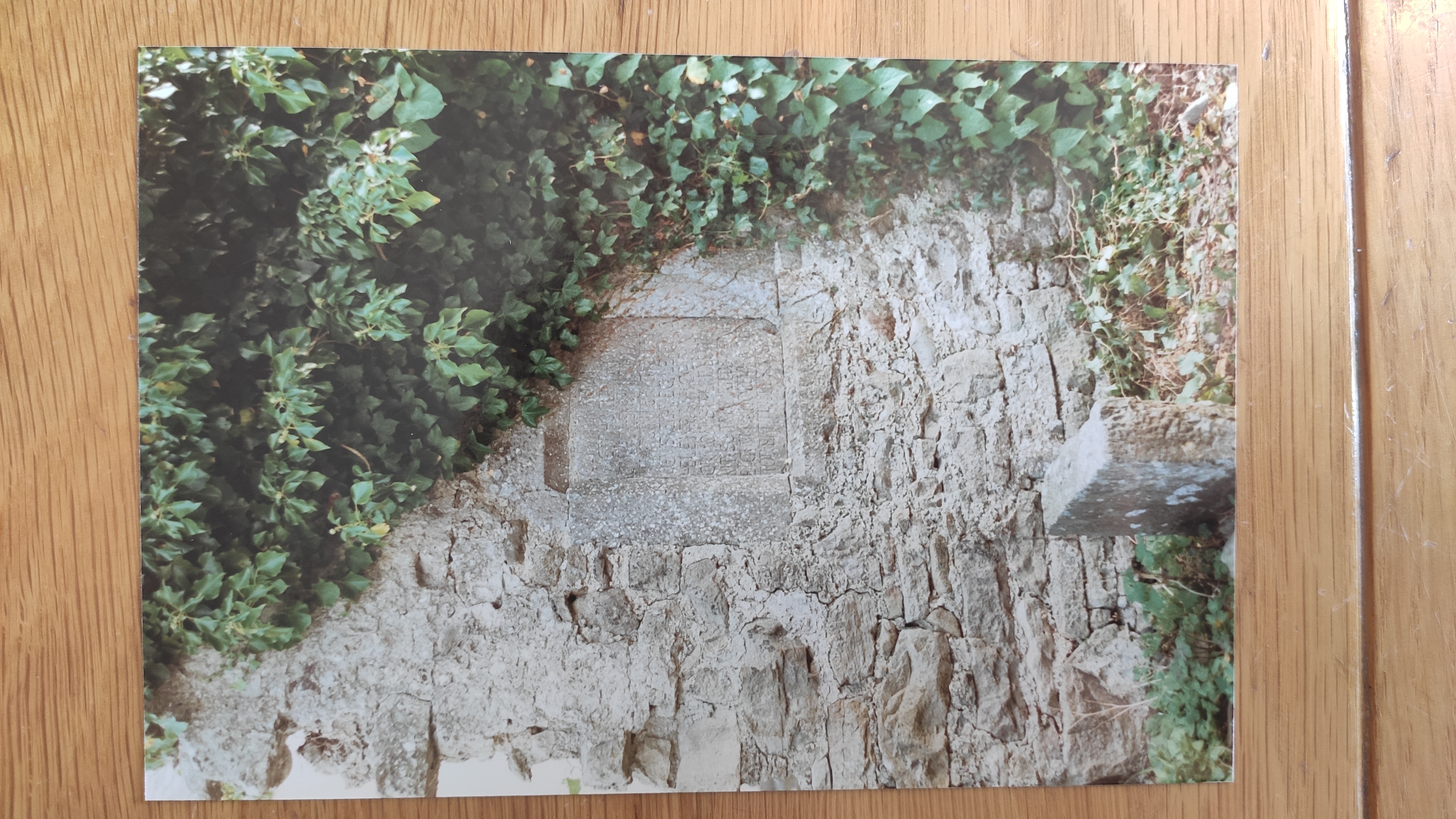
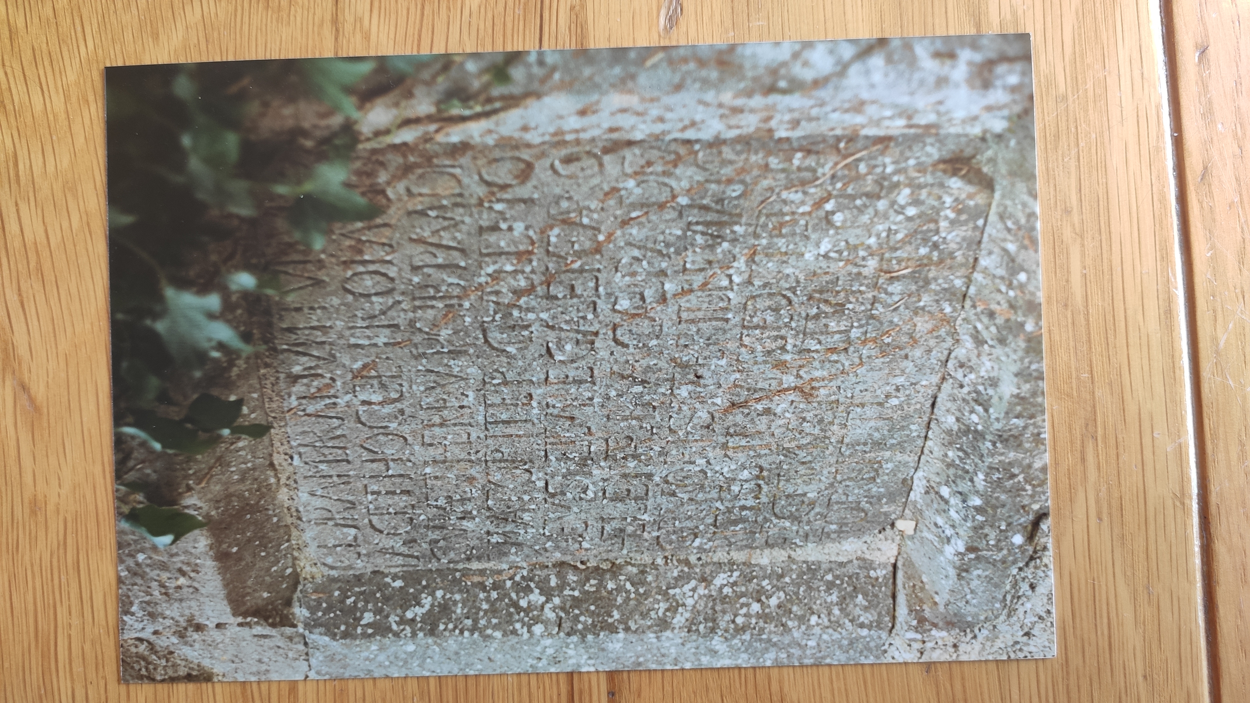
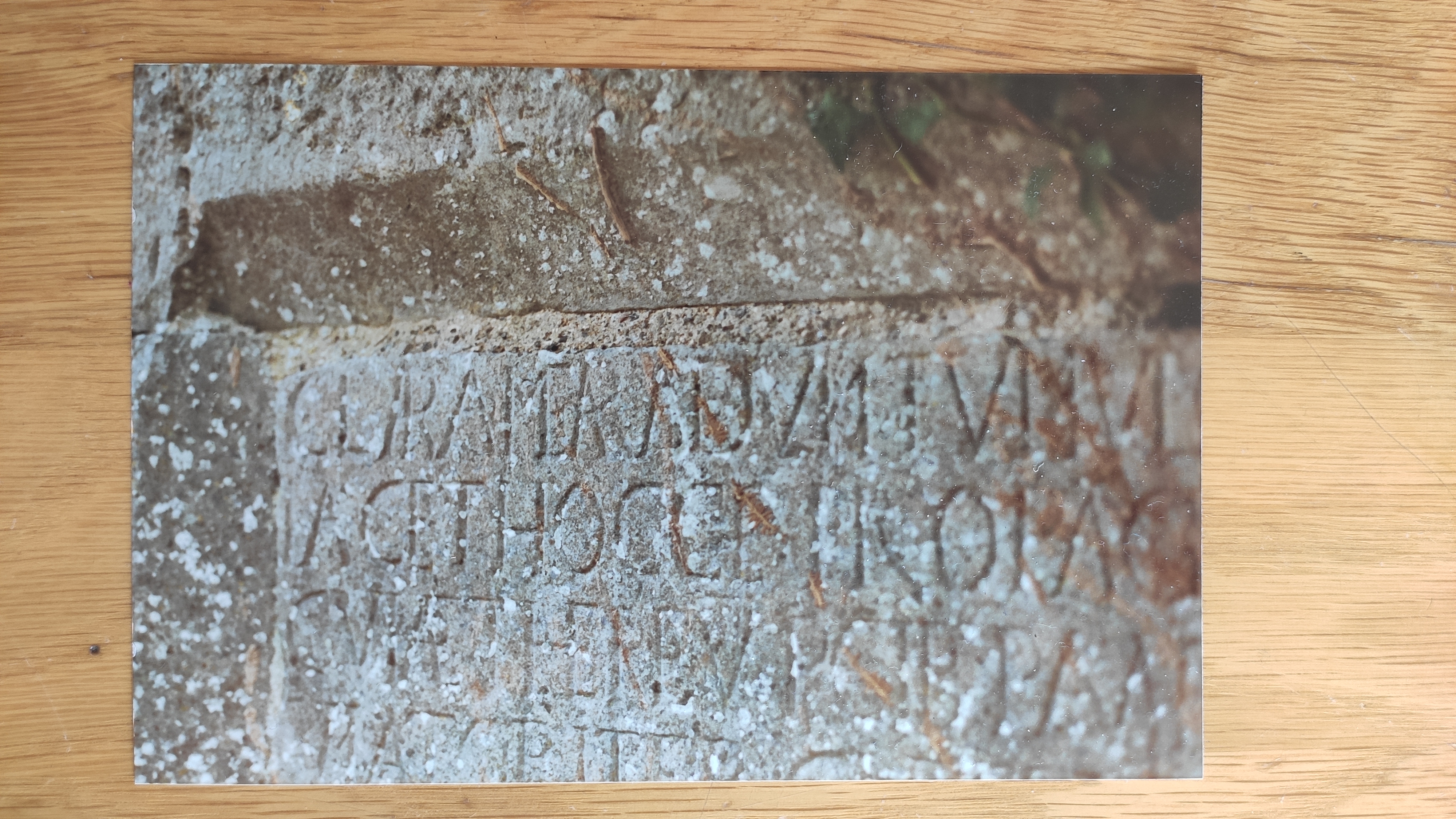
Close-up of the 1624 wall plaque.
Photo 2023.
See
larger
and
full size.
See
angle.
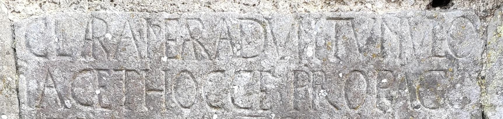
The opening part of the inscription.
Shows it starts:
"Clara
Meara
dum
tumulo
jacet
hocce propago ..."
Translation:
"In this
tomb
lies
the
illustrious
sept of the
Mearas ..."
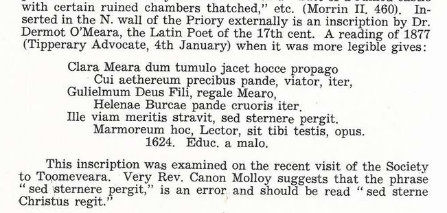
Extract from
[Gleeson, 1952]
about the wall plaque.
[O'Meara, 1996]
quotes a 20th century reading of the date as "1641",
and says that date does not make sense - it should be 1624.
Gleeson
quotes an 1877 reading, when it was more legible, which indeed shows it is 1624.
Translation in [Sheehan, 1949, p.49].
- Location:
[Gleeson, 1952]
says it is then in the N wall externally.
-
It must have been moved. (It looks today as if it was moved.)
-
If it was moved, it was in the 1950s-80s since
it is in the current location as at Boland's photograph in 1980s
and my own visit in 1991.
3D model
of the wall plaque.
From
Archaeological Survey of Ireland.
Click to rotate and zoom.
Looking at the last line, it is unclear where the entire line
"1624. Educ. a malo."
is meant to be.
We shall just have to go with the 1877 reading.
