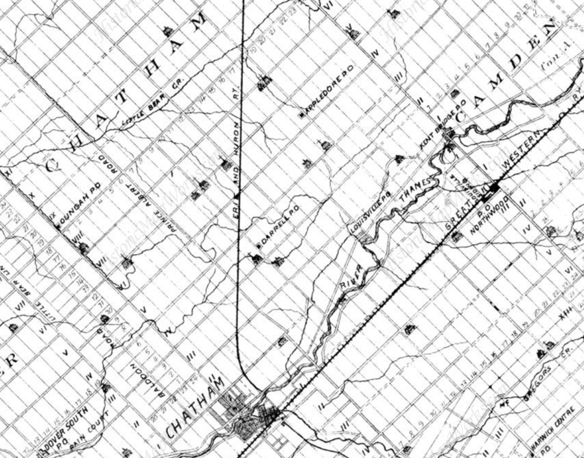
Another view. Rotated to see text, so N is not up.
From 1880 map.
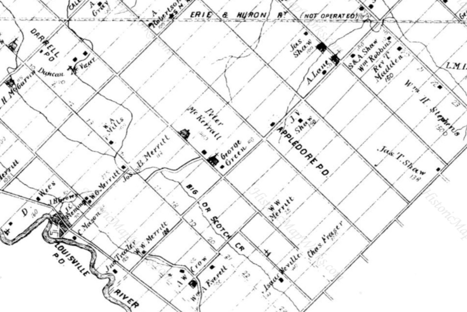
The Noltie farm is where "V" (visible on wider map)
and "19" (visible here) intersect.
It is the blank unlabelled plot across the road from "George Green".
The church at "George Green" is gone.
The church 2 blocks up the road survives.
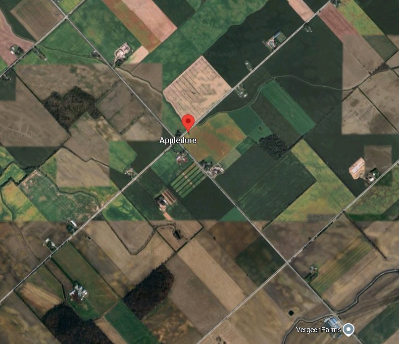
The location of the Noltie graves (red pin) on modern satellite view.
This matches the location of the Noltie plot on the maps above.
The Noltie plot would be the large area to the SE of this junction,
extending to the next road.
This is the junction of the Eberts Line road (N side) and Lindsay Road (W side).
From
here.
The Noltie graves at the Noltie farm.
The graves are at the clump of trees here.
View from Eberts Line road to the NW, looking into the Noltie farm.
Click to rotate.
From
street view.
The Noltie farm.
View from Lindsay Road (SW) side.
Click to rotate.
From
street view.
Please donate to support this site.
I have spent a great deal of time and money on this research.
Research involves travel and many expenses.
Some research "things to do"
are not done for years, because I do not have the money to do them.
Please Donate Here
to support the ongoing research and
to keep this website free.
