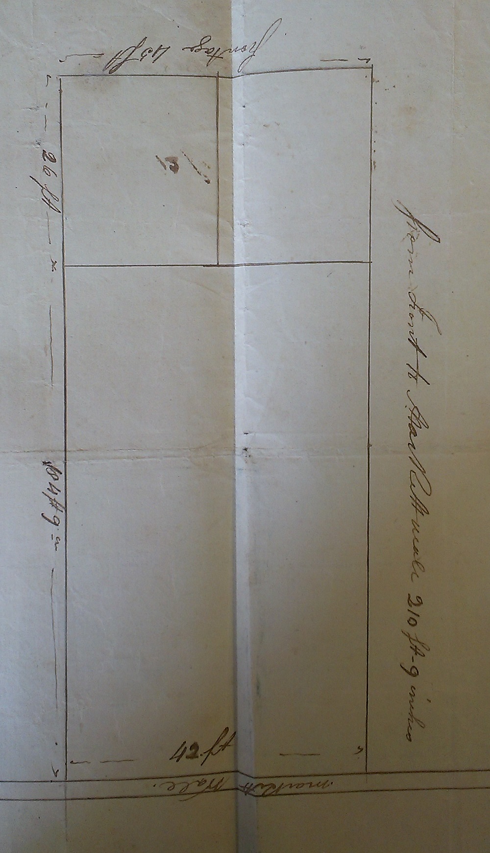
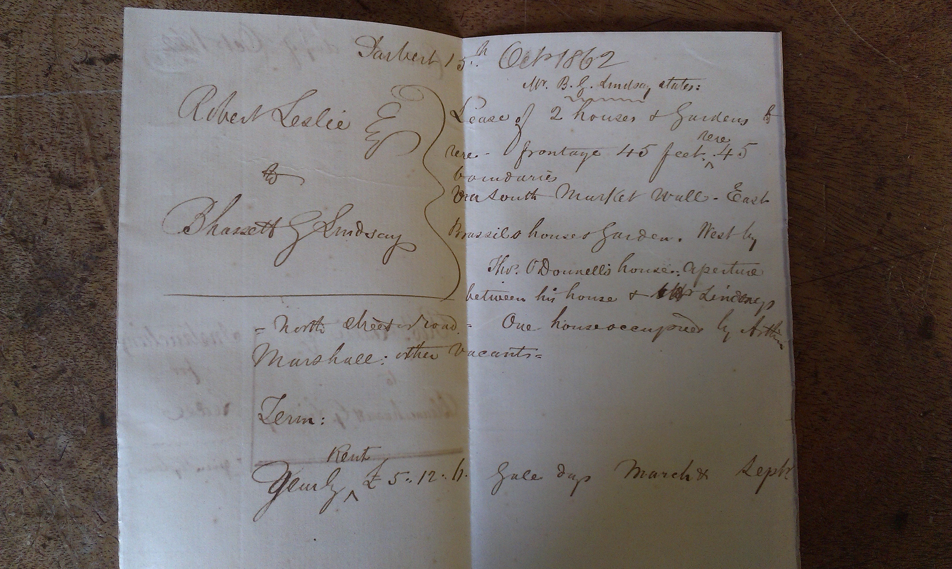
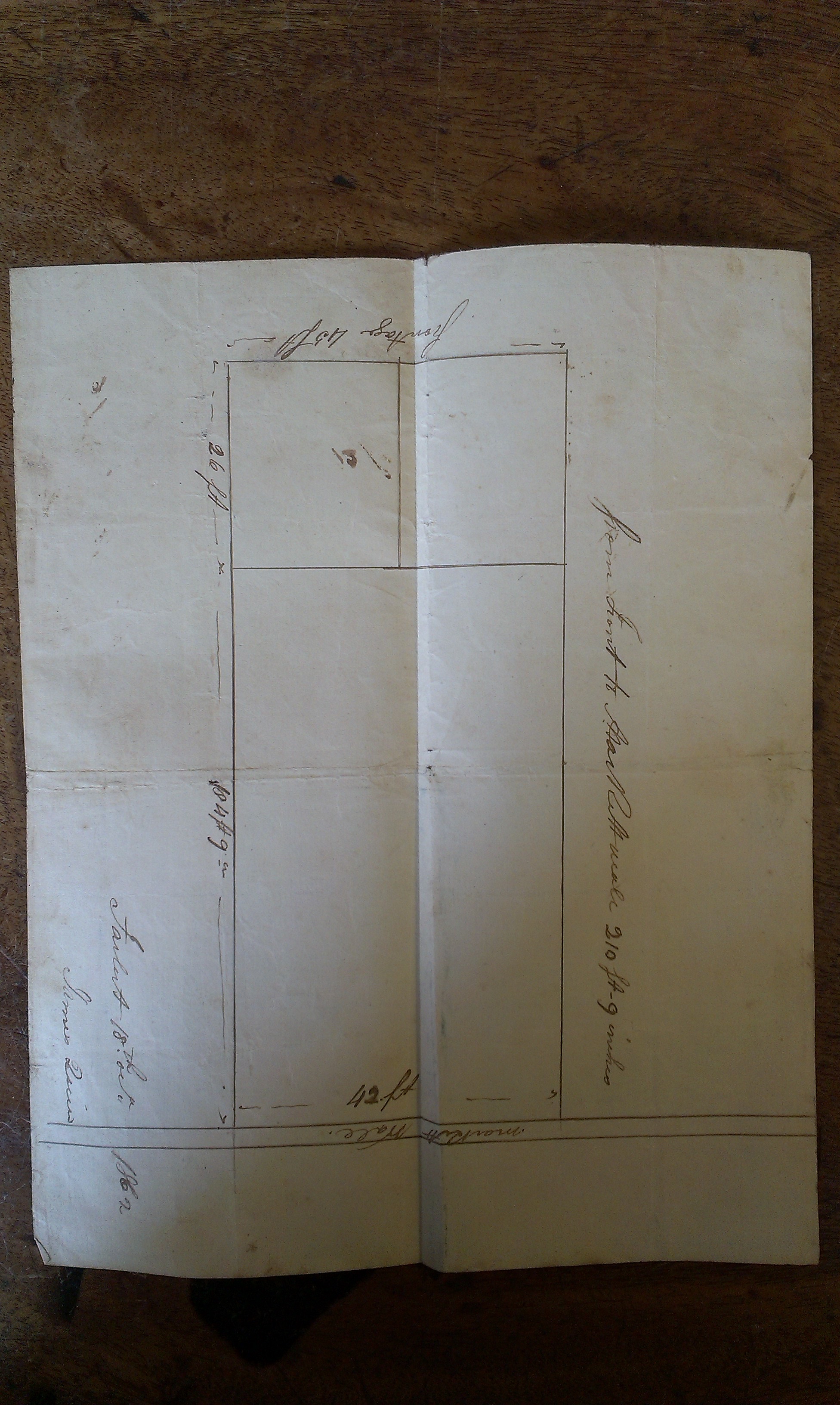
Map of the property in
[Draft lease, Apr 1868].
Rotated so N is up.
See full size
and original.
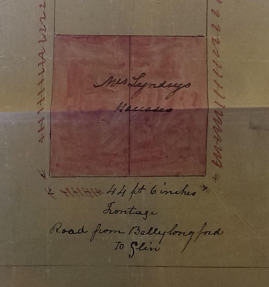
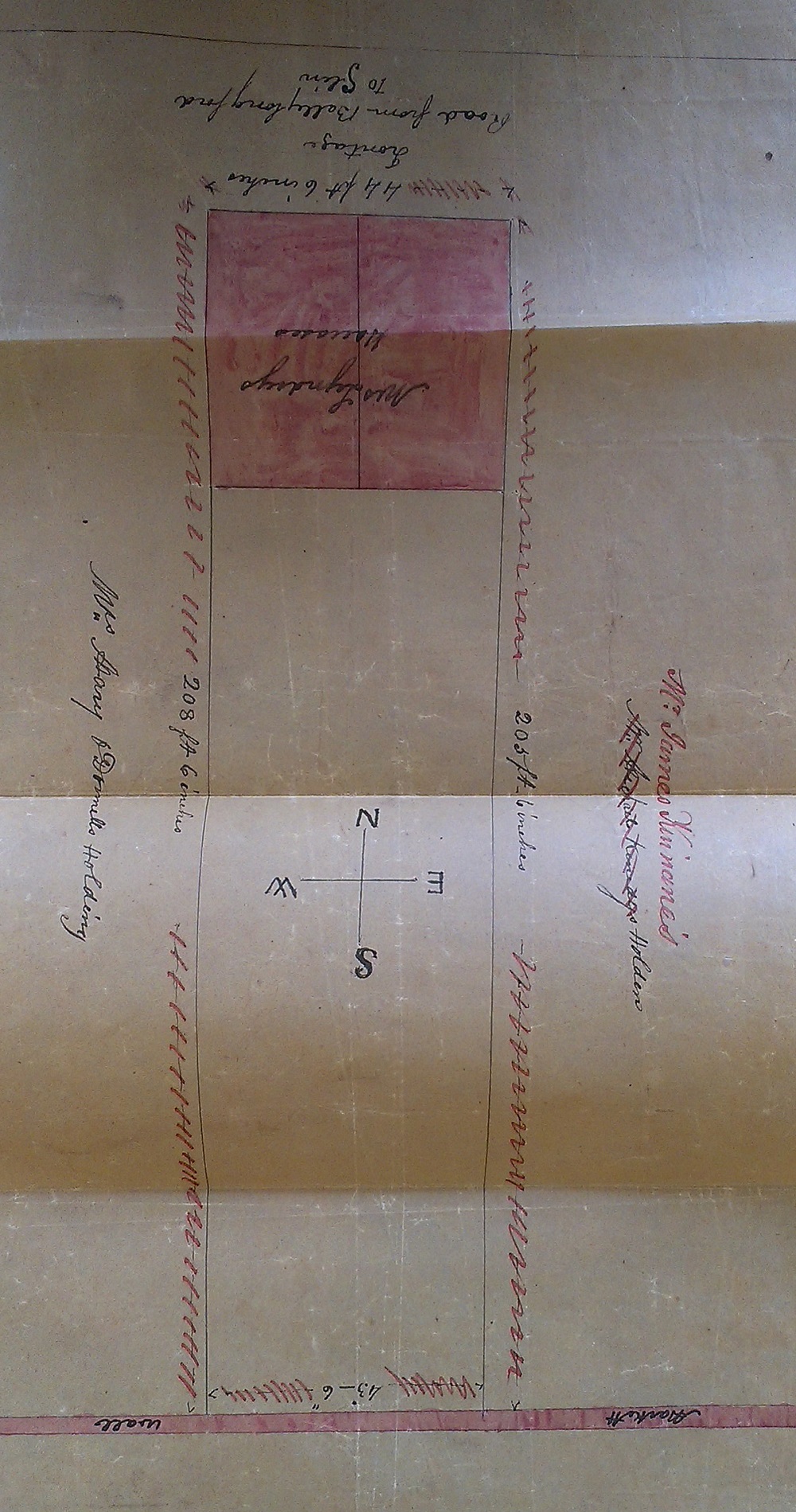
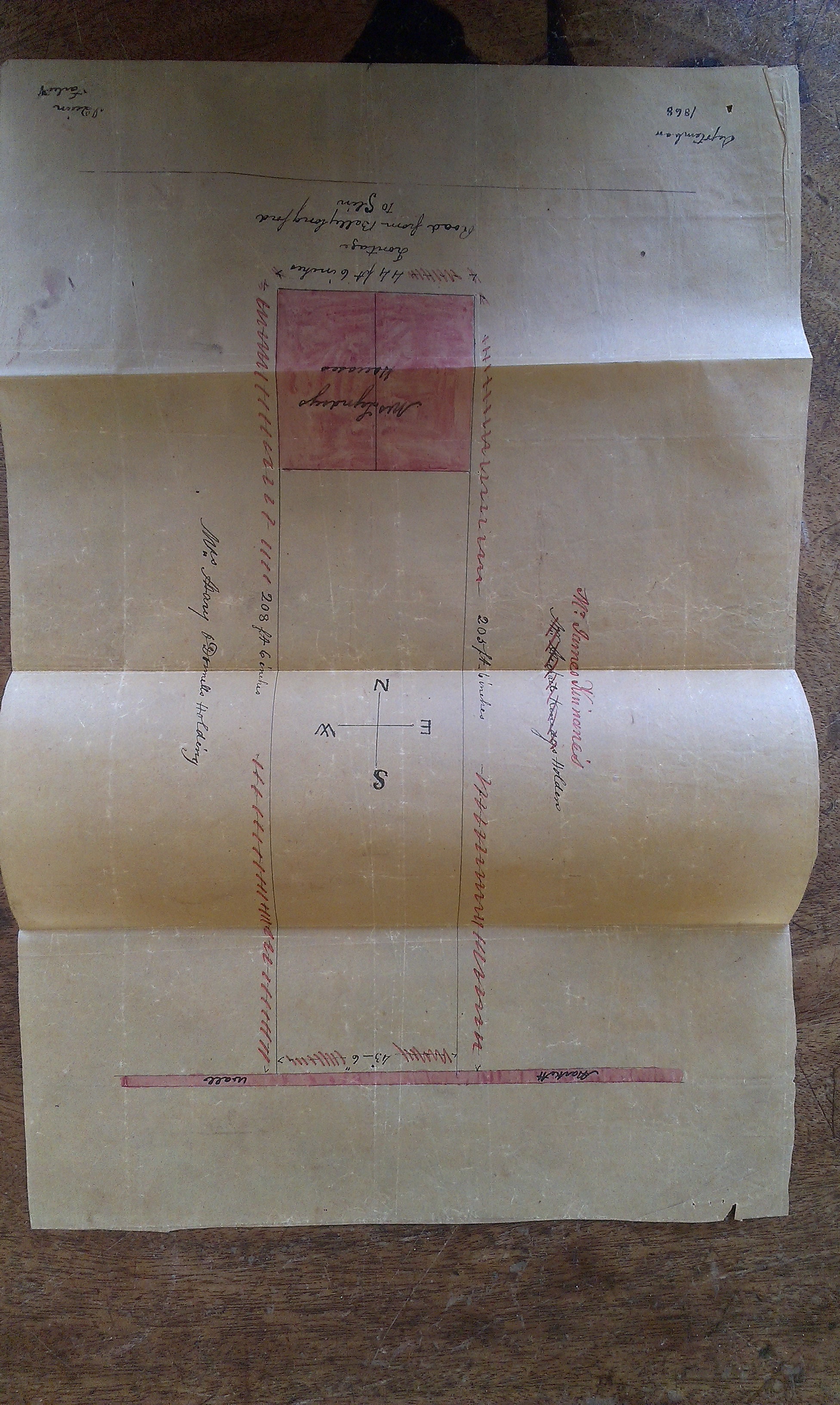
Close-up of above.
Here, S is up.
See full size.
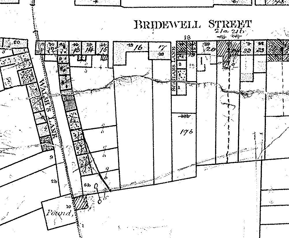
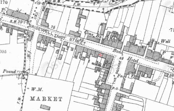
Map of around 1851 showing the houses on Bridewell St that are bounded on the S by the market wall.
The market is the big open area to the S.
Map from
[Griffiths Valuation].
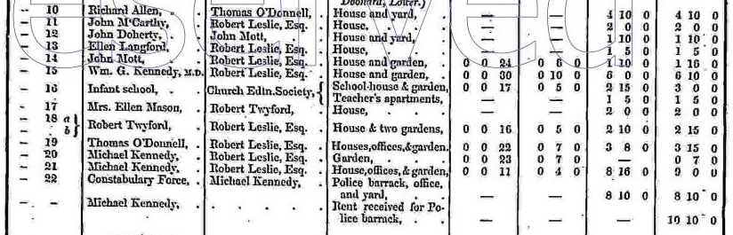
This section of Bridewell St on
[Griffiths Valuation, 1851].
Note
of 1862
says that Thomas O'Donnell is to the W side of the Lindsay property.
So Lindsay property looks like plots 20 and 21.
The question is whether this corresponds exactly to the map above
(which shows signs of re-numbering).
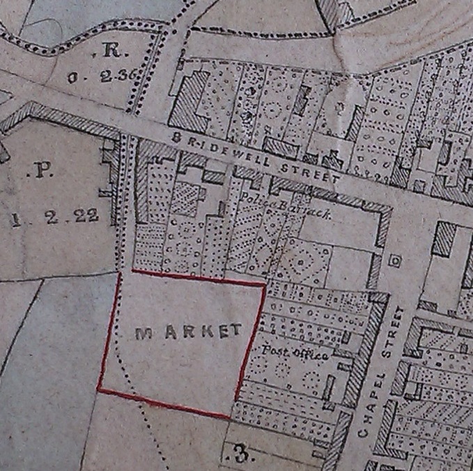
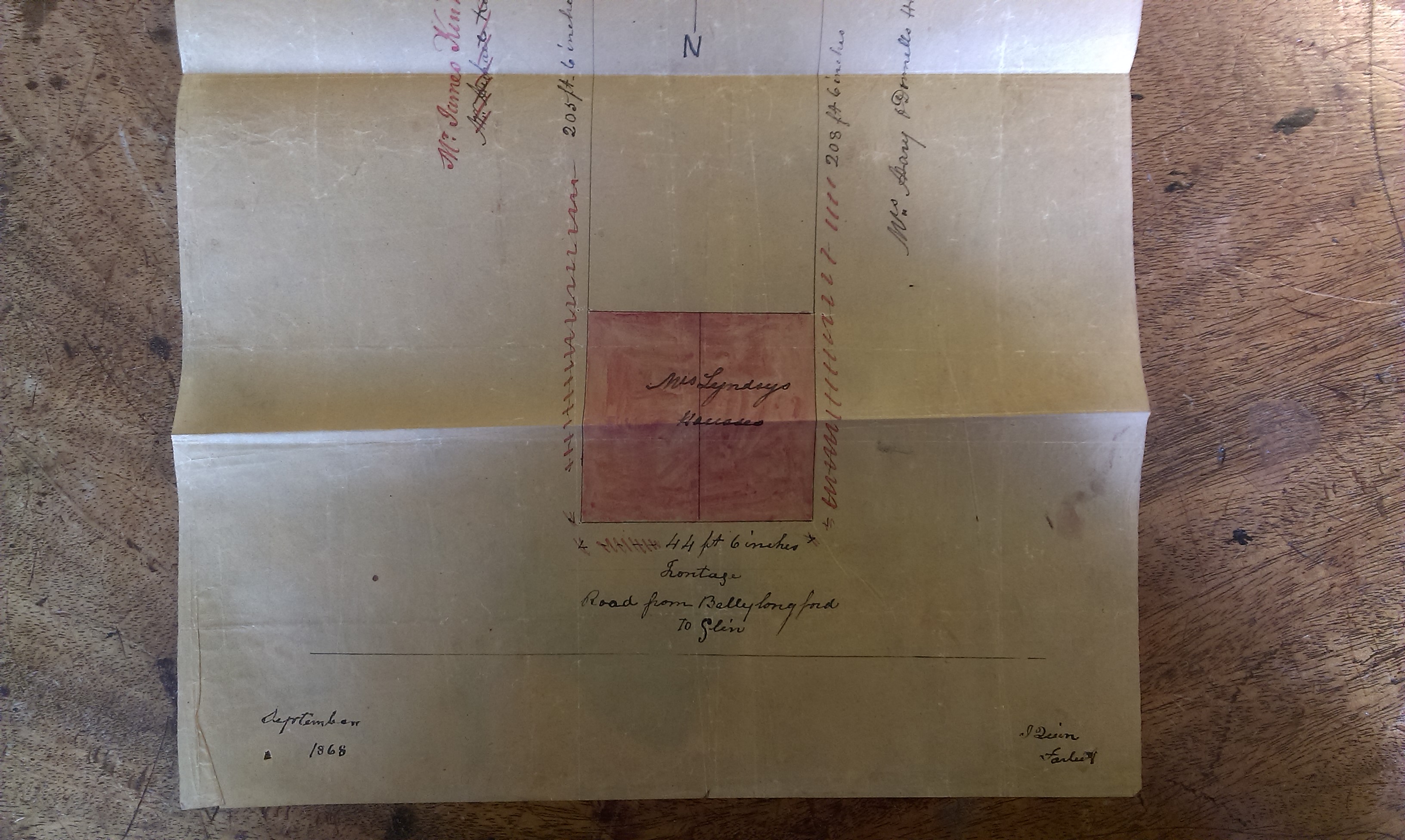
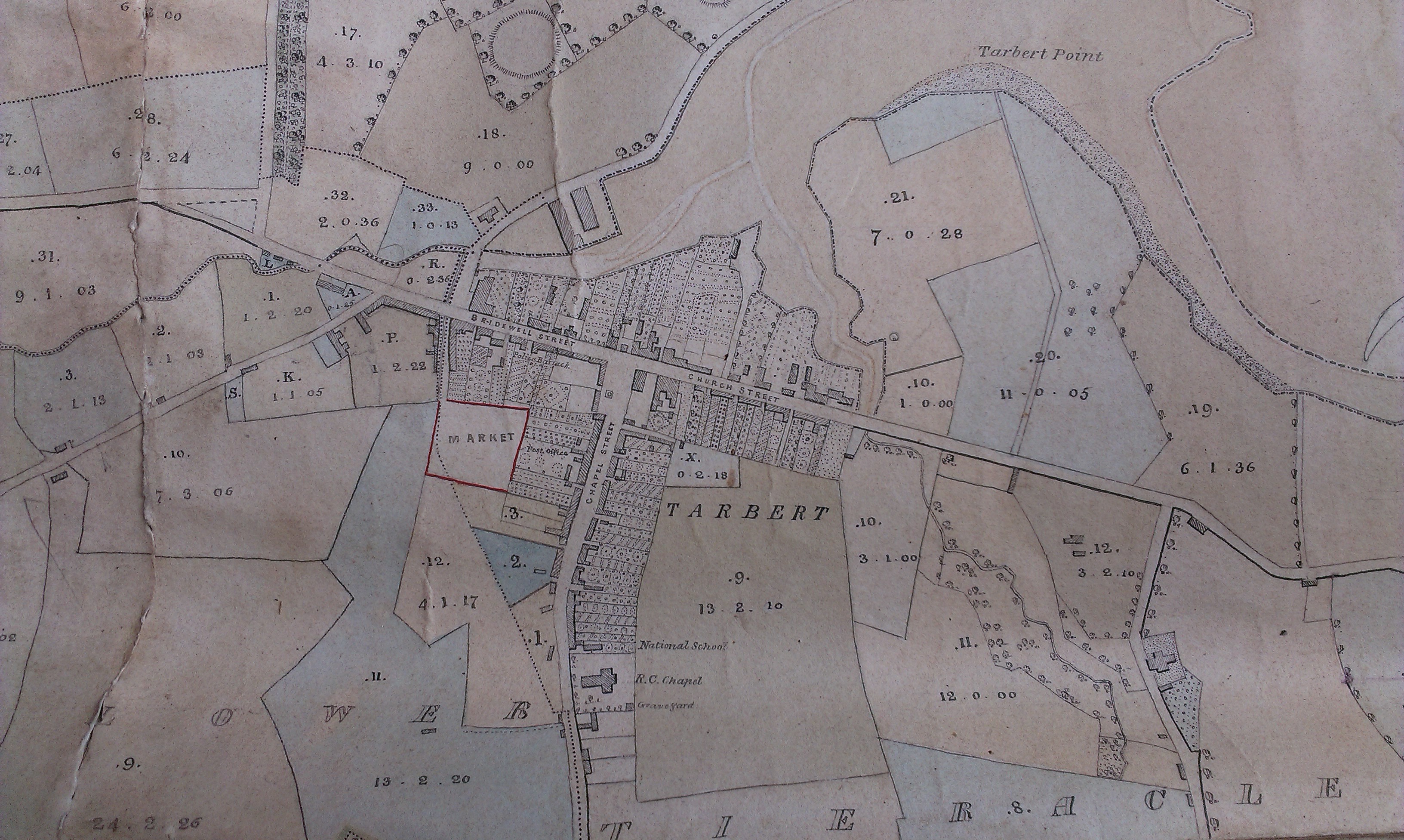
Map of 1868 showing location of market in red.
Extract from
1868 map
made for
Robert Leslie.
See
full size.
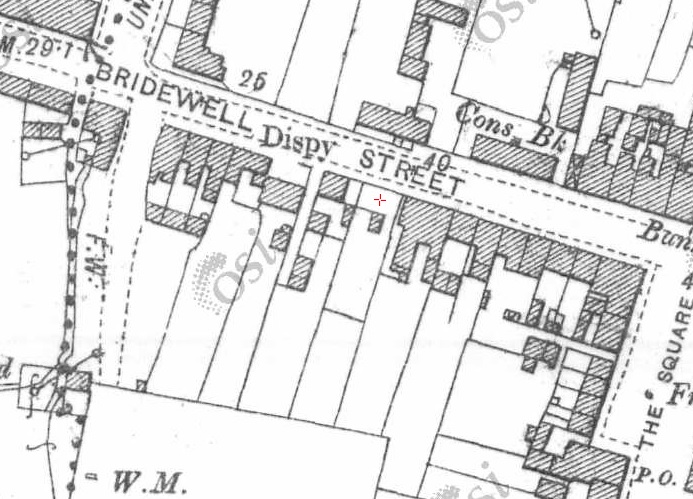
Red cross shows approximate location of the Lindsay property (plots 20 and 21) on
1887 to 1913 map.
This identification needs more work.
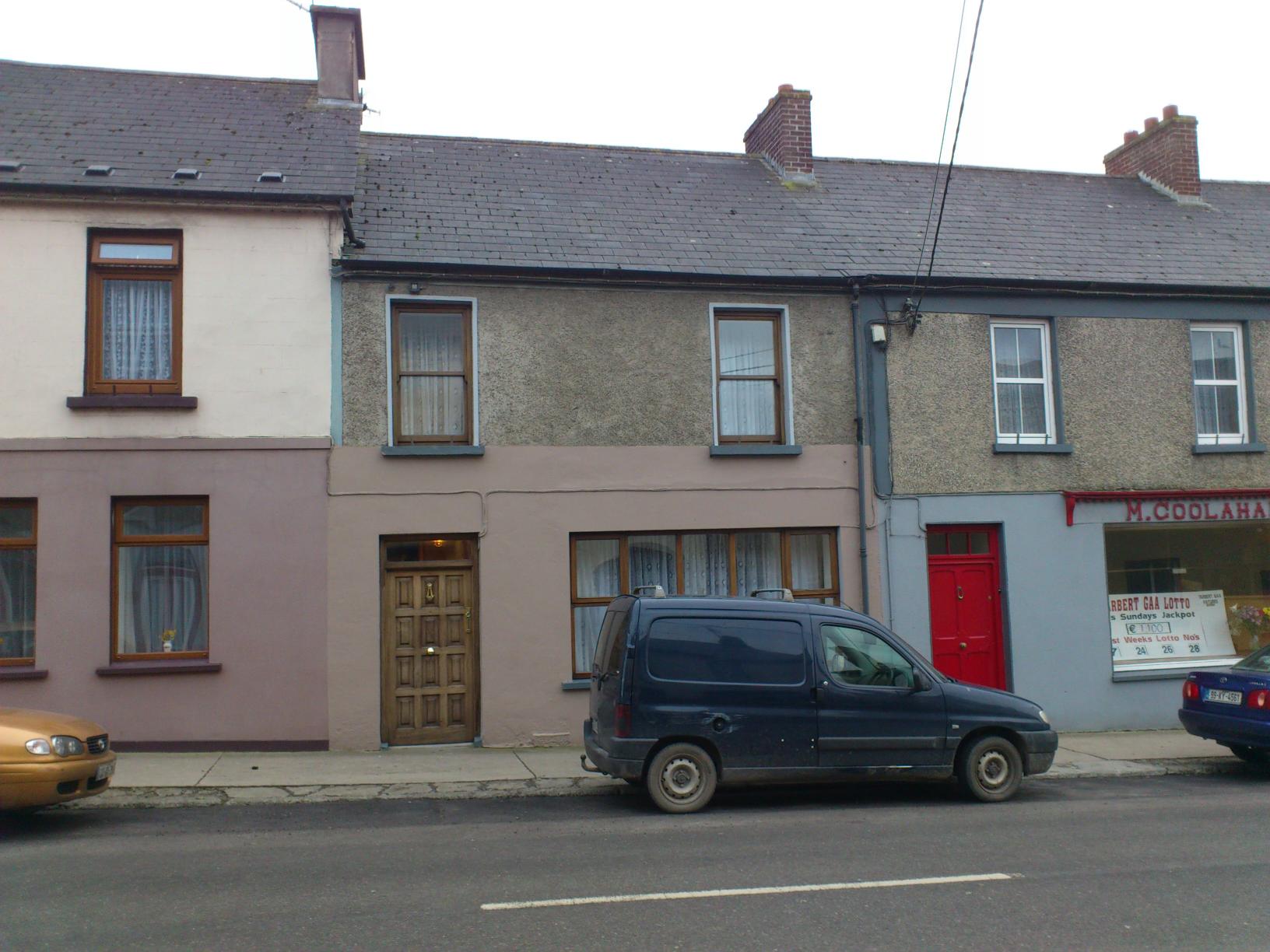
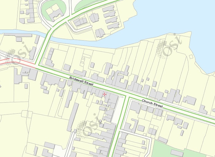
The building with the brown door (red cross) on modern map.
The building with the brown door (red cross) on
1887 to 1913 map.
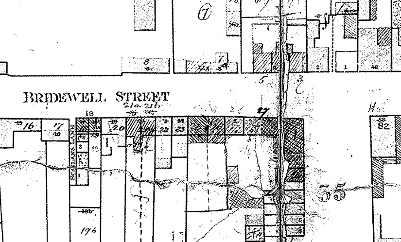
In
[Griffiths Valuation]
it would be building numbered 27.
The entries for
Bridewell St in
[Griffiths Valuation, 1851]
however
do not show plot 27.
They
show the police station at plot 22
(which matches the
1829 to 1842 map)
but then they stop.
They do not show plot 27.
Please donate to support this site.
I have spent a great deal of time and money on this research.
Research involves travel and many expenses.
Some research "things to do"
are not done for years, because I do not have the money to do them.
Please Donate Here
to support the ongoing research and
to keep this website free.
