His brother's descendant the 10th Earl of Pembroke was
Governor of Portsmouth 1782-1794.
There are inventories of his property
at the Government House, Portsmouth, dates 1785 to 1792.
His own house at Wilton
was 40 miles away (as the crow flies)
from Portsmouth.
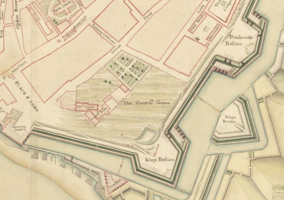
Government House, Portsmouth,
was adjacent to the
Royal Garrison Church ("Domus Dei").
Government House was demolished by 1826.
The Royal Garrison Church survives.
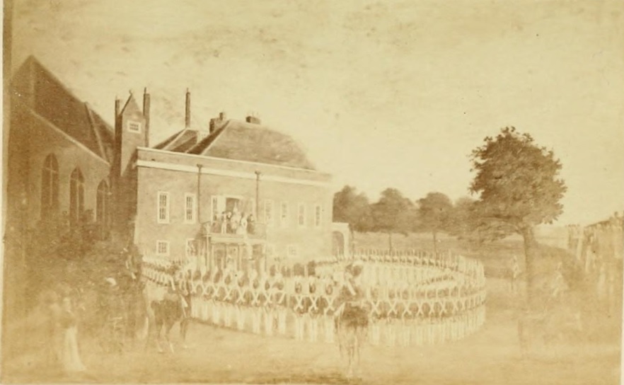
The church and the Government House in 1799 (just after the Earl of Pembroke).
From p.29
of [Wright, 1873].
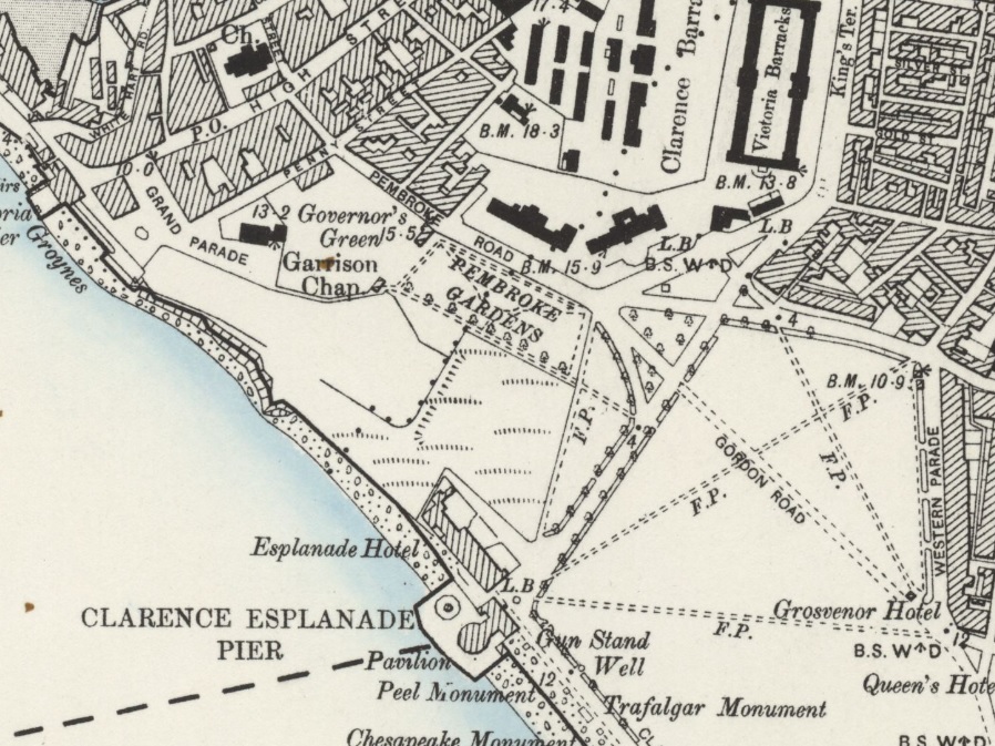
Extract from
OS map.
Revised: 1896. Published: 1898.
Government House is gone.
The Royal Garrison Church survives,
as does the Governor's Green.
The adjacent road was renamed from Fighting Cock Lane
to Pembroke Road.
There is also a Pembroke Gardens.
Presumably both named after Pembroke Bastion
rather than after the 10th Earl of Pembroke.
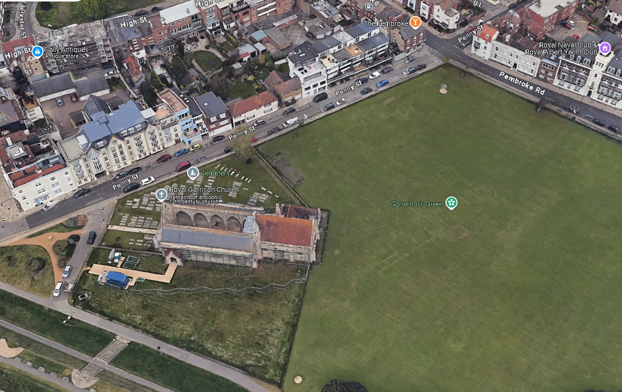
The area around the Royal Garrison Church, Portsmouth, today.
3D view from Google Maps.
Excavation of Governor's Green, Portsmouth.
In
Series 17 (2010)
of
Time Team.
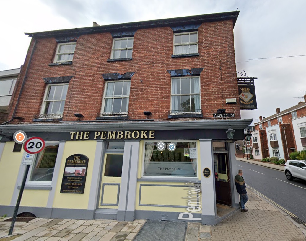
"The Pembroke" pub at the corner of Pembroke Road and Penny St.
From street view.
The pub uses the
arms
of the HMS Pembroke.
There were many Royal Navy ships called HMS Pembroke
since 1655.
[McLean, 2016]
thinks the name comes from
the place Pembroke
rather than an individual.
Please donate to support this site.
I have spent a great deal of time and money on this research.
Research involves travel and many expenses.
Some research "things to do"
are not done for years, because I do not have the money to do them.
Please Donate Here
to support the ongoing research and
to keep this website free.

.jpg)