Later, in WW2, the embassy of Nazi Germany
was two doors away, at 58 Northumberland Rd.
The current situation of 54 Northumberland Rd seems complex.
Gannon Homes
(HQ at 52 Northumberland Rd)
is involved in a
property dispute
about also taking over
54 Northumberland Rd.
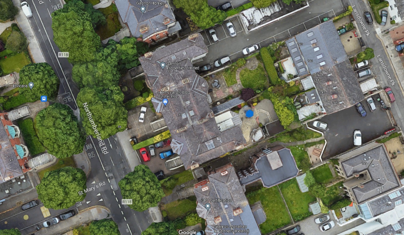
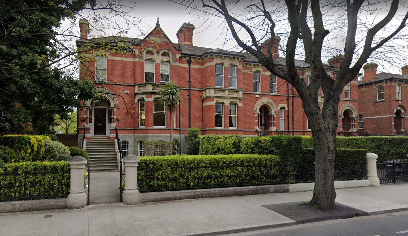
The Humphreys house,
54 Northumberland Rd, is the LHS house of the block of three here.
From street view.
The RHS house of the block, 58 Northumberland Rd, was the Embassy of Nazi Germany during
WW2.
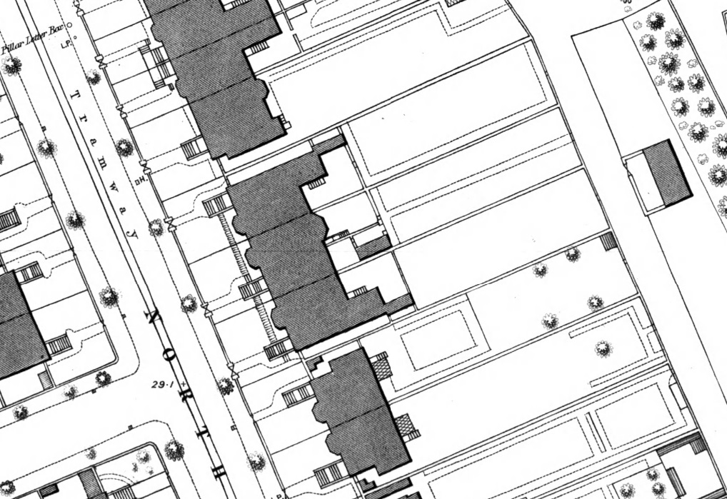
The block opposite St. Mary's Road.
Ordnance Survey of Ireland map.
Date created: 1865.
Date modified: 1888.
From here.
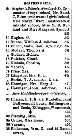
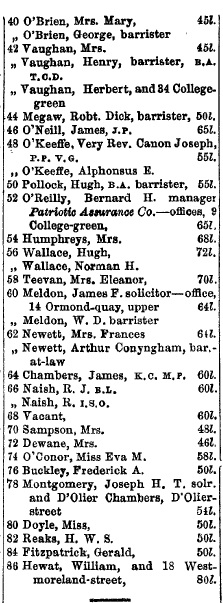
The even numbers (the N or E side) of
Northumberland Rd in
[Thoms, 1914].
Shows Humphreys at no. 54.
The numbers match the numbering today.
[Thoms, 1939]
shows there has been no re-numbering, and the Nazi embassy is at no. 58.
Tracking forward to
[Thoms, 1987]
shows there was no re-numbering.
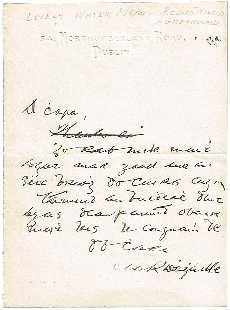
Letter of c.1915
written by
Nell's brother
The O'Rahilly
on notepaper from 54 Northumberland Rd.
For sale in 2024.
Lot 108
in Whytes auction,
7 June 2024.
See full size.
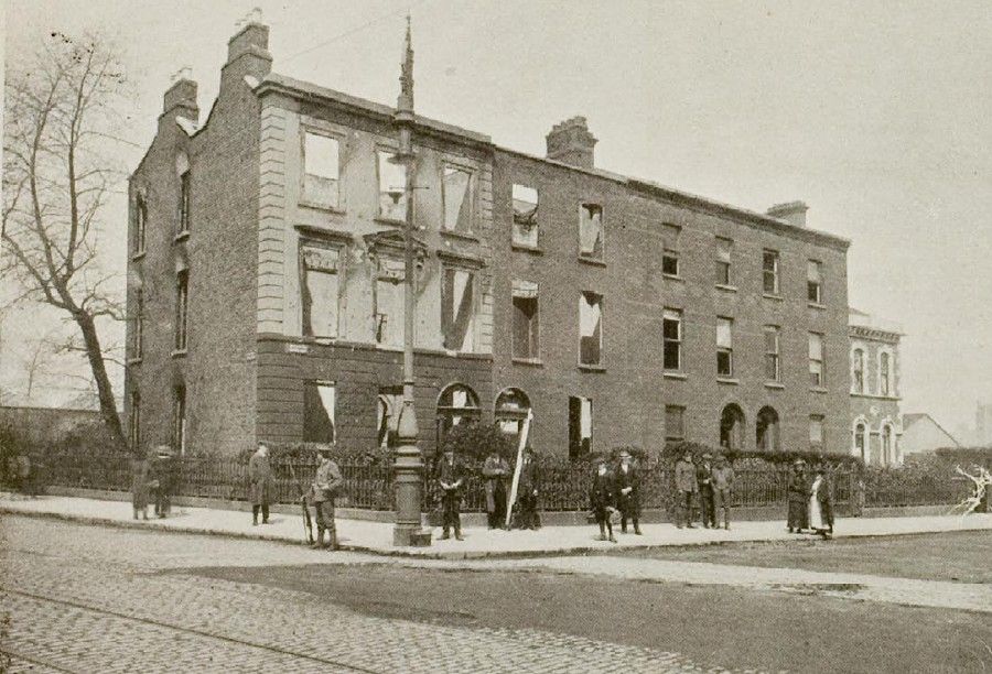
Mount St Bridge after 1916.
From NLI.
Please donate to support this site.
I have spent a great deal of time and money on this research.
Research involves travel and many expenses.
Some research "things to do"
are not done for years, because I do not have the money to do them.
Please Donate Here
to support the ongoing research and
to keep this website free.
