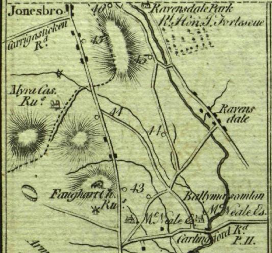
Ravensdale Park, N of Ravensdale, N of Dundalk, Co.Louth. See map.
Ravensdale was then seat of his son
Thomas James Fortescue, MP (died 1795).
Then seat of
William Charles Fortescue, 2nd Viscount Clermont (died 1829).
Ravensdale was inherited 1829 by the 2nd Viscount's nephew
Sir Henry James Goodricke, 7th Baronet.
It was then inherited in 1833
by a distant cousin,
Thomas Fortescue, 1st Baron Clermont (born 1815).
He built a new house, Ravensdale House, c.1840.
He was cr 1852.
Ravensdale became the home of his brother
Chichester Parkinson-Fortescue, 1st Baron Carlingford
(Liberal politician, cr 1874, died 1898).
After 1st Baron Carlingford died 1898,
the house was sold out of the Fortescue family.
It was sold to
Sir Daniel Dixon, 1st Baronet.
He died 1907.
It was later sold to
Arthur Gore, 6th Earl of Arran.
He sold it in 1919
to timber merchant Thomas Archer.
Archer
tried to sell it in
1920 but it did not sell.
On 18 June 1921,
during the
War of Independence,
it was
burnt down by the IRA.
This was
a few weeks before the Truce.
It is believed
that it was burnt because it was unoccupied and would have been
a prime site for a military garrison.
After independence this became a place on the border with NI.
The border with NI (Co.Armagh) runs along the W of the main road
and the main road crosses into NI about 2 miles N of here.
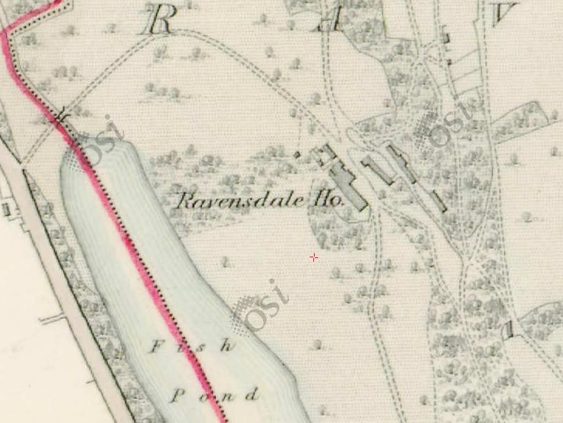
Ravensdale House on
1829 to 1842 map.
Matching the maps, it is clearly at the same site as Ravensdale Park above.
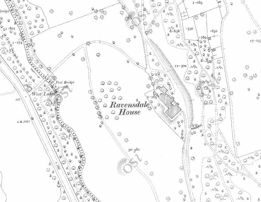
Ravensdale House on
1887 to 1913 map.
See modern
satellite view.
The house is entirely gone.
No trace at site of house.
See street view.
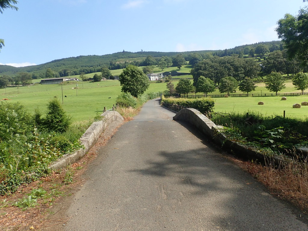
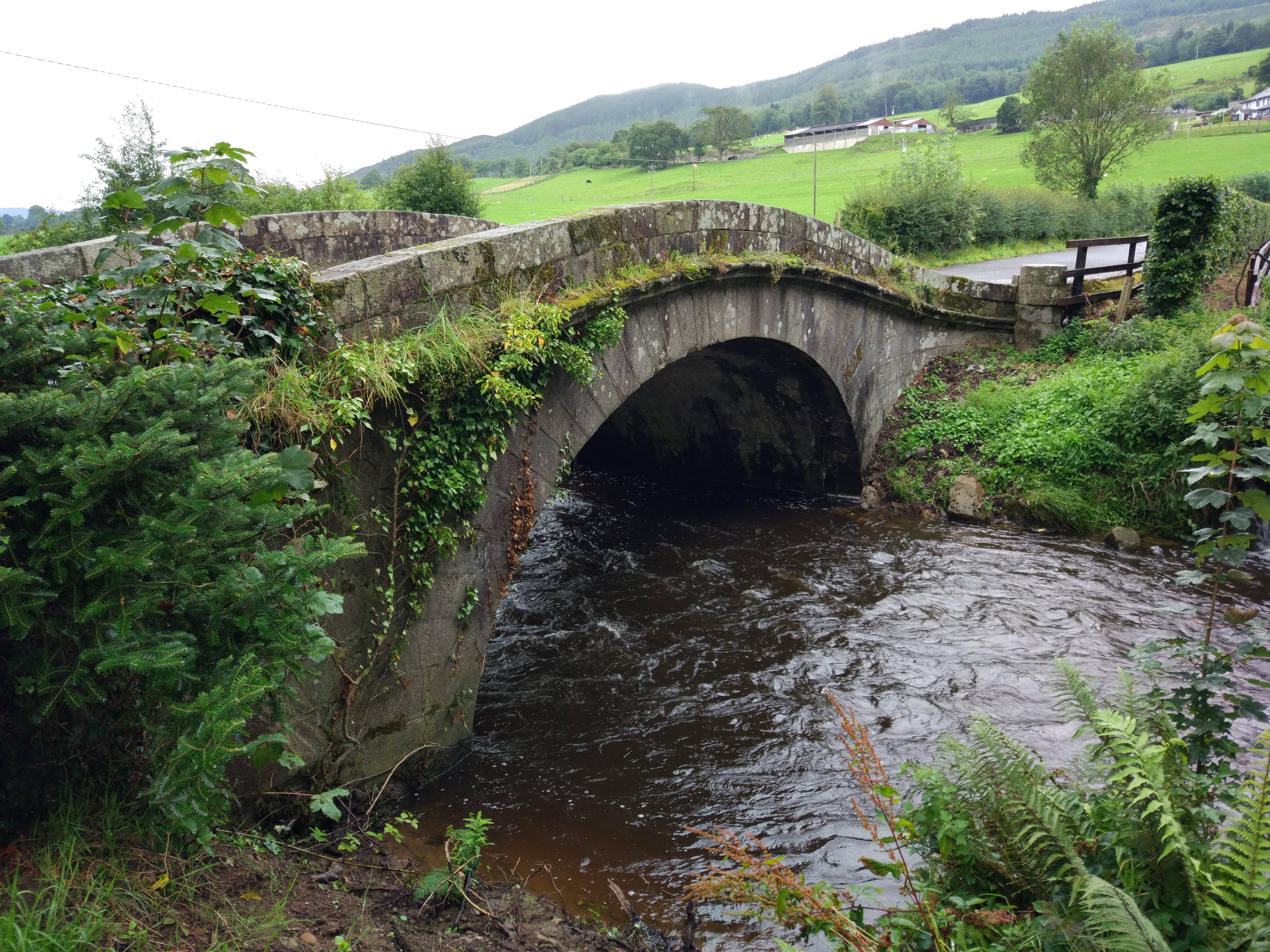
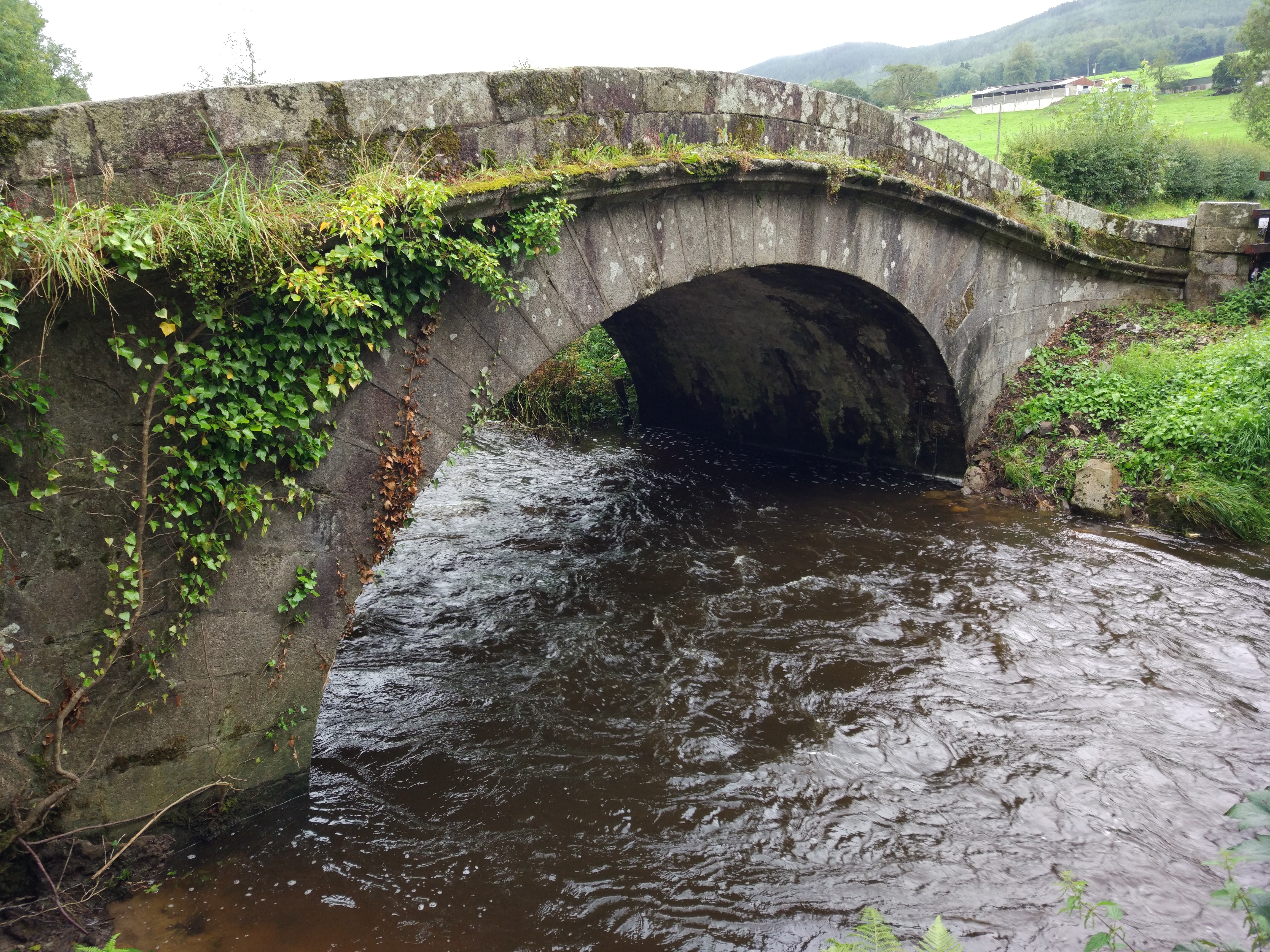
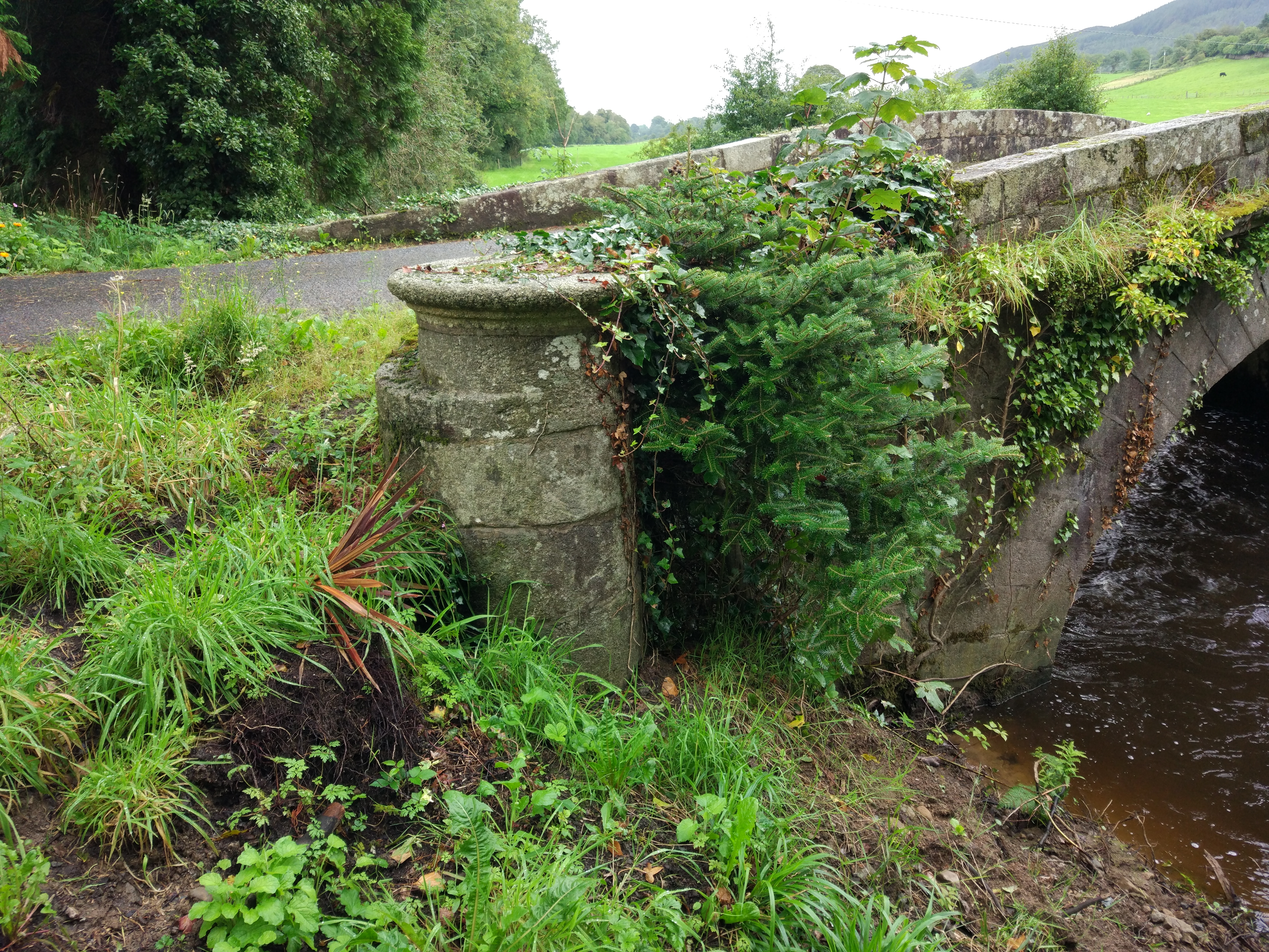
The pretty old bridge close to
Ravensdale House
at the W entrance
survives.
This is to the W at the main road, where the W gate lodge was.
It is unclear when it was built.
It looks a bit like the Marble Bridge further to the S
(which was built c.1790).
W bridge shown on 1829 to 1842 map.
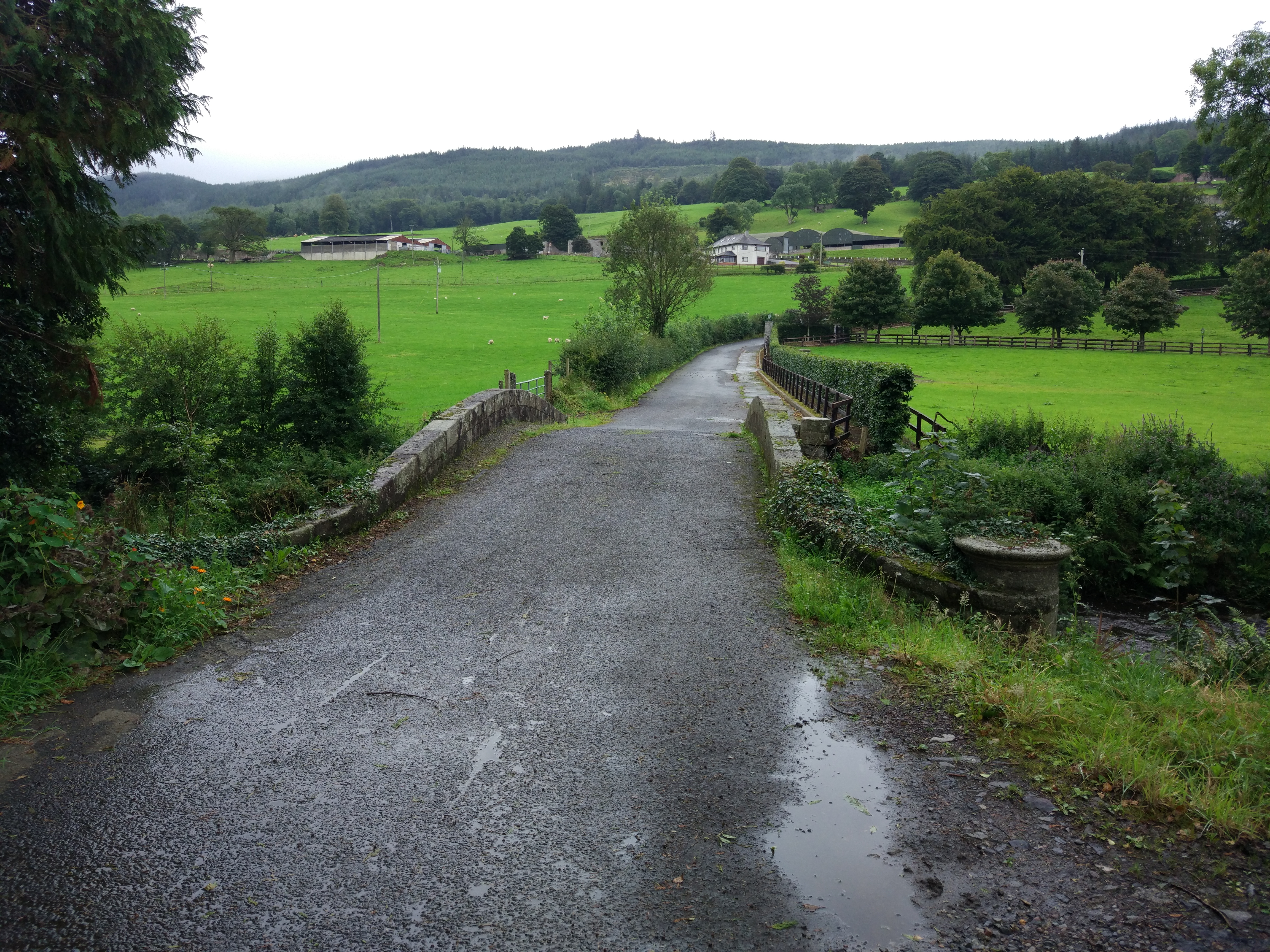
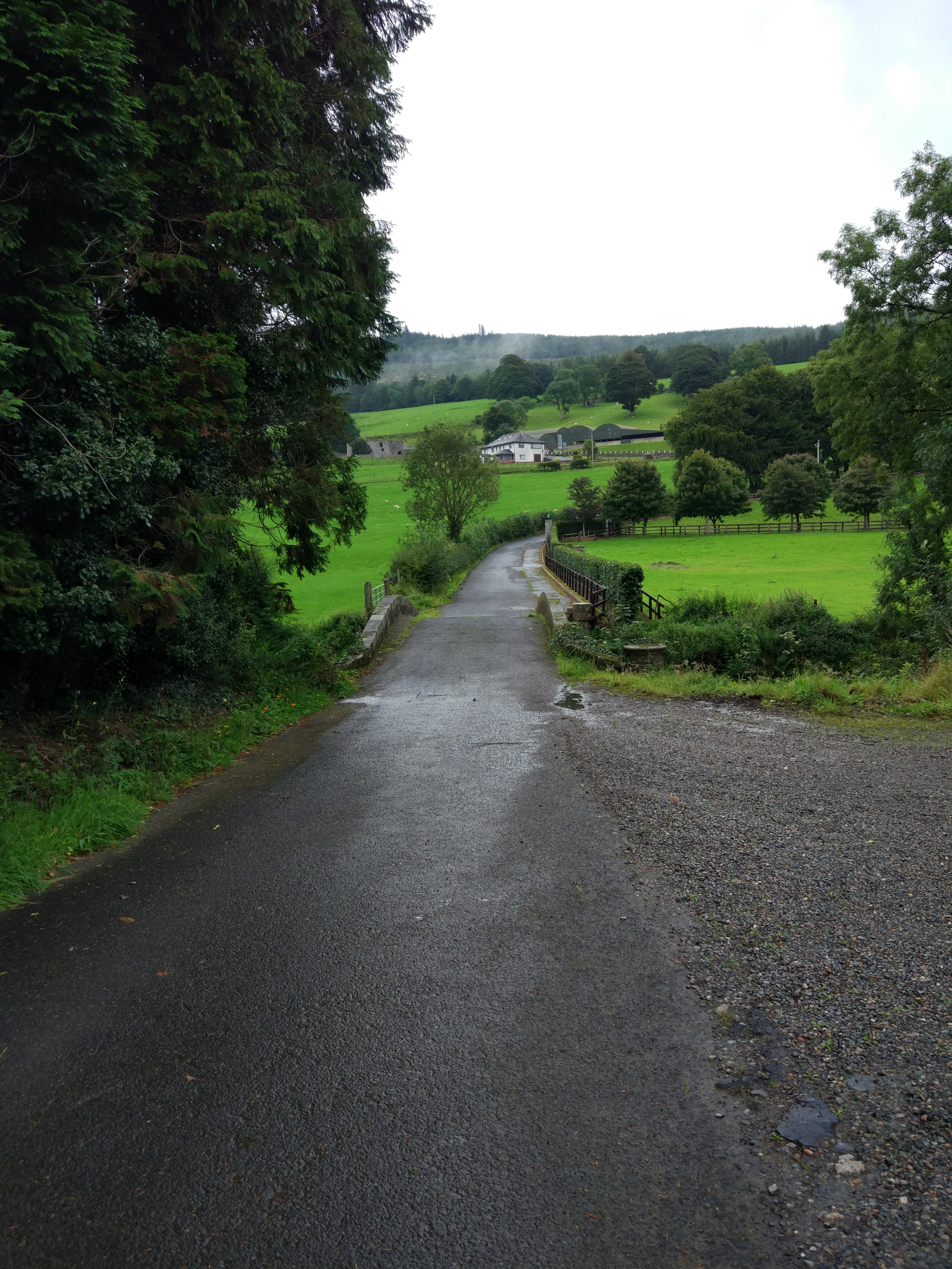
This entrance is now blocked off.
See
street view.
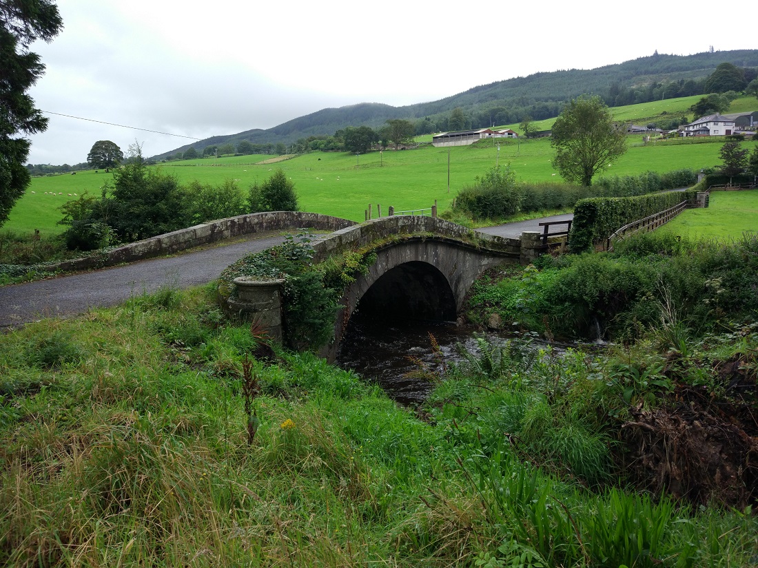
The W bridge.
Photo 2019.
From Geograph.
See 2020 shot
and 2020 shot.

Detail of the bridge.
Photo 2020.
See full size.
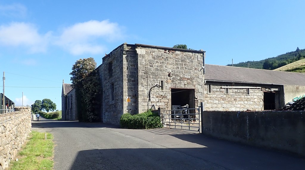
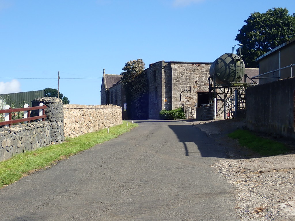
The stable block.
View from the N.
Photo 2020.
See full size.
Please donate to support this site.
I have spent a great deal of time and money on this research.
Research involves travel and many expenses.
Some research "things to do"
are not done for years, because I do not have the money to do them.
Please Donate Here
to support the ongoing research and
to keep this website free.
