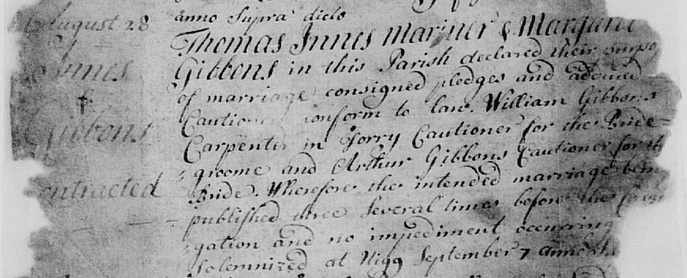
It would be interesting to locate their house.
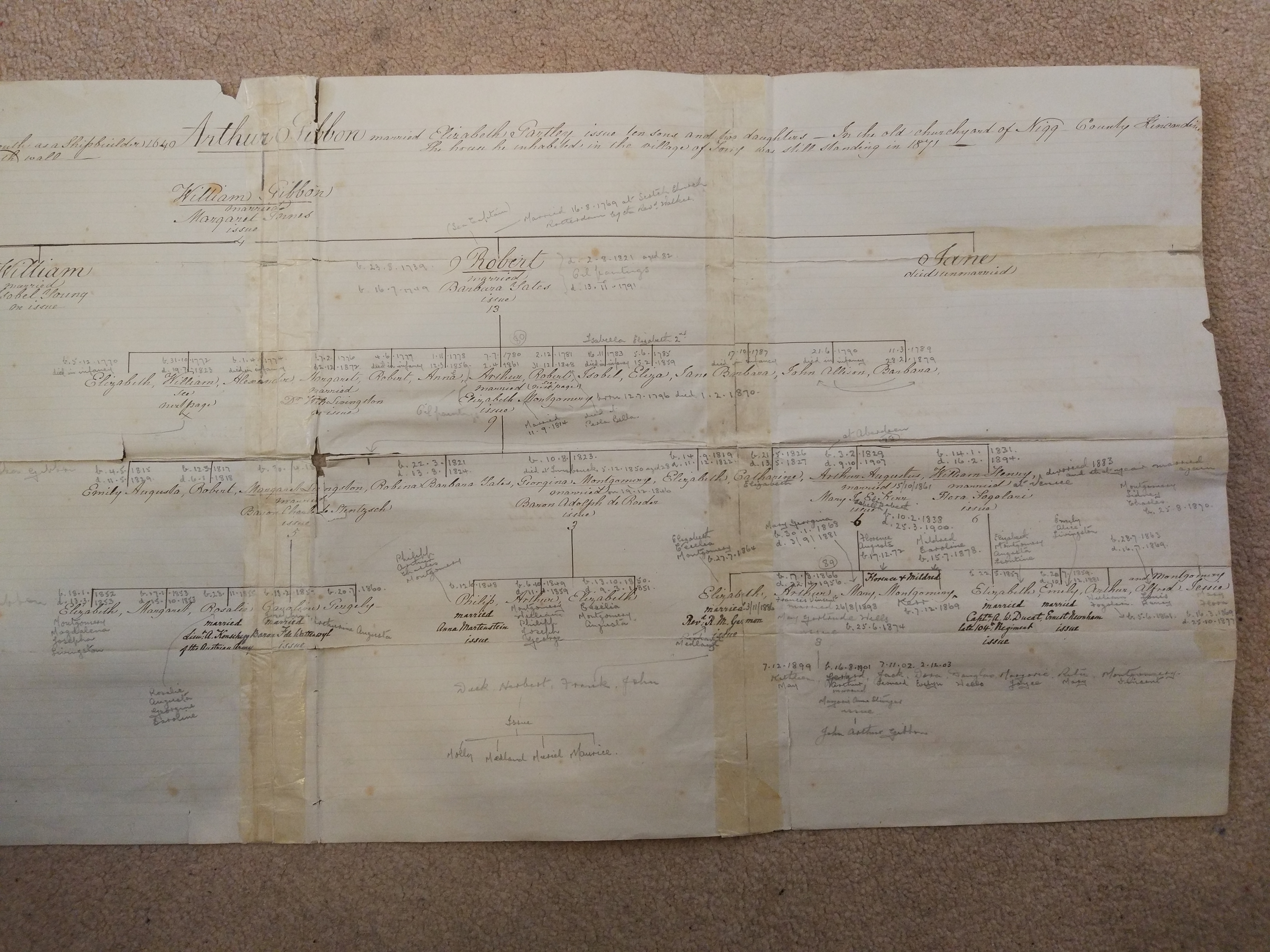
Extract
from
[Barbara Yates Gibbon family tree]
said the Gibbon family home in Torry village was still standing in 1871.
But most of old Torry
has since been destroyed,
first in
the diversion of the River Dee in 1869 to 1873,
and second when much of remaining Torry was cleared in the 1970s for oil installations.
Apparently no house before 1800 survives in Torry today.
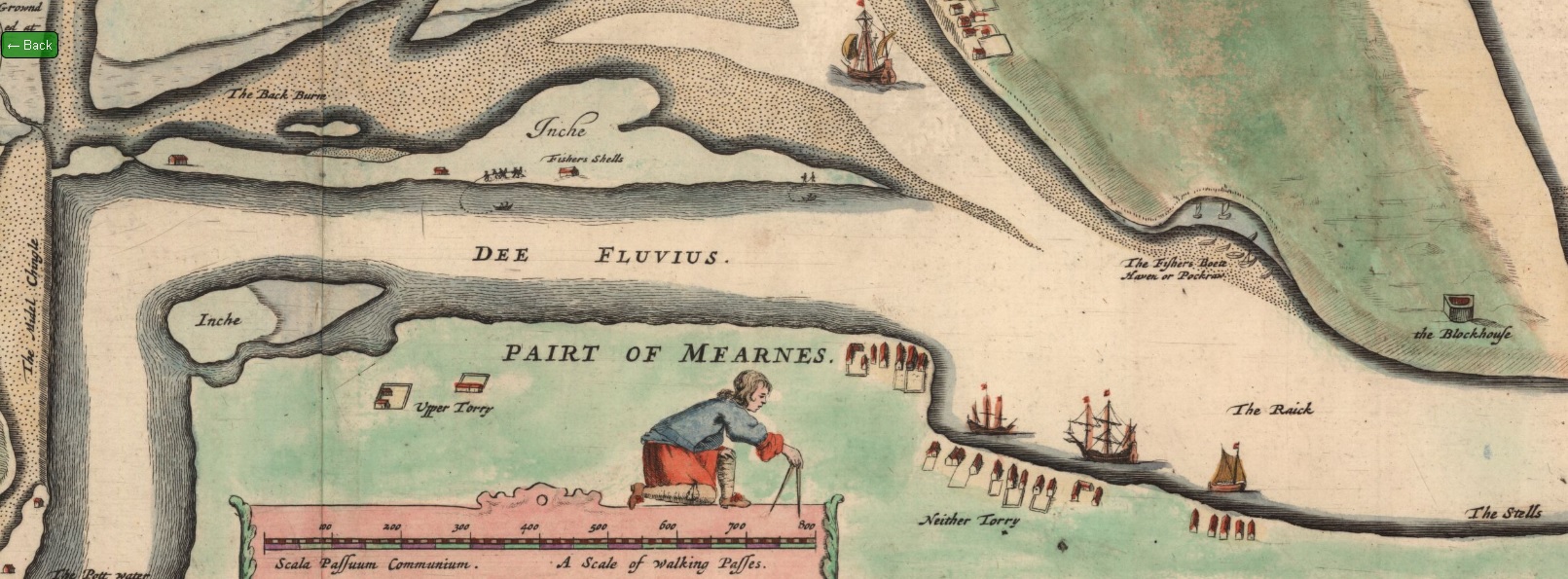
"Upper Torry" and "Neither Torry" outside Aberdeen on
1661 map.
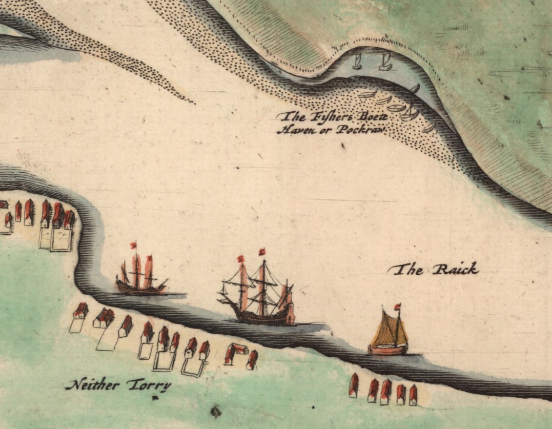
Close-up of 1661 map.
[Clark, 1921]
says the Gibbon shipyard was apparently "in Torry opposite Pocra".
This would be "Neither Torry" here, opposite
"Pockraw".
"Neither Torry" was also called Lower Torry or Old Torry.
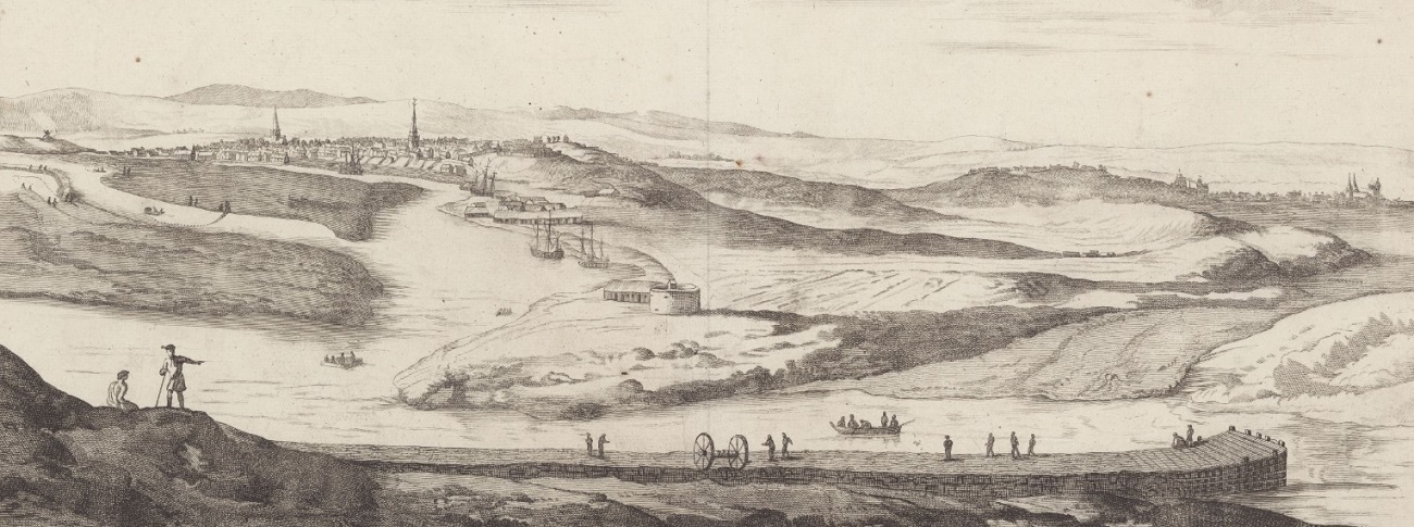
View of "New Aberdeen".
From Theatrum Scotiae (1693)
by John Slezer.
[Ogilvie, 1901]
says this is a view of the Torry Bulwark.
This was a long pier or bulwark that was erected in 1607 and stood until it was removed in about 1810.
This view is some distance E of Torry village, which is not visible (would be off screen to the left).
See full size.
From NLS.
See images from the book.
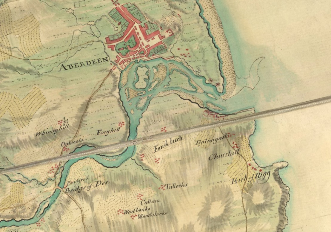
Aberdeen
on
Roy Military Survey of Scotland, 1747-1755.
Torry is visible but not named.
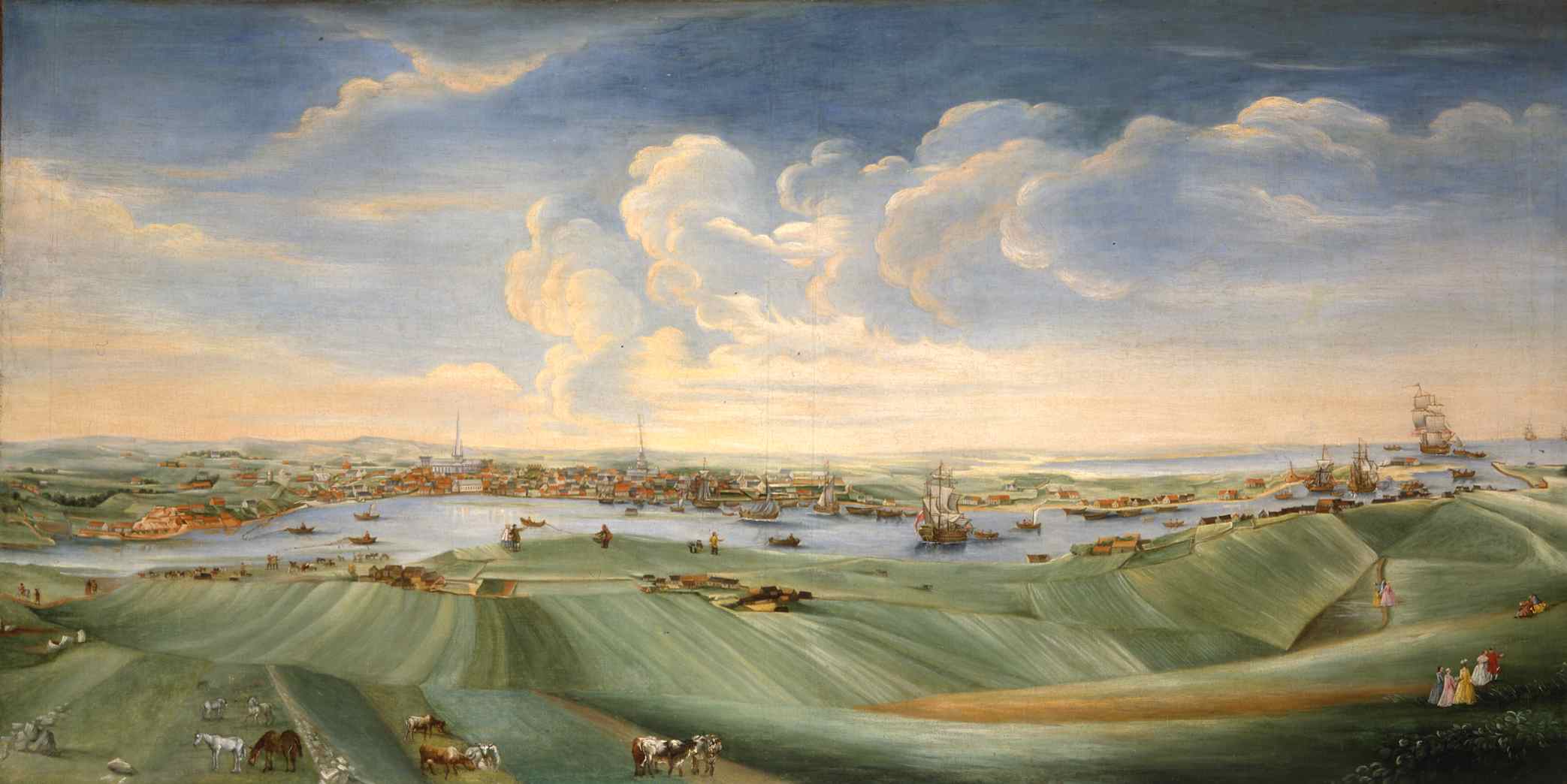
Torry and Aberdeen in 1756.
By William Mosman,
the Aberdeen painter.
Used with the kind permission
of Aberdeen Art Gallery & Museums collections.
See larger
and full size.
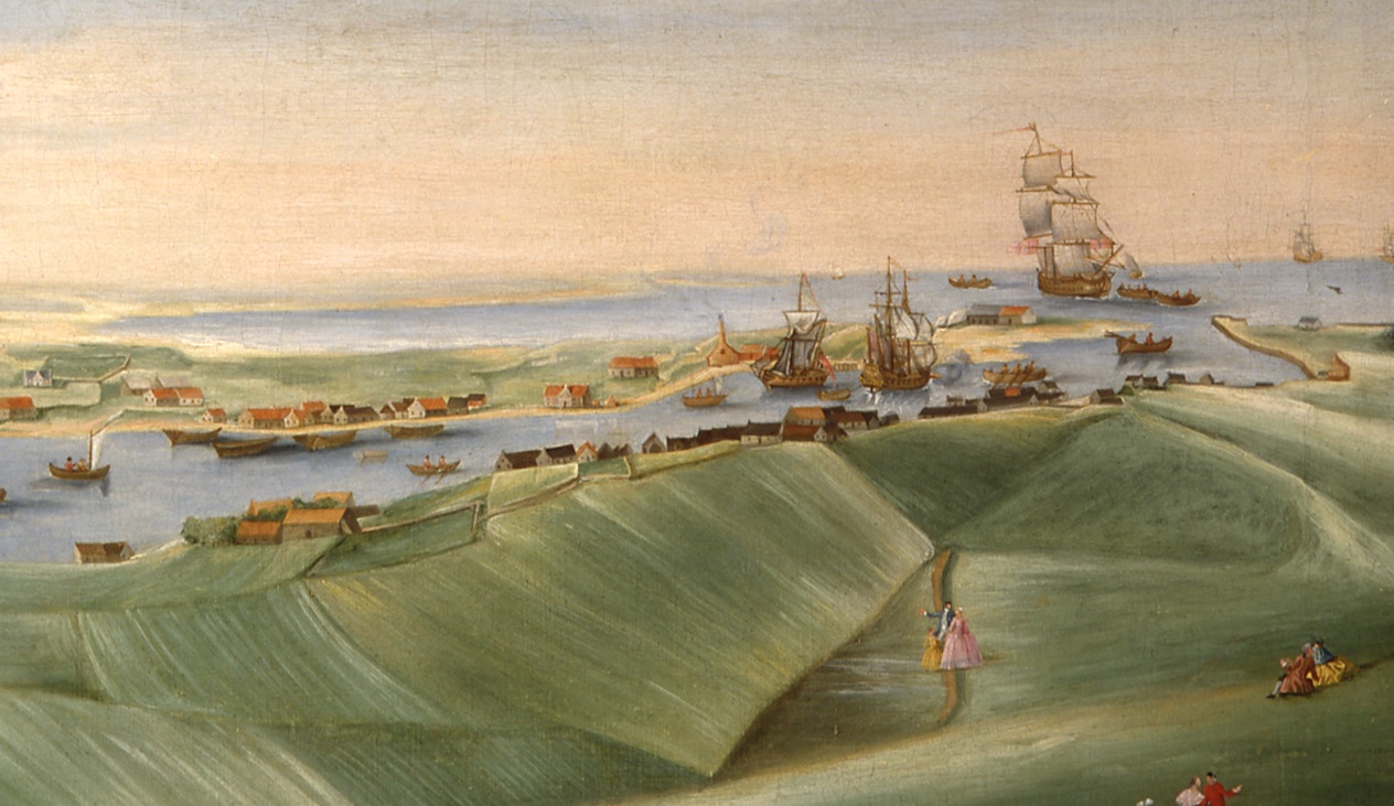
Close-up of Old Torry on the near (S) side of the harbour.
The Gibbon house would be among these houses.
Torry on
1789 map of Aberdeen.
The old Gibbon house was probably at the E end of Torry village,
near the pier.
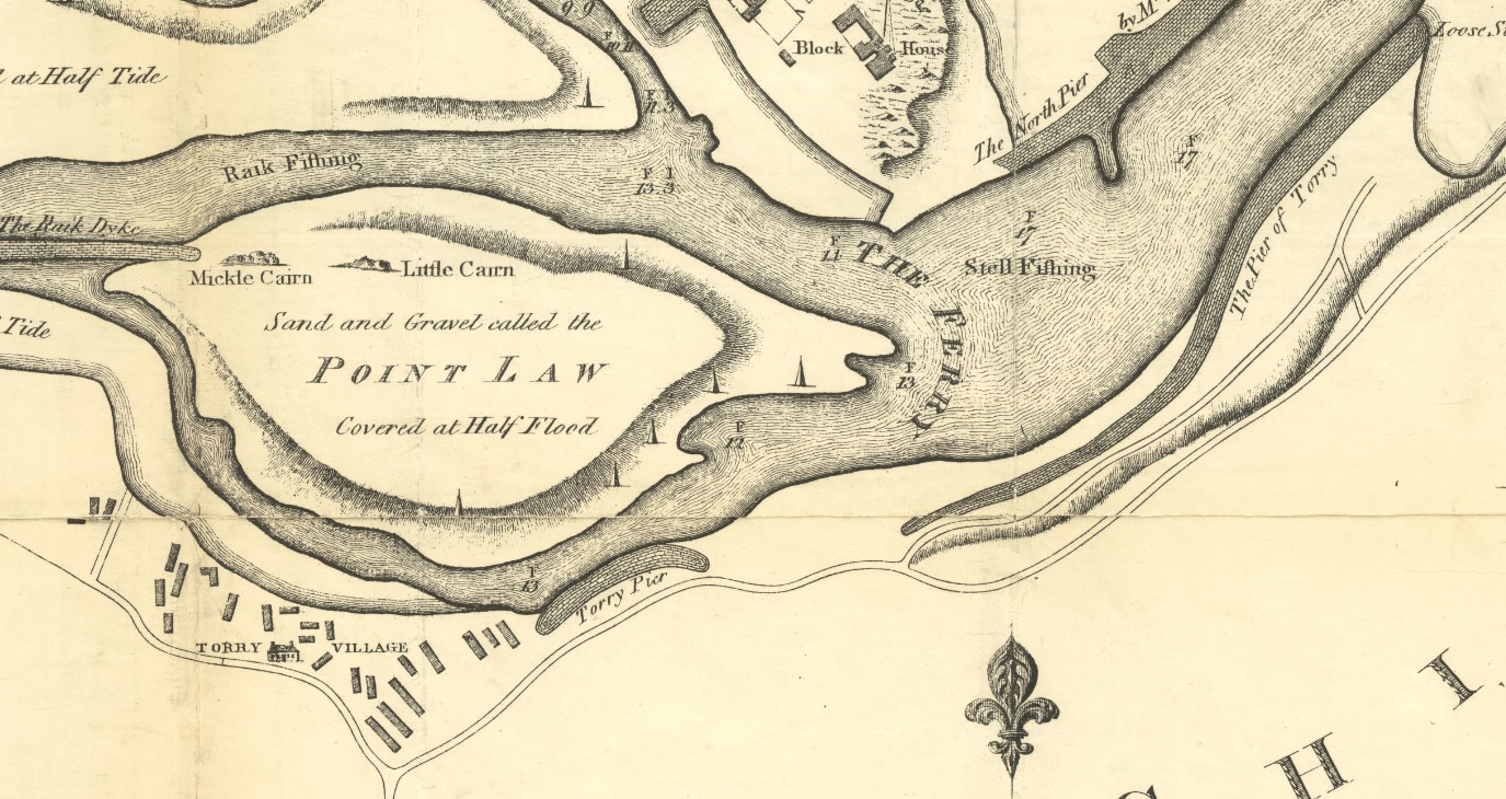
Torry on
1862 map of Aberdeen.
The old Gibbon house was probably at the E end,
near the leading lights.
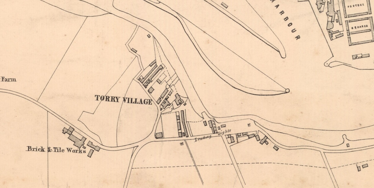
Torry on
OS map.
Survey date: 1865. Publication date: 1868.
The old Gibbon house was probably at the E end, near the small Torry "HARBOUR".
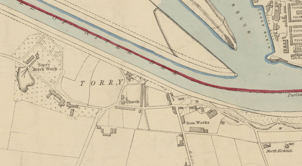
Torry on
1871 map of Aberdeen.
The W side of the village has been wiped out by the diversion of the River Dee
(work carried out in 1869 to 1873).
The E side is still fairly intact.
The old Gibbon house was probably at the E end, to the NW side of the Iron Works here.
Note "Pocra Quay" opposite.
Most of remaining old Torry
was cleared in the 1970s for oil installations.
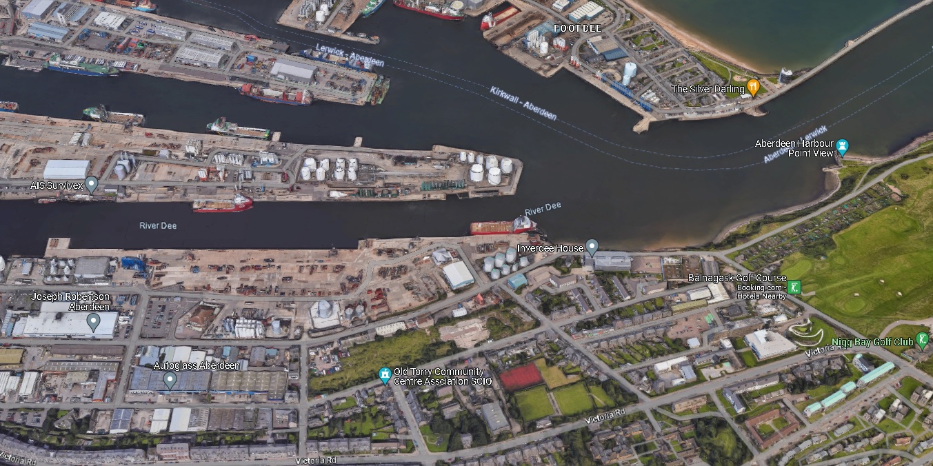
3D view from
Google Maps.
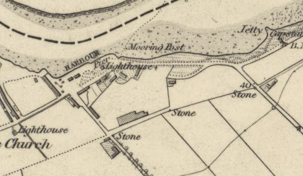
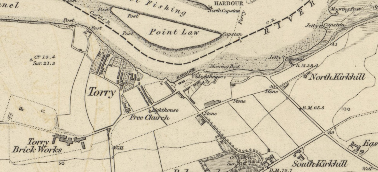
Close-up of
the small Torry harbour (to E side of Torry village) on the above
1868 map.
The old Gibbon house was probably in this
cluster of houses near the "HARBOUR".
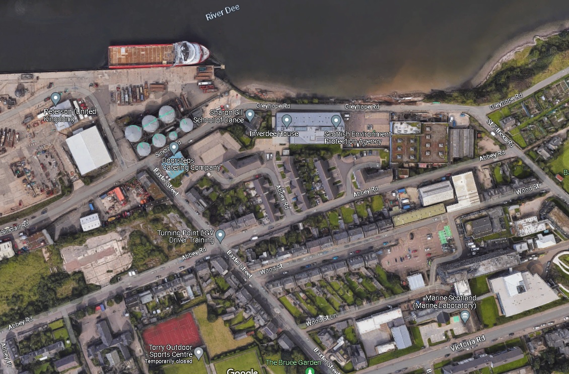
The modern location.
Road pattern is the same, but buildings have been cleared.
From Google Maps.
Please donate to support this site.
I have spent a great deal of time and money on this research.
Research involves travel and many expenses.
Some research "things to do"
are not done for years, because I do not have the money to do them.
Please Donate Here
to support the ongoing research and
to keep this website free.
