The Crescent ("An Corrán") was built in early 19th century.
The
statue to Daniel O'Connell
was erected 1857 on the island in the middle of The Crescent.
The Jesuit
Crescent College
(founded 1859)
moved to Crescent House, The Crescent, in 1862.
The Jesuit Church, The Crescent (linked to the school) was built 1868.
18 The Crescent was home of
Dr. David Humphreys by 1894.
He married in 1895.
Dick Humphreys
was born there in 1896.
Sighle Humphreys
was born there in 1899.
They left by Sept 1902.
The main street of Limerick,
George St, was renamed O'Connell St 1903.
18 The Crescent is now offices,
called "Corraun House" ("Crescent House")
though this is not the same location as the old Crescent House (the school).
See entry
at NIAH.

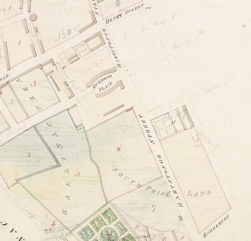
Extract from map of Limerick, by Coffey, 1823.
N is at an angle.
The Crescent (Richmond Place) is now laid out.
See full size.
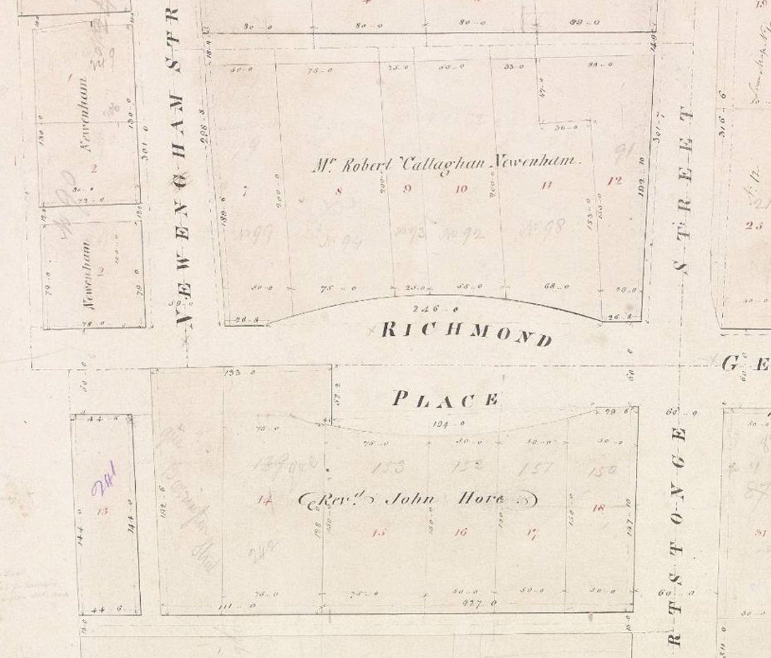
Richmond Place on map of Limerick, by Coffey, 1823.
George St is to the RHS.
The future no.18 would be in the LHS of plot 11.
See full size.

The new town, Limerick.
McKern's map of 1827.
"41" is the Bishop's Palace.
The Crescent (Richmond Place) is visible.

The Crescent (Richmond Place) on
1829 to 1842 map.
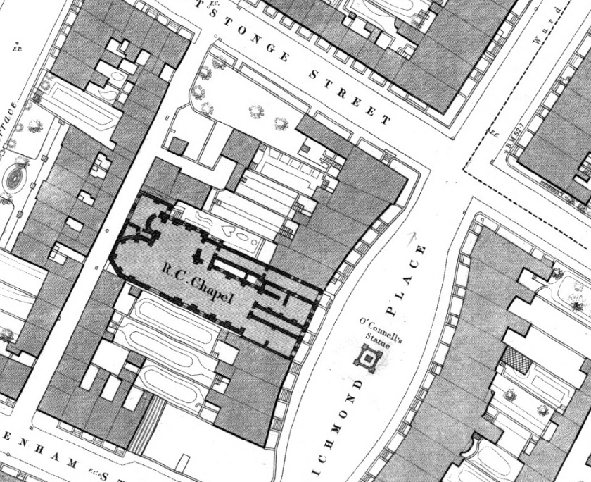
The Crescent (Richmond Place) on
Ordnance Survey of Ireland map.
Date created: 1870.
From here.
Of the 5 houses N of the church, no.18 is the middle one.

The Crescent (Richmond Place) on
1887 to 1913 map.
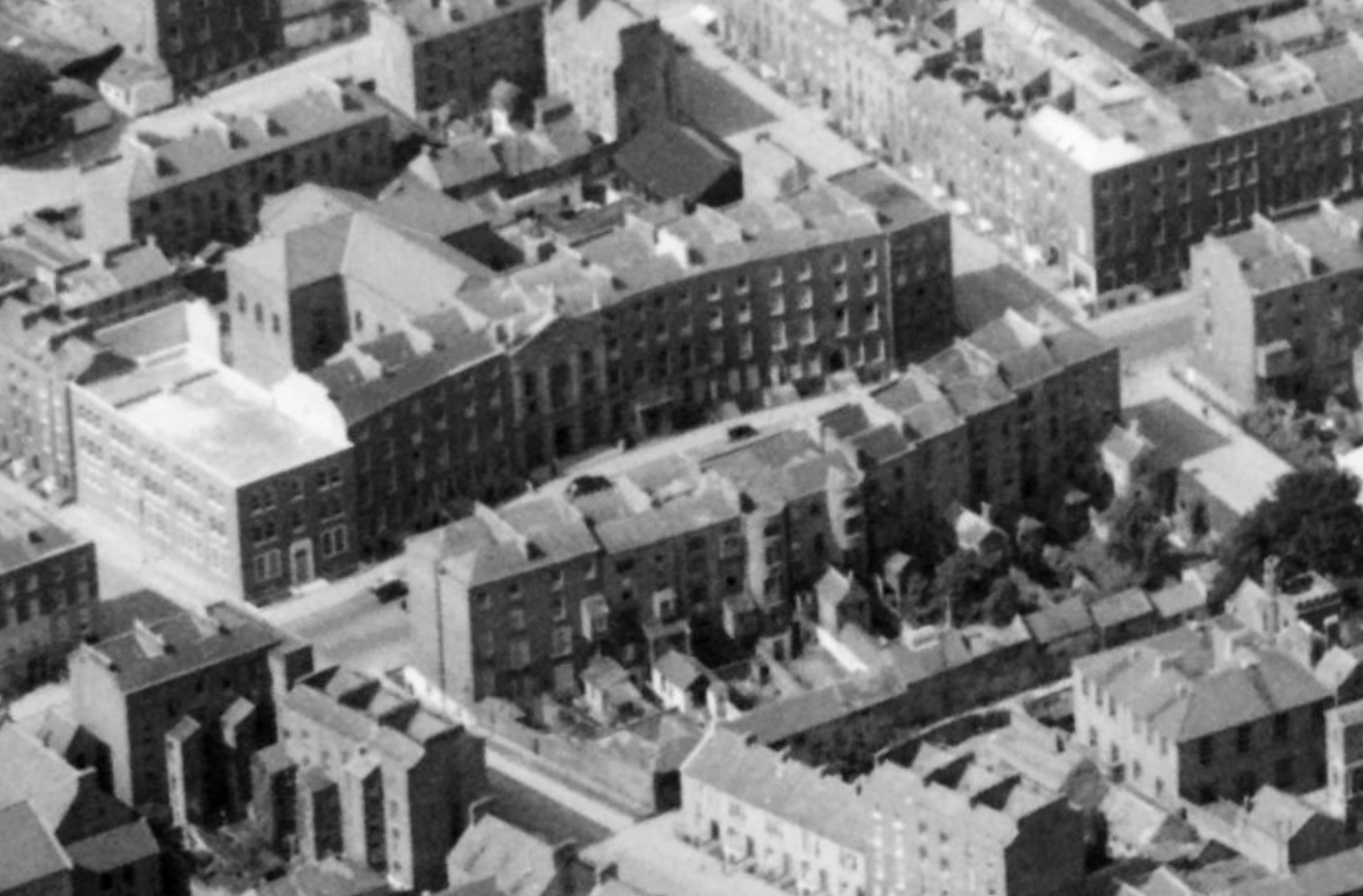
1947 aerial view showing The Crescent.
View from the SE, looking NW.
See wider.
From Britain from Above.
Non-commercial use.


The Crescent in
[Guy's, 1912, p.80].
Numbers 1 to n down the E side.
And then, coming up the W side,
Crescent College with the church,
and then numbers 17 to 18.

In the modern numbering, the numbers go the same way.
This shows there has been no re-numbering for the whole street.
From modern NIAH map.

The Crescent, Limerick.
Photo c. 1880 to 1900.
From NLI.
The school, Crescent College, is to the LHS of the church.
18 The Crescent is to the RHS of the church, just out of shot.
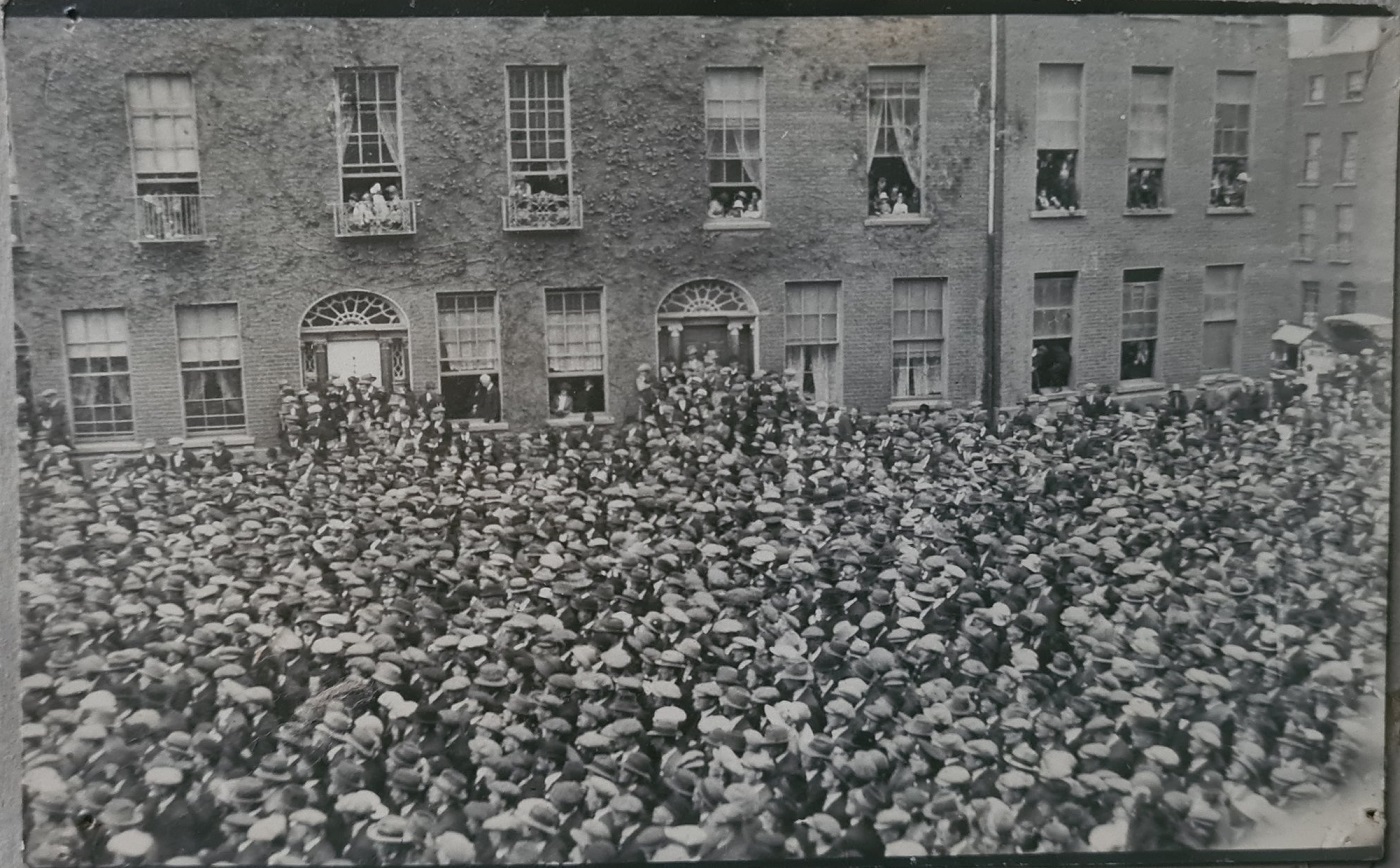
The Crescent, Limerick, in 1923.
Possibly during the
1923 election.
No.18 is the white door and the two windows to the RHS of the door.
No.20 has since been re-built.
See full size.
Posted by Randel Hodkinson.

The Crescent, Limerick, in 1950s.
No.18 visible on LHS.
Image from
here in
Vol.1 of
Limerick, A Stroll Down Memory Lane,
by Sean Curtin.
Used with permission.
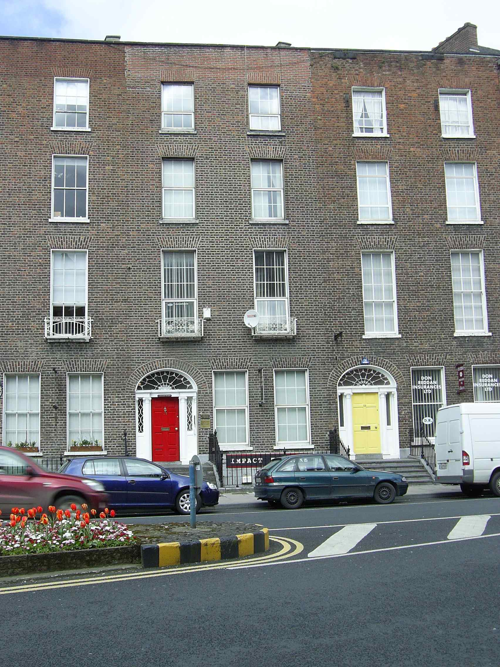
18 The Crescent, Limerick (red door).
Photo 2006.
See full size.
See closer shot
and closer shot.
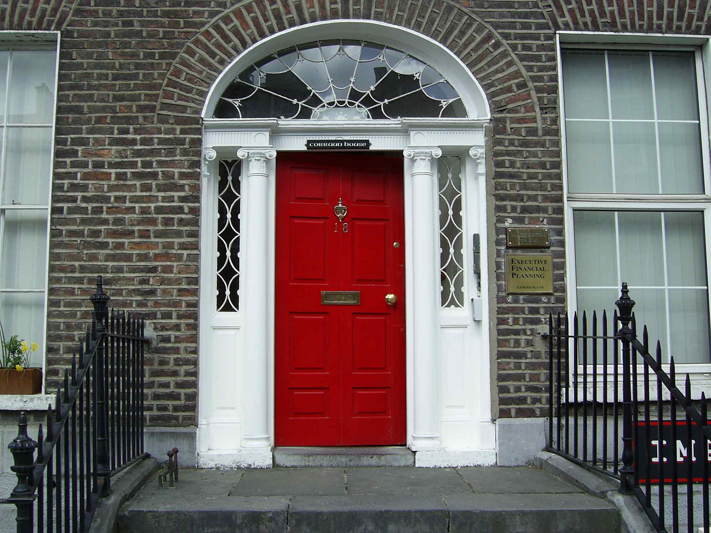
Front door.
Photo 2006.
See full size.
See alternate shot.
Close-up of above.
See full size.
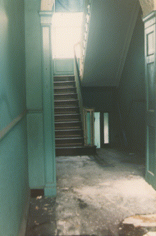
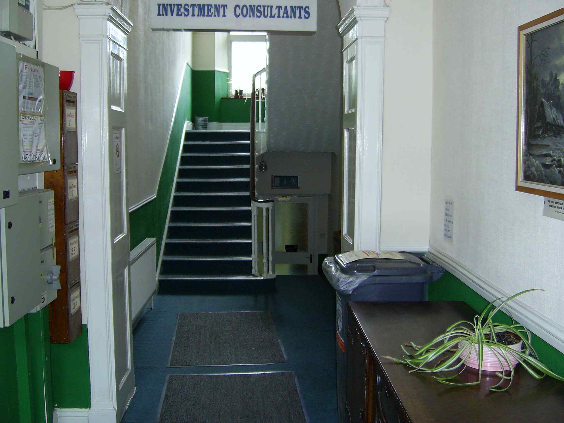
Front hall. Photo 2006.
See full size.
See alternate shot.
Please donate to support this site.
I have spent a great deal of time and money on this research.
Research involves travel and many expenses.
Some research "things to do"
are not done for years, because I do not have the money to do them.
Please Donate Here
to support the ongoing research and
to keep this website free.