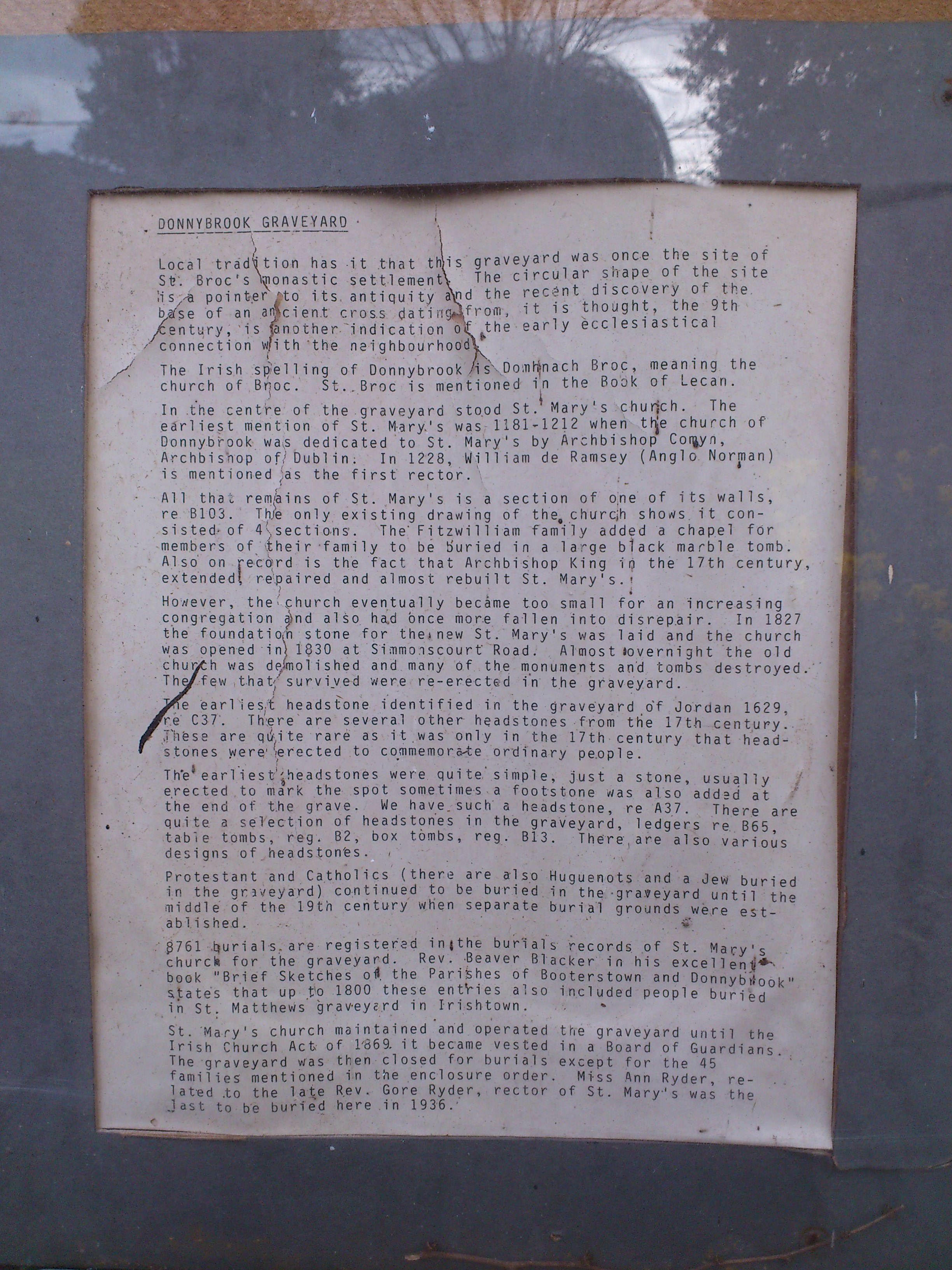
The old Donnybrook church, St.Mary's, dated from the 12th century.
There was a Fitzwilliam chapel,
in which the Fitzwilliam tomb dated from around death of
Sir Richard Fitzwilliam, Kt
1595.
From at least 1615 on (and probably earlier),
Donnybrook church was Protestant,
though the Catholic Fitzwilliams continued to be buried there,
in the old Fitzwilliam tomb.
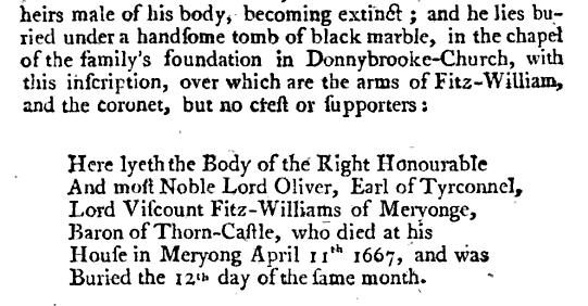
2nd Viscount Fitzwilliam (1st Earl of Tyrconnel,
Catholic) was buried there 1667.
3rd Viscount Fitzwilliam (Catholic) was buried there 1675.
4th Viscount Fitzwilliam (Catholic) said in his will he wanted to be buried there. He died 1705.
The church was rebuilt in the time of
Archbishop King
(1703 to 1729).
The Fitzwilliams conformed to the established church 1710.
Archbishop King was buried
at Donnybrook in 1729.
No monument survives.
The architect
Edward Lovett Pearce
was buried here 1733.
No contemporary monument survives.
Later a plaque was erected to him.
See 2014 photo.
6th Viscount Fitzwilliam
(Protestant)
was buried at Donnybrook in 1776.
The painter
William Ashford
was buried here in 1824.
A new Protestant church, also called "St.Mary's",
was built (foundation 1827, opened 1830)
at the corner of Simmonscourt Rd and Anglesea Rd
(see street view).
The old St.Mary's church at Donnybrook was soon demolished and many of its graves and monuments lost.
Page 11
of
[Blacker, 1860-74] says:
"the materials of it were sold and removed ... and of the monuments in the interior,
not one was rescued from destruction!"
The old church is
gone by the time of the
1829 to 1842 map.
A wall survives of the
old church, in the centre of the graveyard.
Pages 36-37
of
[Blacker, 1860-74]
discuss the loss of the monuments and
confirm that
"A small portion of one of the walls is standing".
Many graves survive
(the earliest from 1629).
[Blacker, 1860-74]
gives inscriptions.
But monuments in and around the church site do not survive.
The Fitzwilliam tomb does not survive.
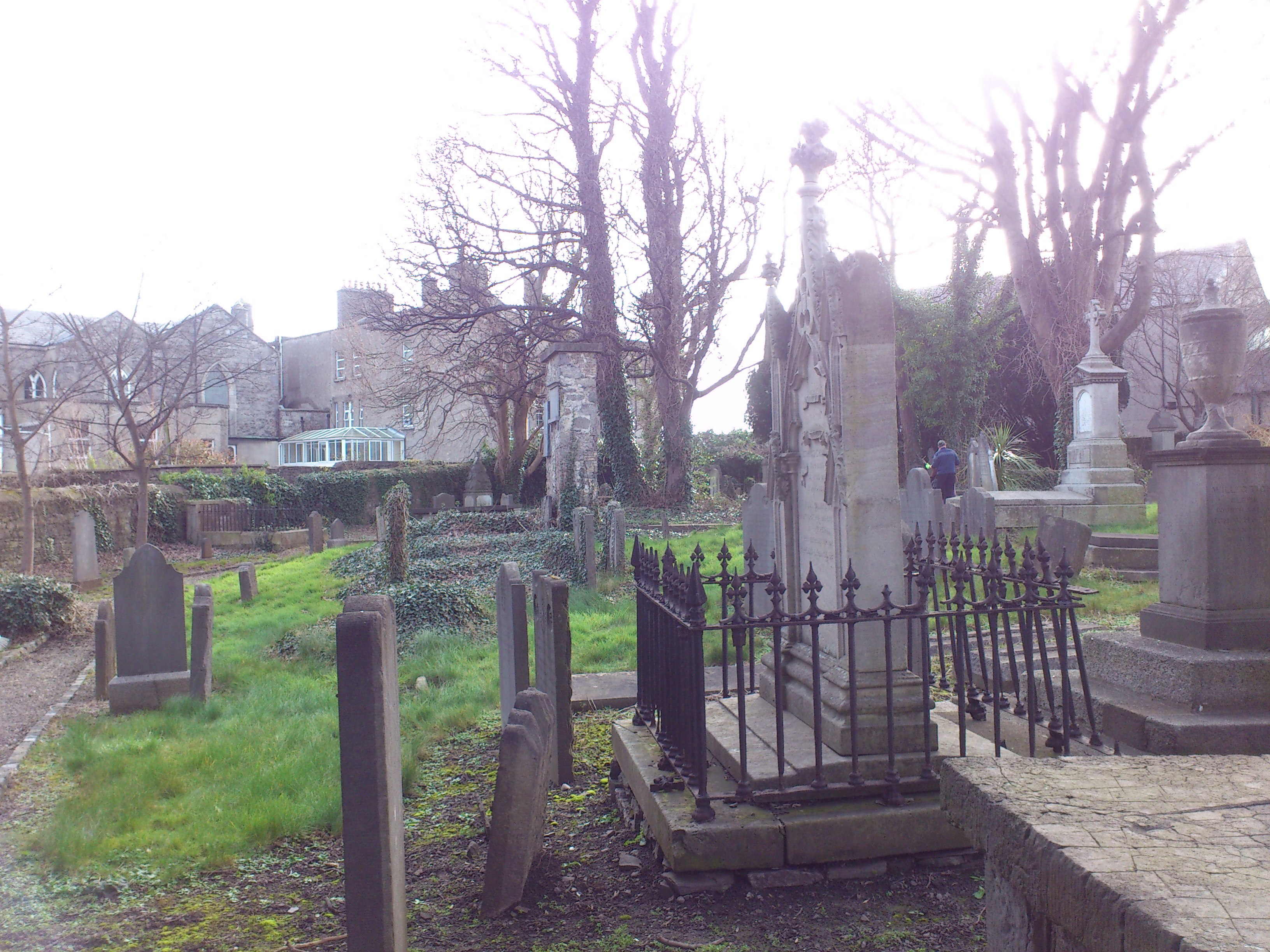
Note that the paths in the graveyard are new. They were only laid out in late 20th century restoration.
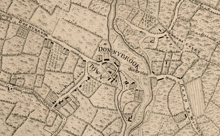
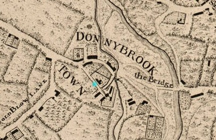
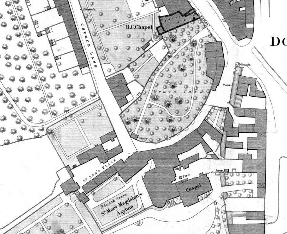
The now vanished St.Mary's church, Donnybrook,
would be the building beside the blue marker.
This location given for the church here
is much closer to the laneway than the bit of wall that survives today,
which is in the middle of the graveyard.
Even if the bit of wall is from the extension on the E side of the church,
it seems the map's positioning is a bit inaccurate.
There are old graves today at the back of the graveyard by the laneway,
so the church could not have been there.
It must have been more in the centre, where the surviving wall is.
From this map, the church gate must have been on the W laneway, not on the E road as it is today.
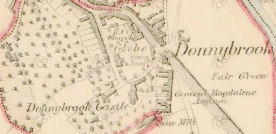
Donnybrook graveyard on
1829 to 1842 map.
The church is completely vanished.
The houses in the lane
survive today
(see street view).
Beside them here (to the S) appears to be an old corner gate into the churchyard (now bricked up).
Note the old 18th century Catholic church to the NE side.
Ordnance Survey of Ireland map.
Date created: 1865.
From here.
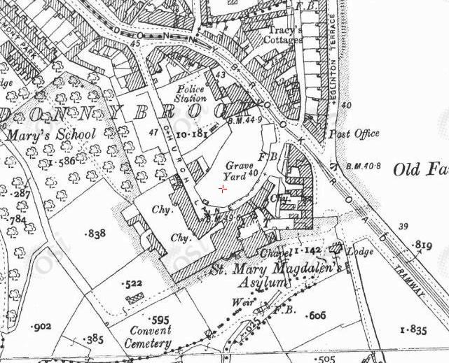
Donnybrook graveyard
on
1887 to 1913 map.
Note the old houses in the lane.
If there was a gateway S of them, it is now bricked up.
The lane is called "Church Lane".
The Catholic church has moved to a big new site further out of town.
The wall of the old Catholic church remains on the NE side of the graveyard.
See 2014 photo.
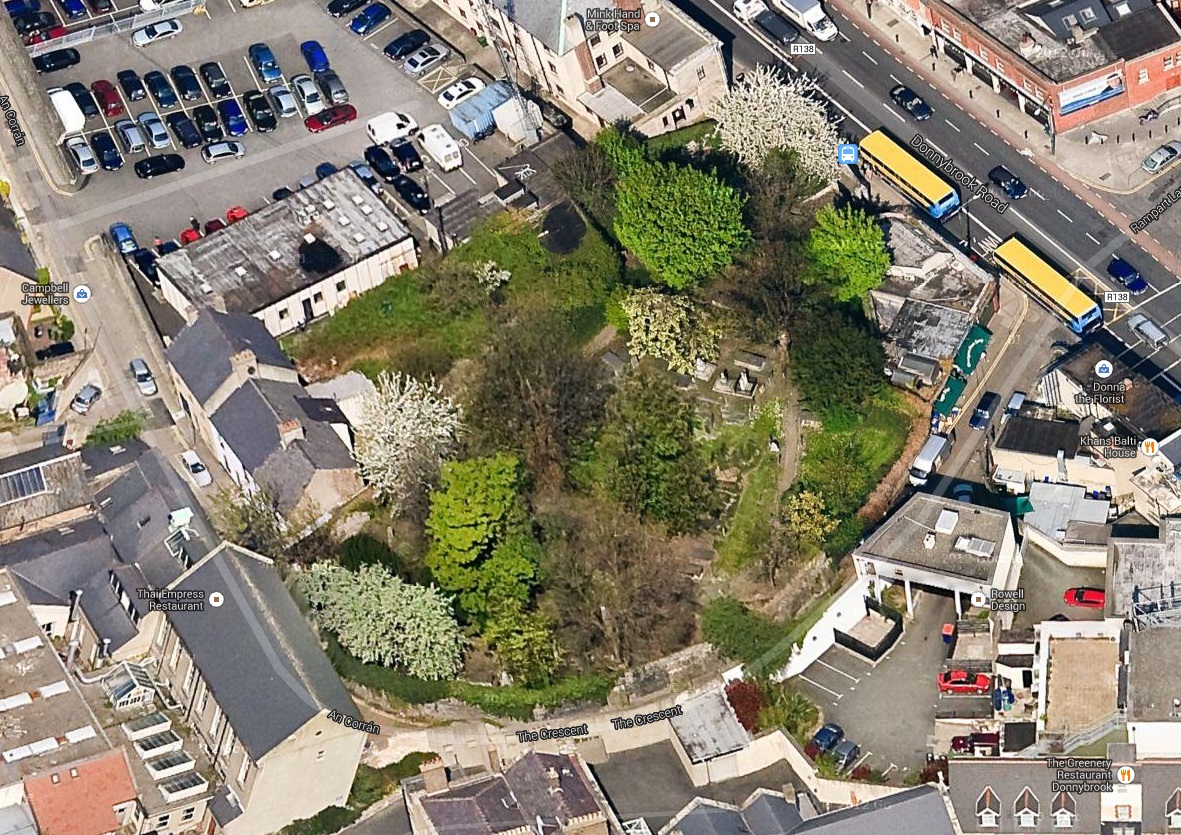
45 degree view looking N from
Google Maps.
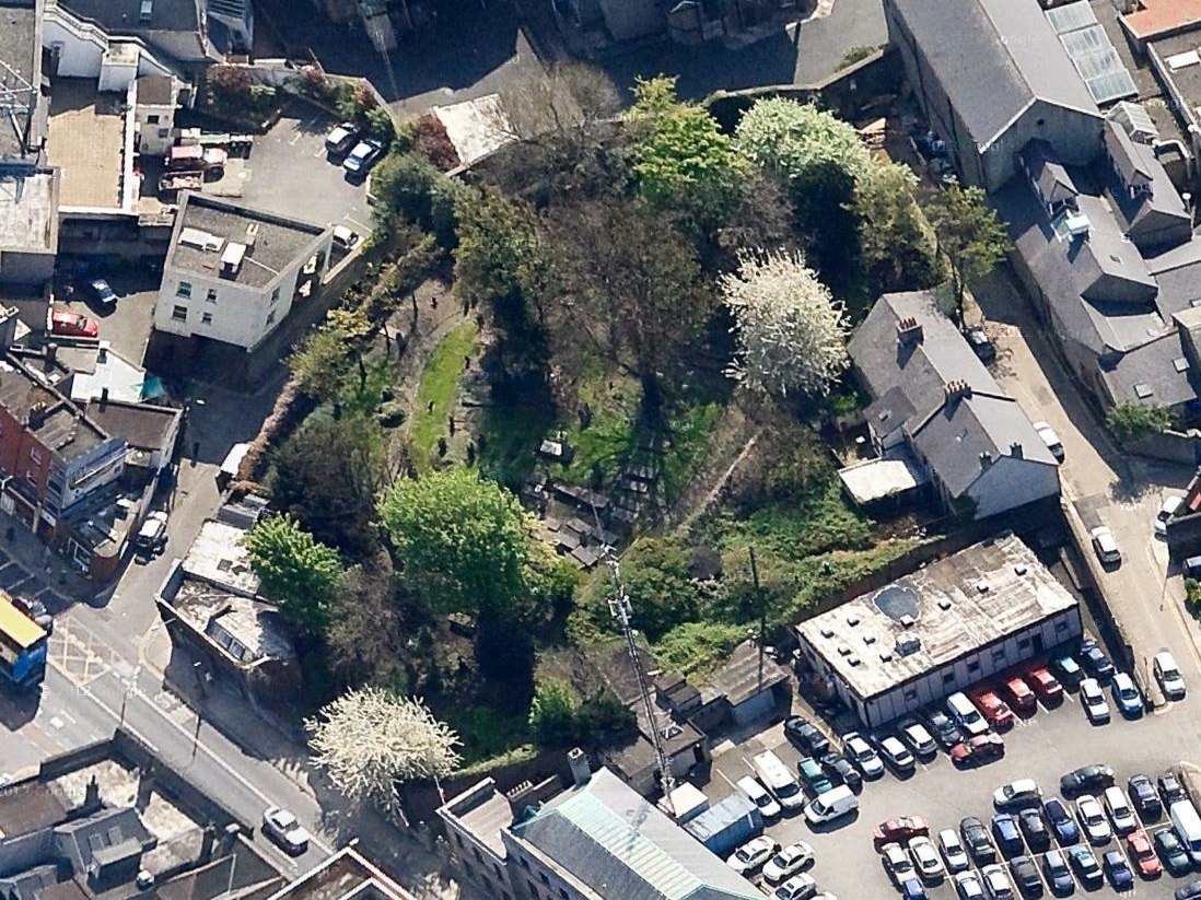
45 degree view looking S from
Google Maps.
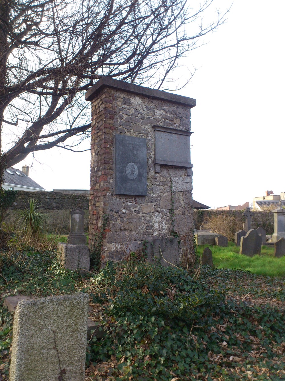
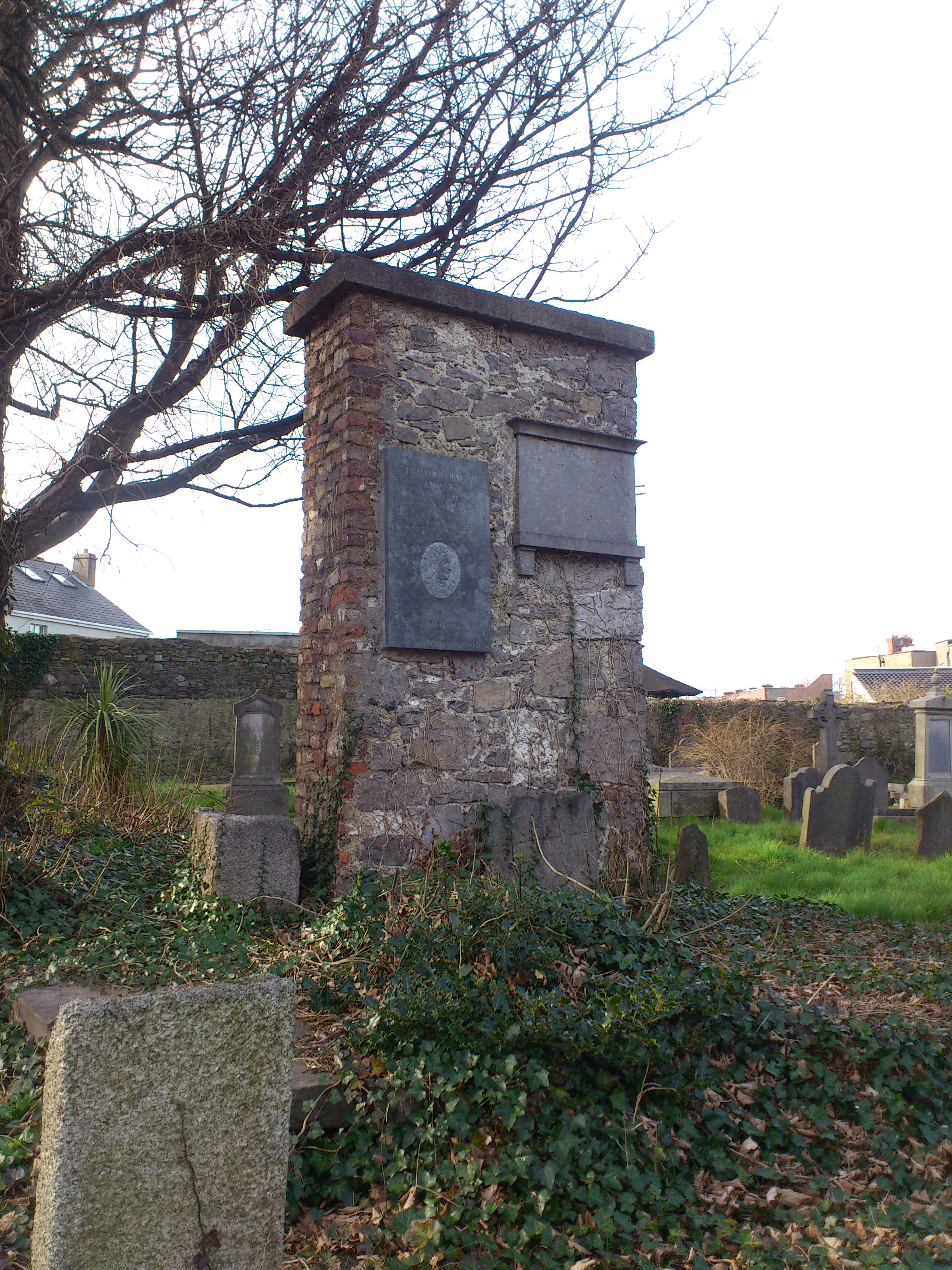
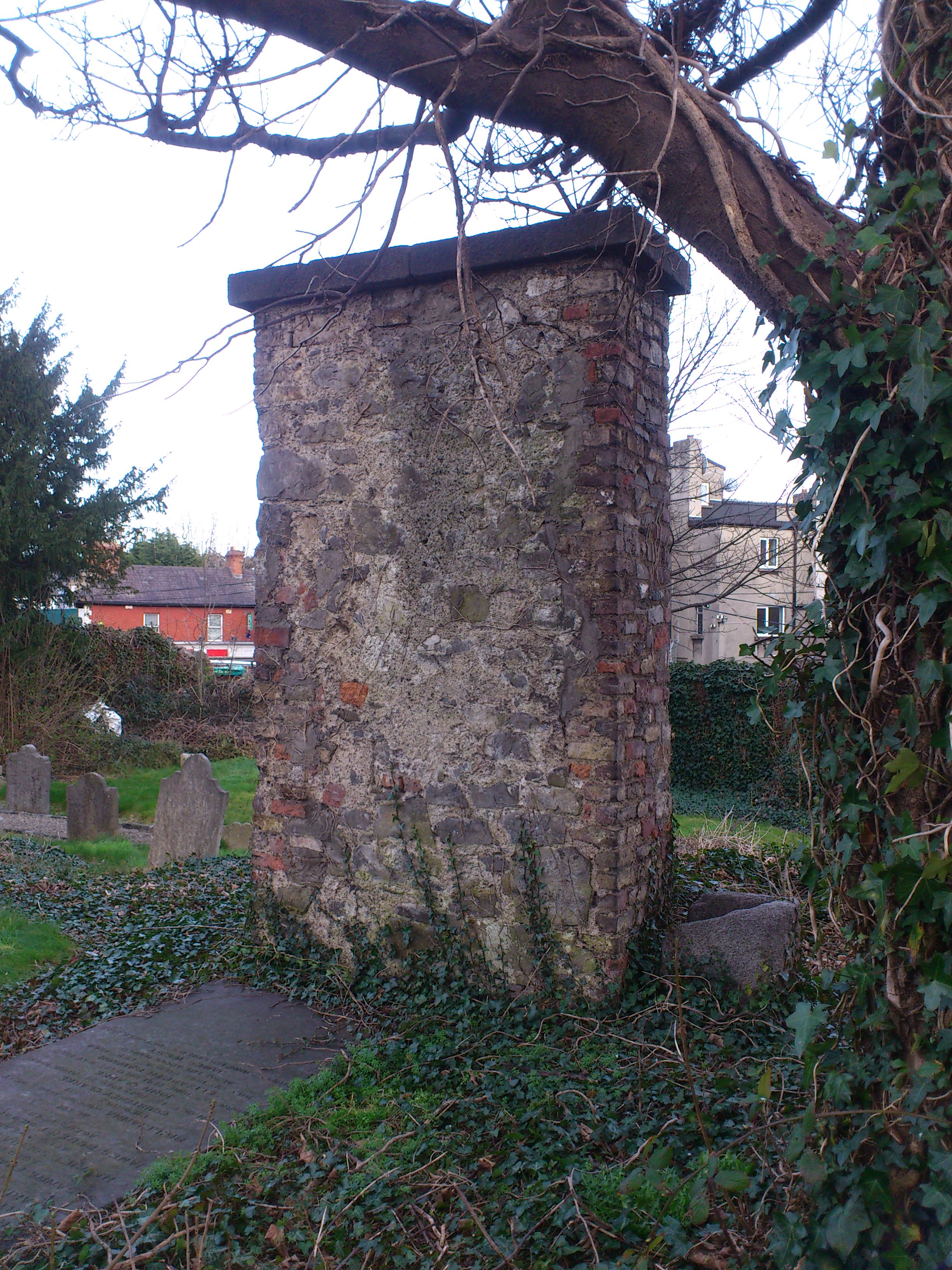
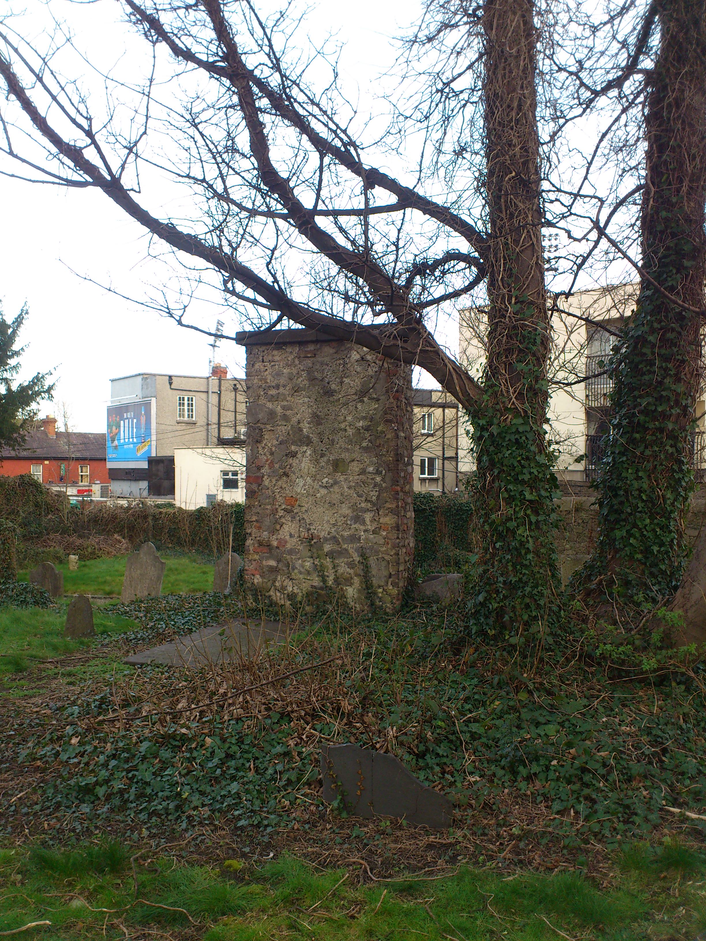
The surviving wall of the old Donnybrook church.
Photo 2014.
See full size
and other shot.
See wide shot
showing location in the centre of the graveyard.

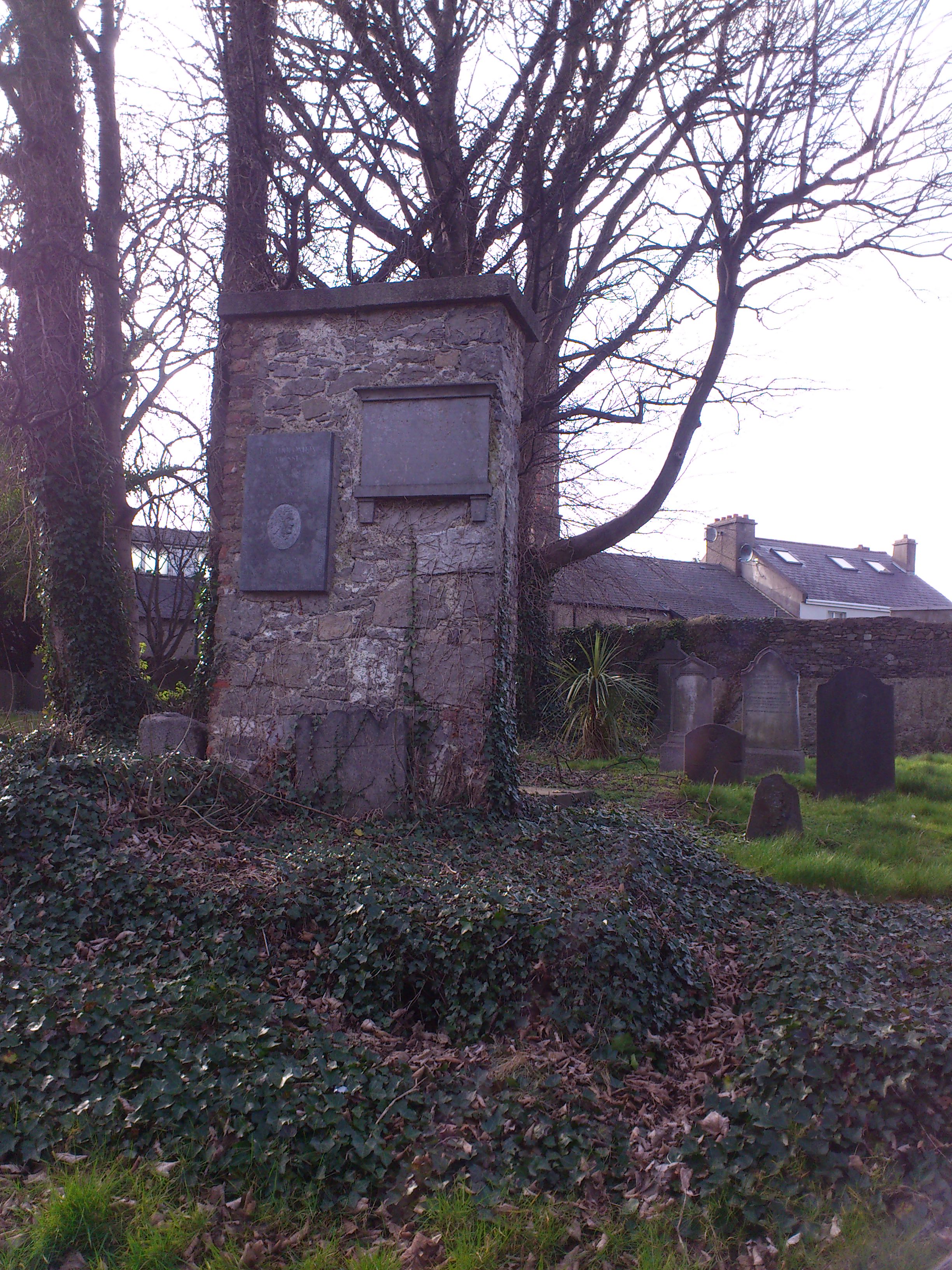
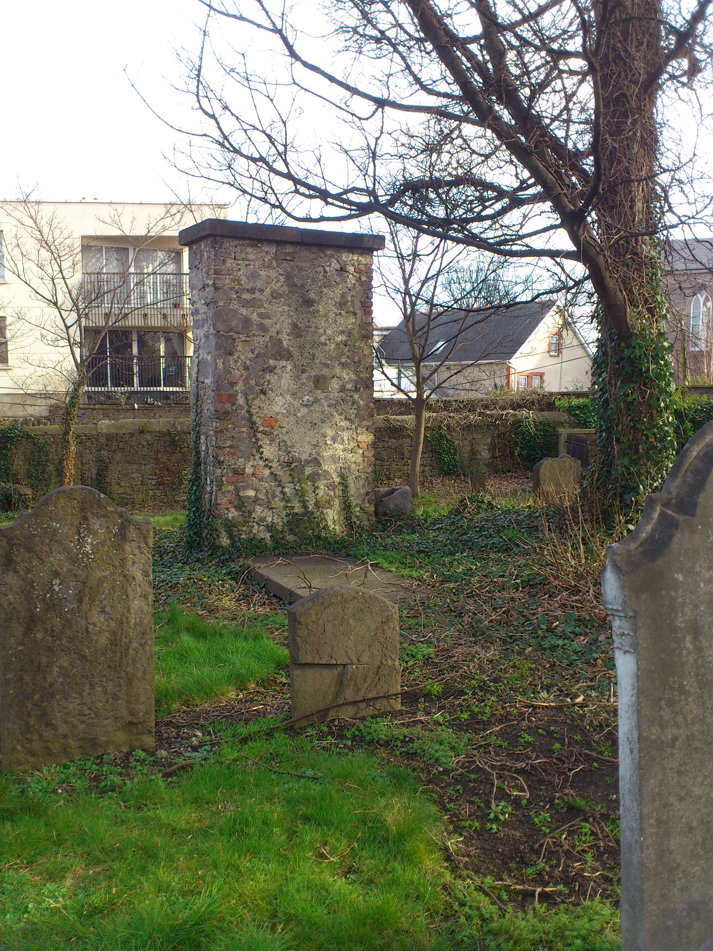
The rear side of the surviving wall of the old Donnybrook church.
Photo 2014.
See full size
and other shot.
See
wide shot and
wide shot
showing location in the centre of the graveyard.
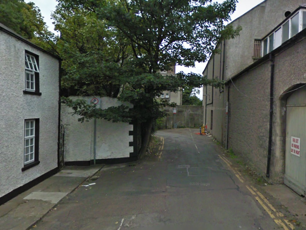
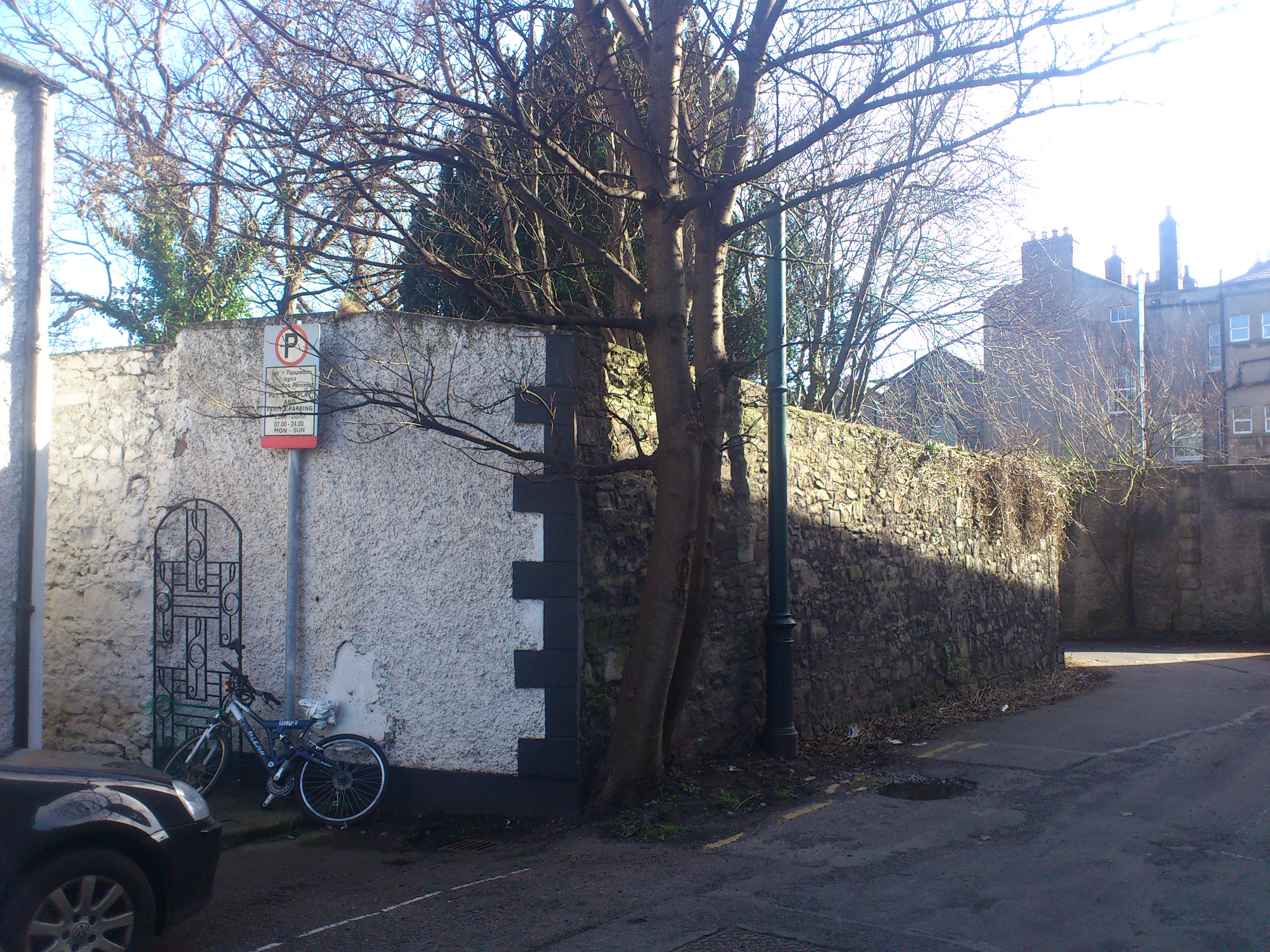
The houses in the lane (on LHS).
From Google street view.
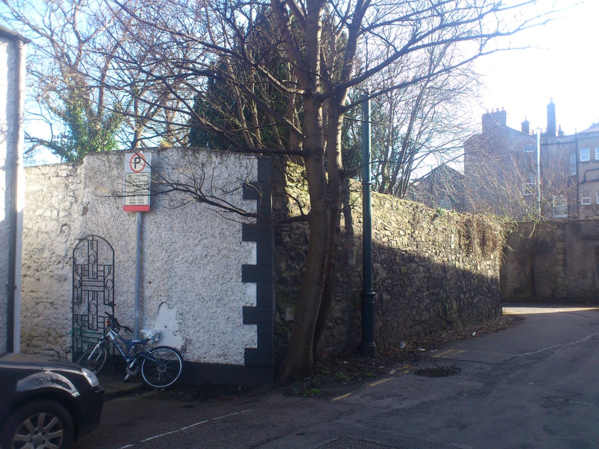
The wall of the graveyard beside the houses in the lane.
Photo 2014.
See full size.
Close-up
makes it look like there might be an old bricked-up gate into the graveyard here.
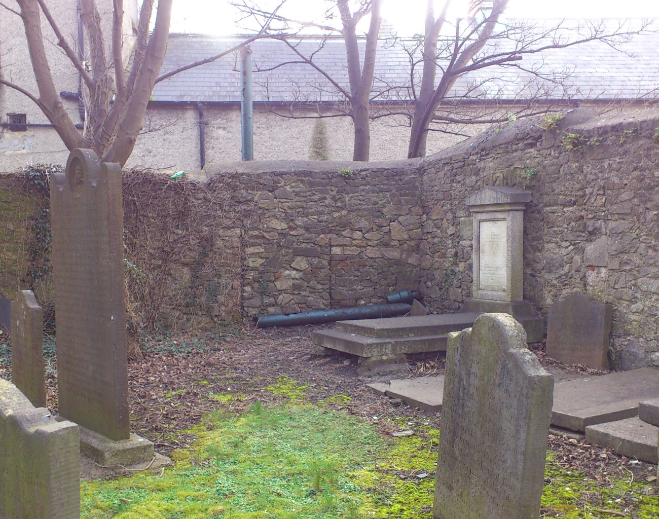
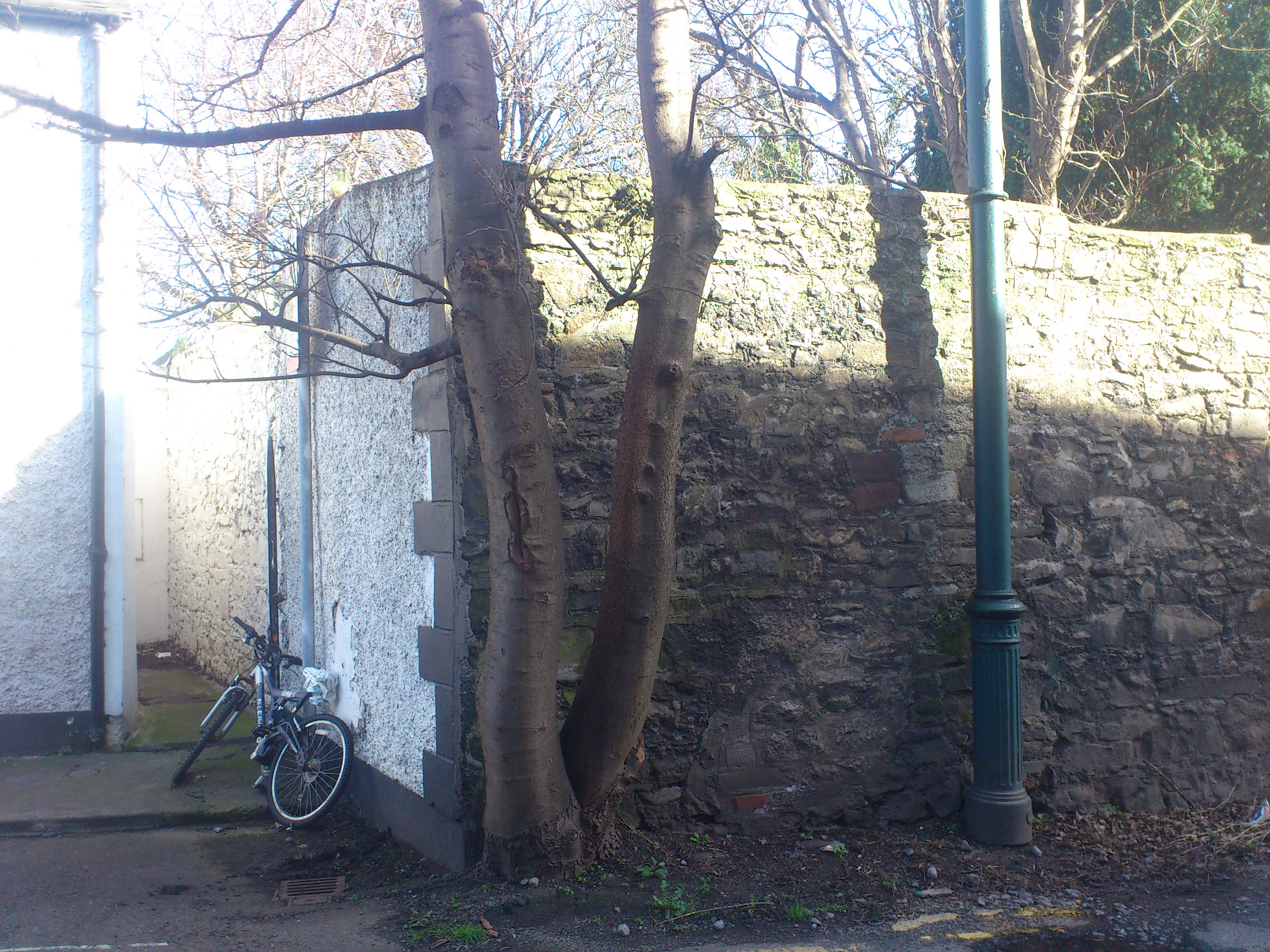
The view from the inside.
It strongly looks like a bricked-up gateway.
Photo 2014.
See full size.
Please donate to support this site.
I have spent a great deal of time and money on this research.
Research involves travel and many expenses.
Some research "things to do"
are not done for years, because I do not have the money to do them.
Please Donate Here
to support the ongoing research and
to keep this website free.
