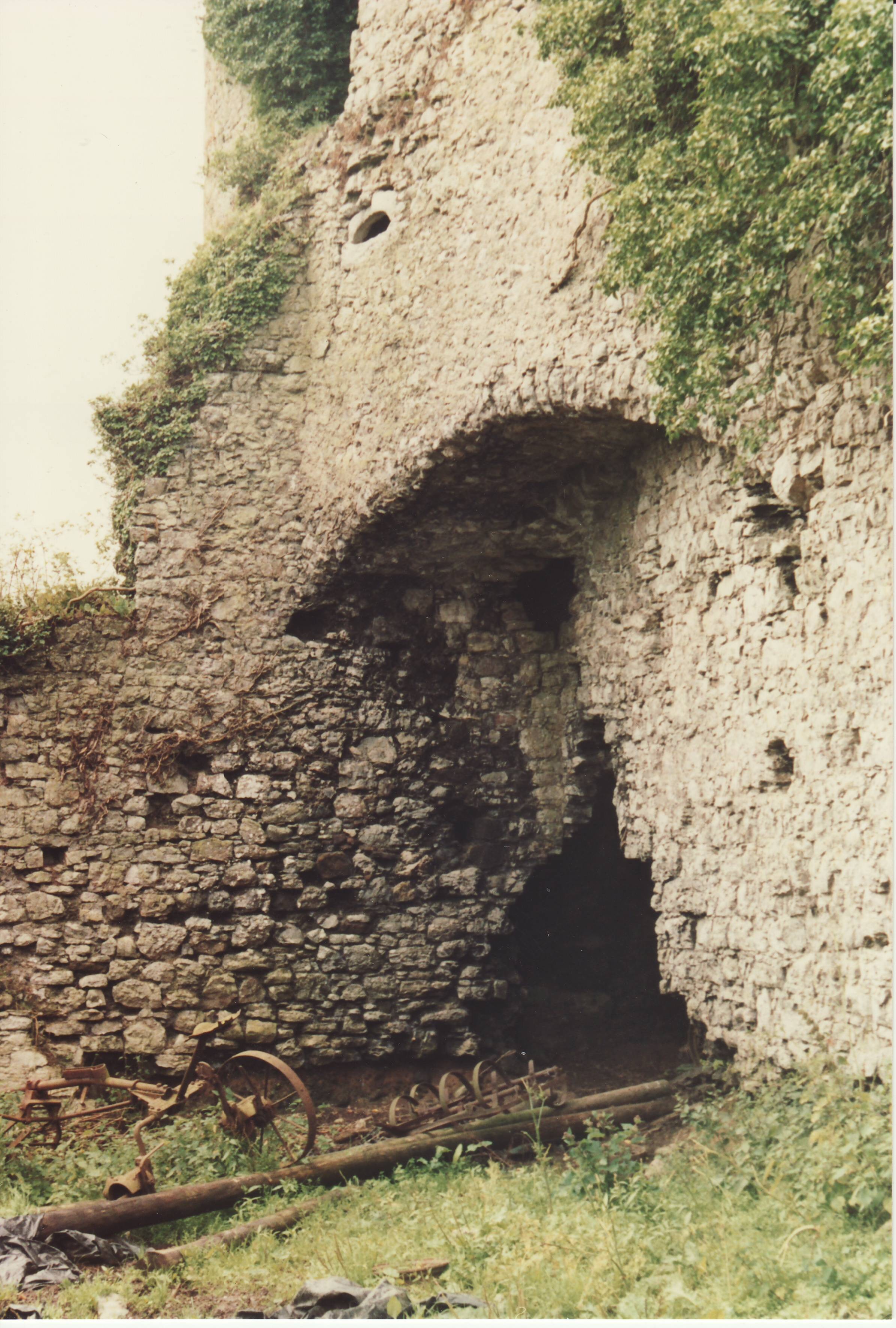
Brittas Castle used to have a massive keep,
with an enclosed courtyard, and a surrounding moat.
It was the seat of Sir John Bourke of Brittas.
It was besieged in 1607.
Sir John was arrested and executed for his Catholic faith.
See [Tierney, 1966]
and [Tierney, 1990].
Standish Grady of Elton
got a lease of Brittas, Co.Limerick (which must be this place) in 1672.
Brittas Castle was destroyed in 1691.
A later
Standish Grady of Elton
held nearby
Garranebane and Scartvavaryeoge
since
[Deed, 1734].
Standish Grady
held Brittas, Co.Limerick,
as at
[Deed, 1737].
[Deed, 1810] seems to shows that John Humphrys of Glenstal had Brittas in 1810.
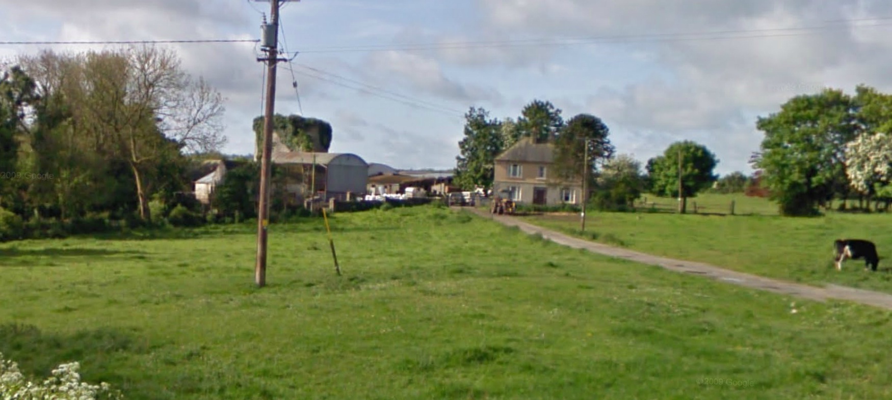
William Humphrys
lived at Brittas (in the farmhouse, not in the castle).
William is listed at Brittas in
[Tithe Survey] sometime in 1823-37.
He holds the largest plot in the townland.
He is listed at Brittas in
[Griffiths Valuation, 1852].
He holds the largest plot in the townland.
He was evicted in old age in 1882.
Humphrys family apparently got back into Brittas in 1890s.
Humphrys family sold Brittas.
Humphrys are gone from Brittas by 1901.
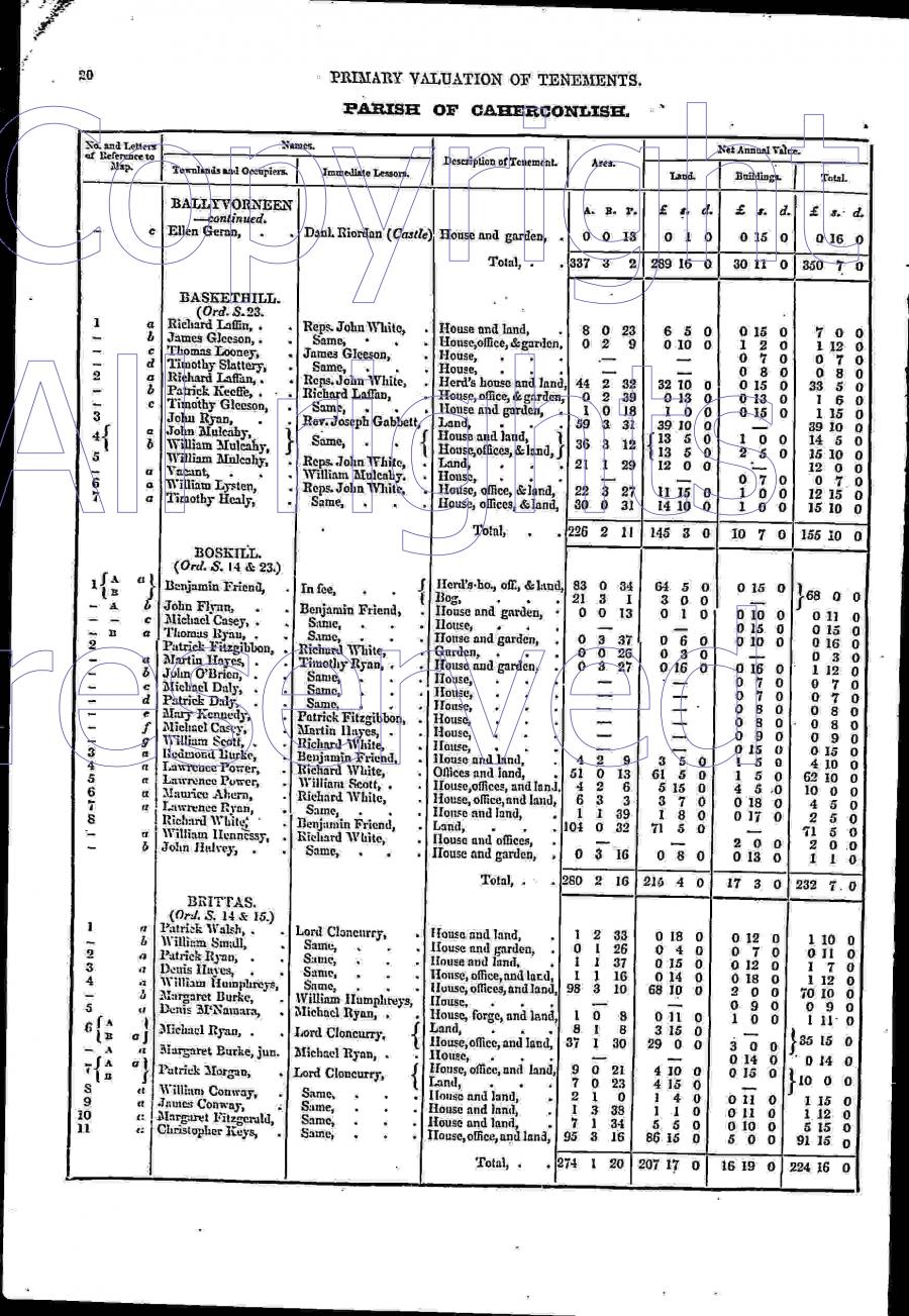
Screenshot of above.
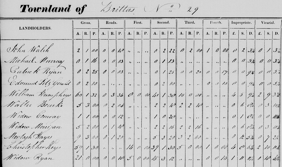
Entries at Brittas in
[Tithe Survey] sometime in 1823-37.
From here.
William Humphrys holds 60 acres, the largest plot in the townland.
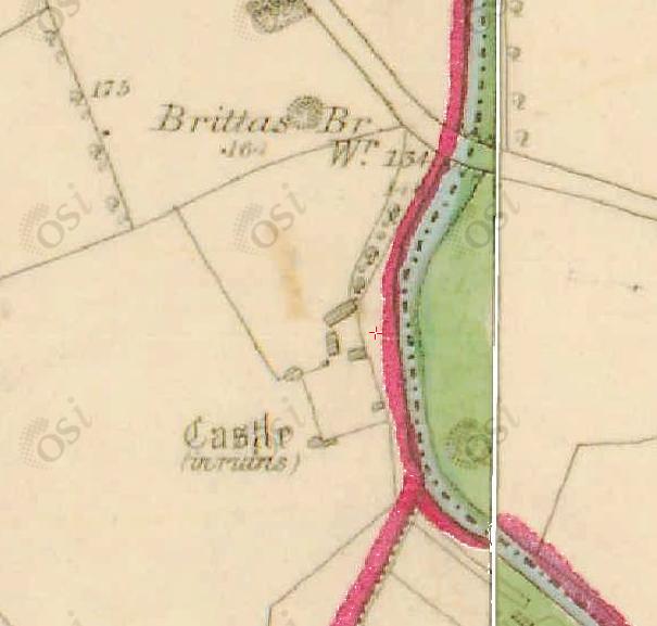
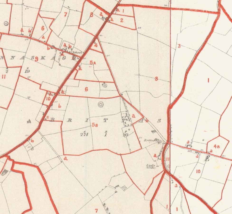
Brittas Castle on
1829 to 1842 map.
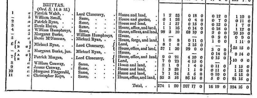
Entries for Brittas on
p.20
of
[Griffiths Valuation, 1852].
From
askaboutireland.ie.
"William Humphreys" holds 98 acres,
leasing from
2nd Baron Cloncurry.
He has the largest plot in the townland.
He has the 3rd biggest house in the townland.
He sub-lets out a small house with no land.
The numbering on the map linked to
[Griffiths Valuation]
at
askaboutireland.ie
does not match the plot numbers in the text.
However, we can see that the Humphrys farm is plot 3 on the map
and the Humphrys house is 3a.
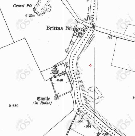
Brittas Castle on
1887 to 1913 map.
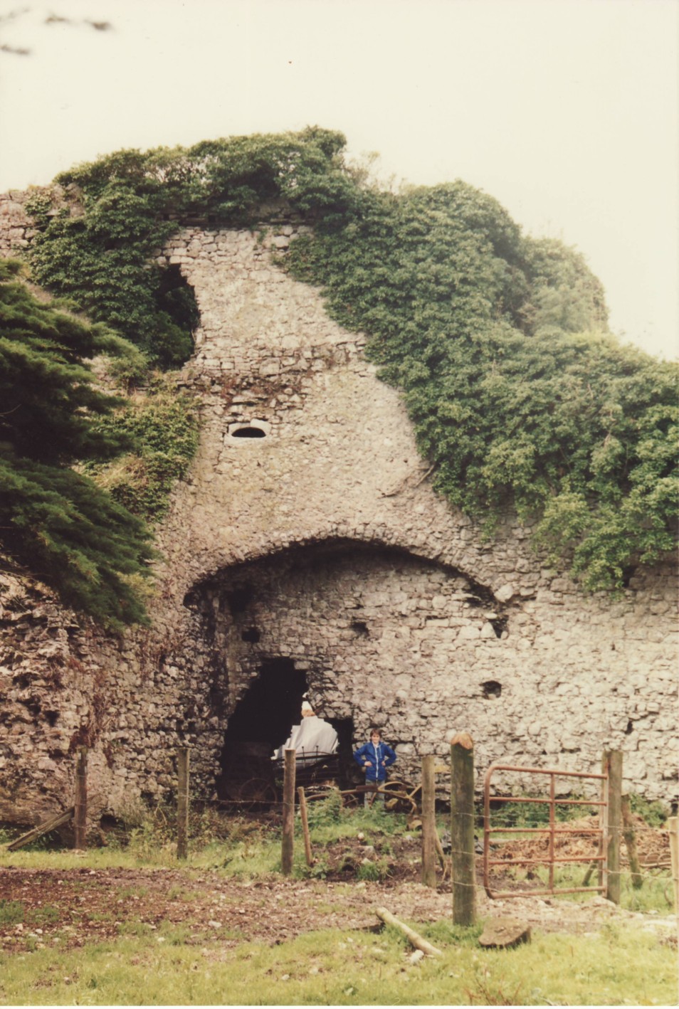
Brittas Castle.
Photo 1985.
See larger
and full size.
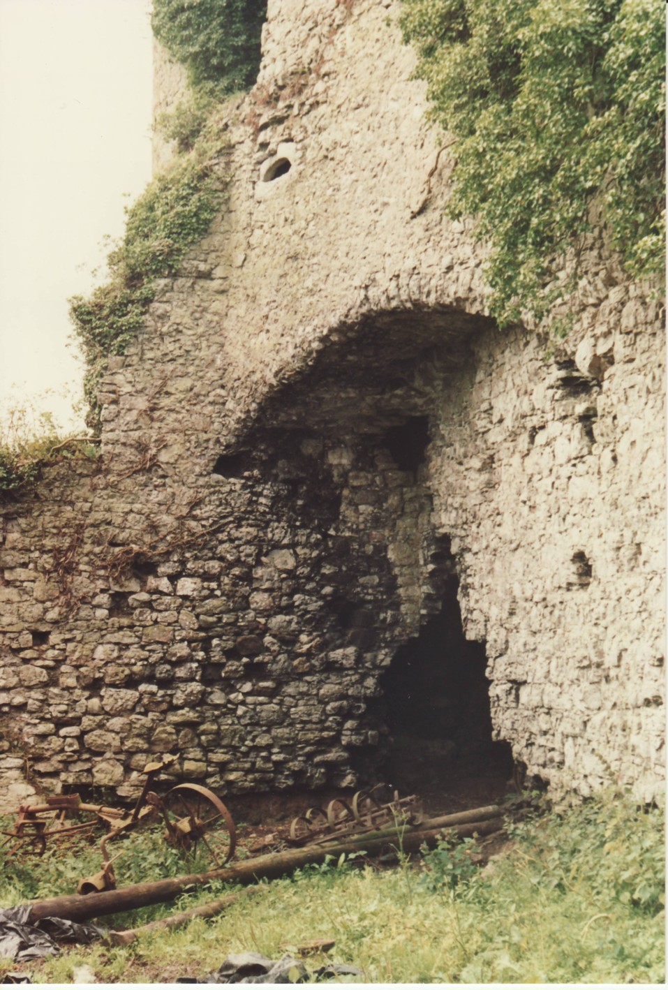
Brittas Castle.
Photo 1985.
See larger
and full size.
See also photo in
[Tierney, 1966].
Please donate to support this site.
I have spent a great deal of time and money on this research.
Research involves travel and many expenses.
Some research "things to do"
are not done for years, because I do not have the money to do them.
Please Donate Here
to support the ongoing research and
to keep this website free.
