The Church St property
was acquired by
Joseph Lindsay
in the long term lease
of 1804
[Deed, 1804].
[Deed, 1820]
and
[Deed, 1864]
say
Joseph Lindsay
built the two houses here shortly before 1804.
[Letter of 8 Sept 1802]
refers to Joseph Lindsay as one of the people who have recently built in Tarbert.
[Deed, 1804]
is quoted in
[Deed, 1820]
as saying:
"on which said front ground is lately built by said Joseph Lindsay
slated houses two storie high".
The White House, Church St,
was home of Joseph's widow
Catherine Enraght
after her husband's death 1805.
[Deed, 1812]
is a lease from
Sir Edward Leslie, Baronet
to Joseph's son
William Lindsay
of "three" houses in Tarbert that were built by his father.
These may be the Church St properties.
The Church St houses
are definitely part of the
lease of 1820
[Deed, 1820]
which renews the original lease of 1804.
Catherine Enraght died at the White House, Church St, in 1832.
In 1851 her son
William Lindsay
was landlord of
the White House
and the adjacent property,
and was renting them out.
William's widow
Letitia Blennerhassett
moved into the White House apparently after her husband's death 1862.
She was apparently there in 1864,
and was living there in 1875
when the properties were put on sale (subject to her continued occupation until death).
Letitia probably died in the White House in 1876.

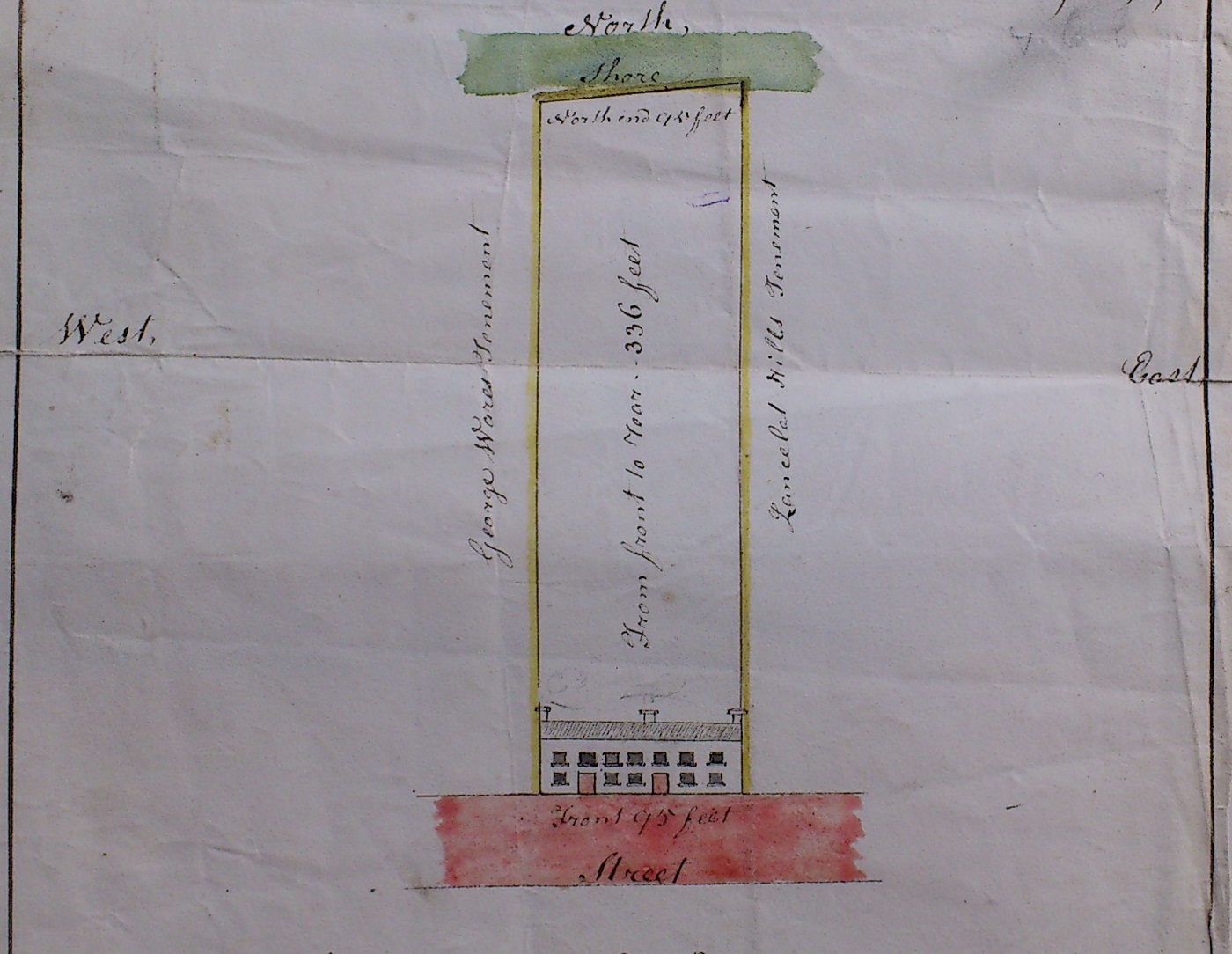
Map of the Lindsay property on
Church St, Tarbert, in
[Deed, 1820].
N is up.
Deed describes this property as "on the North side of the Square" in Tarbert.
Running from Church St up to the shore.
See larger
and full size.
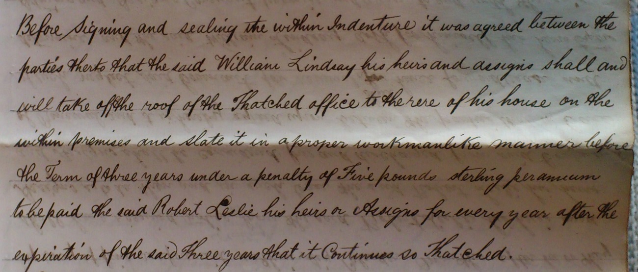
As part of
[Deed, 1820],
William Lindsay
agrees to replace a thatched roof on a rear building at the property with a slated roof.
See larger
and full size.
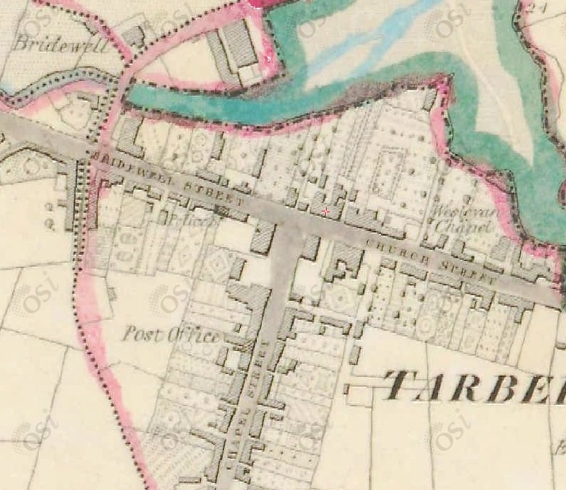
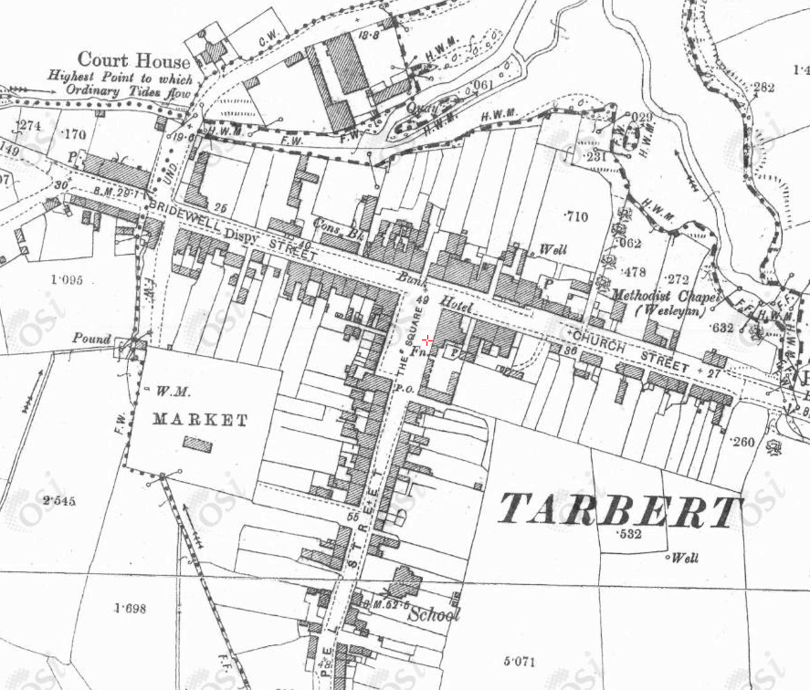
Map of Church St, Tarbert. 1829 to 1842 period.
The Lindsay property leased from
[Deed, 1804]
is the block with the red cross marked on it.
Two houses joined, with land stretching up to the estuary.
From OSI.

In [Griffiths Valuation, 1851]
William Lindsay is landlord of (renting out) the houses numbered 45 and 46 Church St, Tarbert.
In this map North is to the right.
Number 45 is the White House,
where
Catherine Enraght
lived after 1805
and died 1832.
In 1851 William Lindsay is
renting both properties out to the
Guardians of Glin Union
for use as an "Auxiliary workhouse"
(the main workhouse would have been at Glin).
William Lindsay's will dated 1852
says he is in possession of these two properties
"together with the passage at the West end of said premises".
He must mean the East end.
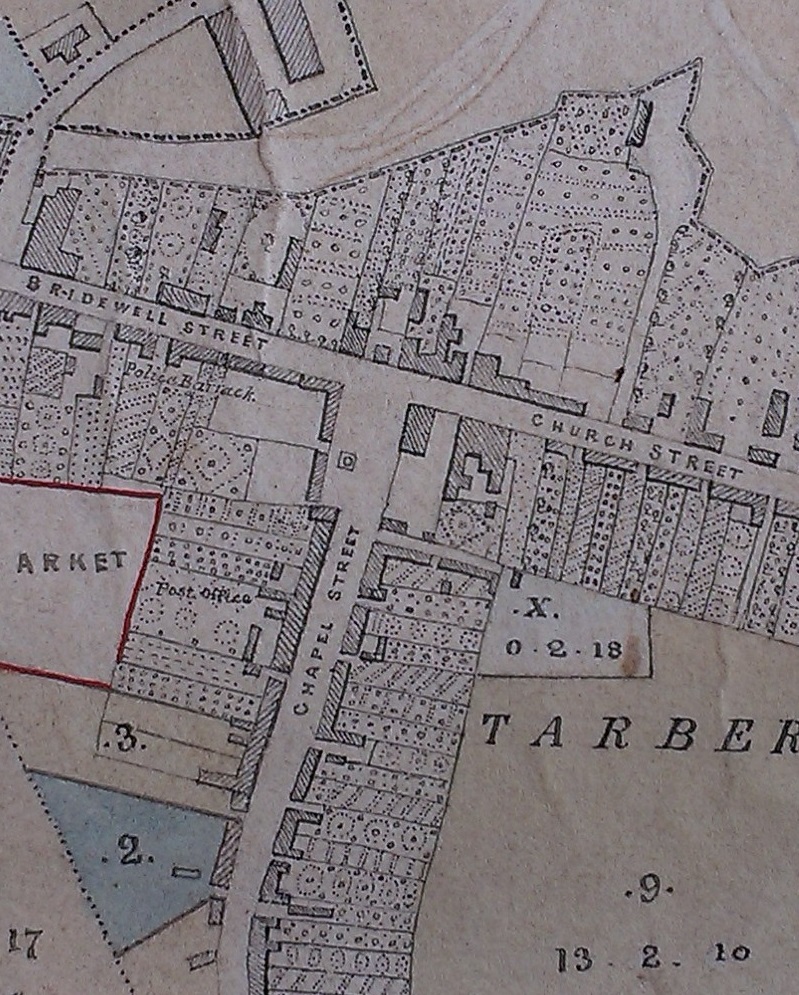
Building no. 82 / 83
here
(Gallagher's Hotel)
is the start of Chapel St.
Map from askaboutireland.ie.
William Lindsay died 1862.
It seems that
his widow Letitia
then moved into the White House
(where she apparently lived until her death 1876).
The other Church St house (shown as number 46 in Griffiths Valuation) was leased out for trade.
[Deed, 1864]
says that Letitia
is living in one of the houses
(would be the White House).
[Deed, 1865]
leases the two houses to Michael Slattery, auctioneer, of Tralee,
and Michael Ahern, shopkeeper, of Tarbert
(probably subject to Letitia's continued occupation of one of them, see below).
A new building was built apparently in 1871 at location number 46.
[Deed, 1871]
shows Daniel Fitzgibbon, draper, setting up shop here.
Though
[Slater's directory, 1870]
lists Daniel Fitzgibbon, draper, Market Square.

Notices
of July-Aug 1875
refer to the sale of Lindsay properties in Tarbert.
Notices
in
Freemans Journal, July 17, 1875,
and Aug 18, 1875,
and
19 Aug 1875.
Notices also in
Irish Times,
August 12, 1875
and
August 18, 1875
and
August 25, 1875.
They say these properties are
held under the old lease
[Deed, 1820].
They are for sale in 1875
subject to the continued occupation of one of the houses by Letitia Lindsay, age "nearly 100".
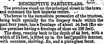
The notices describe the properties as
"two slated dwellinghouses
... on the principal street in the town".
They say Letitia is living in one of them,
and the other is a building that was
"built specially for the drapery trade within the past four years"
and has "a plateglass front".
That is,
Letitia is living in the White House.
And number 46 is the drapery, built around 1871.
(Hence the building shown as number 46 in
Griffiths Valuation 1851
is the older building on the same site.)
This is Fitzgibbon's drapery, renting from Lindsay.
This is confirmed by the photo and census below.
Fitzgibbon's drapery, The Square, is listed in
[Slater's Directory, 1894].
Smyth's grocers, Church St (see below) is listed in
[Slater's Directory, 1894].
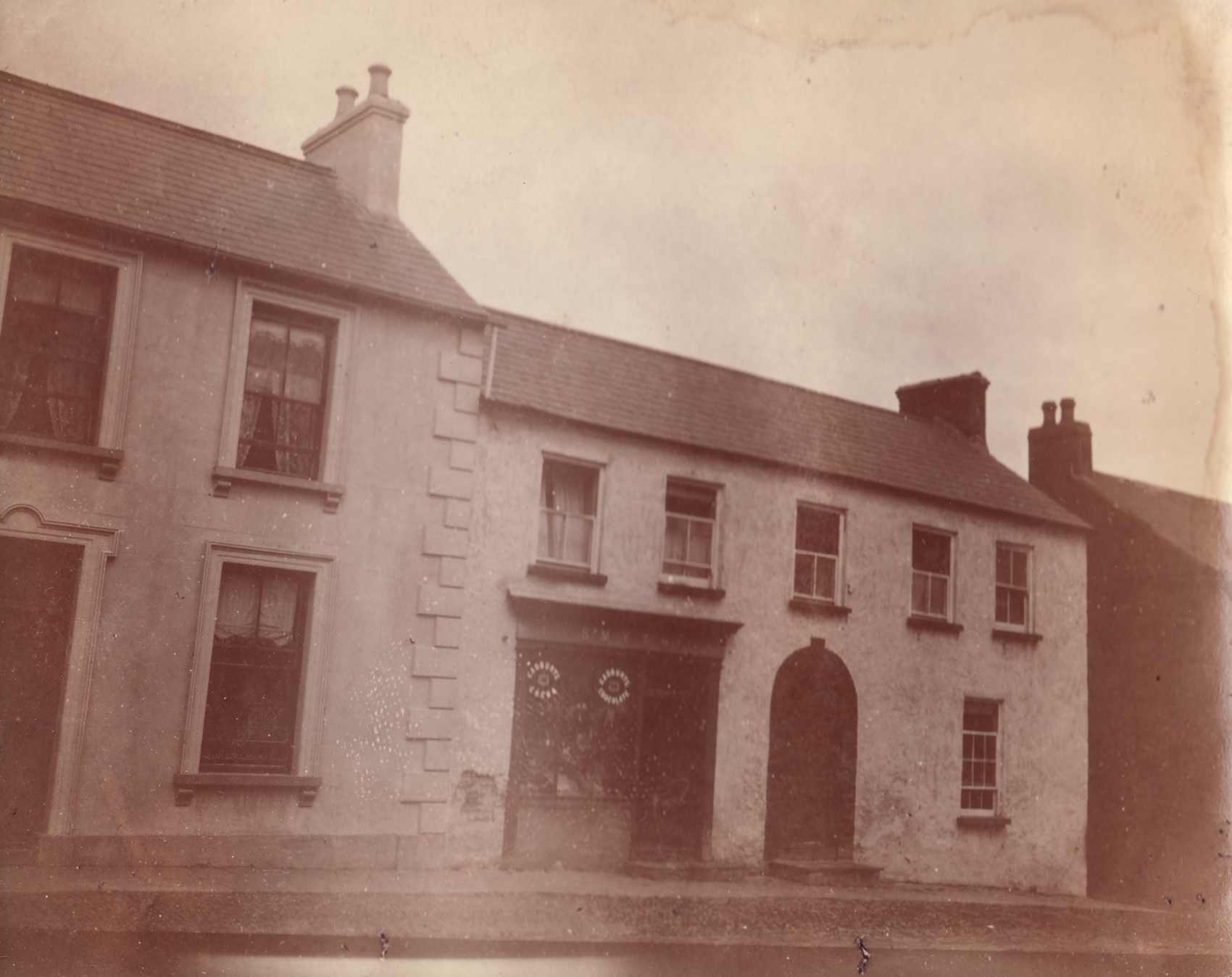
The Lindsay properties on Church St.
From old Lindsay photo album.
Photo probably taken by
Rev. Thomas Enraght Lindsay
in 1896 or 1897.
On LHS is property numbered 46 in Griffiths Valuation.
On RHS (here Smyth's shop) is property numbered 45,
which is described
as the White House.
See larger
and full size.
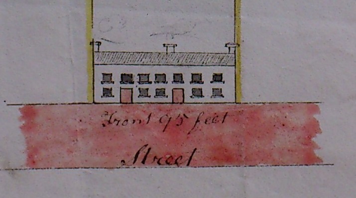
Comparison with the drawing on
[Deed, 1820].
The White House would be the RHS house.

Fitzgibbon's drapery, The Square, is listed in
[Kelly's Munster Directory, 1906].
Benson-Fitzgibbon was drapery up to 1920s.
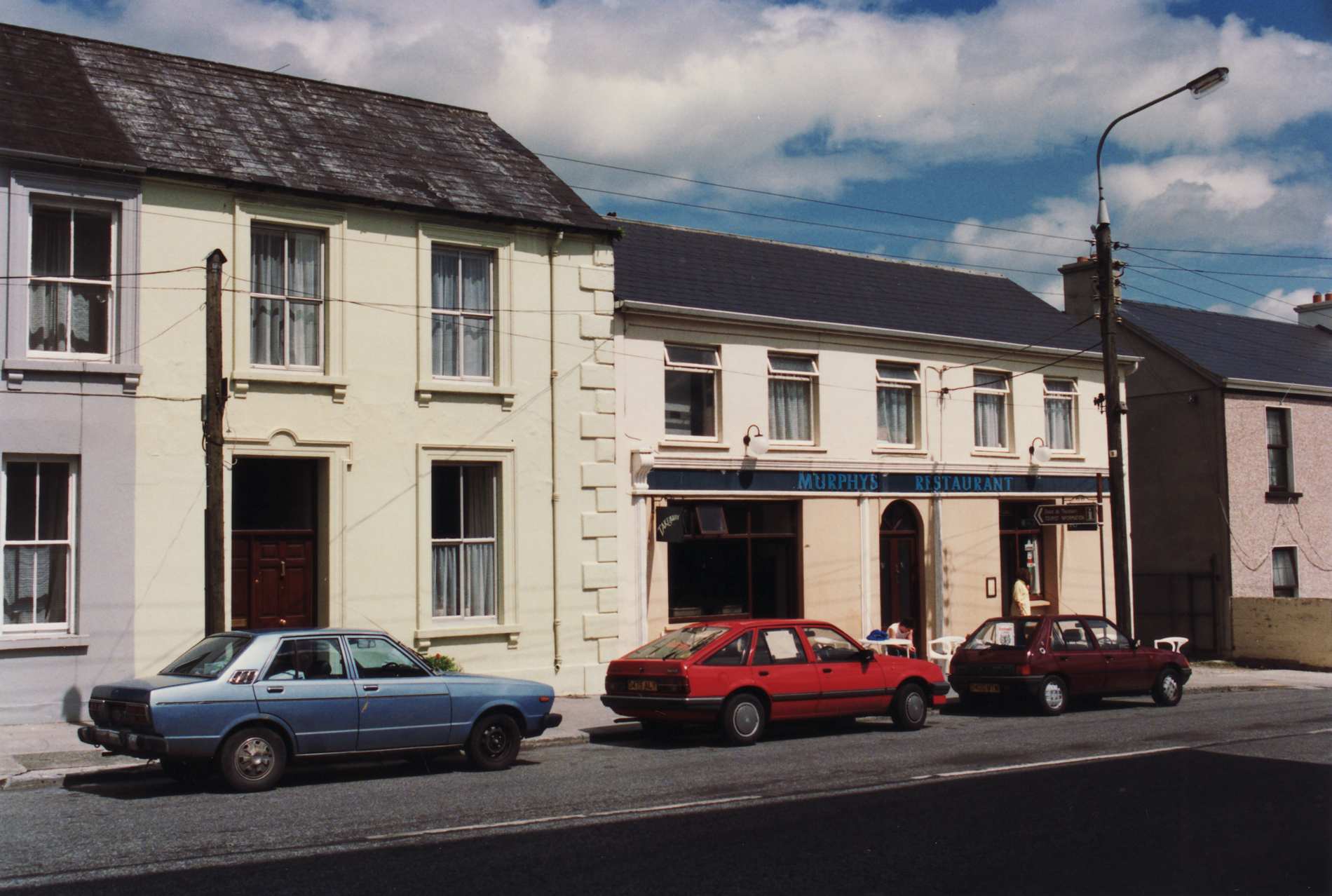
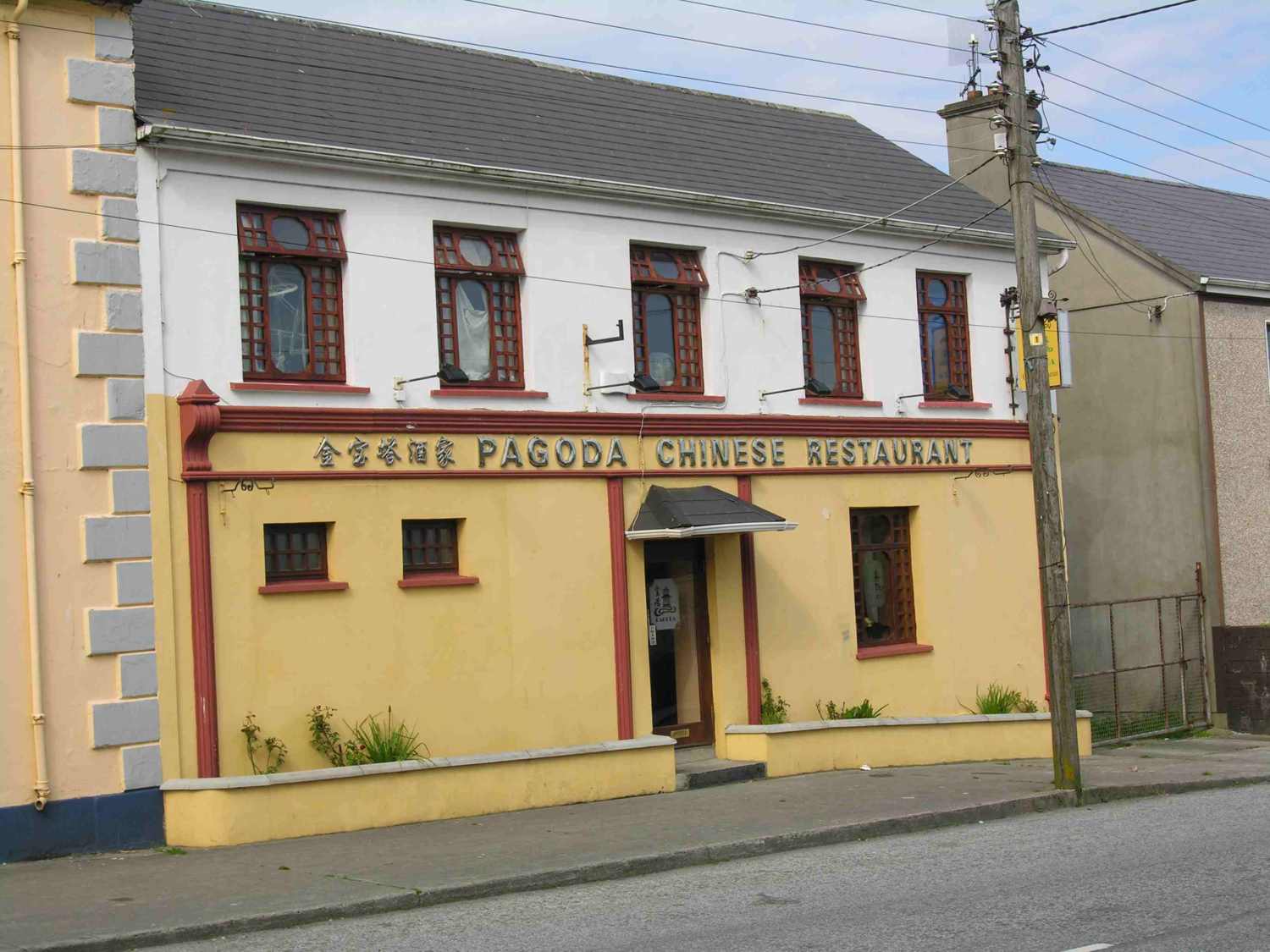
In 2005 the White House was the Pagoda Chinese restaurant.
See larger
and full size.
See also side view.
Photos from Sandra Lindsay.

The White House
shortly before 2011
was the "Golden Coast" Chinese restaurant.
Screenshot from Google Street View, pre-2011.
See full size.
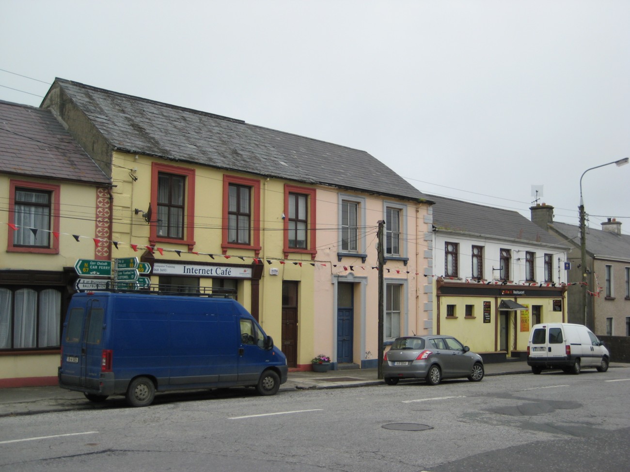
Street view of the above location.
Click to rotate and move.
From
Google Street View.
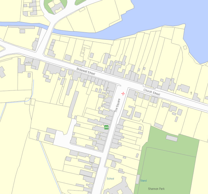
Modern map of the area.
The property numbered 46 in Griffiths Valuation has now had its back garden divided in two.
From OSI.
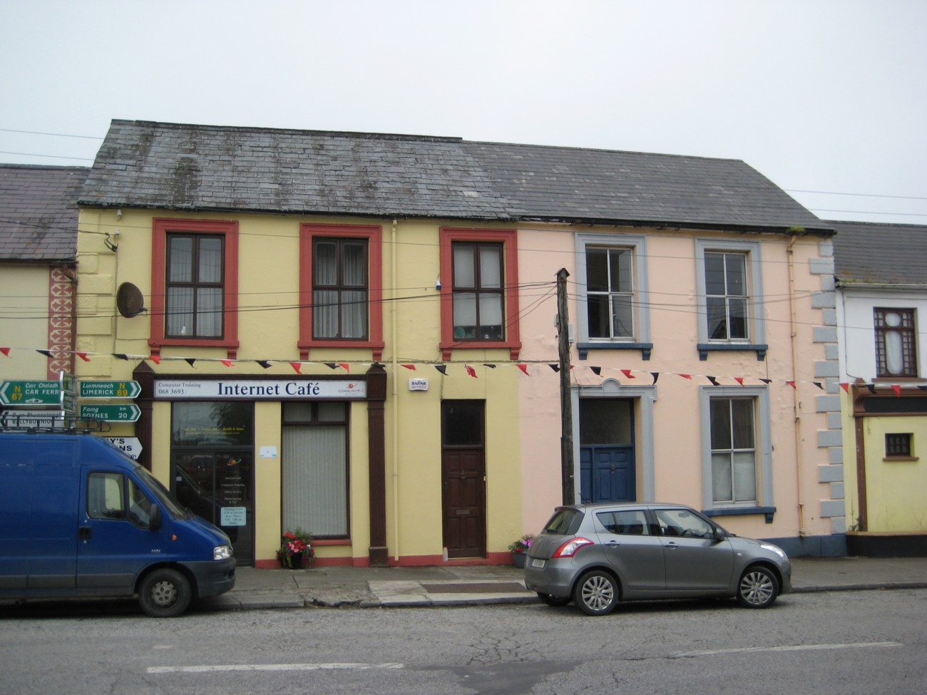
Property number 46 would be the full block with 5 windows on the top.
This is now divided in two, the LHS part yellow, the RHS part pink.
This was apparently built about 1871.
The LHS part is the
Community I.T. Access
Internet cafe
(also here).
Photo 2011. See full size.
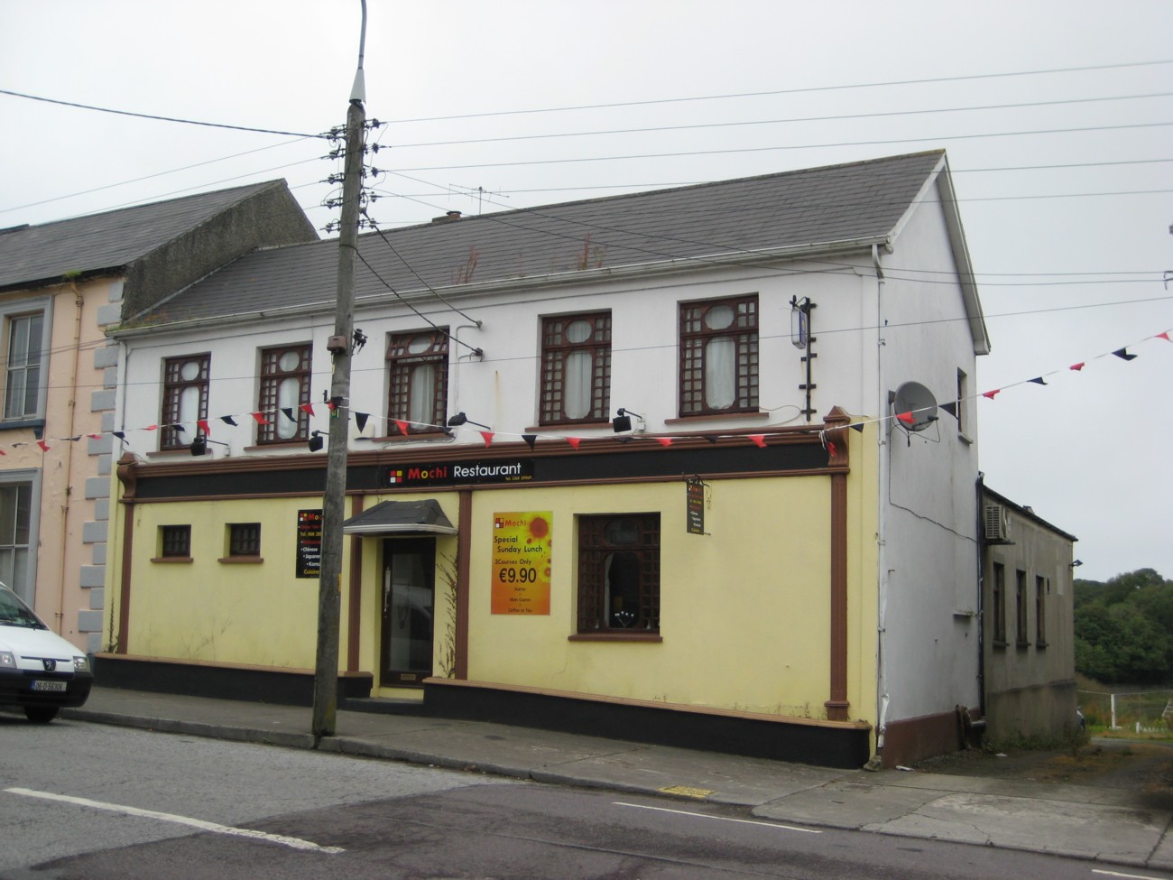
The White House
was built about 1803.
This is now Mochi Restaurant (Chinese, Japanese and Korean food).
Photo 2011. See full size.

The interior and the back of the White House.
The back (N side) goes out to an inlet off the Shannon estuary.
See larger
and full size.
Photo 2005 from Sandra Lindsay.
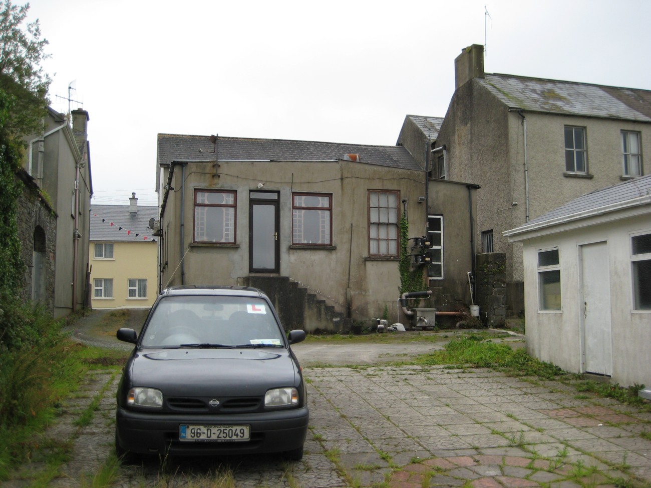
Rear of the White House.
Photo 2011. See full size.
See LHS (laneway).
See RHS
(back of other Lindsay building).
And other shot.
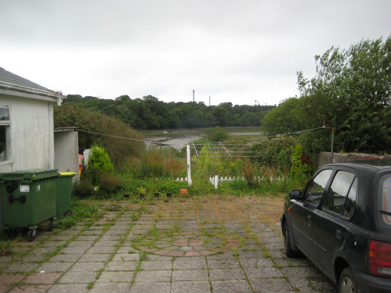
View from rear of the White House.
Photo 2011. See full size.
In the distance, across the water, is the road up to Tarbert Island.
See other shot.
Please donate to support this site.
I have spent a great deal of time and money on this research.
Research involves travel and many expenses.
Some research "things to do"
are not done for years, because I do not have the money to do them.
Please Donate Here
to support the ongoing research and
to keep this website free.