| Spelling |
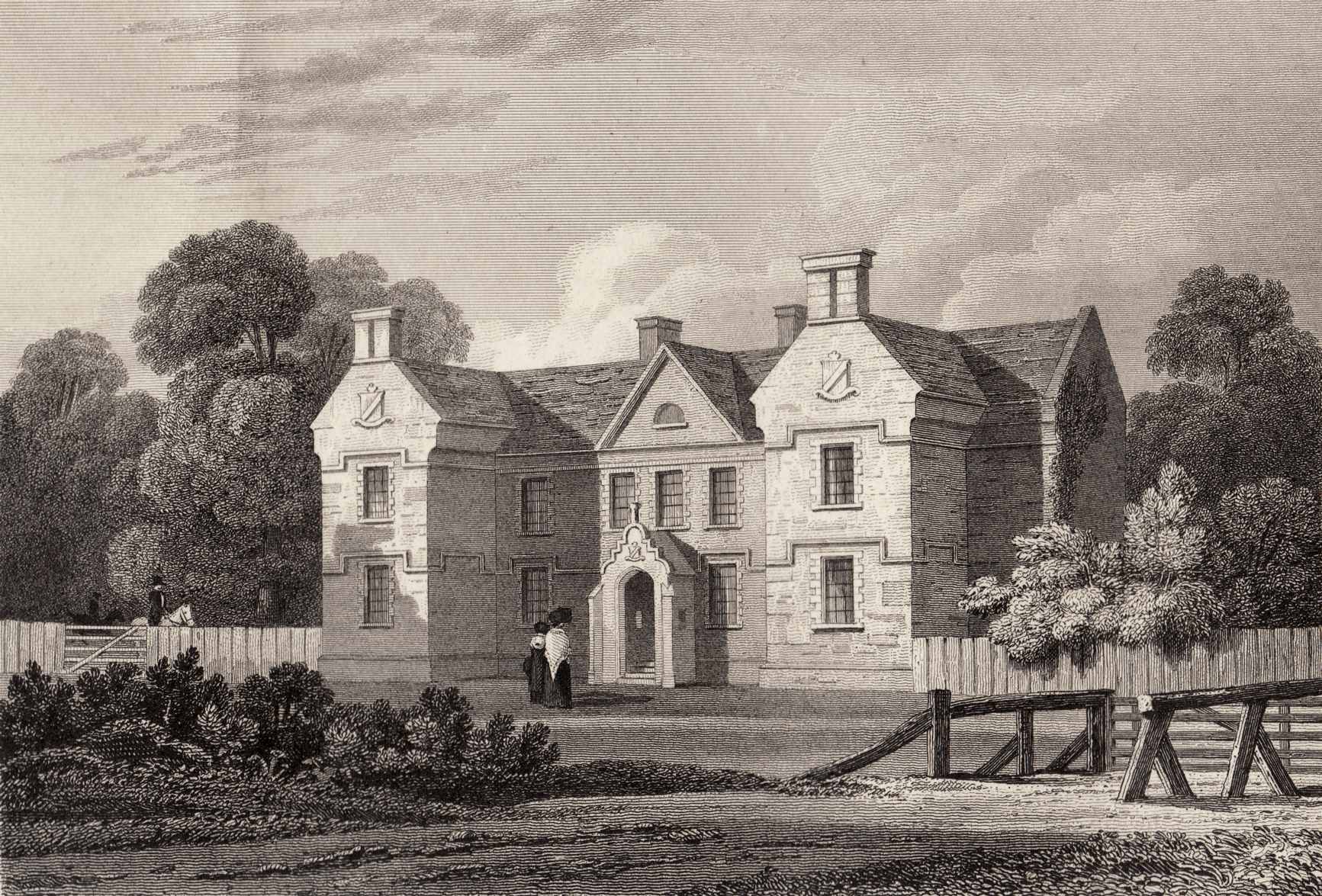
Crotto House (or Crotta House), Co.Kerry.
Crotto was
inherited 1796 by
William Carrique Ponsonby.
He
made alterations to the house 1819,
from plans drawn by
Sir Richard Morrison,
giving it a more Elizabethan look.
He died 1831.
Crotto was
inherited 1831 by
Thomas Carrique Ponsonby.
Sir John Benn-Walsh visited in 1834
and described it as "an old ruinous house nearly two hundred years old".
Thomas Carrique Ponsonby
sold it 1842.
"Samuel Julian"
is
listed
at Crotto House in
[Griffiths Valuation, 1852].
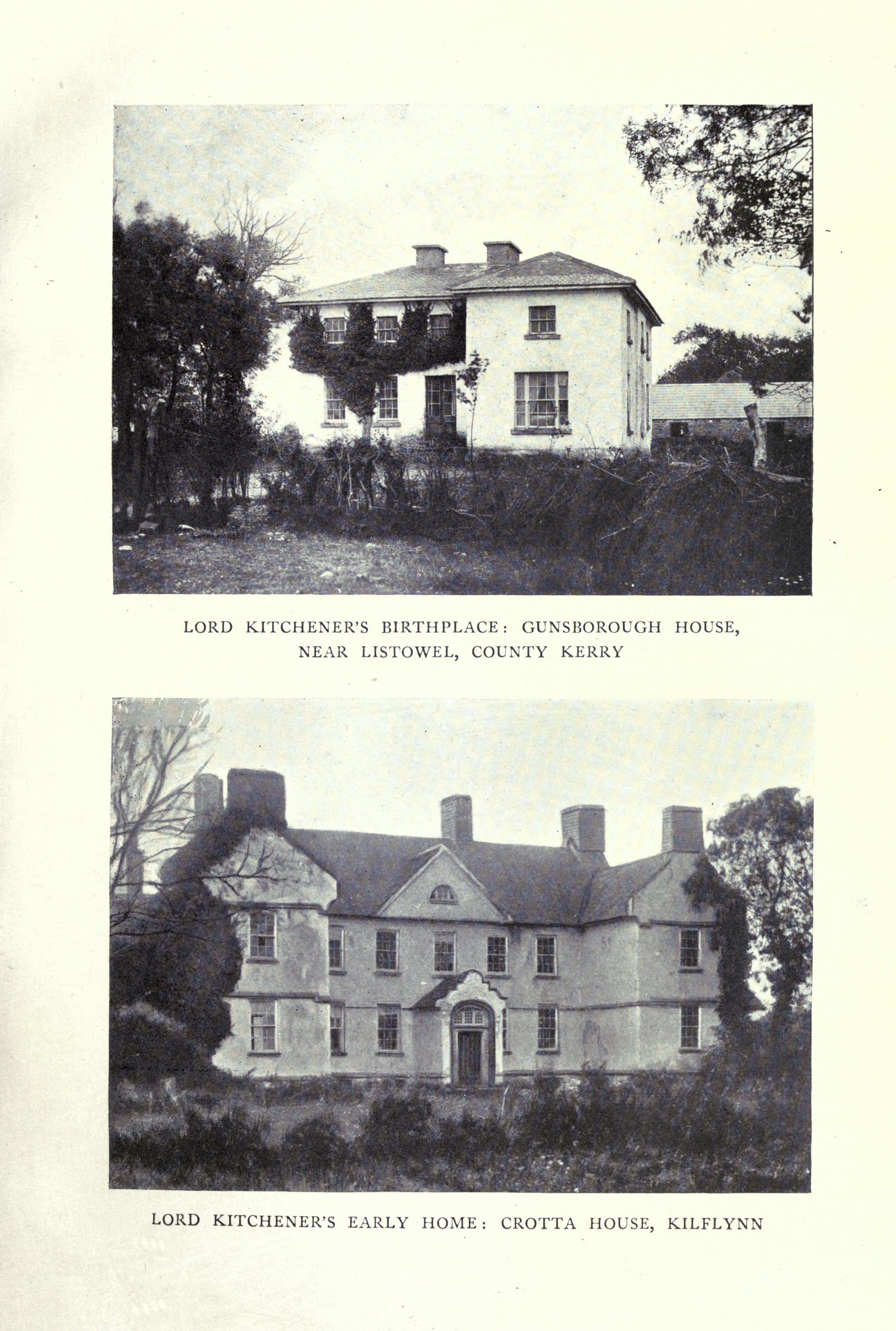
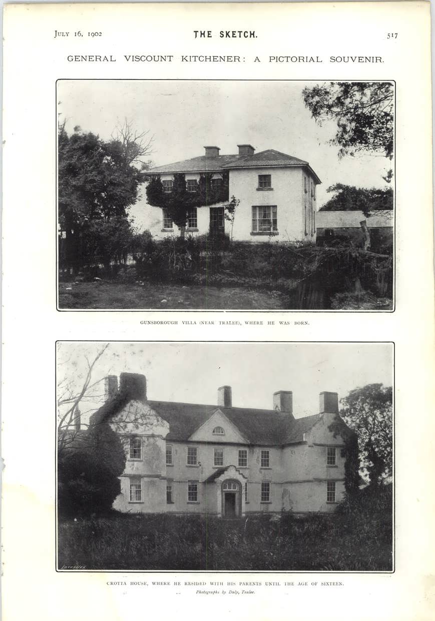
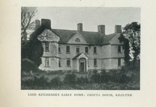
Kitchener (born 1850)
lived as a child in Crotto House (his father leased it for some years before 1863).
Sadly,
this rare 17th century house was demolished,
in stages, in the 20th century.
The house fell into decay for years before it was demolished.
See Crotta
in 1901 census.
The big house, with 32 rooms,
16 windows in front of house,
and 13 out-buildings,
is occupied by "Caretaker"
Hugh Moriarty.
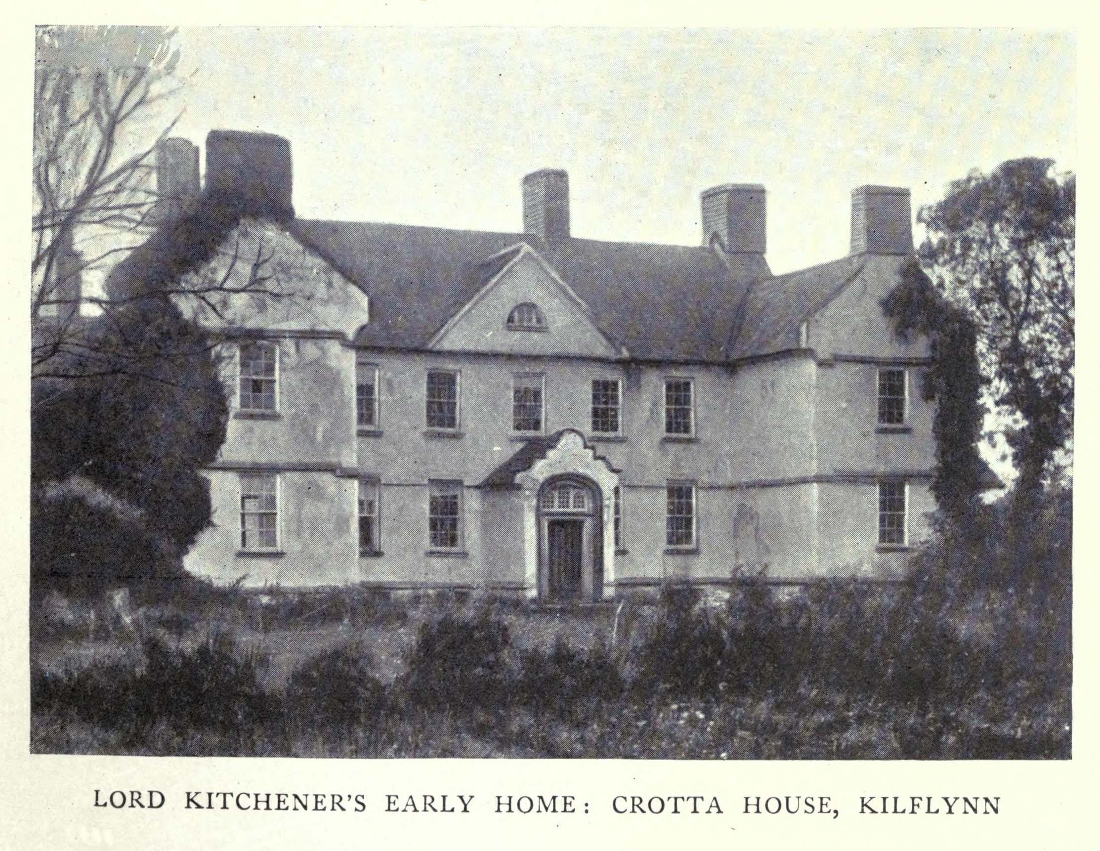
Photo of around 1902 (below)
shows the house still in normal condition.
["Horatio Kitchener at Crotta",
Kilflynn Chronicle
11th edn, Dec 2006]
thought Crotto was occupied in 1910.
See Crotta
in 1911 census.
No big house is seen in the list of buildings.
It might be vacant, hence no entry.
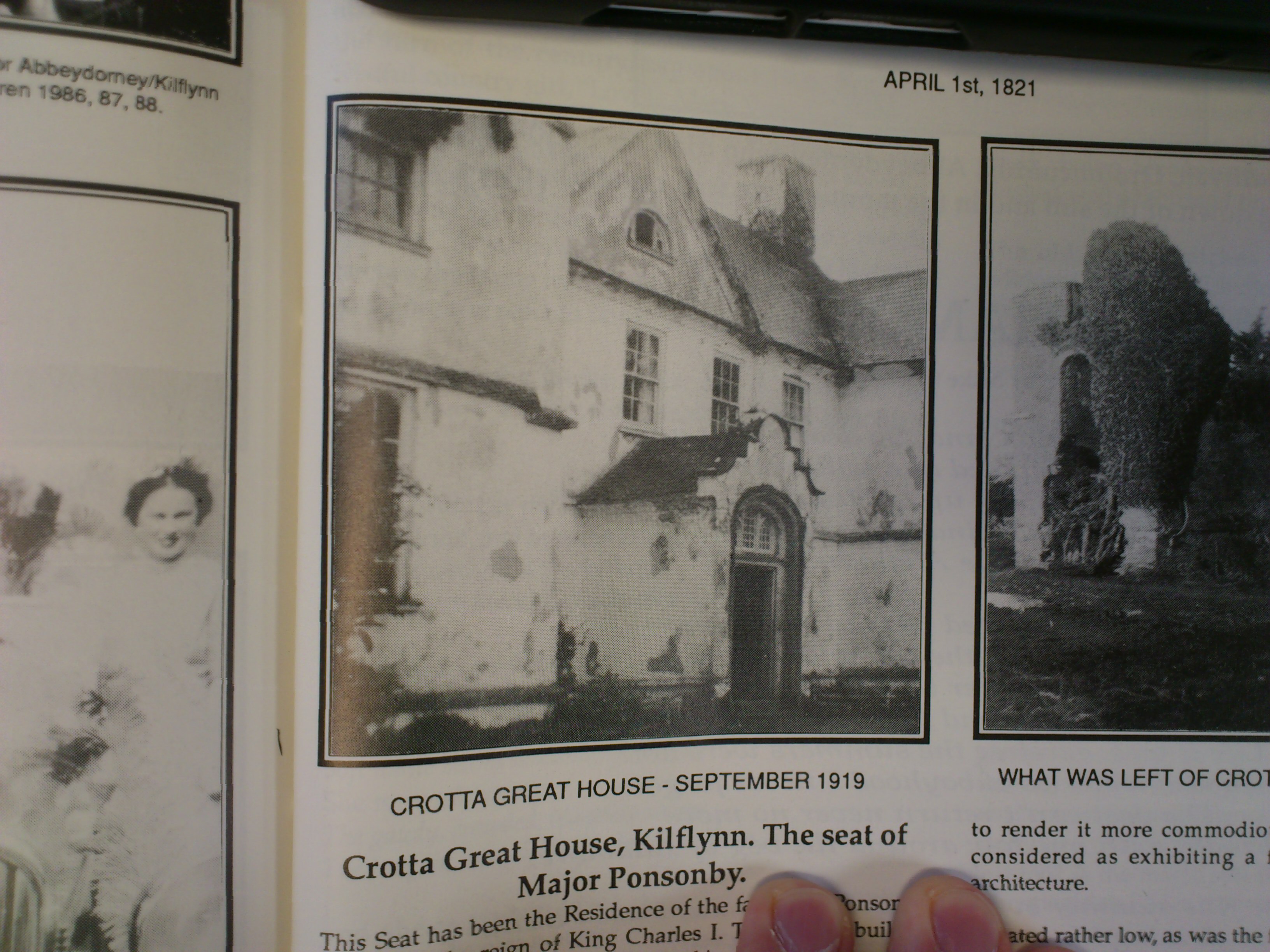
Photo of 1919 (below)
shows Crotto looking run-down, but not a ruin.
It might be vacant.
[Galvin, 2017]
says Crotto was partially burnt in 1920
during the War of Independence.
He says it was vacant and was used as a hideout for IRA men on the run,
so the
Black and Tans
partially burnt it.
Photos (below) originally said to be c.1910, but in fact must be 1920s,
show Crotto is
in a ruined state.
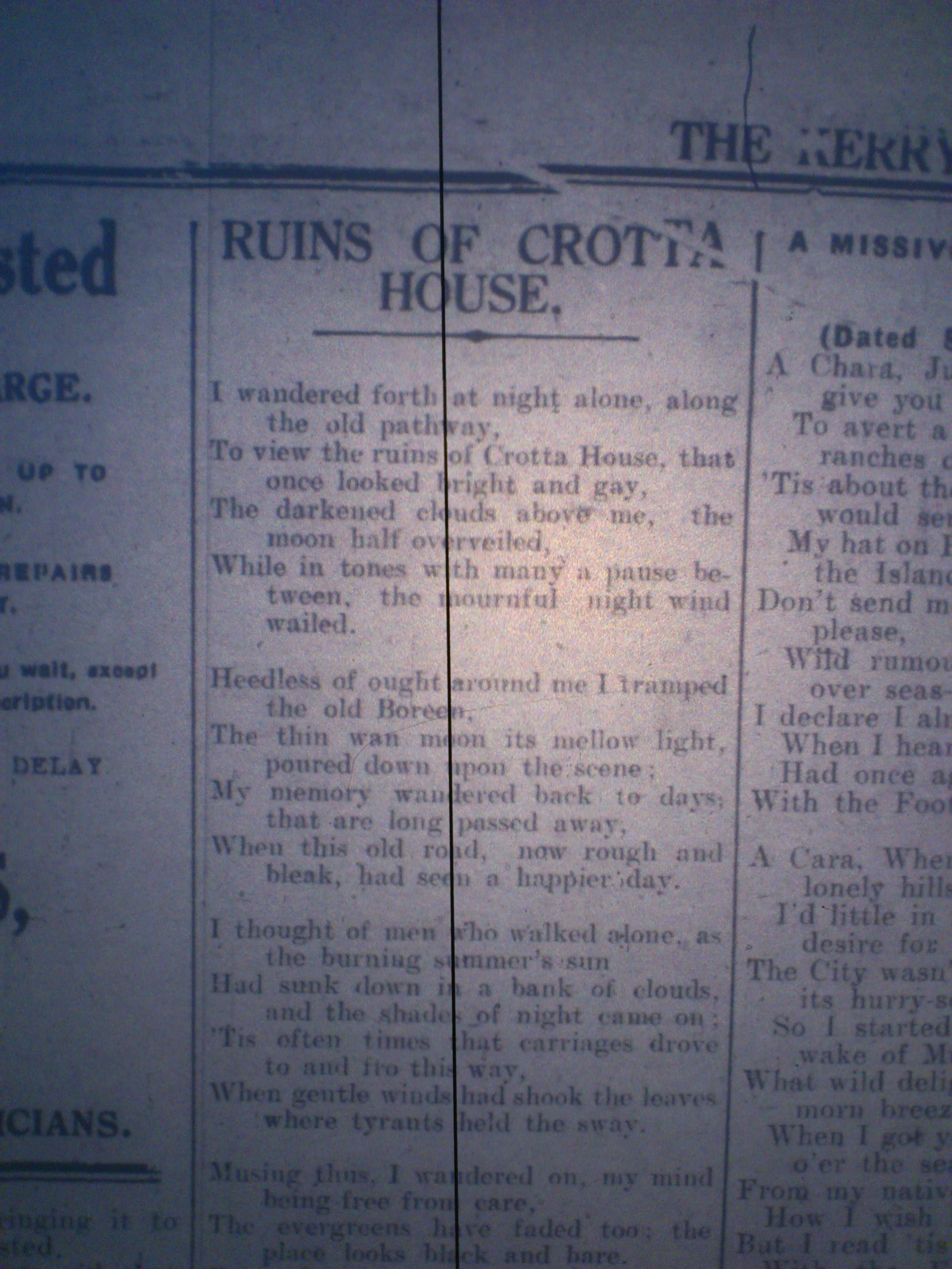
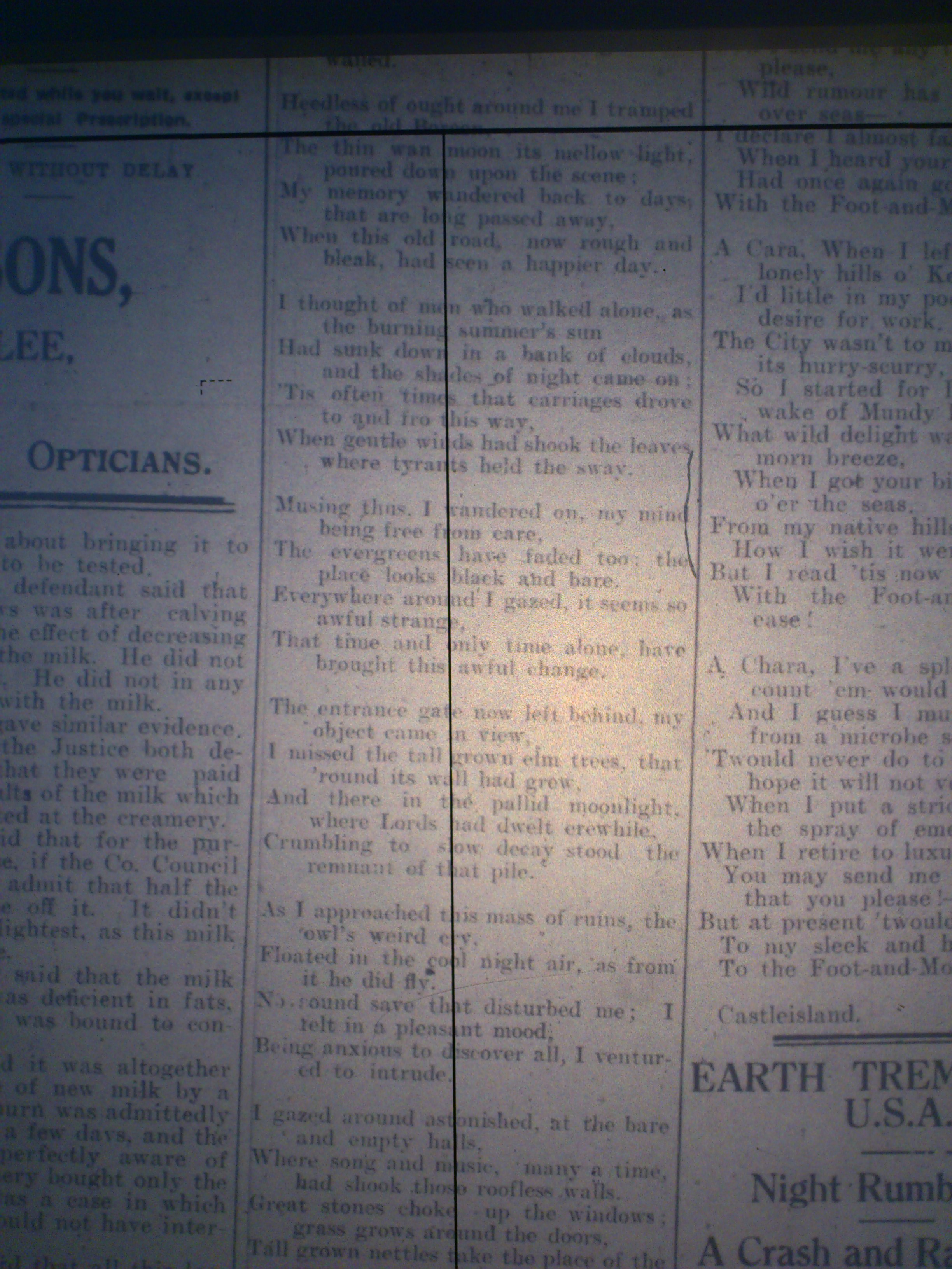
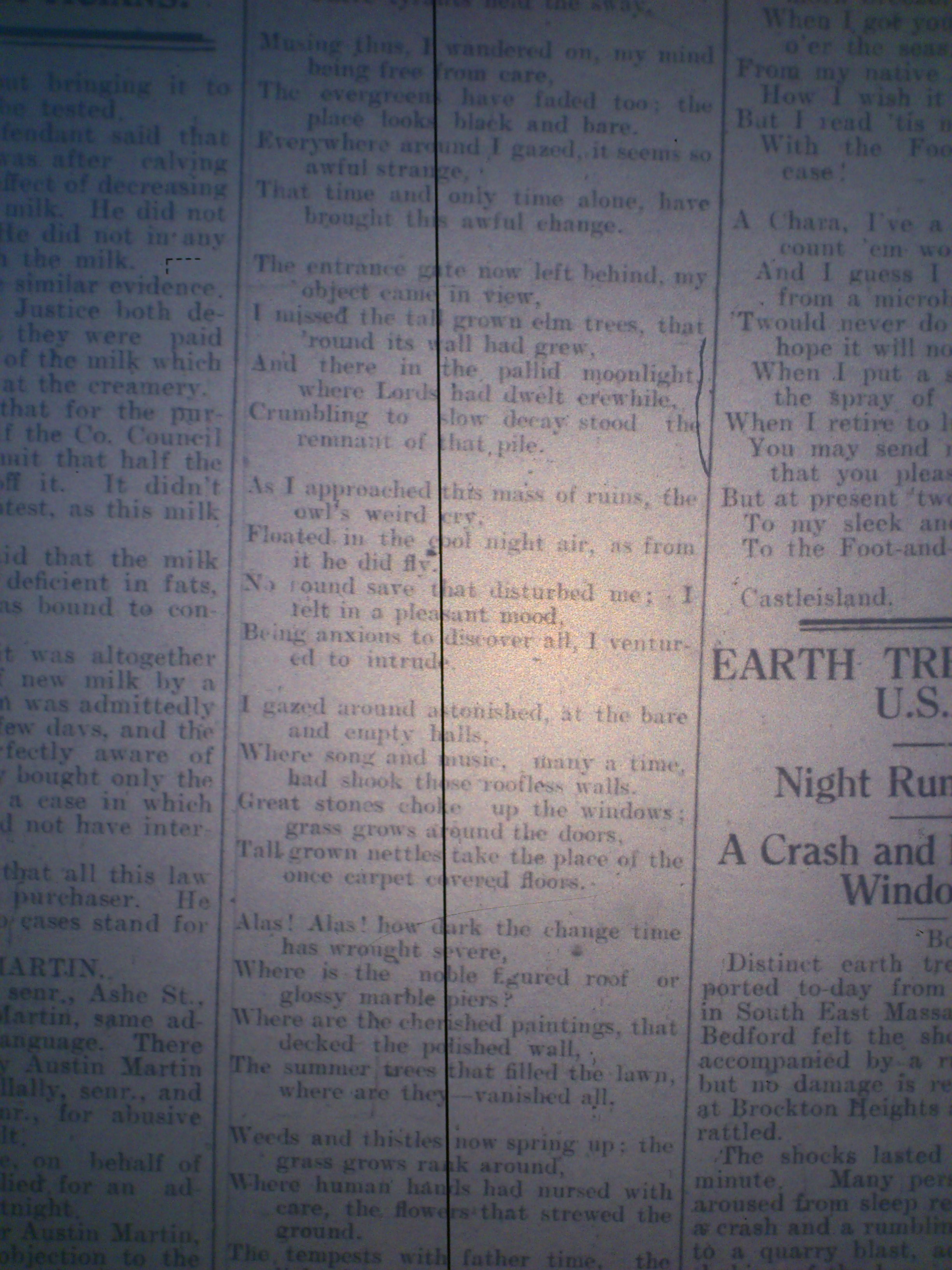
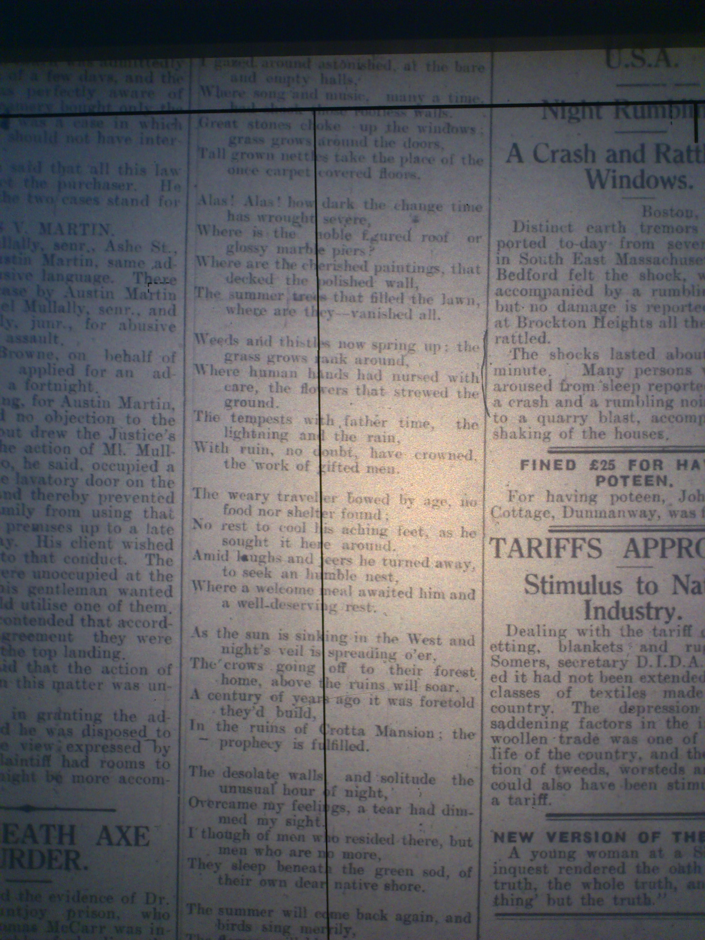
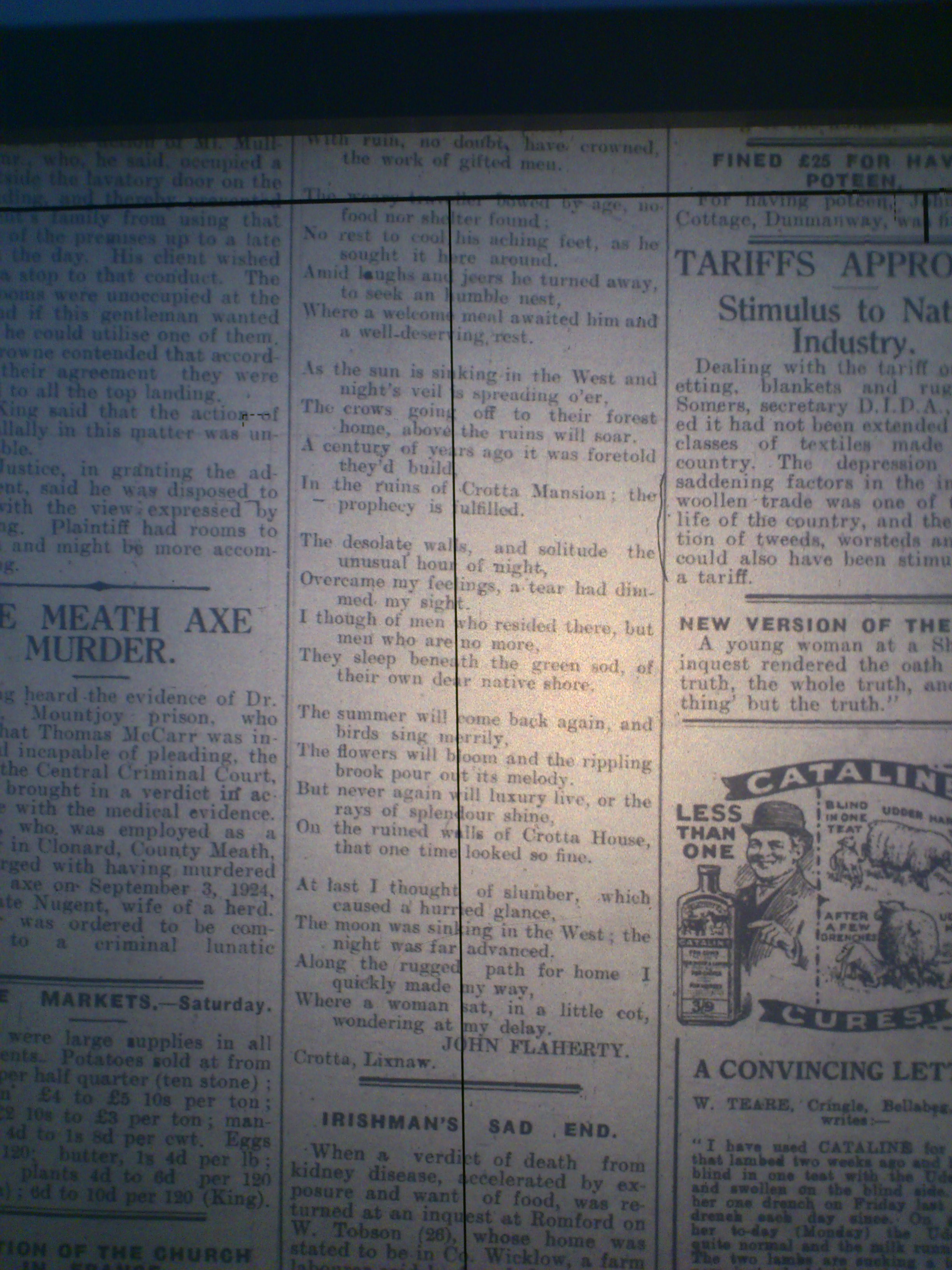
Crotto was in ruins by the time of [1925 poem].
[Gourley, 1965]
describes substantial ruins surviving as at 1965:
"From the massive ruined walls of to-day, we can judge it
to have been a stately home."
[Gaughan, 1974]
says "part of Crotta House" was then still standing.
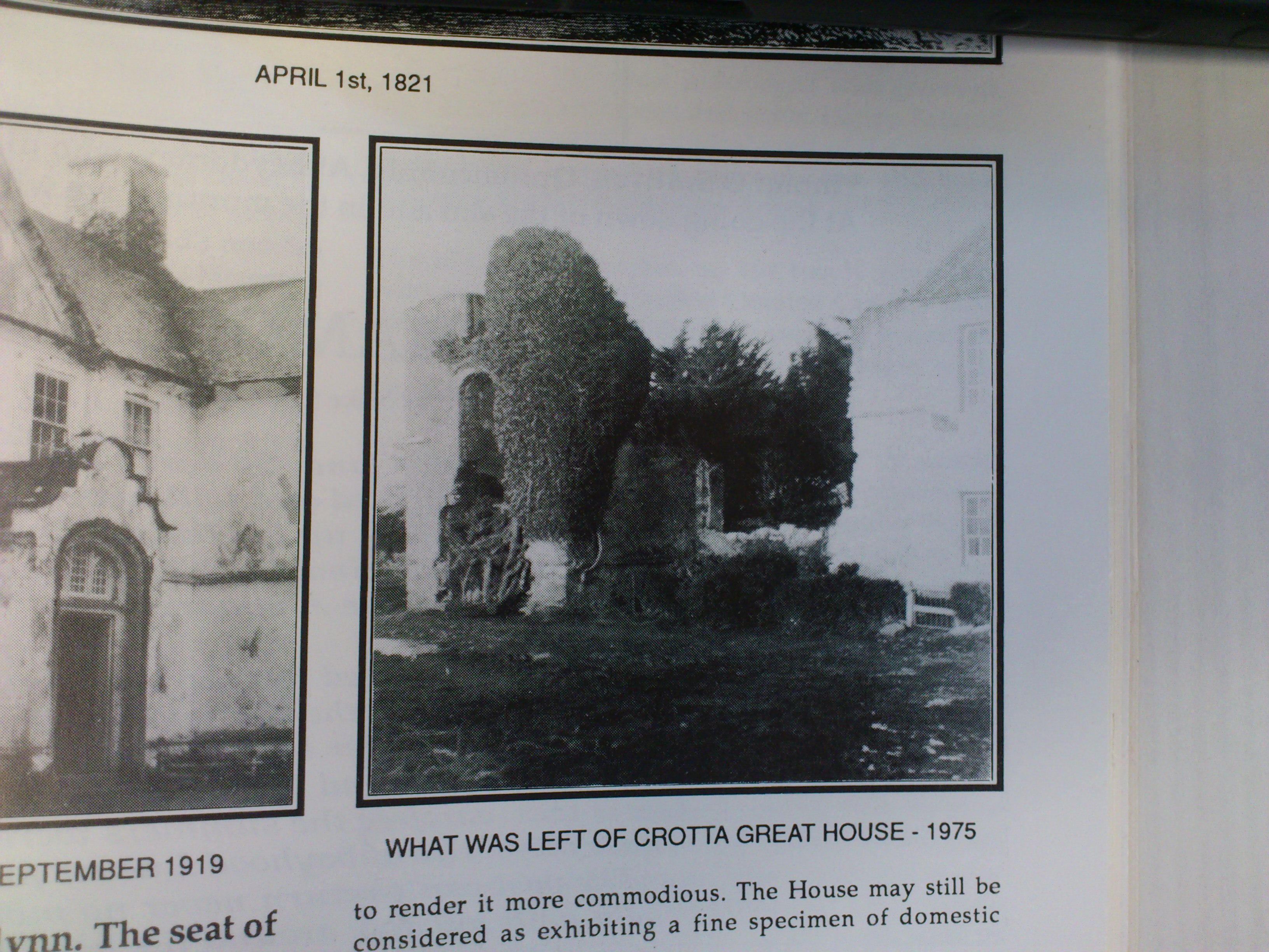
Photo of 1975 (below) shows part of the house surviving as a ruin.
It was finally demolished think late 1970s.
[Houses of Kerry, 1994]
says little then remained of Crotto
except some stone walls and part of the stableyard.
"Crotta" is the newer name.
Spelled "Crotta" in
1821 engraving and
OSI maps and
[Griffiths Valuation, 1852] and
[Grew, 1916] and
[1925 poem].
All the local people call it "Crotta" today.
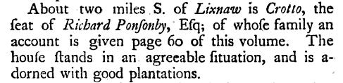
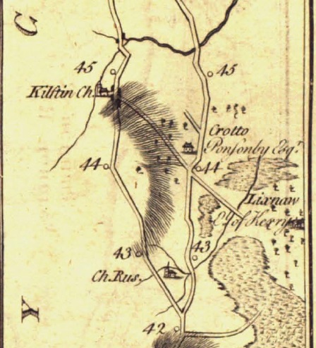
Crotto
on
p.105
of
[Taylor and Skinner, 1777].
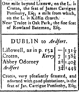
Crotto in
[The Post-chaise Companion, 1786, p.180].
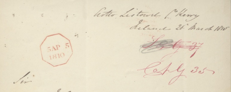
Capt. Daniel Guion
uses his wife's house Crotto as an address for correspondence in March 1810.
From
[ADM 1/1857/29].
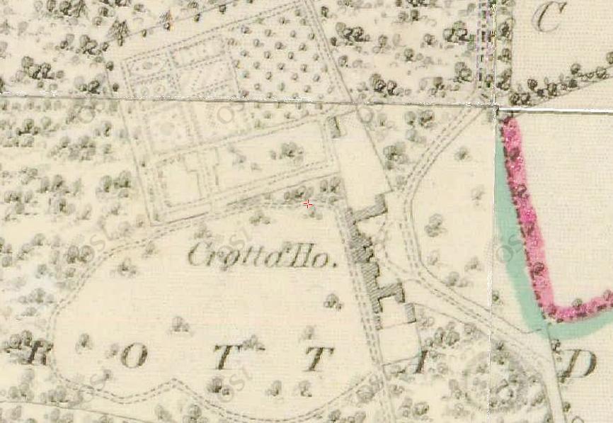
Crotto House. 1829 to 1842 period.
From OSI.
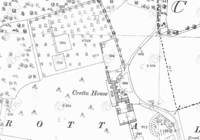
Crotto House. 1887 to 1913 period.
From OSI.
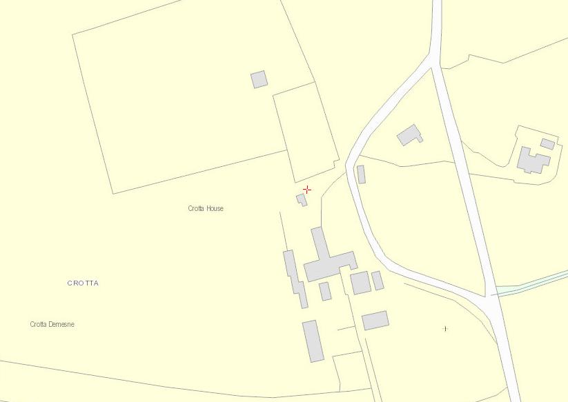
Site of Crotto House. Modern map.
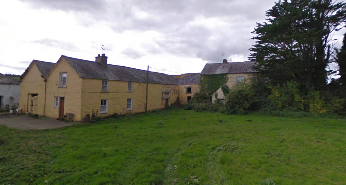
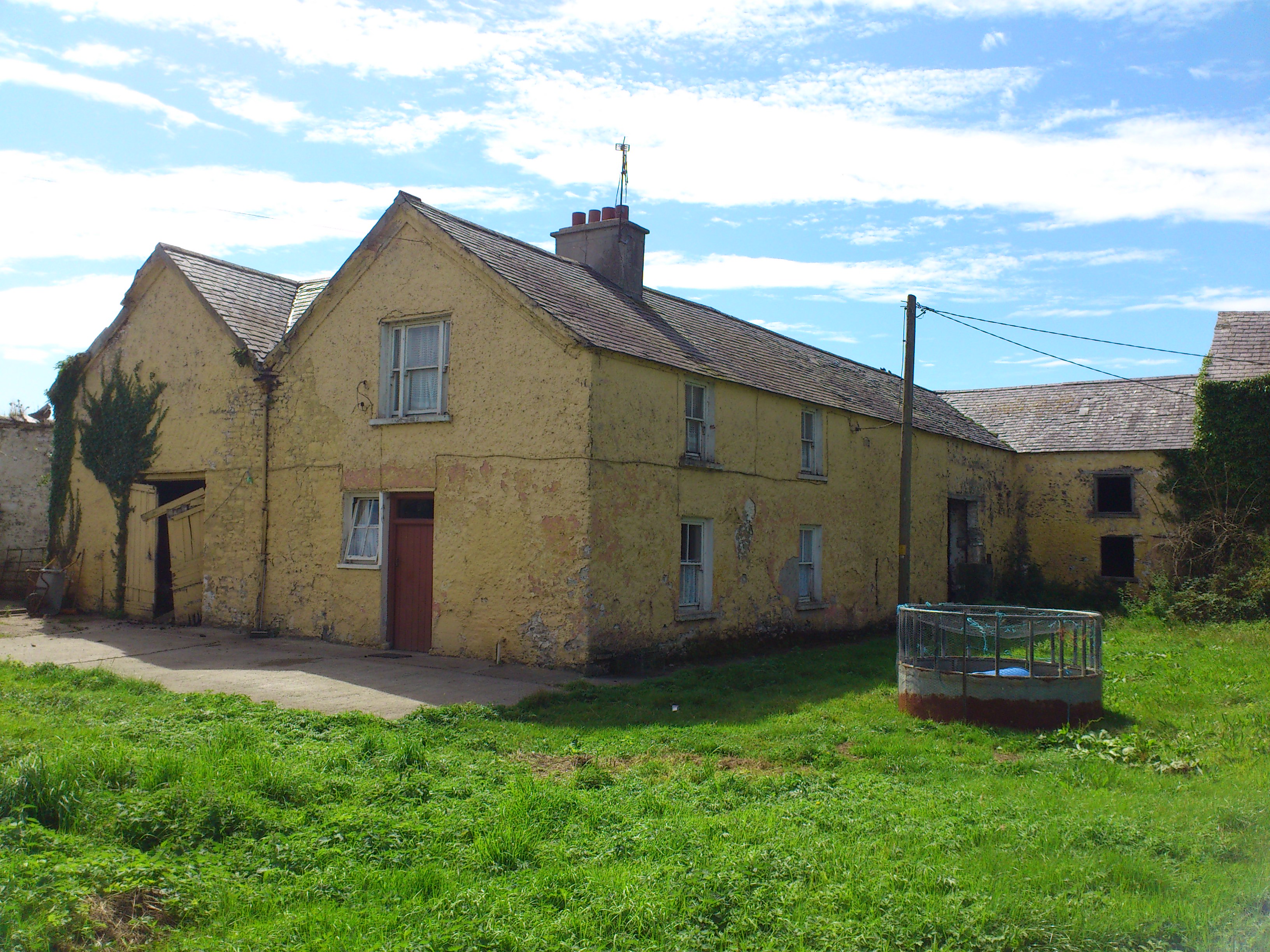
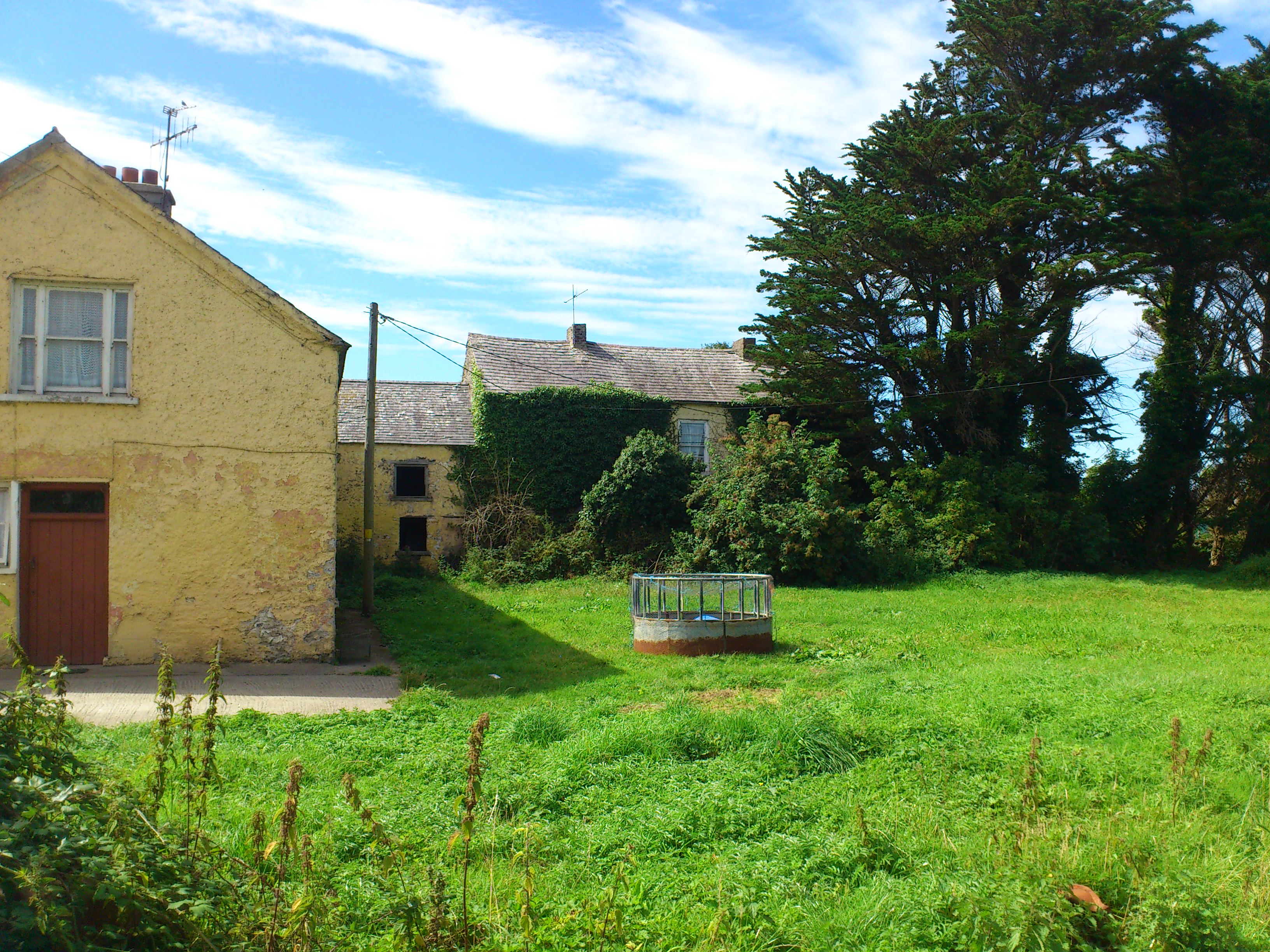
The LHS wing (that used to adjoin the main central block) survives.
From OSI.
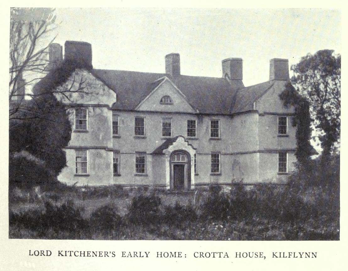
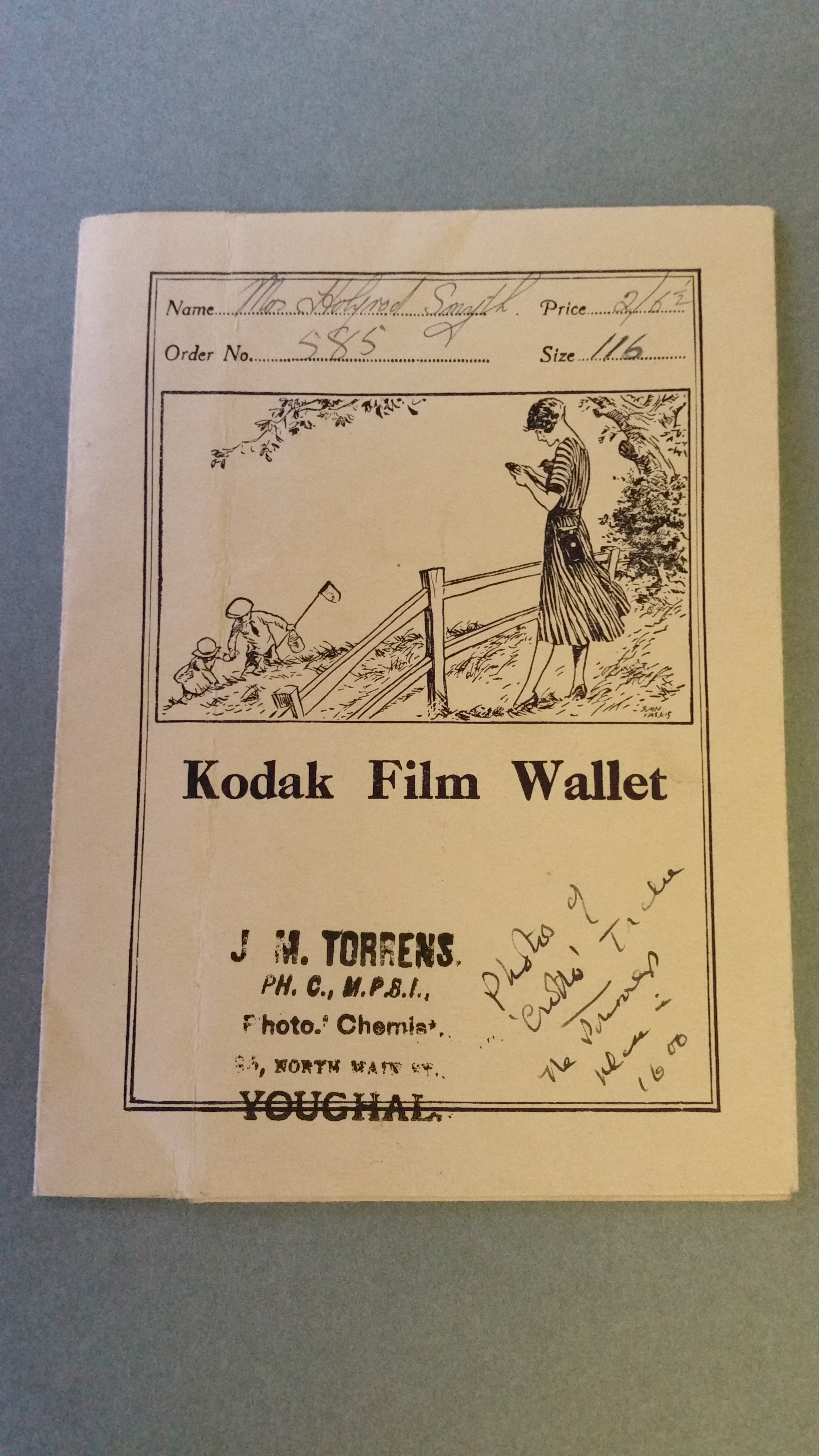
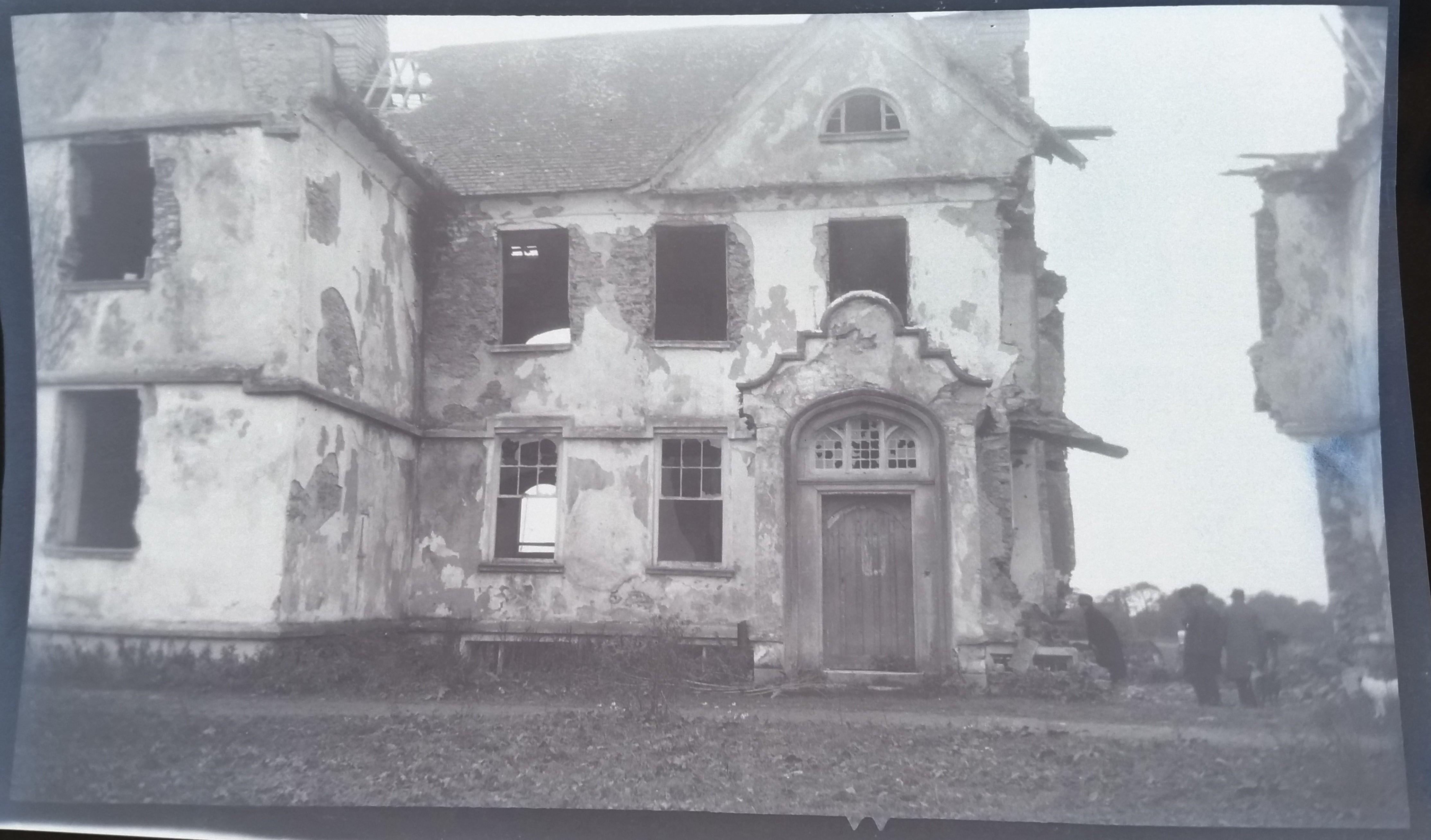
Crotto House.
Photo said to be Sept 1919.
It is clearly earlier than the Holroyd-Smyth photos below, since the N wing has not yet collapsed.
See full size.
From [O'Donovan, 1989, p.269].
Used with permission.
See scan from book.
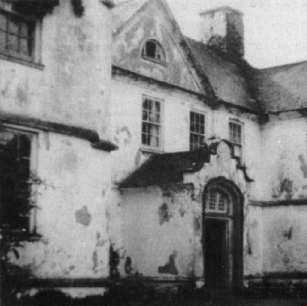
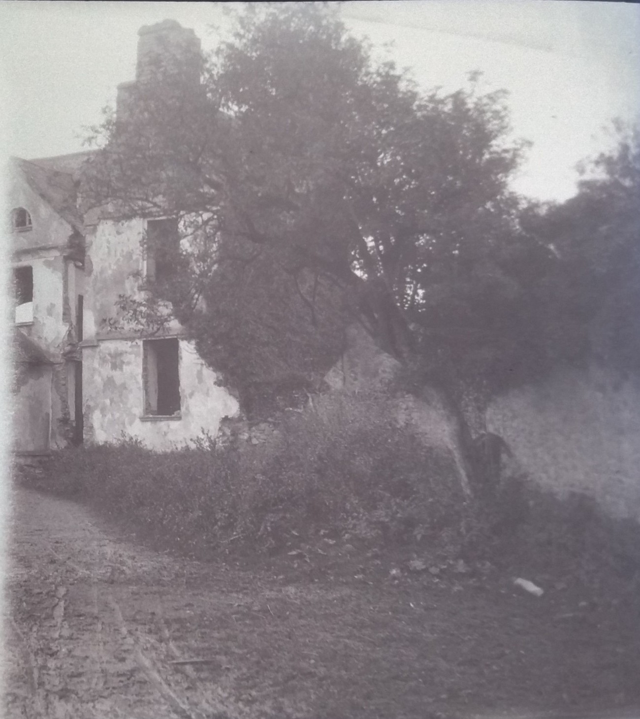
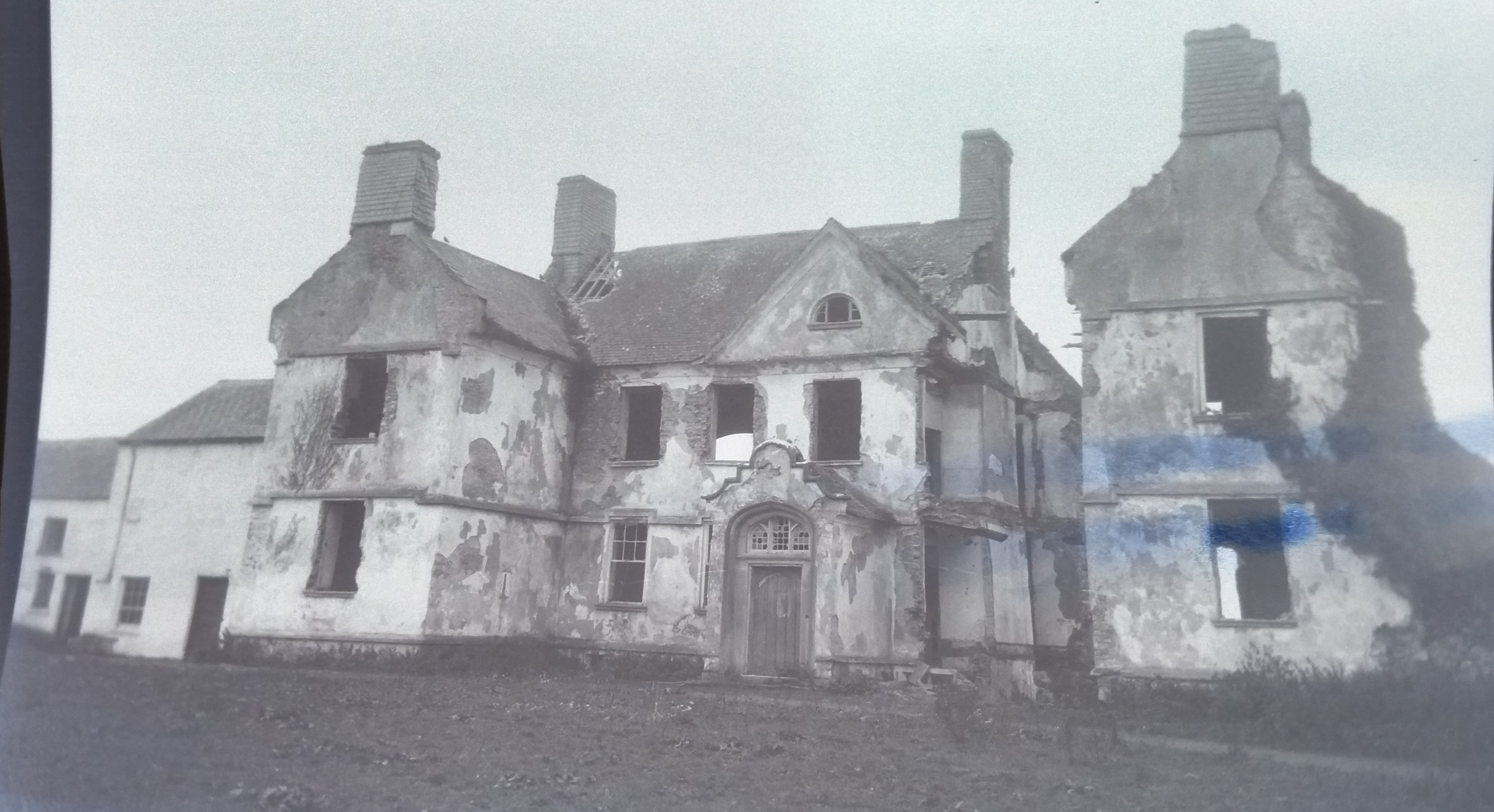
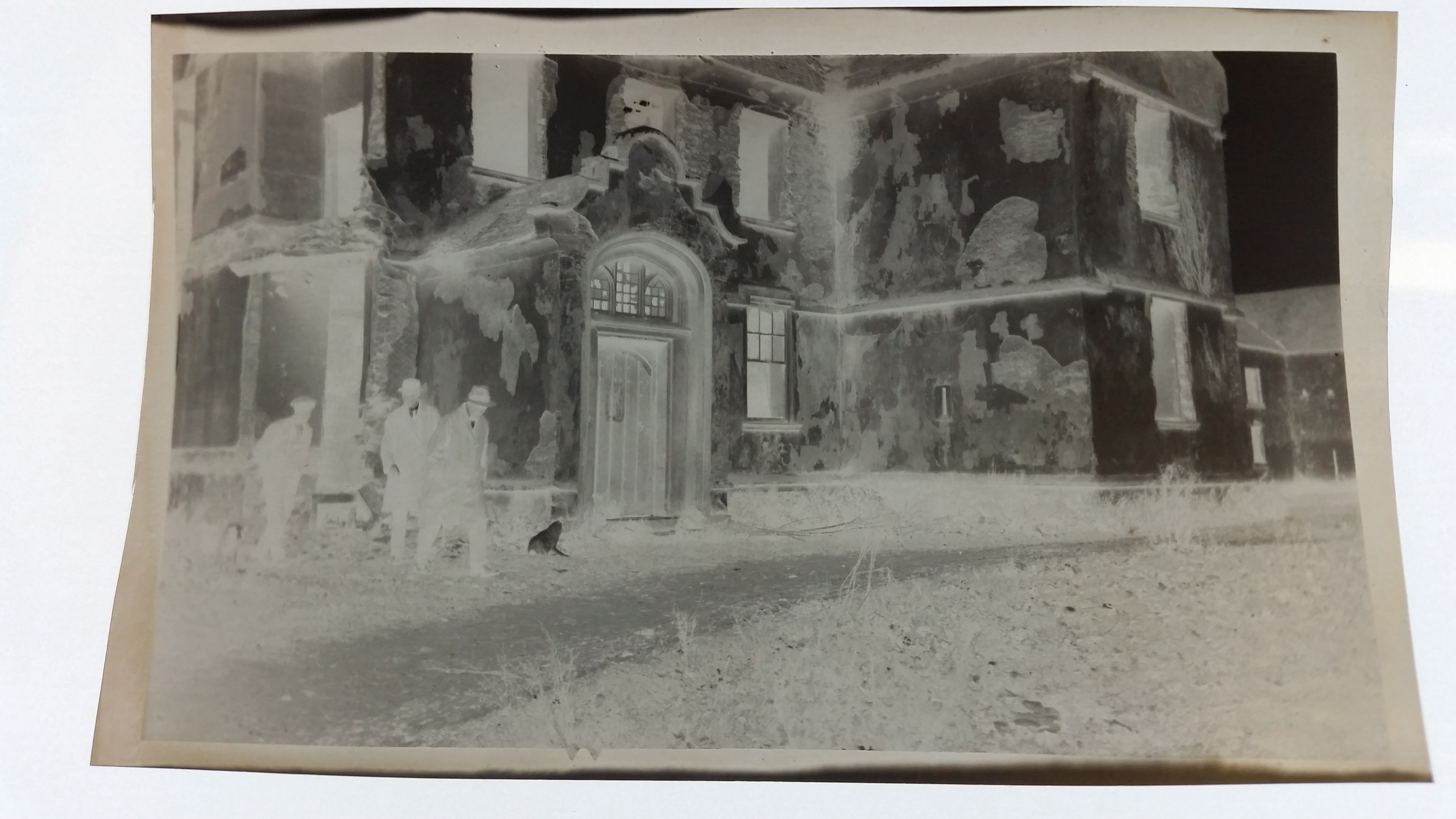
Crotto House, in a ruined state.
The N wing has partially collapsed.
From negatives in
Holroyd-Smyth Family Papers.
MS 49,518/108
in
[NLI].
Meant to be c.1910.
However, it is clearly later than the photo above.
Envelope suggests 1920s, not c.1910.
See larger
and full size.
See original.

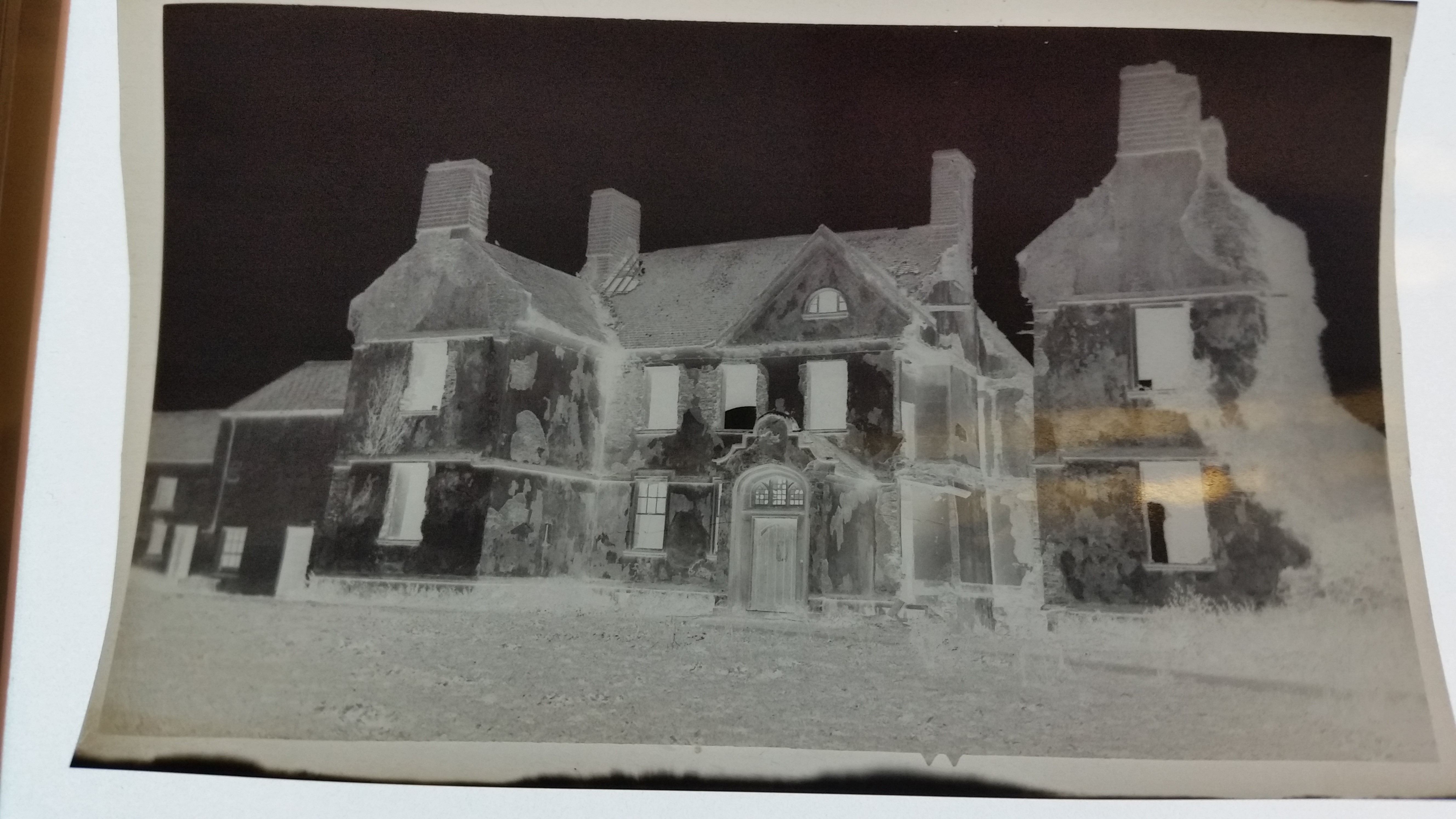
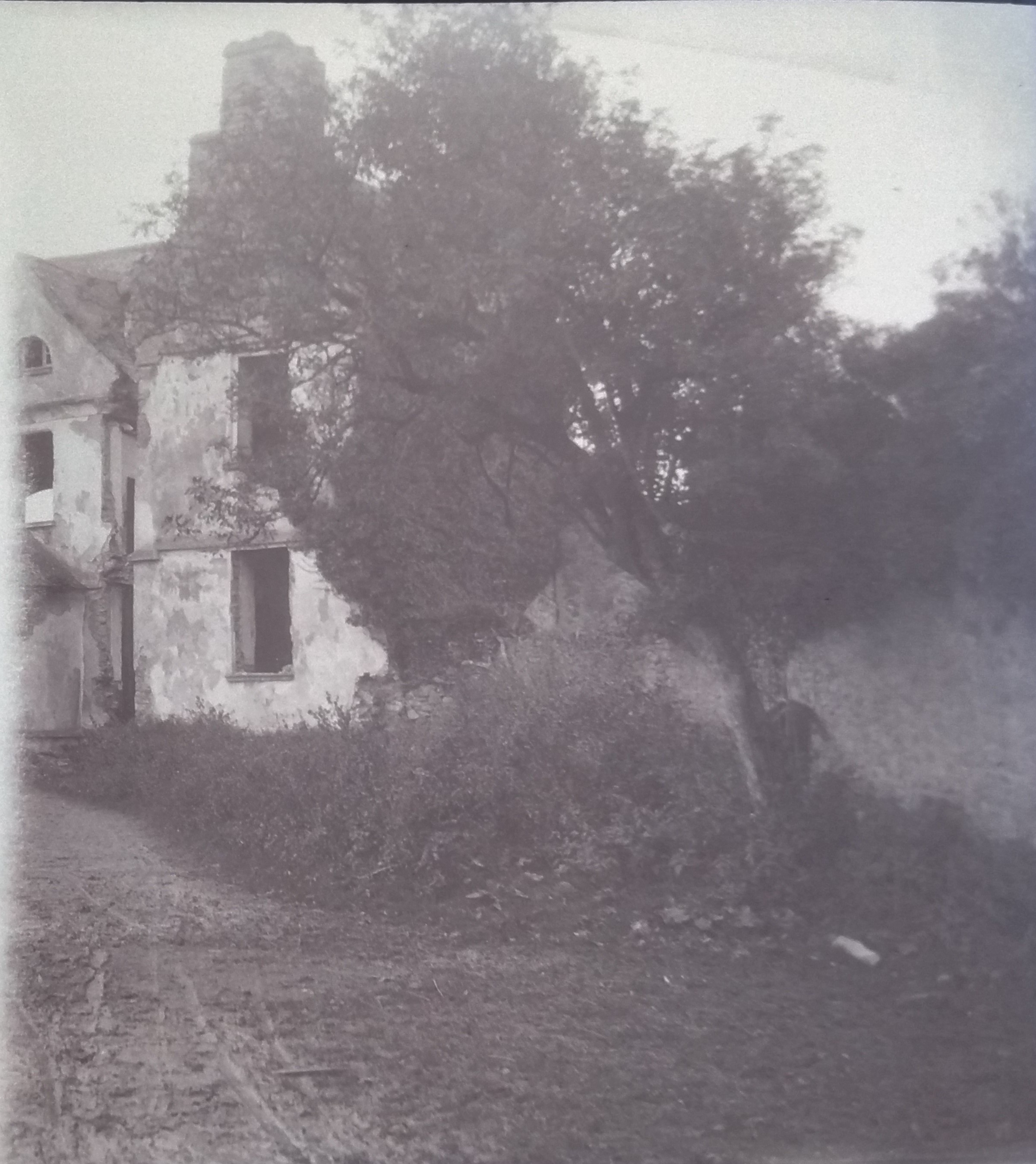
Crotto House.
From Holroyd-Smyth Family Papers.
The roof lines of the outbuildings at the S end are not the same as today.
But this must be the same view.
There were no outbuildings like this at the N end.
See larger
and full size.
See original.

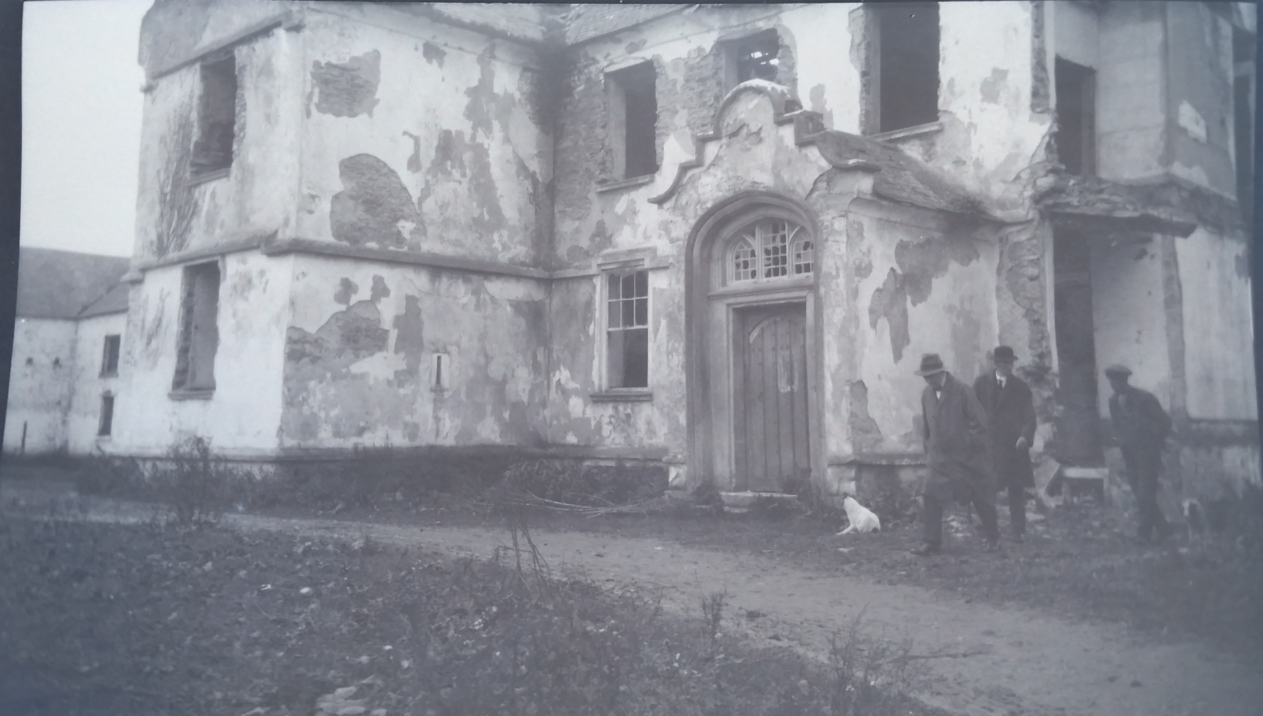
Crotto House.
From Holroyd-Smyth Family Papers.
See larger
and full size.
See original.
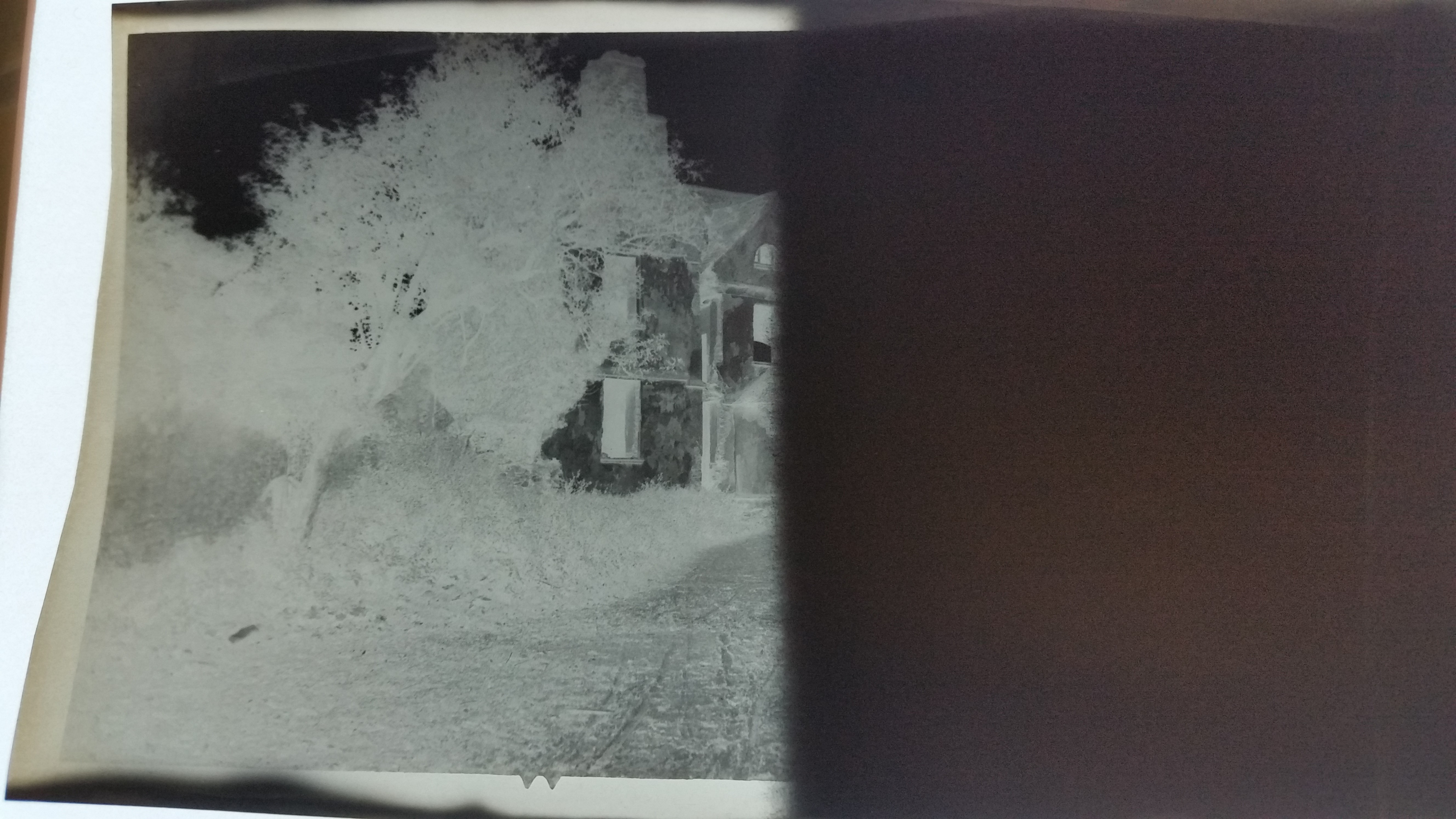
Crotto House. The N end.
From Holroyd-Smyth Family Papers.
See larger
and full size.
See original.

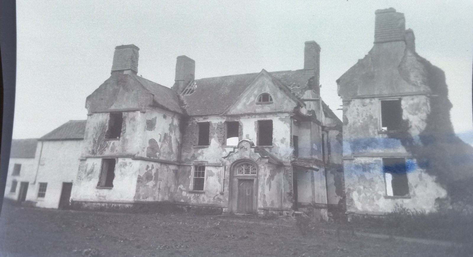
Ruin of Crotto House, 1975.
See full size.
From [O'Donovan, 1989, p.269].
Used with permission.
See scan from book.

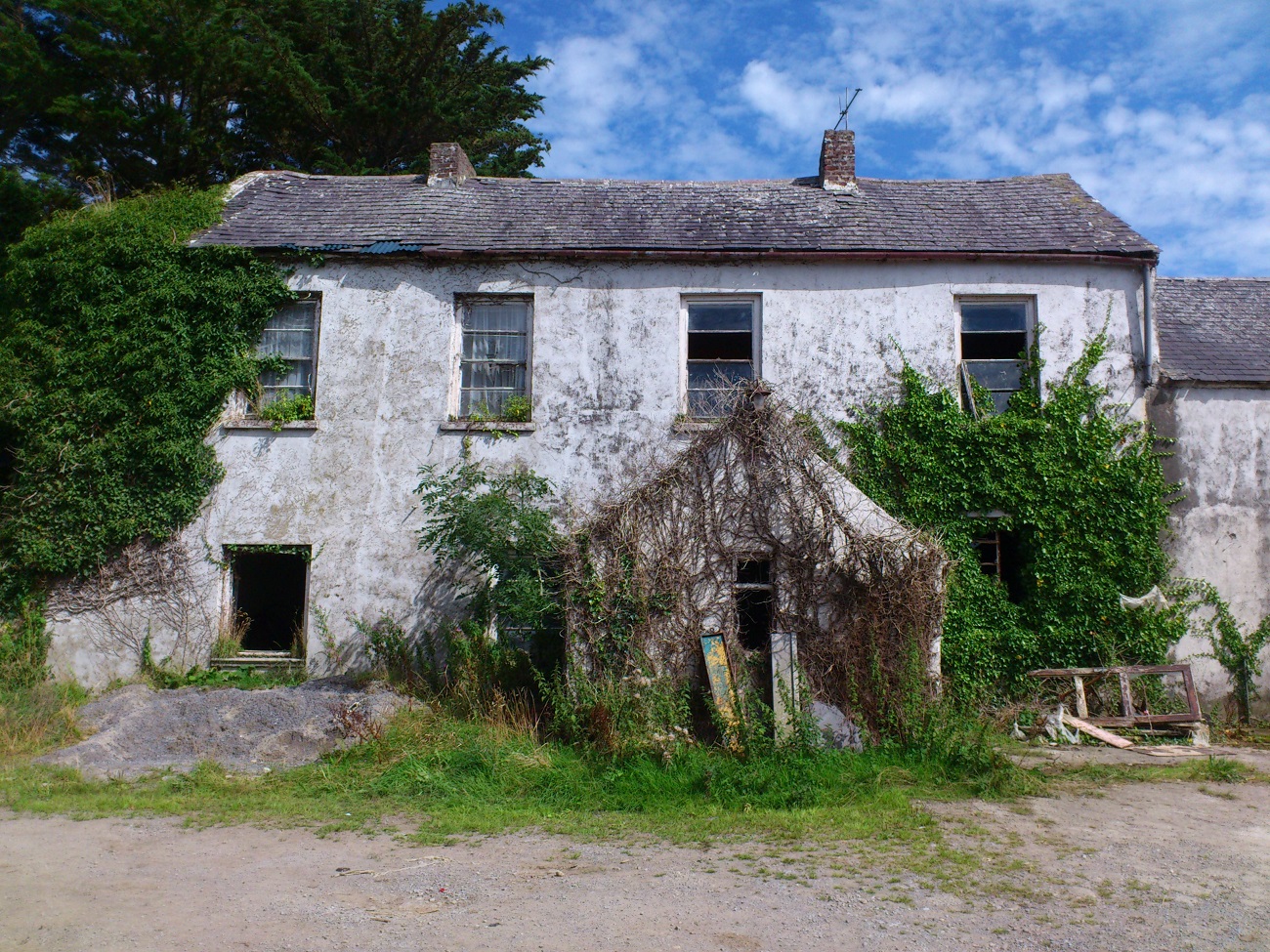
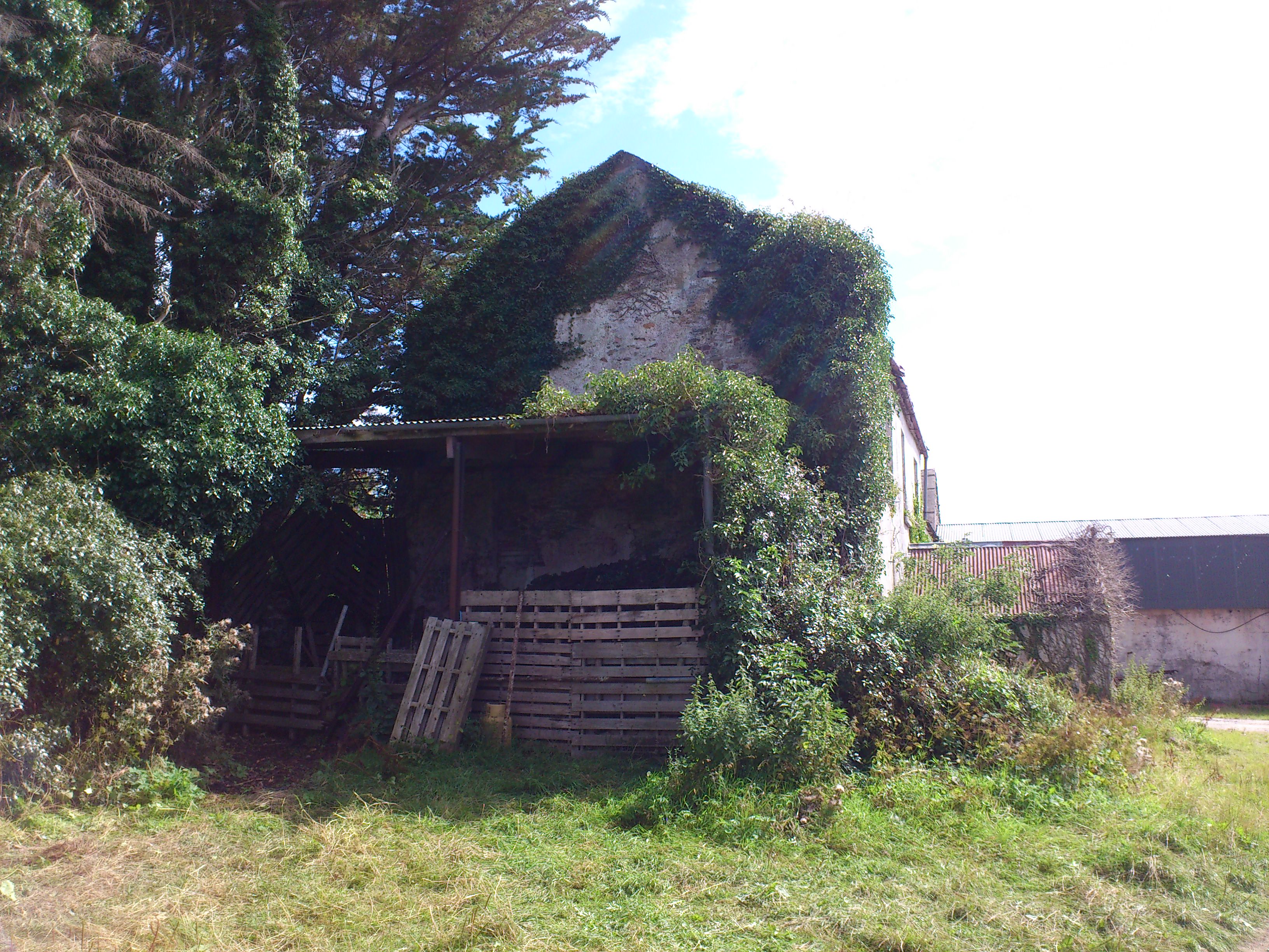
The surviving building at Crotto (the LHS wing or S wing).
This is apparently the old stables.
Photo 2013.
See larger
and full size.
See LHS shot
and RHS shot.

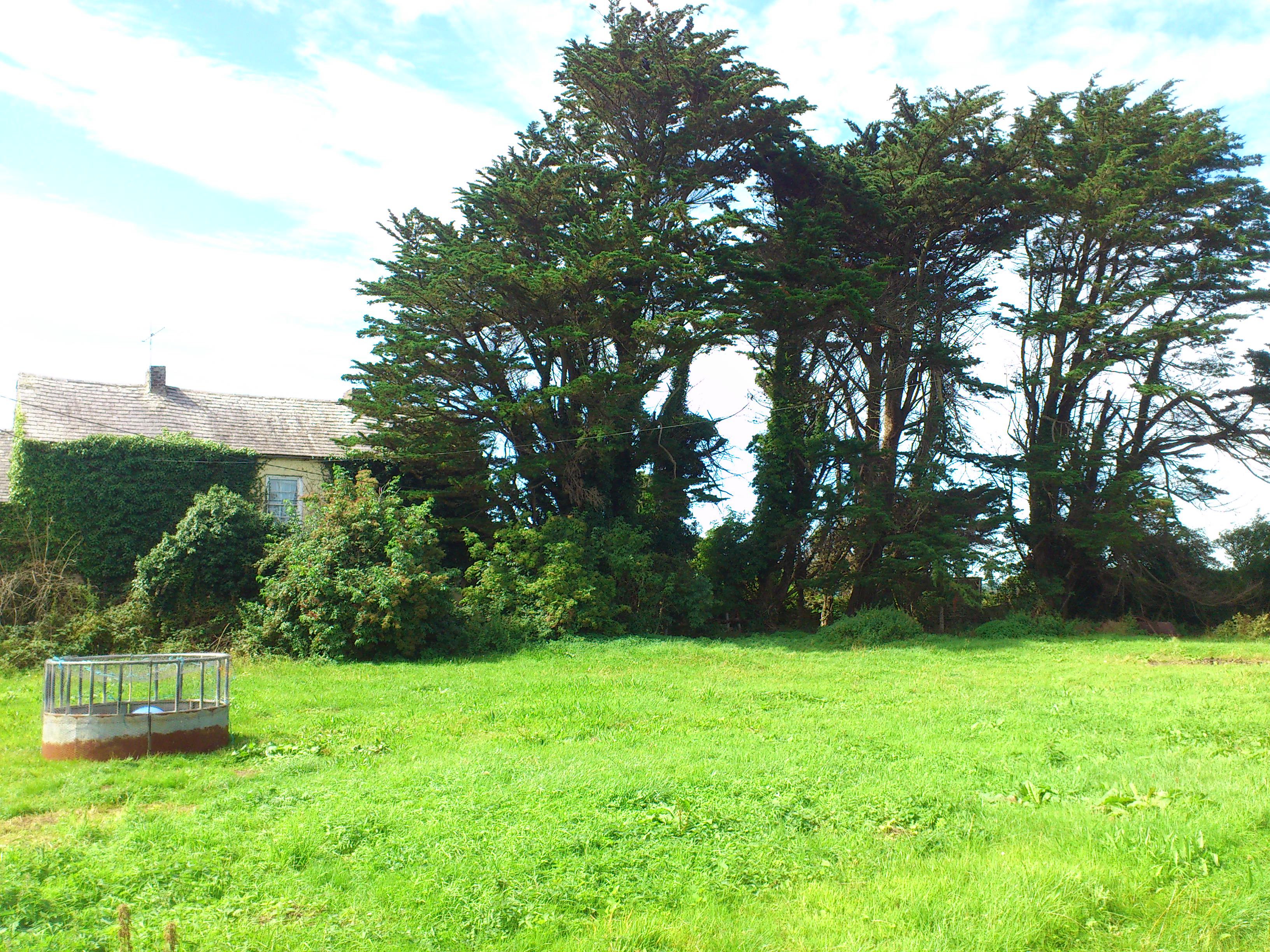
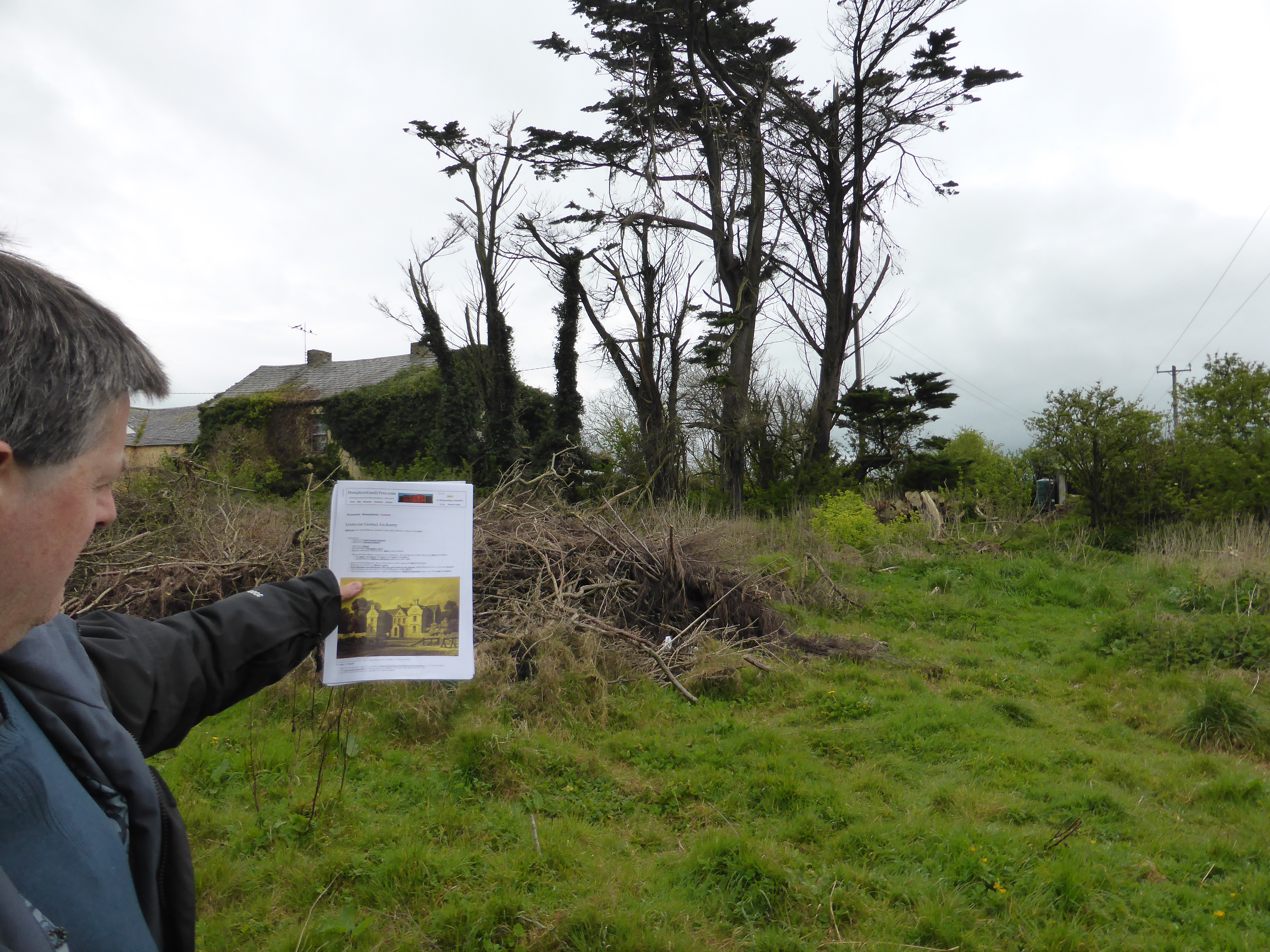
Crotto House stood where these trees are, to the RHS of the surviving building.
Photo 2013.
See larger
and full size.
See other shot.
See
2016 shot
of me showing where the house stood.
Building at back (W side) of Crotto House site.
Photo 2013.
See larger
and full size.
See LHS shot
and RHS shot.

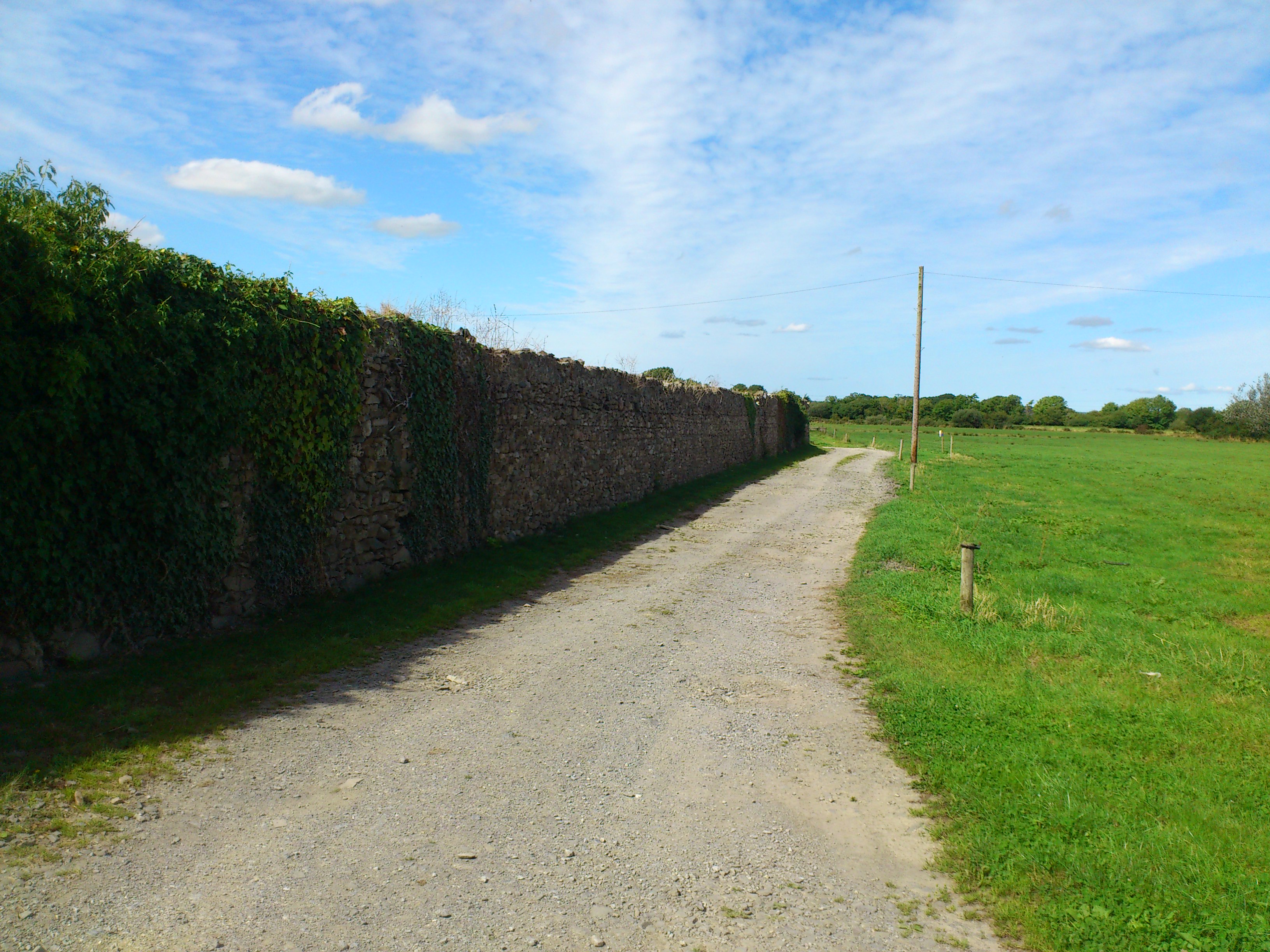
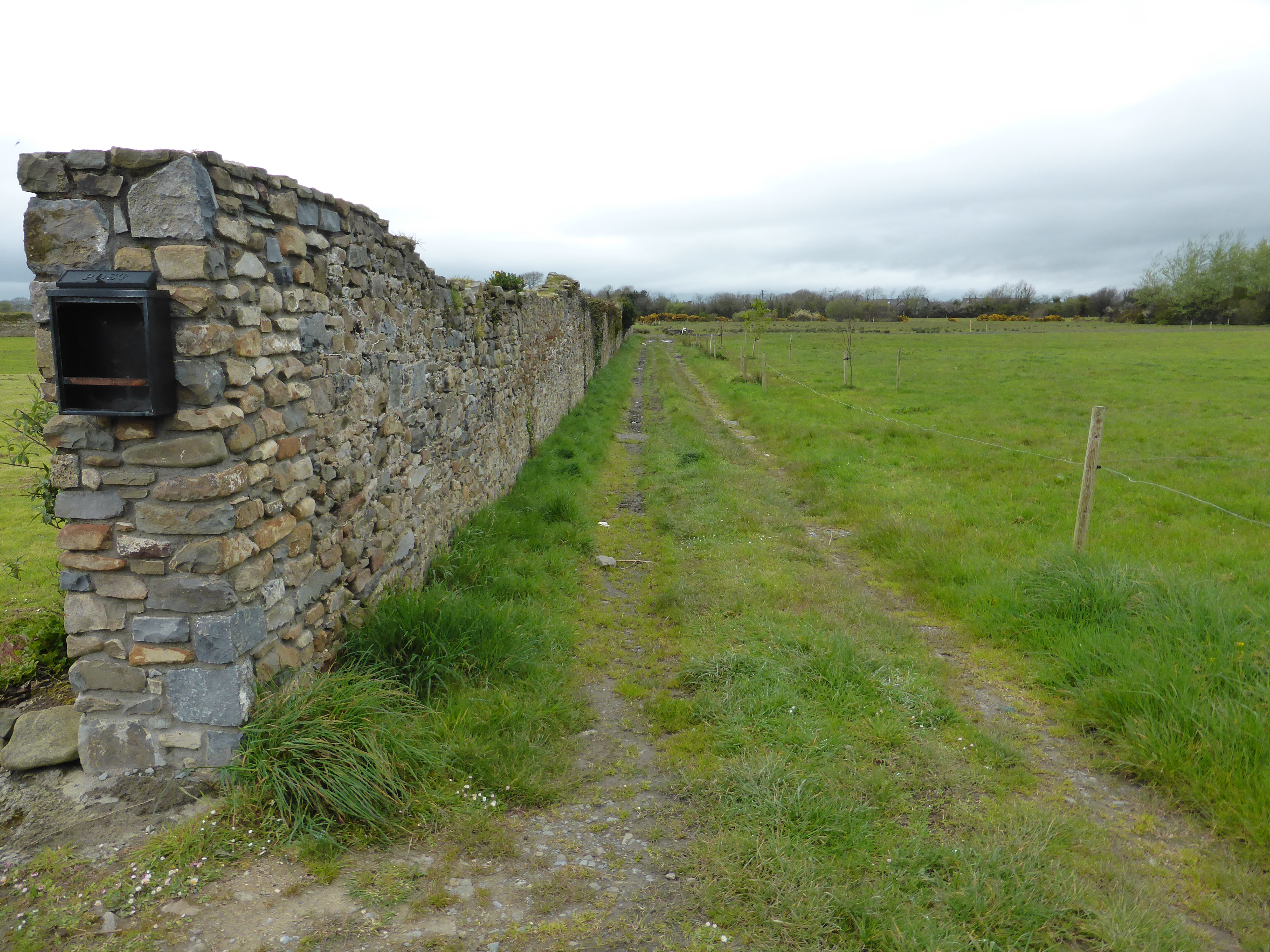
The old orchard wall surviving to the N of the Crotto House site.
Photo 2013.
See larger
and full size.
See other shot.
See
2016 shot.
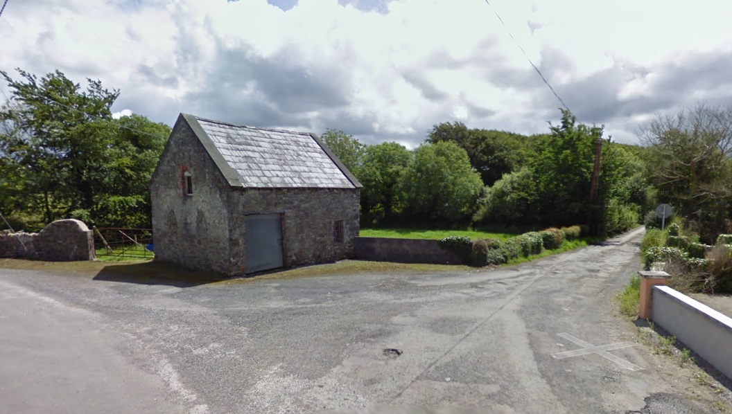
The surviving gate lodge at the N entrance to Crotto.
2011 image from
street view.
The gate lodge is mid 19th century.
See
entry
in
NIAH.
See
1887 to 1913 map.
Please donate to support this site.
I have spent a great deal of time and money on this research.
Research involves travel and many expenses.
Some research "things to do"
are not done for years, because I do not have the money to do them.
Please Donate Here
to support the ongoing research and
to keep this website free.
