Tarbert was an important strategic location in the late 18th to early 19th centuries
for both defence (protecting the Shannon against foreign naval invasion)
and revenue and customs.
In the late 18th to early 19th centuries
there was a regular threat of French invasion.
The French attempted to invade Ireland in
1796.
They landed forces in
1798.
French plans to invade Britain and Ireland
intensified
under Napoleon in 1803-05.
The Shannon was high on the list for possible invasion places in French planning.
Many
British and Irish defences against invasion
were built.
The military battery at Tarbert Island was built 1790s, replacing earlier works.
Land and naval forces from different parts of Ireland were stationed there.
Joseph Lindsay
worked in the customs service at Tarbert
from 1785 to his death 1805.
Richard Ponsonby
was
head of customs at Tarbert ("Surveyor of Tarbert") 1803 to 1811.
He lived on Tarbert Island.
Joseph Lindsay worked
under Ponsonby in 1803-05.
Joseph's son
William Lindsay
worked in the customs service at Tarbert
under Ponsonby, 1805 to 1811.
Capt. Daniel Guion
was Captain in the Irish Sea Fencibles (naval militia) 1806-10,
headquarters at Tarbert.
He married Richard Ponsonby's niece.
Richard Ponsonby died 1811.
[Joseph Lindsay, 1897]
says that a house came with his job, and when he died
his widow
Letitia Blennerhassett
had to leave.
She "was obliged to give up the government house and went to Limerick to live".
Letitia Blennerhassett married 2ndly in 1811 to William Lindsay.
William Lindsay's brother George Lindsay was a coast guard officer at Tarbert.

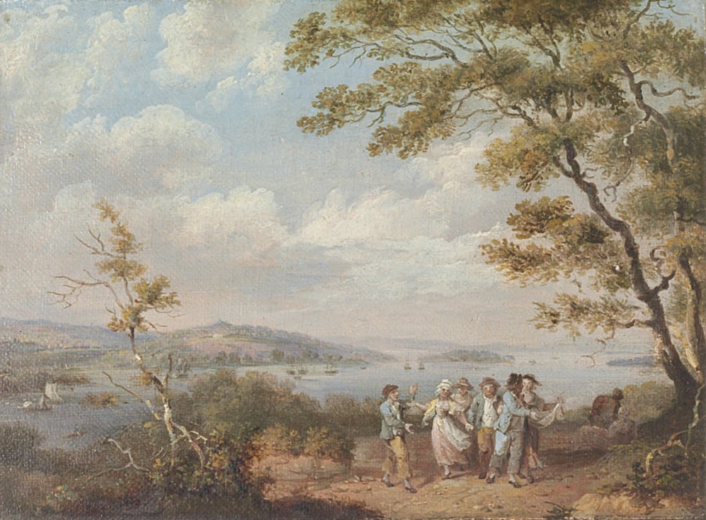
A view of Tarbert, Co. Kerry, from the Co.Clare bank of the River Shannon.
Tarbert House is visible centre-left on the Co.Kerry bank.
Tarbert Island is centre-right on the Co.Kerry bank.
Painted c.1782
by Francis Wheatley.
[Pielou, 1935]
says it refers to an incident in 1781.
From the Glin Castle collection.
Sold by
Christie's
2009.
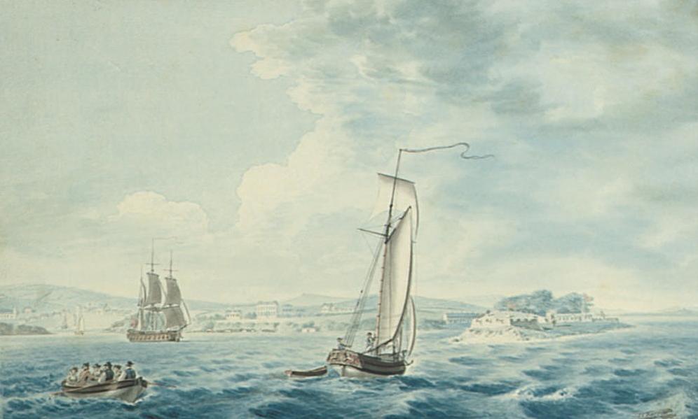
Shipping off Tarbert, Co. Kerry.
Tarbert town to LHS,
Tarbert House in centre,
Tarbert Island to RHS.
Painted 1795
by Joseph Charles Barrow.
From the Glin Castle collection.
Sold by
Christie's
2009.
Richard Ponsonby and his wife Letitia lived on Tarbert Island on the RHS.
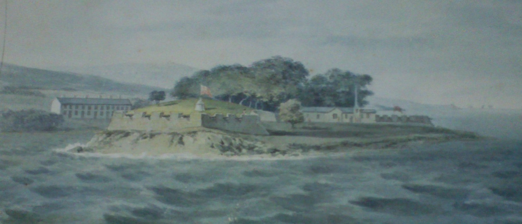
Detail of above showing Tarbert Island.
Richard Ponsonby and Letitia probably lived in one of these buildings.
See larger.
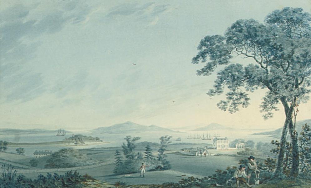
View of Tarbert House and Tarbert Island, Co. Kerry.
Tarbert Island to LHS.
Tarbert House to RHS.
Painted 1795
by Joseph Charles Barrow.
From the Glin Castle collection.
Sold by
Christie's
2009.
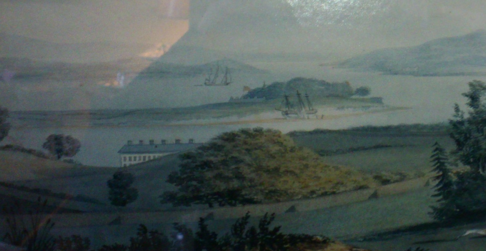
Detail of above showing Tarbert Island (where Richard Ponsonby and his wife Letitia lived).
See larger.
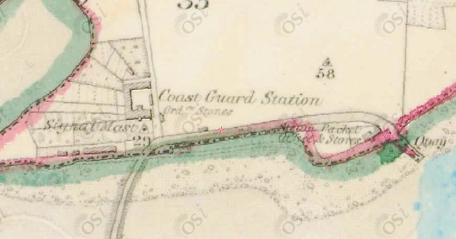
Coast Guard Station, Tarbert Island.
From 1829 to 1842 map.
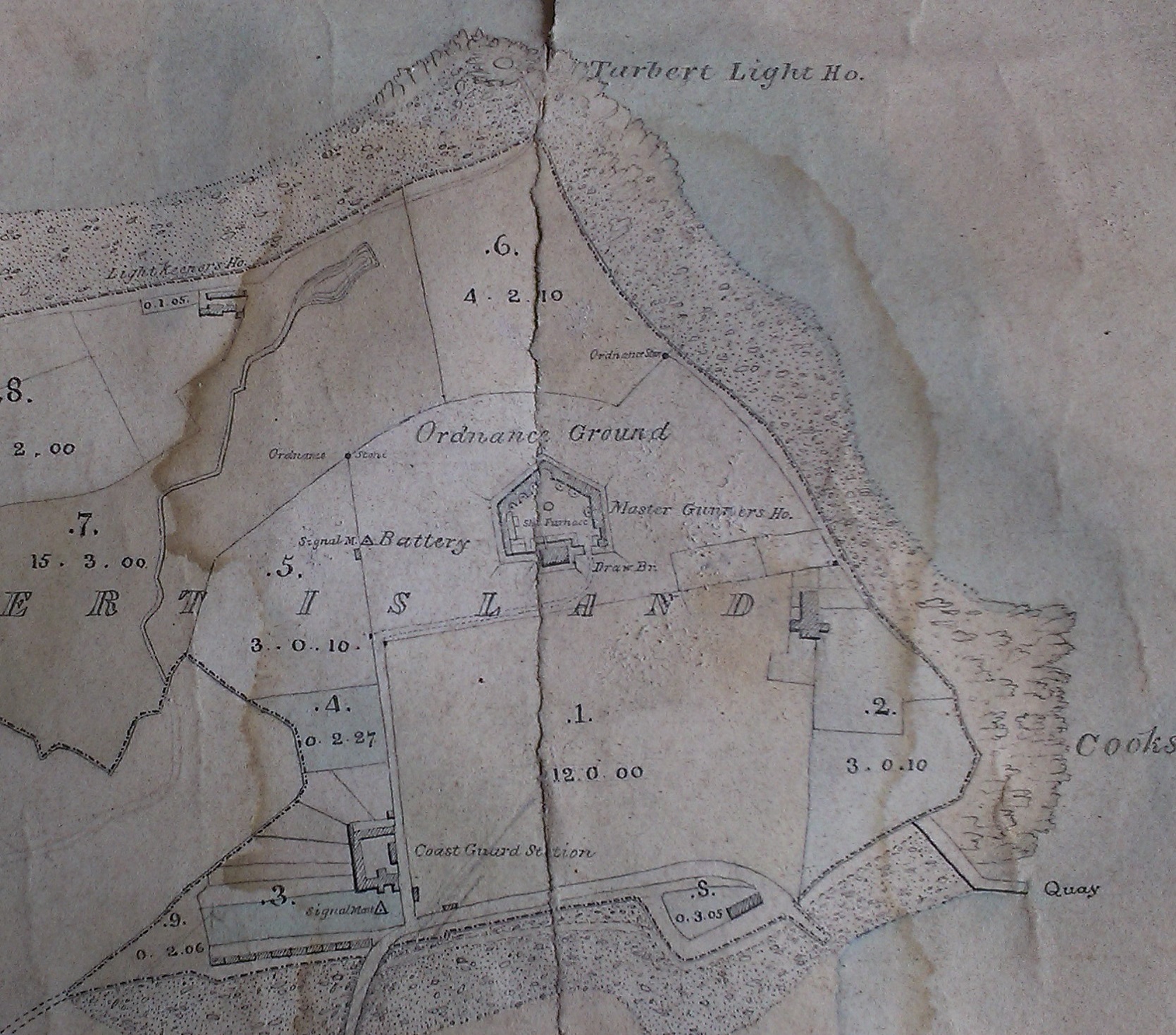
Tarbert Island.
Extract from
1868 map
made for
Robert Leslie.
See
larger
and
full size.
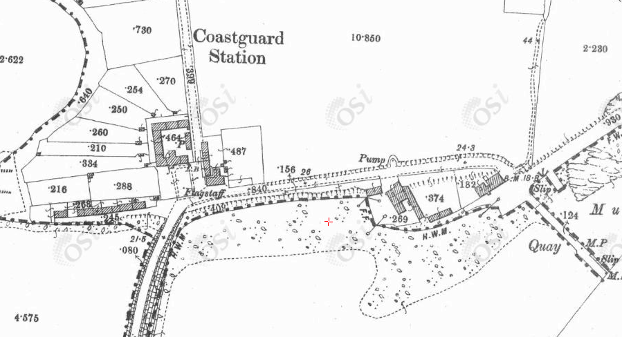
Coast Guard Station, Tarbert Island.
From 1887 to 1913 map.
In fact, this map is from survey of 1897 (see below).
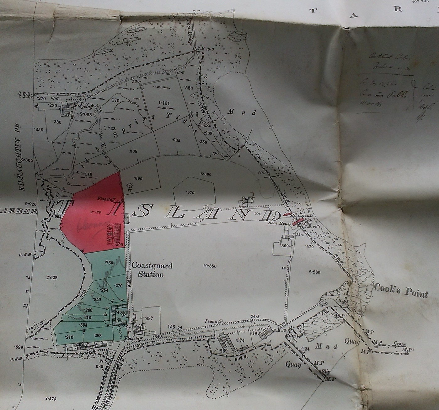
This map, identical to above, says "Surveyed in 1897"
and printed
1898.
See
larger
and
full size.
See
close-up and
close-up.
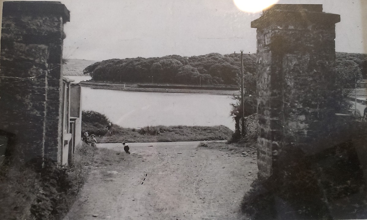
The old gates into the coastguard station. Looking out.
At the bend in the road.
Old gates now gone.
See modern
street view
(then turn around).
See larger
and full size.
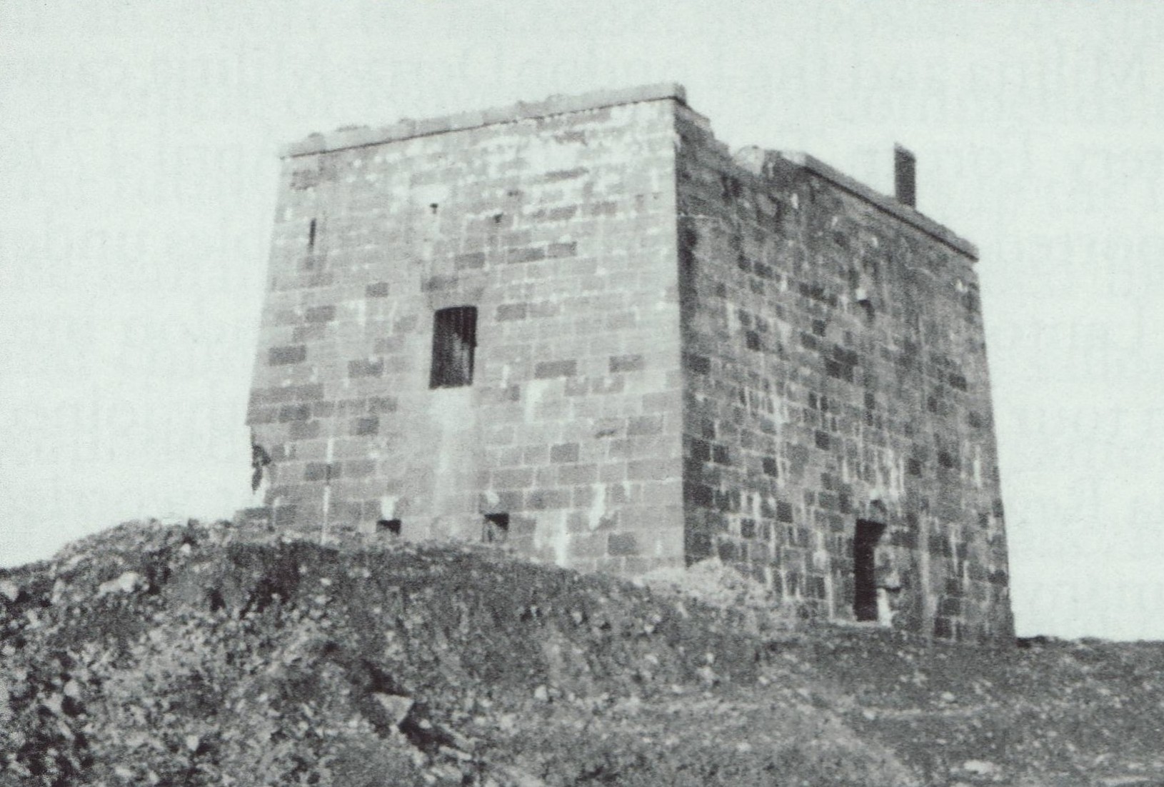
Tarbert Battery Fort (built 1790s).
Photo 1963, just before demolition.
See larger
and full size.
From [Lynch, 2008, p.313].
Used with permission.

Tarbert Island
on modern satellite view.
It is now occupied by a large power station.
See
street view.

The pier on Tarbert Island.
Photo 2006 from Geograph. Creative Commons.

The pier on Tarbert Island.
See full size.
Photo 2008 from Flickr. Creative Commons.
Please donate to support this site.
I have spent a great deal of time and money on this research.
Research involves travel and many expenses.
Some research "things to do"
are not done for years, because I do not have the money to do them.
Please Donate Here
to support the ongoing research and
to keep this website free.