The original castle at Dundrum was 13th century.
A new "Dundrum Castle" house
was built beside the old castle in the 18th century.
Austin Cooper visited in 1780 and said
"The Castle of Dundrum ... is inhabited, and in excellent repair".
But he must be referring to the new house, since he says:
"at the N.E. end of it are the remains of a much older building than the present castle,
which is visibly a modern addition
...
There is but very little of this ancient part remaining".
See
[Ball and Hamilton, 1895].
The 18th century "Dundrum Castle" house was demolished c.1996.
Think this is now the site of the "Dundrum Castle House" apartments.
The ruin of the medieval castle survives today.
SW of old Dundrum village.
This was
on the W bank of the river.
A field went down from the castle to the river.
The ruin is now on the W side of the bypass which follows the old river.
Access is restricted, behind locked gates of the apartment complex.
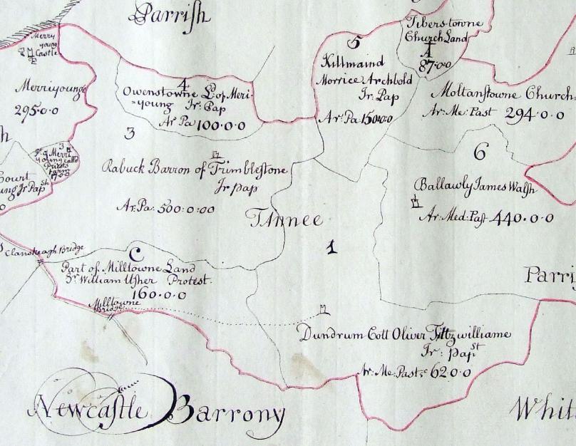
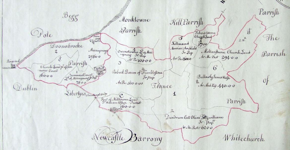
Part of the parish of Taney
in the
[Down Survey, 1655 to 1658].
E (sea) is up.
1st Viscount Fitzwilliam
holds
Owenstown (plot 4).
2nd Viscount Fitzwilliam
holds
Dundrum (plot 1)
and Ballinteer (plot 2, not marked, but would be the lower-right (SW) part of the Dundrum plot).
Dundrum Castle is shown.
Merrion Castle
and the sea are visible in top left.
This is part of the larger map of
Donnybrook and Taney.
From
TCD.
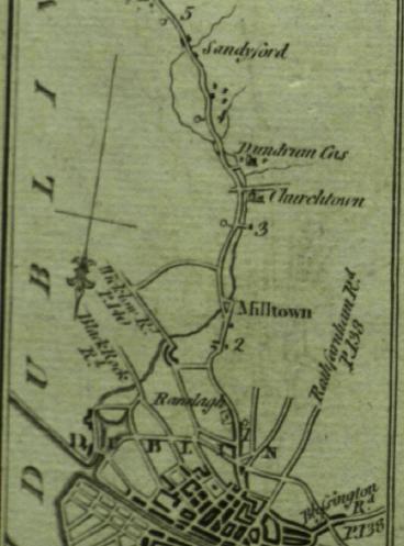
Dundrum
in
[Taylor and Skinner, 1777].
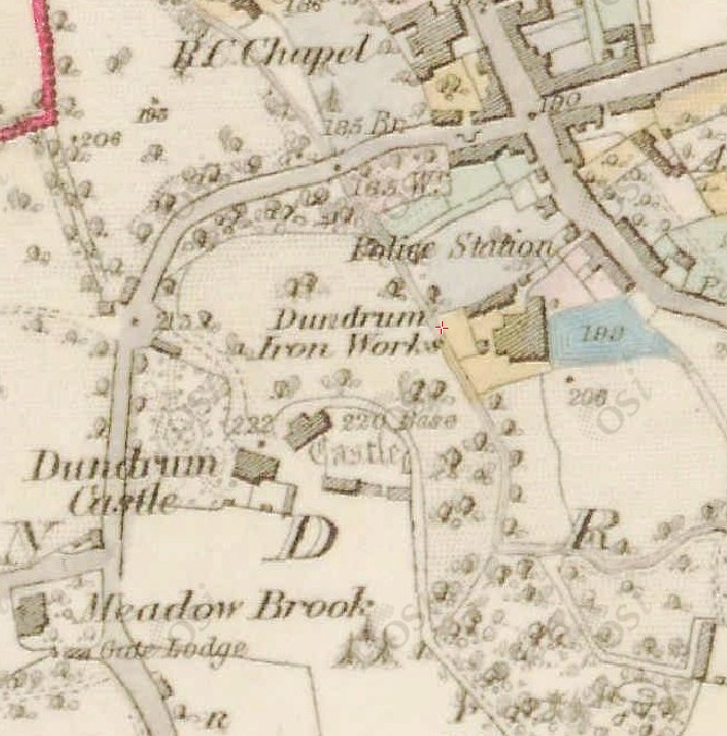
Dundrum Castle.
From
1829 to 1842 map.
The medieval castle is the building to the N centre.
To the SW is the 18th century "Dundrum Castle" house.
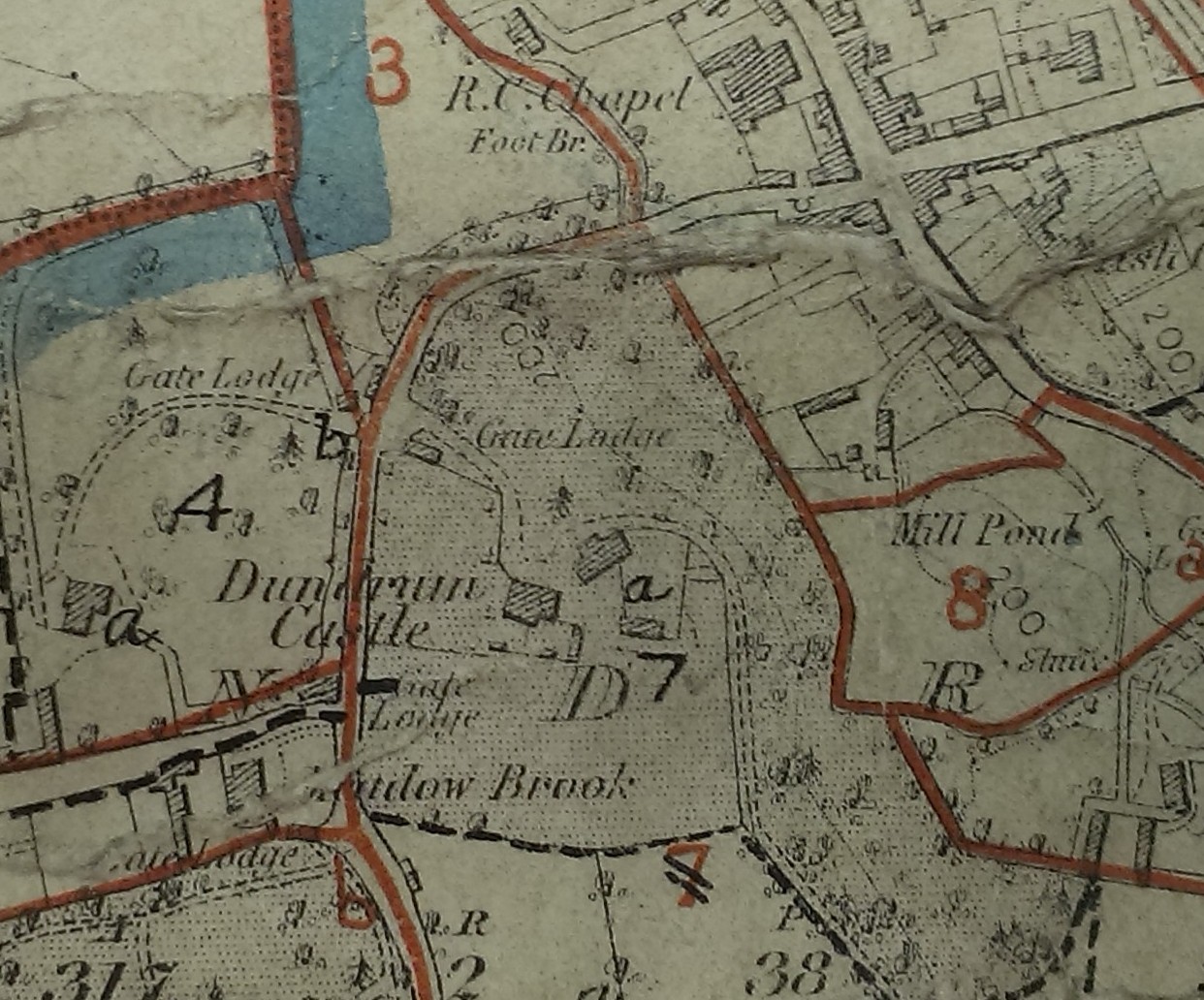
Dundrum Castle on map in
[VO]
of unclear date.
See full size.
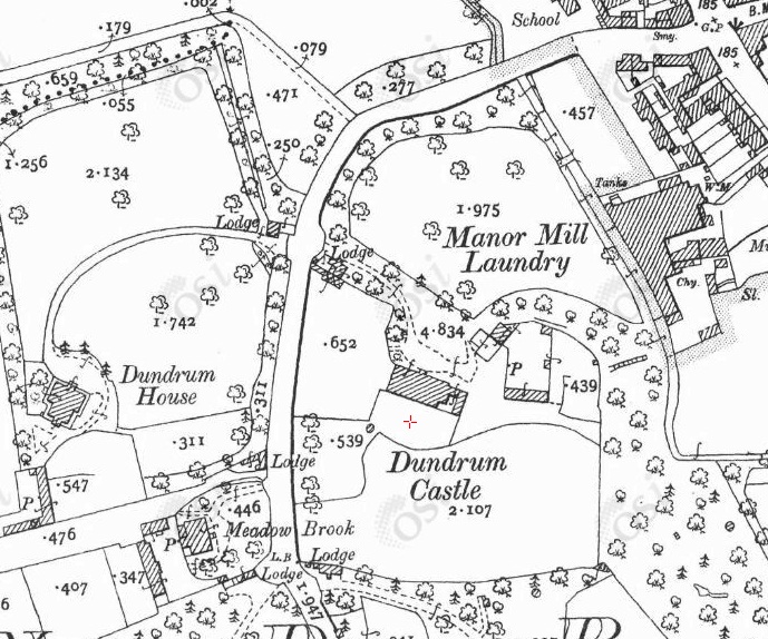
Dundrum Castle.
From
1887 to 1913 map.
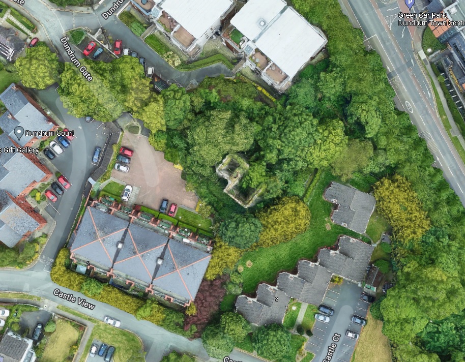
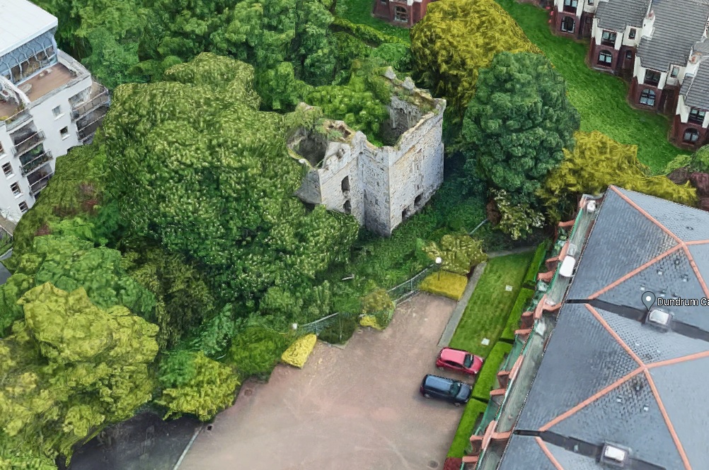
Dundrum Castle.
Modern satellite view.
From Google Maps.
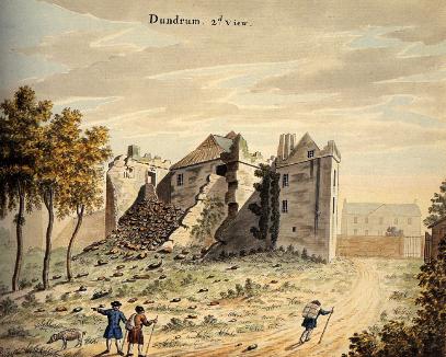
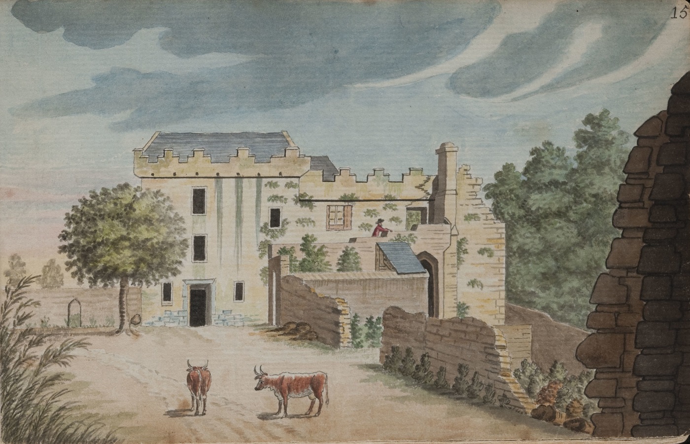
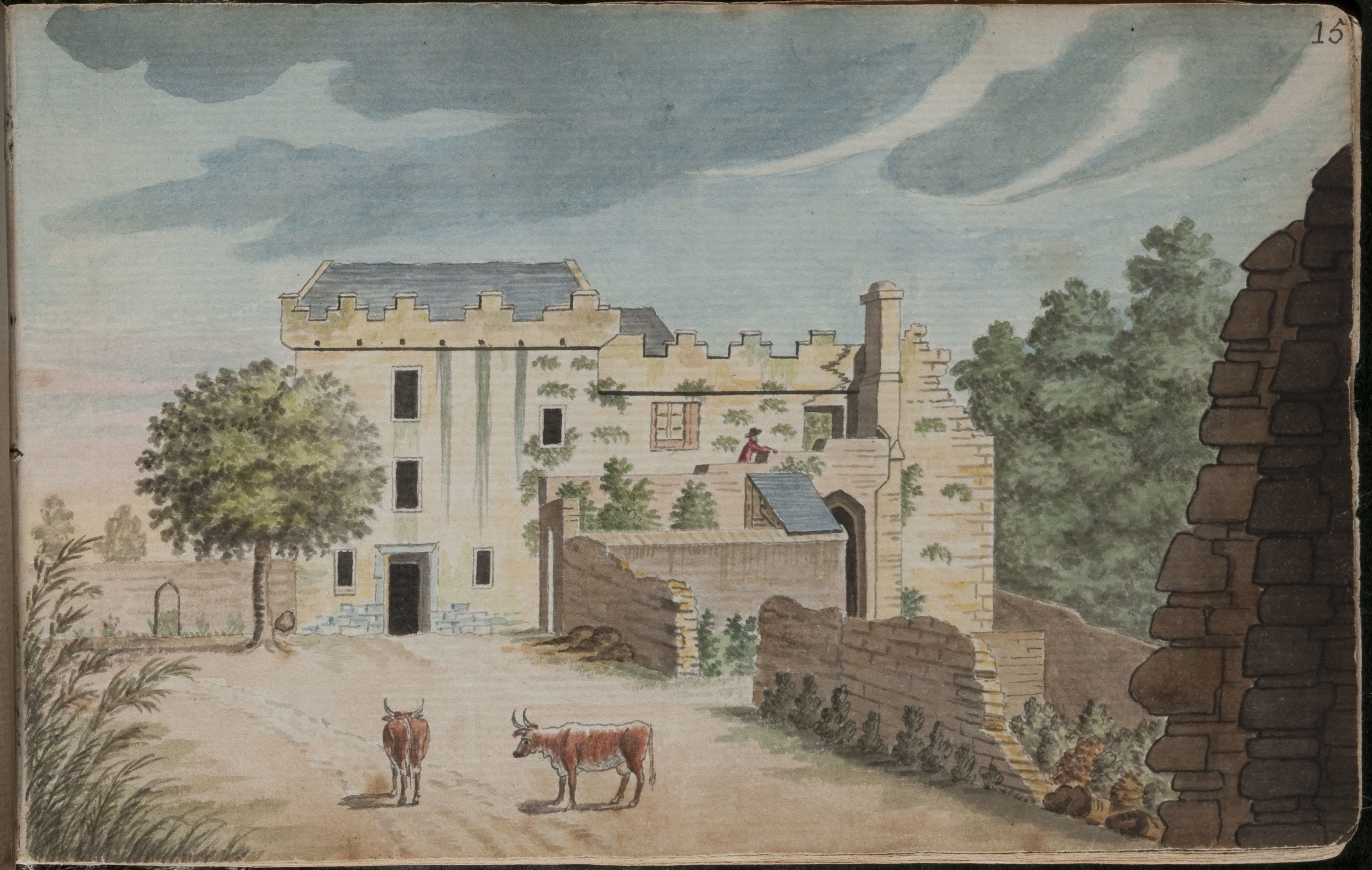
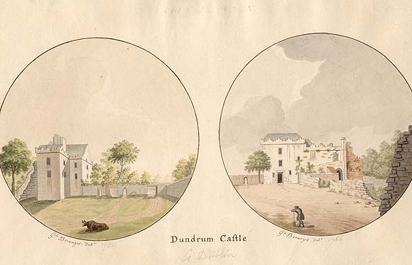
Dundrum Castle from the W.
i.e. Through that wall are gardens leading down to the river.
Drawn by Gabriel Beranger, 1765.

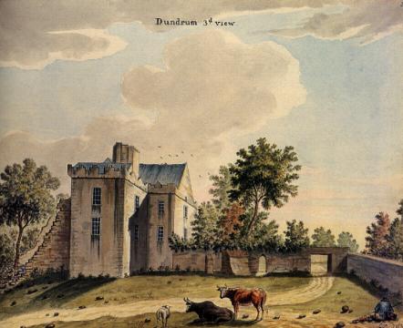
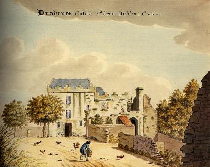
Dundrum Castle.
Copies of above pictures.
Printed by Gabriel Beranger, 1766.
From NLI.
See copy reprinted
in 1780.
From NLI.
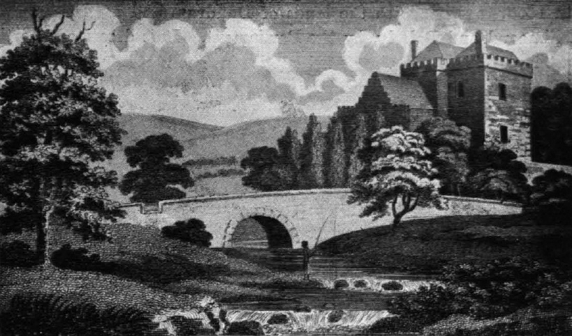
Dundrum Castle, 1802.
From The Literary and Masonic Magazine.
Printed in [Ball, vol.2, 1903].
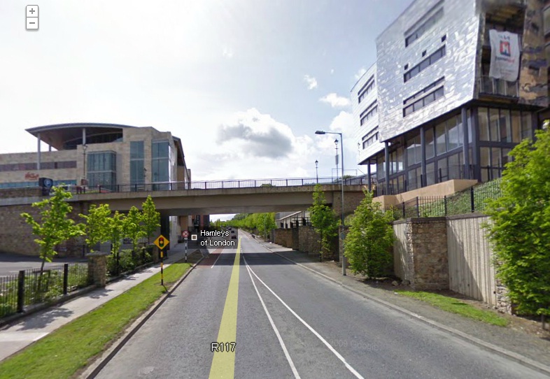
Modern
street view
of same location as 1802 picture above.
The bypass follows the line of the old river.
The bridge is on the site of the old bridge.
The castle is ahead to the RHS on the bank higher up.
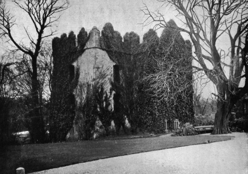
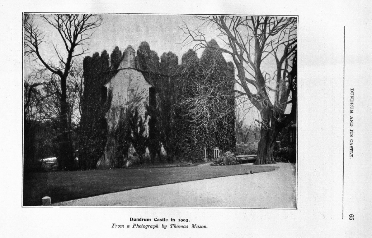
Dundrum Castle, 1903.
From [Ball, vol.2, 1903].
See full size.
Please donate to support this site.
I have spent a great deal of time and money on this research.
Research involves travel and many expenses.
Some research "things to do"
are not done for years, because I do not have the money to do them.
Please Donate Here
to support the ongoing research and
to keep this website free.
