| Map of the Flanagan estate |
The old house in Greenhills
|
The main properties in the estate were:
[Hannan]
found the estate reached a maximum size of 500 acres in 1914,
though it was near enough to that size for the whole 1895-1925 period.
At its peak the Alderman had land in
Crumlin, Drimnagh, Rialto, Dolphin's Barn,
Walkinstown, Greenhills, Tallaght, Kilmainham and Rathfarnham.
They said that all of Crumlin was under cabbage.
Frank Flanagan
said his father the Alderman was a genius at using the various
Land Acts
to buy property.
The story is that the Corporation stopped the Alderman buying more land.
[Frank Flanagan's memoirs]
said the Alderman farmed almost 1,000 acres.
The estate was gradually sold off by
Frank Flanagan in 1931 to 1959.
Some sold commercially to developers.
Some subject to Compulsory purchase orders.
Most of the estate is built-up suburbs today.

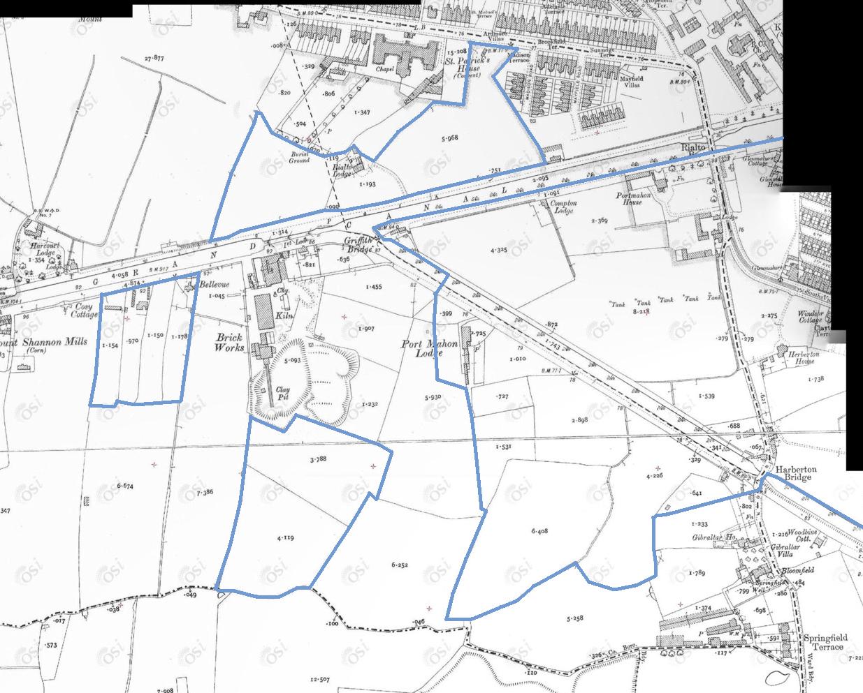
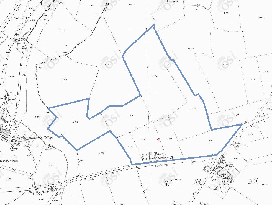
The estate of
Leicester House, Crumlin.
Just N of the estate below.
On
1887 to 1913 map.
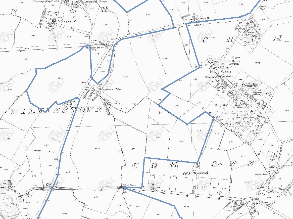
Lands held around Walkinstown and Crumlin.
Just S of Leicester House estate above.
On
1887 to 1913 map.
See full size.
The Alderman held
Walkinstown House
and
Leicester House
and
all the land
in the middle section above, and more land to the north and south.
See
modern map
and
satellite view.
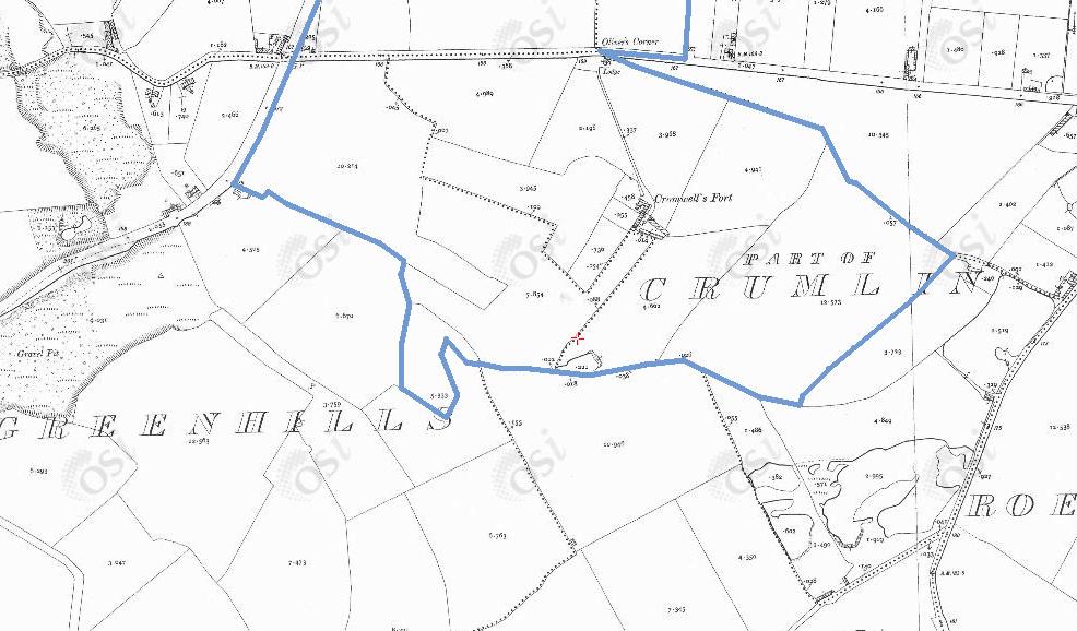
Southern part of Crumlin.
Just S of the above map.
On
1887 to 1913 map.
The Alderman owned the farm called
Cromwell's Fort, Crumlin.
It is said that
Oliver Cromwell
camped here during his
Irish campaign (1649-1650).
The Cromwell's Fort house is now gone.
The site is now sports pitches.
See satellite view.
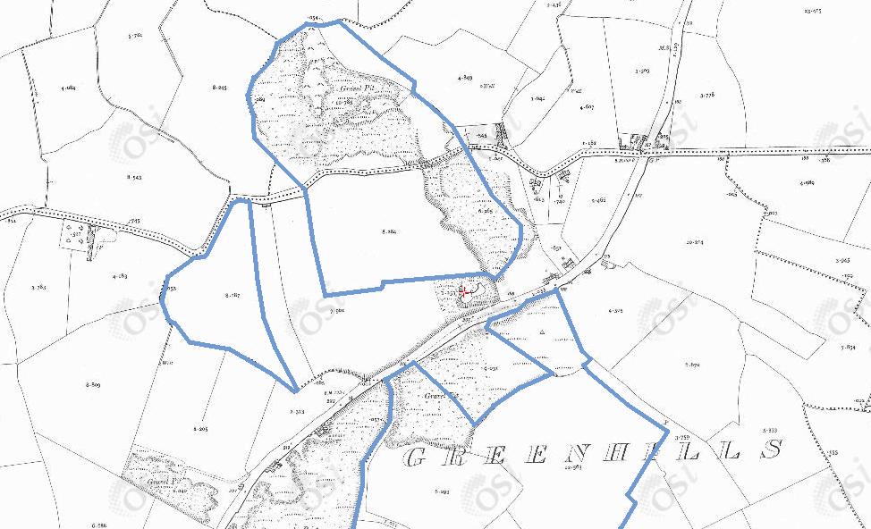
Northern part of Greenhills.
Just S and W of the above map.
On
1887 to 1913 map.
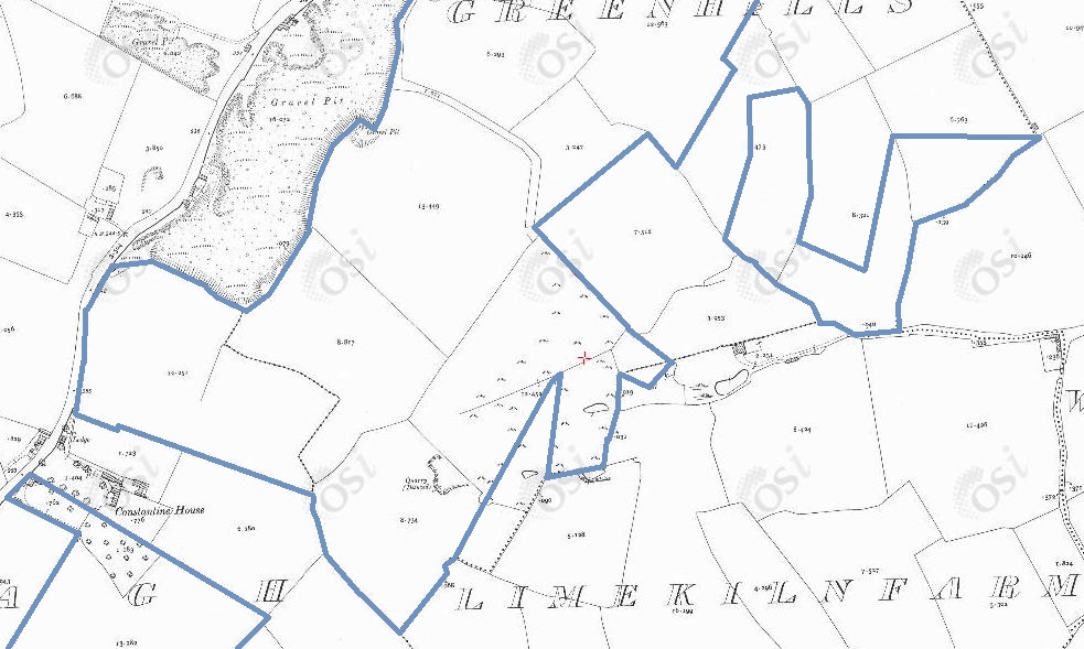
Southern part of Greenhills.
Just S of the above map.
On
1887 to 1913 map.
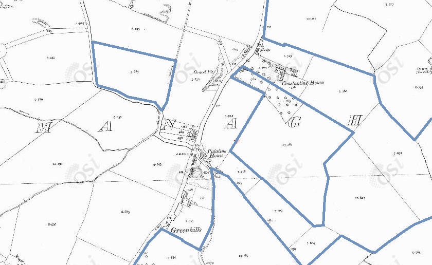
Kilnamanagh, Greenhills Road.
Just S and W of the above map.
On
1887 to 1913 map.
Including the old family farm at Greenhills.
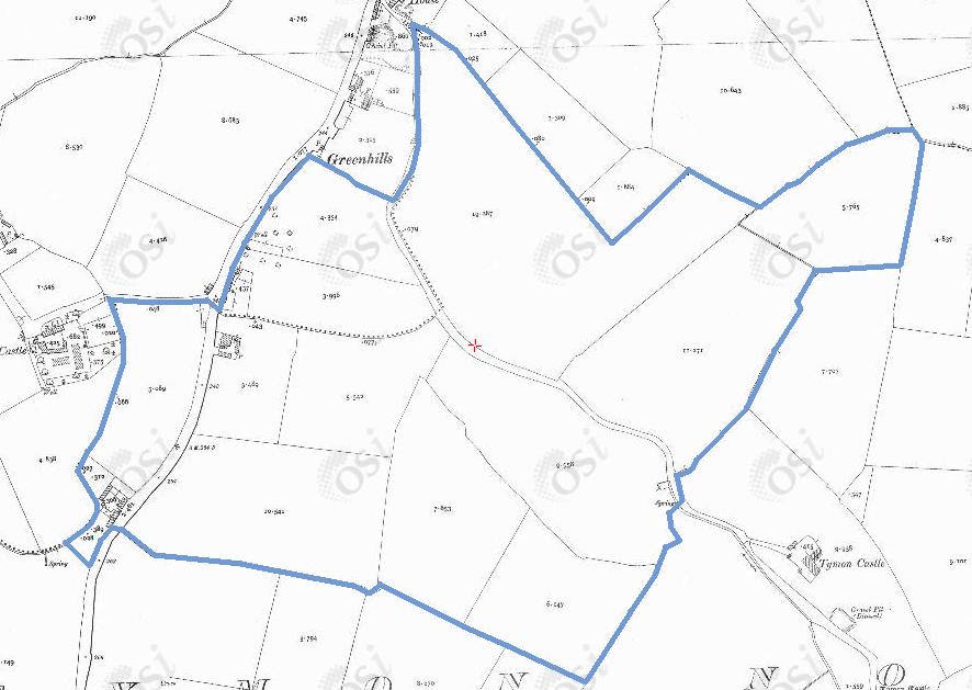
Southern part of Greenhills Road.
Just S of the above map.
On
1887 to 1913 map.
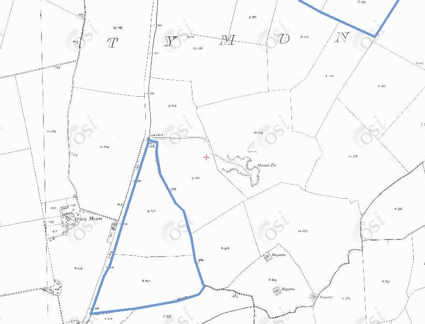
Tymon North.
S of the above map.
On
1887 to 1913 map.
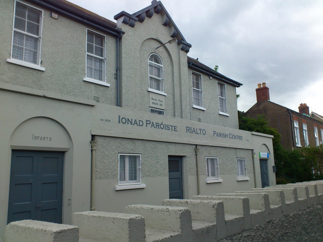
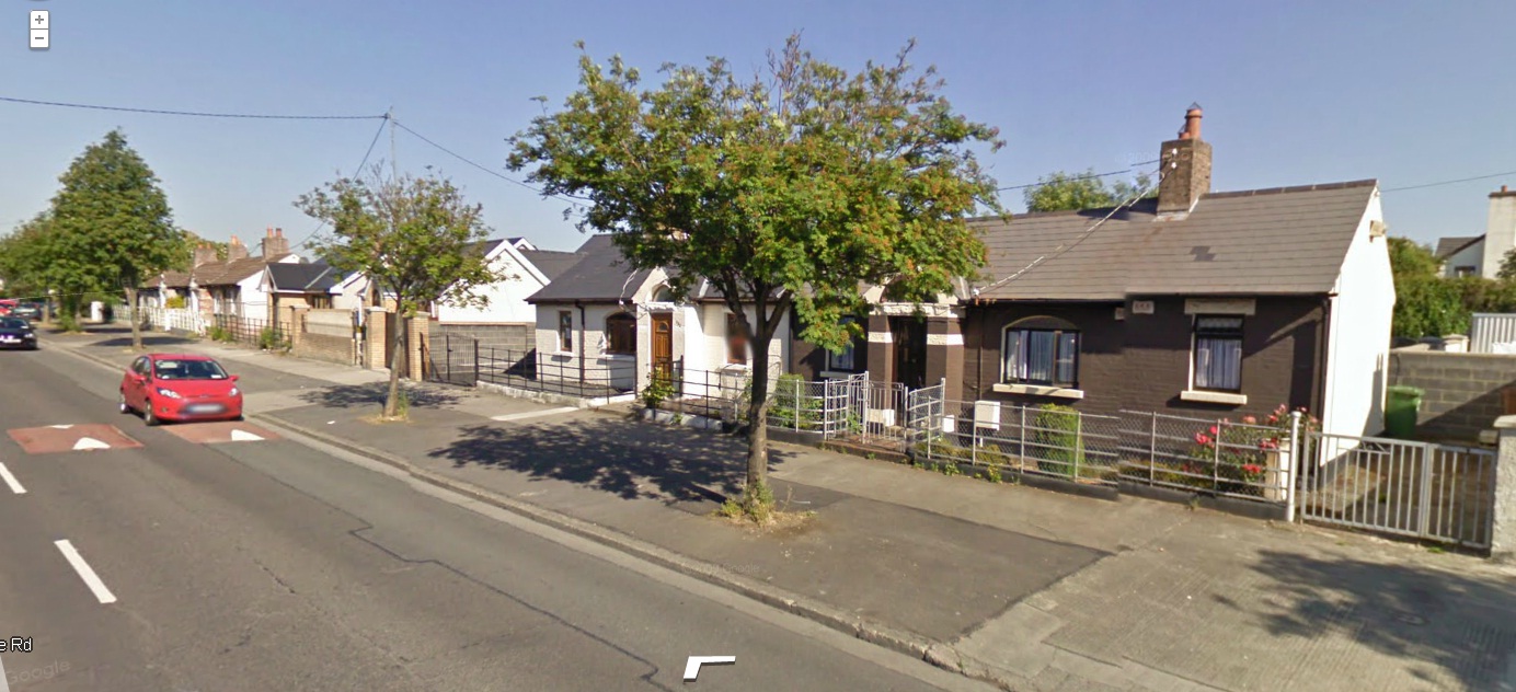
Old cottages on the N side of Kildare Rd, Crumlin.
These were built from 1904 to 1917
[Hannan].
The Alderman acquired these cottages
for his workers.
These cottages were all, at one time,
occupied by ploughmen who worked for Flanagans
[Watchorn, 1985].
Everything around them was fields.
From Google street view.
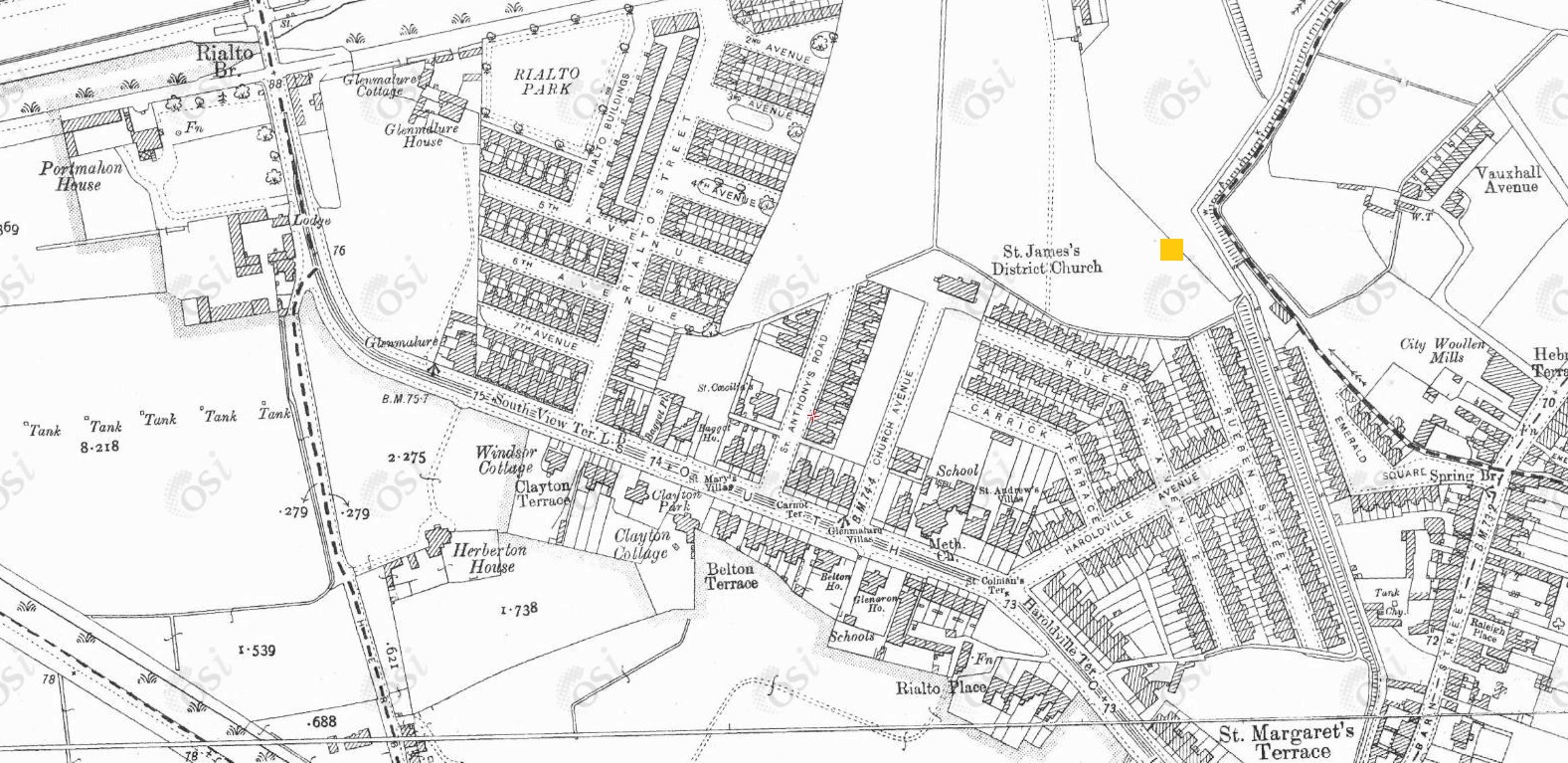

2009 screenshot from
street view
of the site of
"Flanagan's Fields".

"Flanagan's Fields" at the location above.
Photo 2014.
From
The Grow Dome Project.
Please donate to support this site.
I have spent a great deal of time and money on this research.
Research involves travel and many expenses.
Some research "things to do"
are not done for years, because I do not have the money to do them.
Please Donate Here
to support the ongoing research and
to keep this website free.