Walkinstown House was in
Wilkinstown townland (old spelling),
Crumlin civil parish,
Barony of Uppercross,
Co.Dublin.
Walkinstown House was on E side of Walkinstown Rd.
A bit S of Drimnagh Castle.
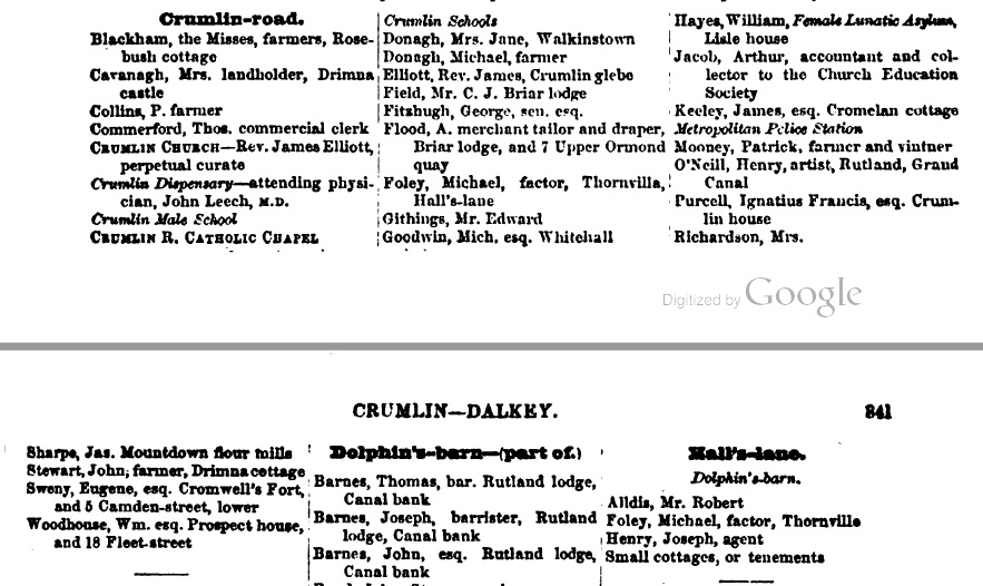
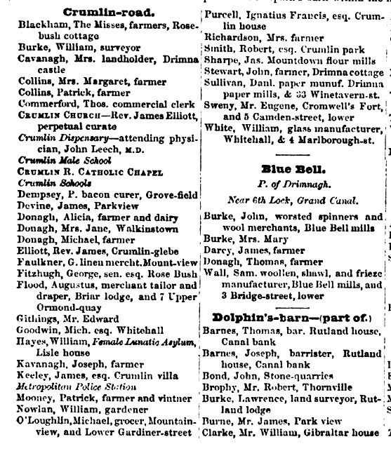
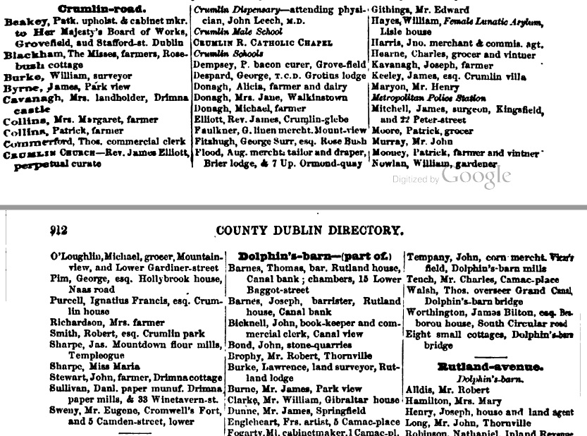
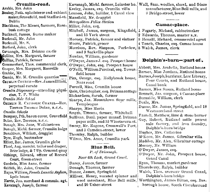
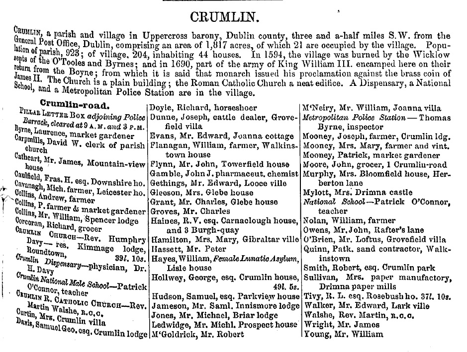
Mrs. Jane Donagh is listed at
"Walkinstown" (thus spelt) under
Crumlin in
[Thom's, 1850, pp.840-841].
Same listing under
Crumlin in
[Thom's, 1851, p.909].
Same listing under
Crumlin in
[Thom's, 1852, pp.911-912].
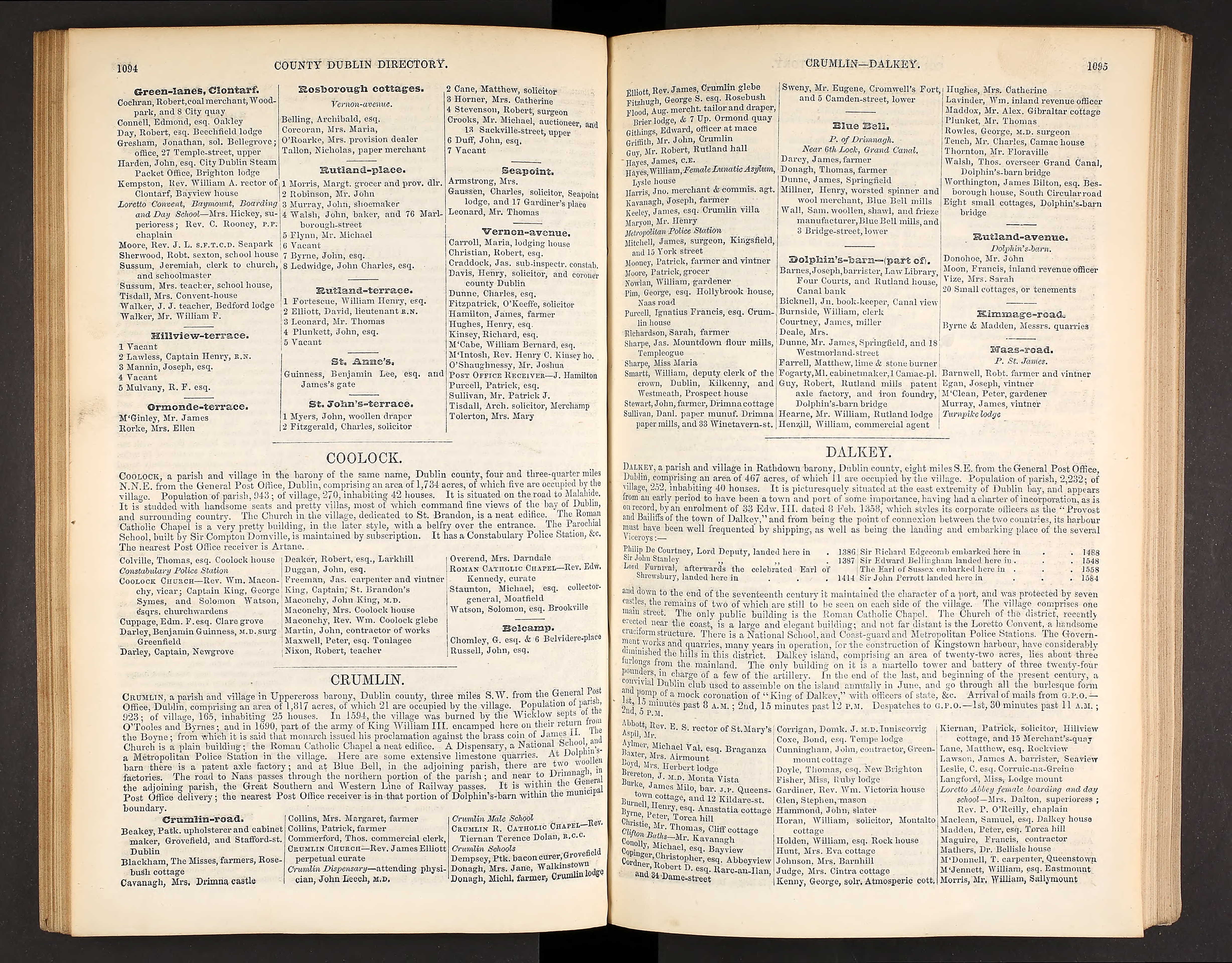
Same listing under
Crumlin in
[Thom's, 1856, pp.1094-1095].
Same listing under
Crumlin in
[Thom's, 1858, p.369].
Same listing under
Crumlin in
[Thom's, 1859, p.1186].
Same listing under
Crumlin in
[Thom's, 1860, p.407].
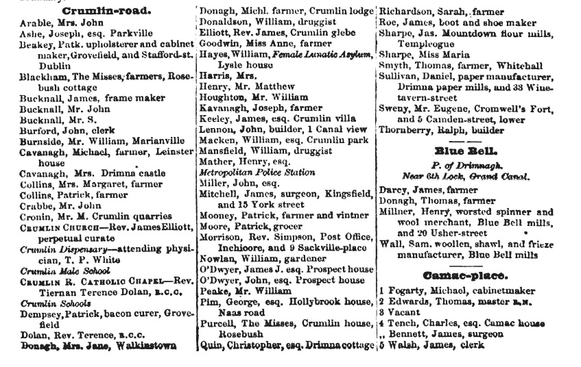
James Donagh is listed at
"Walkinstown house" under
Crumlin in
[Thom's, 1868, p.1559].
Same listing in
[Thom's, 1871].
Charles Donagh transferred Walkinstown House
to Flanagan in 1870 to 1873.
John Graves is listed at Walkinstown House in
[Thom's, 1872].
Still listed there in
[Thom's, 1874, p.1664]
but that is probably slightly out of date. See the following.
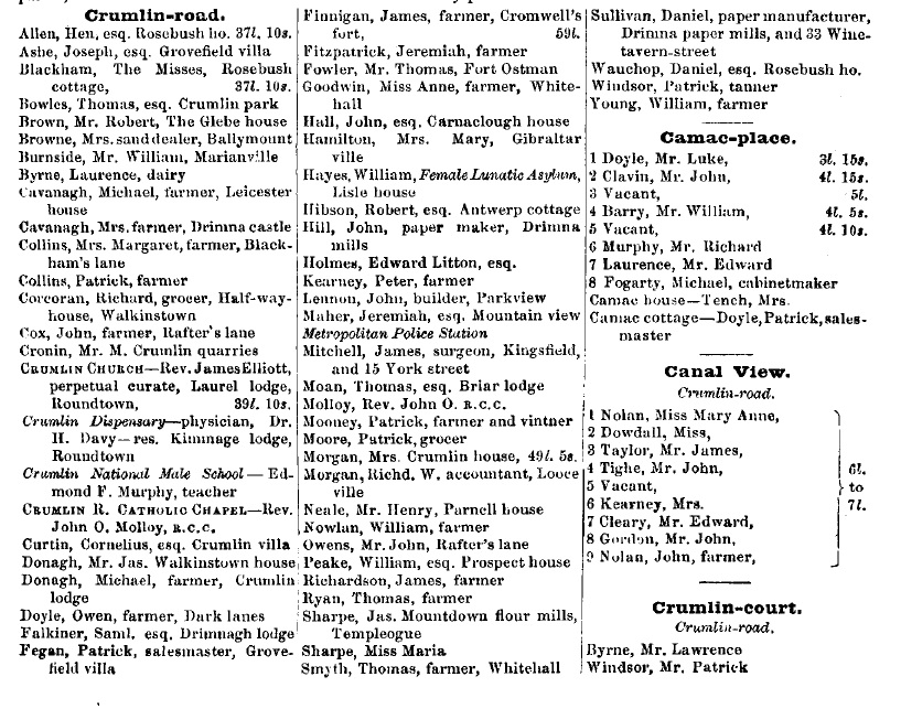
William Flanagan, junior
moved into Walkinstown House.
"W. Flanagan, Walkinstown" is listed in
Irish Times,
July 9, 1873.
William Flanagan is
listed at
Walkinstown House
in
[Thom's, 1875] and later.
See him listed there under
Crumlin
in
[Thom's, 1877, p.1503].
William Flanagan was living
there at time of death 1886.
His widow Anne Murtagh lived there after him.
[Thom's, 1895]
lists "Mrs. Flanagan, Walkinstown House".
She is there in
[Thom's, 1896].
Thomas J. Curtis is listed there in
[Thom's] 1897 to 1901.
Renting
from the Alderman.
See Thomas Curtis
listed
there in 1901 census.
It may be coincidence but
"T. Curtis" appears at
Newtown House
many years later.
Walkinstown House is listed as vacant,
under Crumlin, in
[Thom's] 1902 to 1910.
"The Bird" Flanagan
then lived there.
He is
there as at 1911.
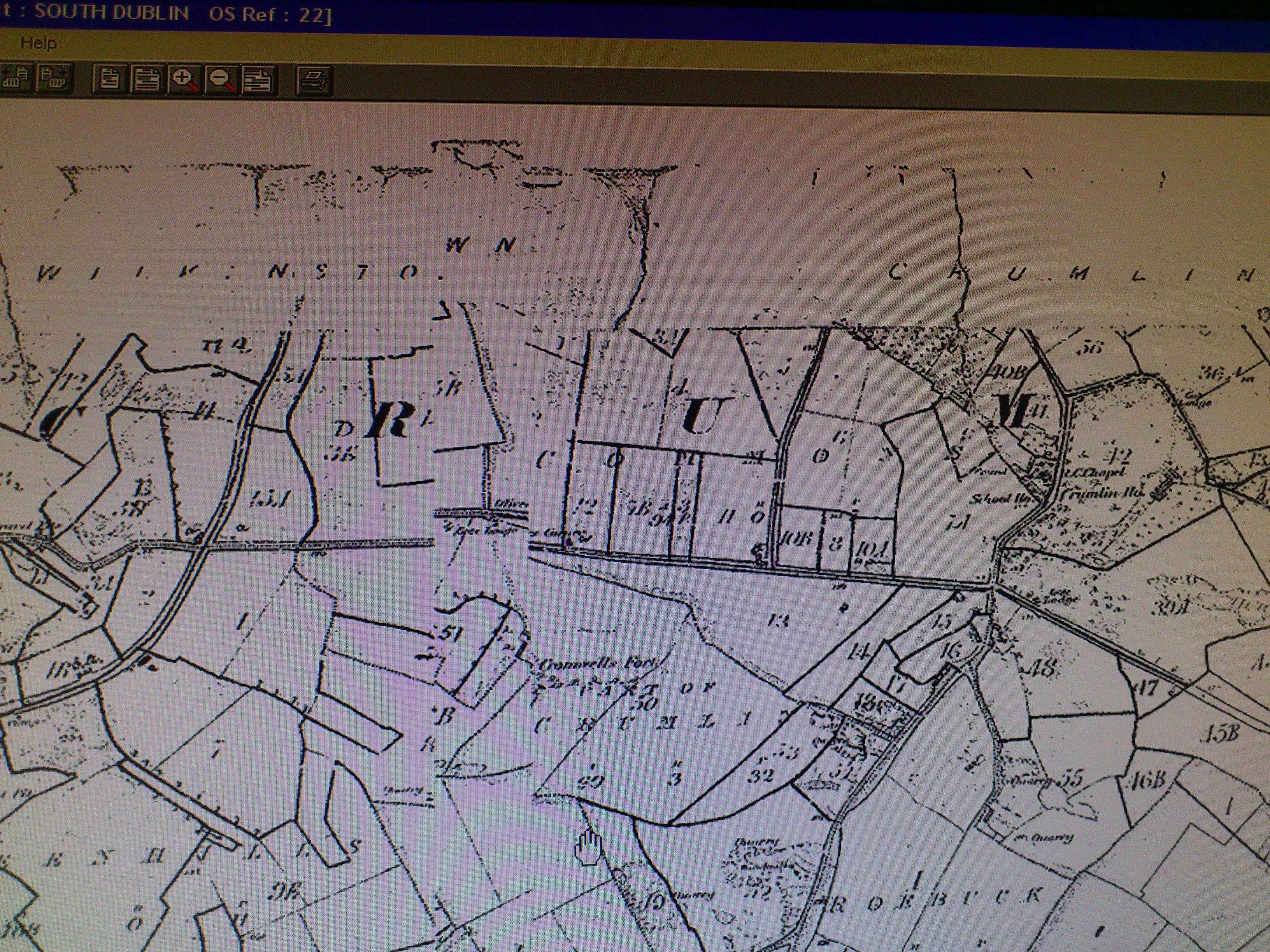
The 1887 to 1913 map
shows the house surrounded by fields.
No housing estates yet.
The house was attacked by the
Black and Tans
during the War of Independence, 1919-1921.
Presumably because of the family's Irish Party
connections
(despite the fact that Frank
was a former British Army officer).
The house was
not badly damaged.
The porch was burnt.
The Bird died at Walkinstown House 1925.
Patrick Crowley
is listed there in
[Thom's, 1927].
Would be renting
from Flanagan.
Walkinstown House is listed as vacant in
[Thom's] 1928 to 1932.
Frank Flanagan
then lived there.
He is first listed there in
[Thom's, 1933].
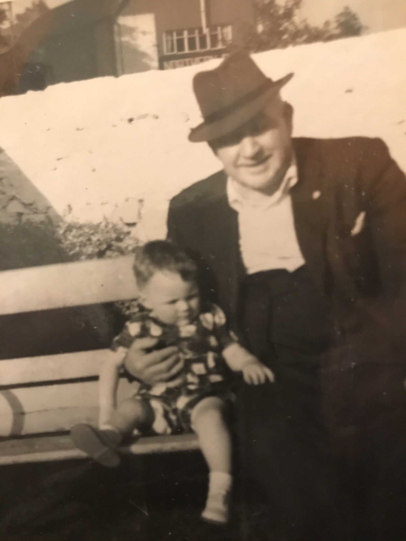
Deirdre Flanagan was born there in 1936, and grew up there.
Extensive housing estates were built in Walkinstown,
all around the house.
Think around 1950.
Some
Dublin Corporation.
Some private.
1952-1954 photo
shows extensive housing estates around the house.
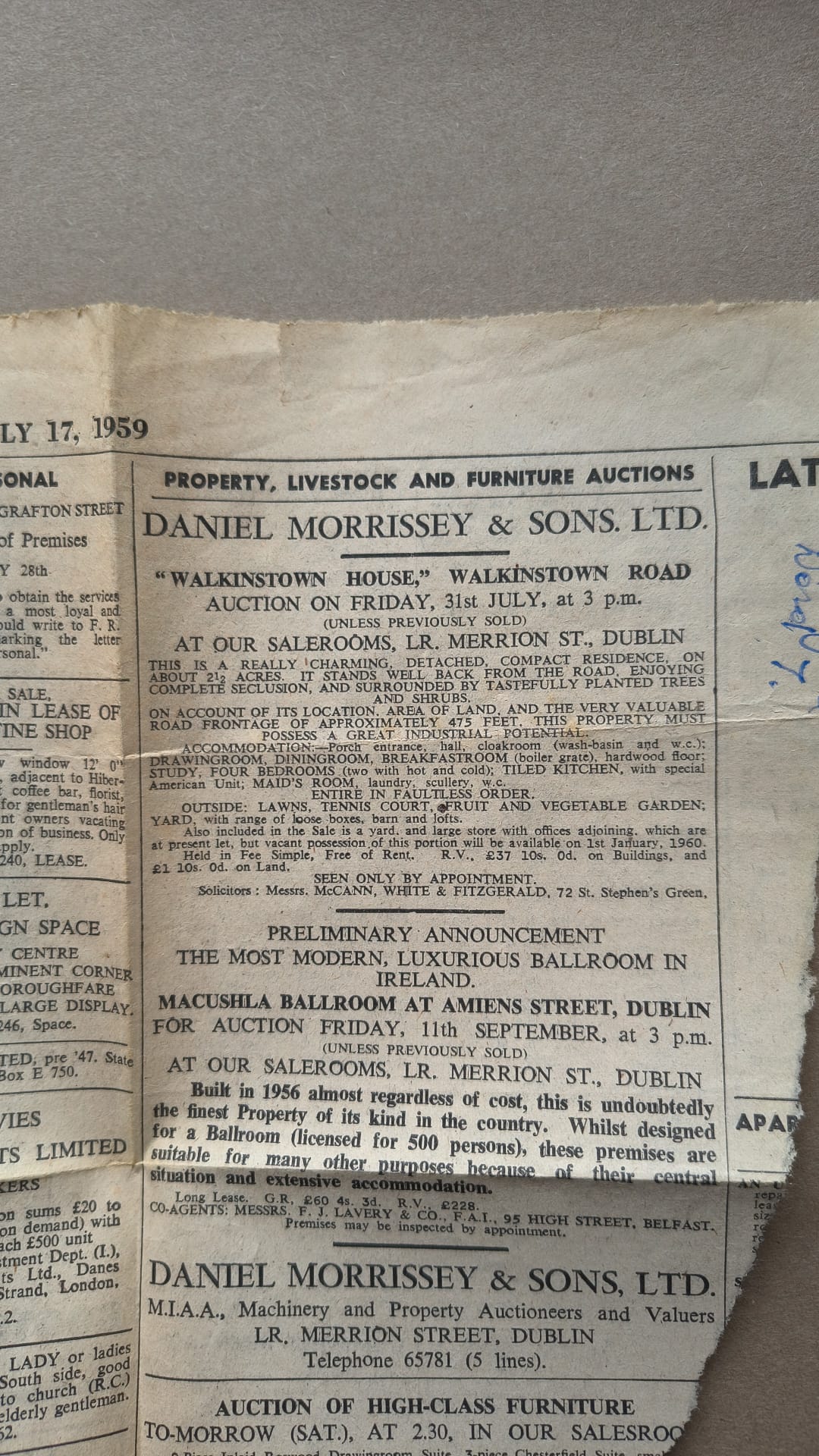
Frank finally sold Walkinstown House in 1959.
Apparently at auction 31 July 1959.
He was gone by mid 1960.
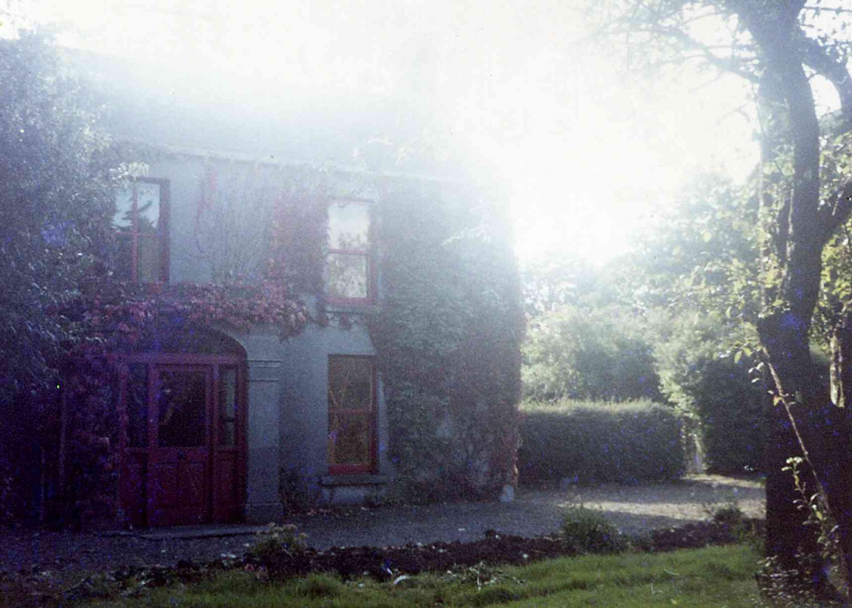
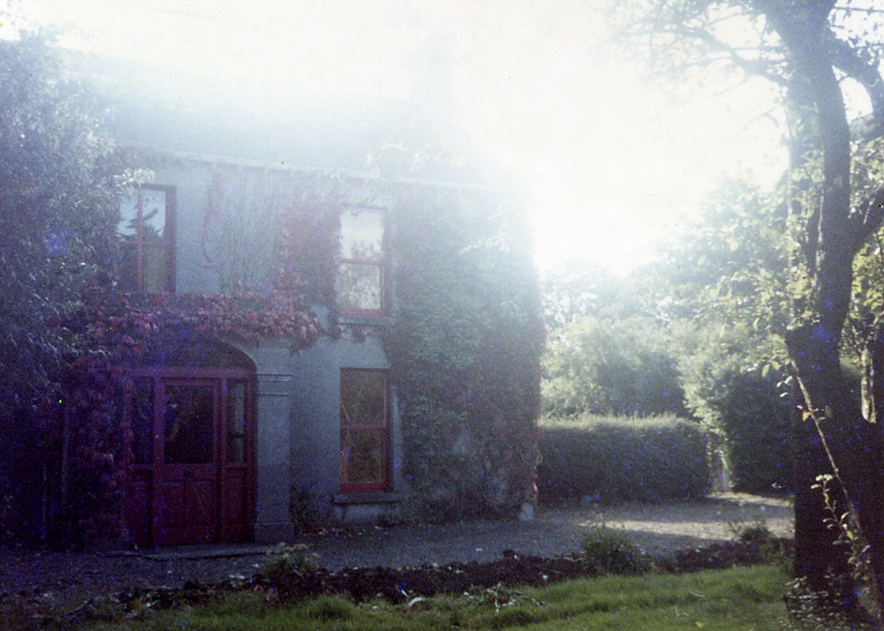
House and out-buildings are now all gone.
All that has survived is some of the wall and the trees at the edges.
See
Walkinstown House - The site today.
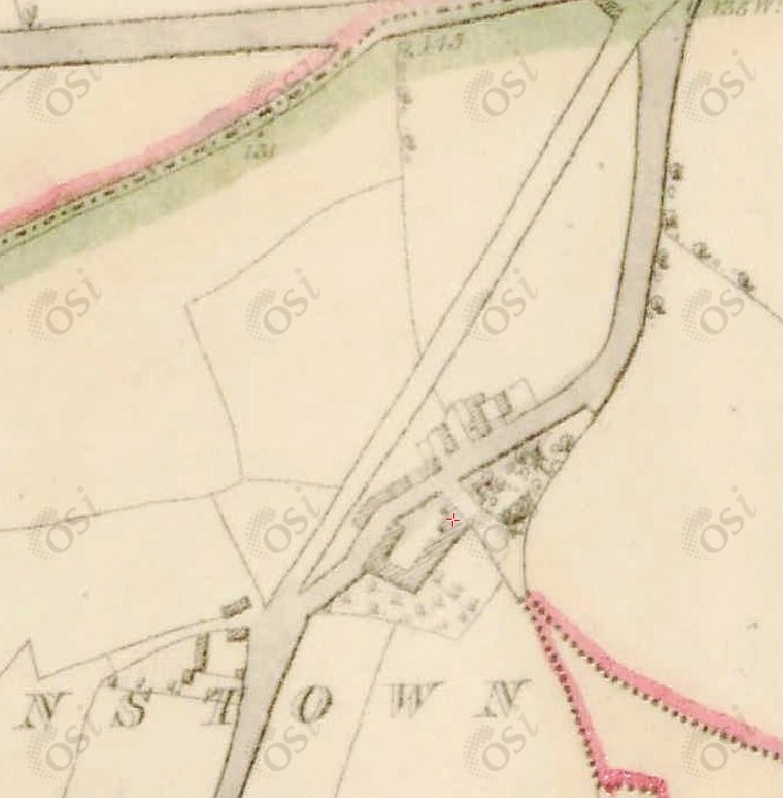
Site of Walkinstown House on
Griffiths Valuation map at
askaboutireland.ie.
The hamlet seems to be mainly cleared by now, and there is one big holding (plot no.4),
called "Buttercup Lodge".
Unfortunately, the numbering of
[Griffiths Valuation]
does not match the numbering of this map.
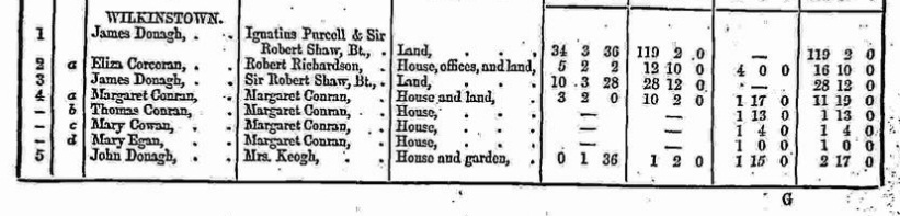
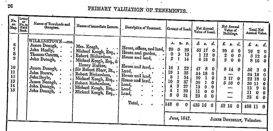
[Griffiths Valuation, 1847]
shows one big house, plot no.6, occupied by James Donagh,
and a number of smaller houses with various occupants.
No Flanagans.
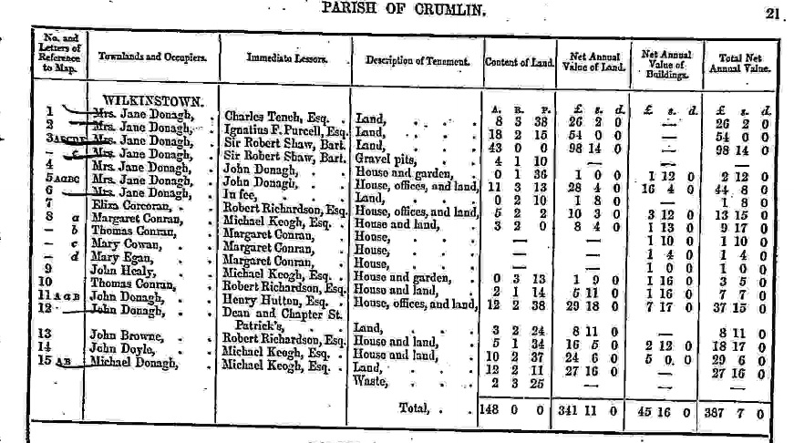
[Griffiths Valuation, 1850]
shows one big house, plot no.5, occupied by Mrs. Jane Donagh,
and a number of smaller houses with various occupants.
No Flanagans.
Neither of these match this map, where the big house is plot 4.
Note that
[VO] Griffiths Valuation maps, Dublin county,
map 18 is damaged, and
map 22 is too far south.
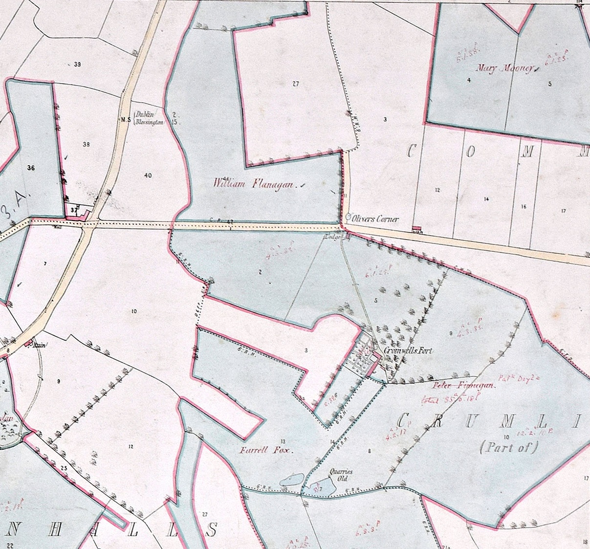
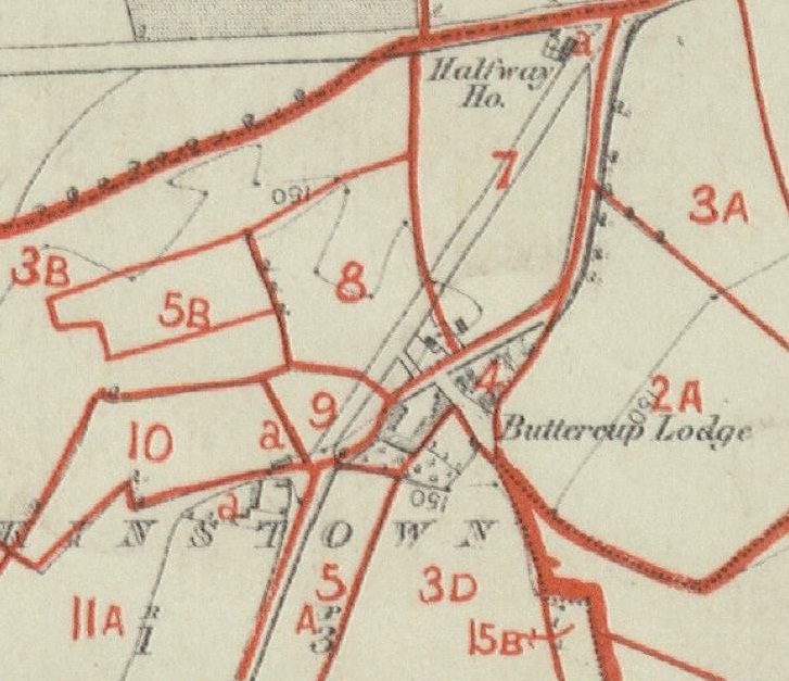
Part of the Shaw estate held by
William Flanagan (died 1886)
as at 1879.
From
Walkinstown down to S part of Crumlin.
From here
and
here
in
Maps of the Shaw estate, 1879.
Based on Ordnance Survey maps of 1866.
Shows "Buttercup Lodge"
at site of Walkinstown House.
Note the new entrance to the house from the NW (in yellow).
Note Collins property at Crumlin to the NE.
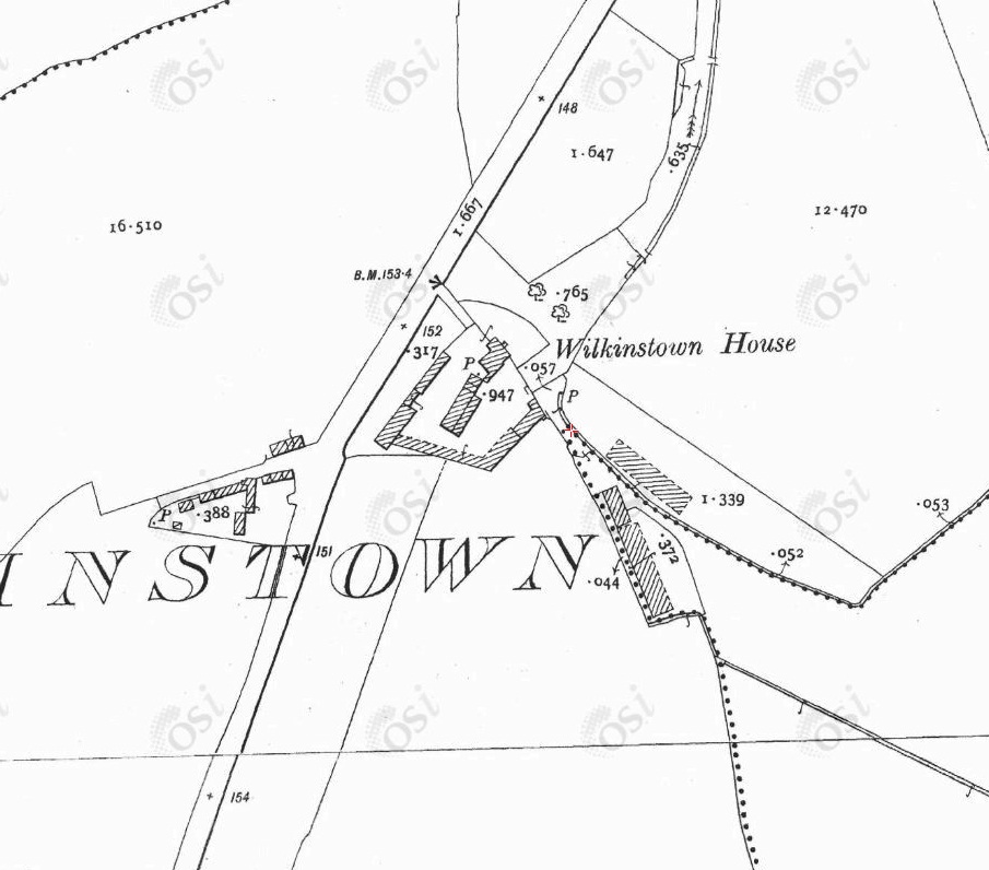
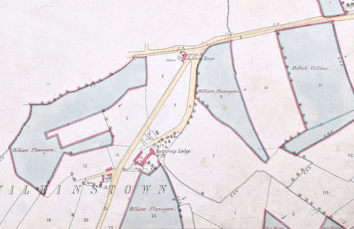
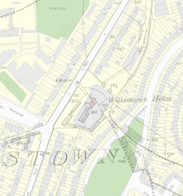
Walkinstown House on
1887 to 1913 map.
The hamlet is gone.
The old main road is now dis-used.
There is a new approach to the house from the side.
There was a tiny stream down the E side of the old road, visible here (E side of "635").
The map shows the main block of the house
surrounded by, to the W, S and E,
the stables and outbuildings.
Entrance to NW.
There was an archway between the house to the N and the stables to the S.
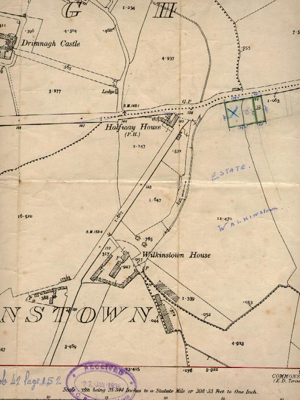
This map has date 1936 on it, but it is clearly a copy of the
1887 to 1913 map.
Section "765" to the NE was a small
paddock
where horses were kept.
To keep the horses away from the house,
across the front (S) of the paddock
(where two trees are drawn here)
was a hedge (with a fence inside it) and a gate in the hedge.
This section
is exactly the same shape as the NE supermarket car park today.
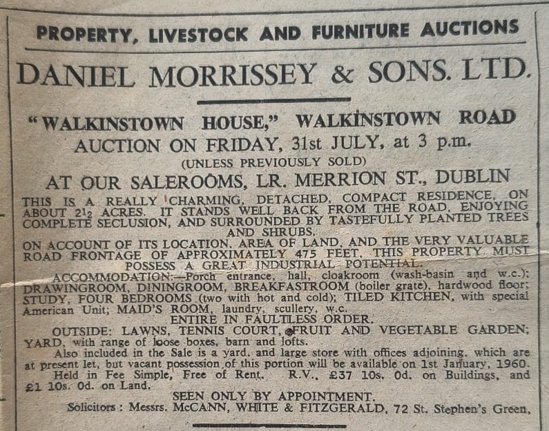
Sale of Walkinstown House.
Notice
in Irish Times, 17 July 1959.
See larger.
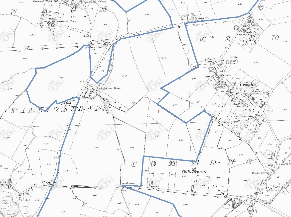
Overlay of
1887 to 1913 map
and
modern map.
Site of the main house (red cross) is buried under the supermarket.
The shape of the paddock to the NE
matches the shape of the NE supermarket car park.
SuperValu supermarket, E side of Walkinstown Rd (site of Walkinstown House).
Click to toggle map/satellite view.
Click to zoom in/out.
Drag to move.
From
Google Maps.
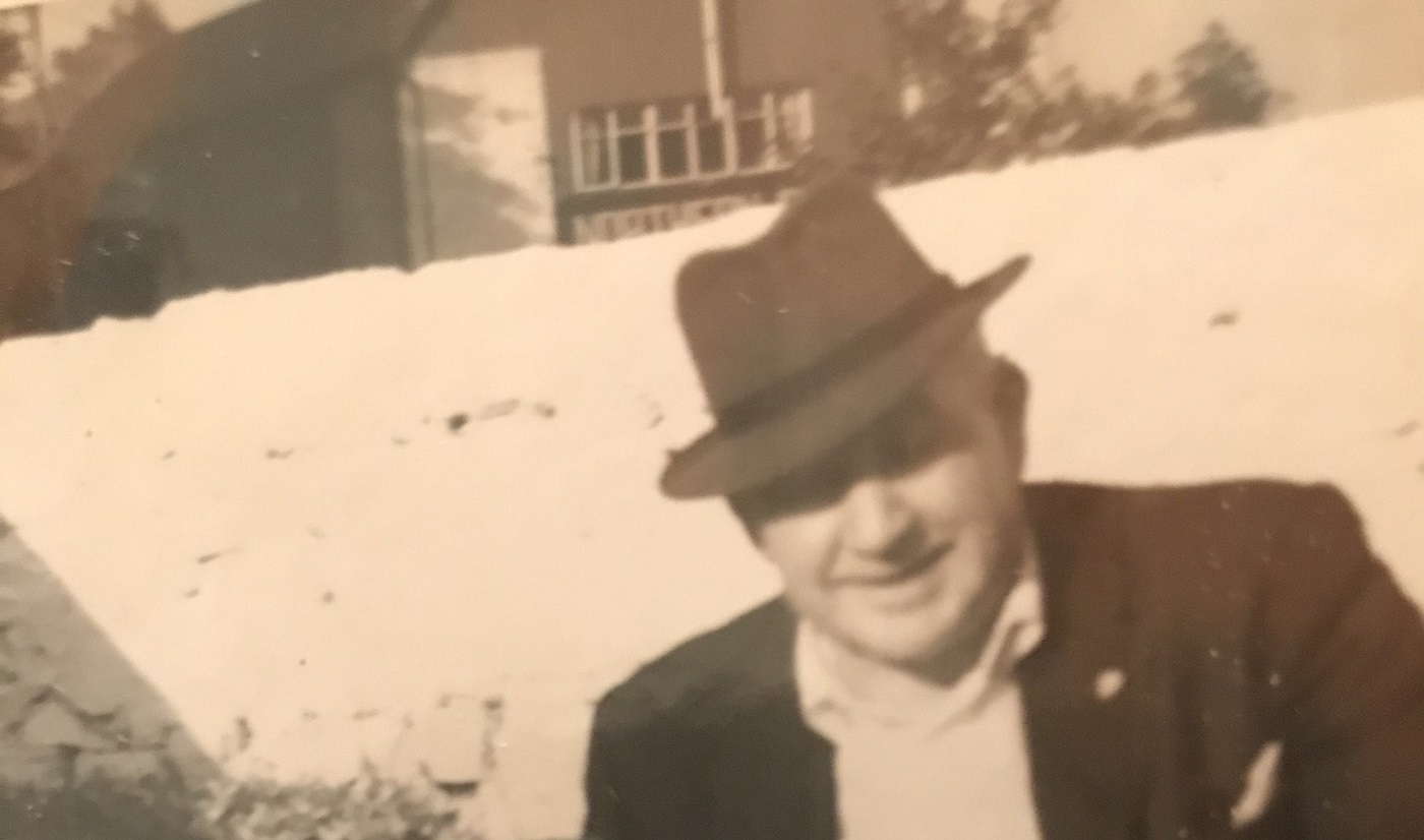
Photo 1964 at the E wall of the Norton farm.
Looking across the road to the hay shed of Walkinstown House.
Courtesy of James E. Norton.
See full size.
Please donate to support this site.
I have spent a great deal of time and money on this research.
Research involves travel and many expenses.
Some research "things to do"
are not done for years, because I do not have the money to do them.
Please Donate Here
to support the ongoing research and
to keep this website free.
