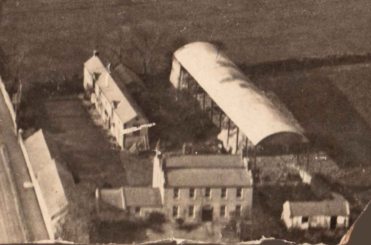
Leicester House is identifiable as
plot 1 in Crumlin in Griffiths Valuation, 1850.
81 acres plus a mid-sized house.
Occupied by William Graham,
renting from "Reps. of J. Smith".
The map linked to Griffiths Valuation, 1850,
is marked "Leicester House".
Assuming this map is around 1850, then "Leinster house" in Thom's 1858 to 1860
must be just a mistake.
(Since it is "Leicester House" before and after.)
Can't see Leicester House under
Crumlin in
[Thom's, 1850, pp.840-841].
Can't see Leicester House under
Crumlin in
[Thom's, 1851, p.909].
Can't see Leicester House under
Crumlin in
[Thom's, 1852, pp.911-912].
Can't see Leicester House under
Crumlin in
[Thom's, 1856, pp.1094-1095].
[Thom's, 1857]
has no Dublin directory.
Michael Cavanagh is
listed at "Leicester house" under Crumlin in
[Thom's] 1861 to 1881.
See him listed under
Crumlin in
[Thom's, 1868, p.1559].
See him listed under
Crumlin
in
[Thom's, 1877, p.1503].
Cavanagh still there in
[Thom's, 1881].
The Alderman then installed his son in it.
Larry Flanagan
is listed at Leicester House in
[Thom's] from 1896 to 1926.
Larry is listed
in 1901 census at
Leicester House.
He is "farmer".
He owns the land on which he lives.
Leicester House has 6 rooms,
10 windows in front of house.
There are 5 out-buildings
(consisting of 1 stable, 1 coach house, 1 harness room,
1 cow house and 1 piggery).
Larry is listed
in 1911 census at
Leicester House.
He is "market gardener".
He owns the land on which he lives.
Leicester House has 11 rooms,
10 windows in front of house.
There are a total of 21 out-offices and farm buildings
(consisting of 14 stables, 1 coach house, 1 harness room,
1 cow house, 1 piggery, 1 barn, 1 potato house and 1 shed).
Larry died there in 1925.
Michael Flanagan
is listed at Leicester House in
[Thom's] from 1927 to 1932.
Leicester House
was auctioned early 1931 (when the Alderman was still alive).
Liam Cosgrave
thinks Larry possibly did not own Leicester House
- that the Alderman stayed the owner of it.
Our Lady's Children's Hospital, Crumlin, was built to the E of Leicester House in 1949-1956:
Joseph Noonan (the younger) is listed at
Leicester House, 14-18 Drimnagh road,
in [Thom's, 1951, p.1330 and p.1821].
"J. Noonan" is listed at
Leicester House, 14-18 Drimnagh road,
in [Thom's, 1953, p. 1342].
Joseph moved to 117 Cromwellsfort Road, Walkinstown.
He called his house there "Leicester House".


Leicester House, Crumlin,
on
1829 to 1842 map.

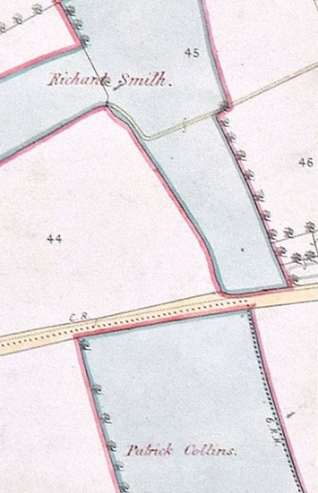
Leicester House, Crumlin (plot 1) on
Griffiths Valuation map at
askaboutireland.ie.
Note
Drimnagh Castle to W
and
Collins property to SE.
See also
[VO] Griffiths Valuation maps, Dublin county,
map 18.

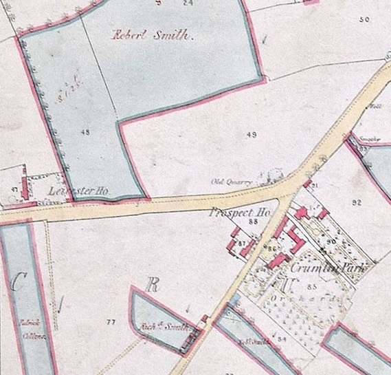
Leicester House, Crumlin.
Close-up of above.
Note
Collins property
across the road to the S.
|
|

Leicester House, Crumlin,
on
1887 to 1913 map.
Note the stables are not yet built.
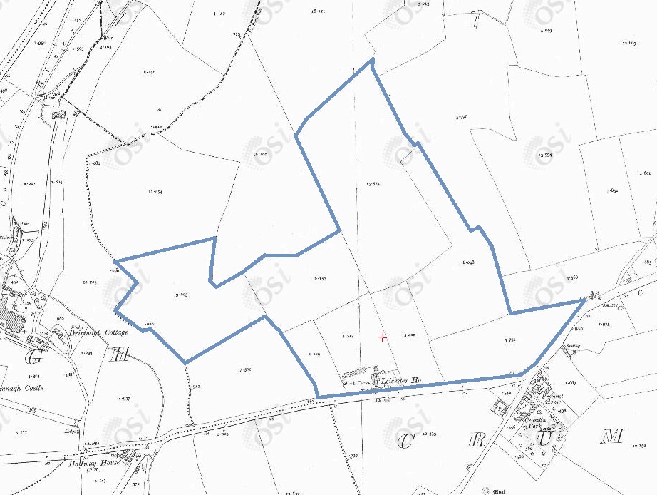
The estate of
Leicester House,
on
1887 to 1913 map.
According to
[Hannan].
[Deed, 1885]
and the sale notice of 1931
both show 84 acres attached to the house.
The sale notice of 1931
says these are in 8 fields (which matches the above).
See also
other Flanagan lands across the road to the south.
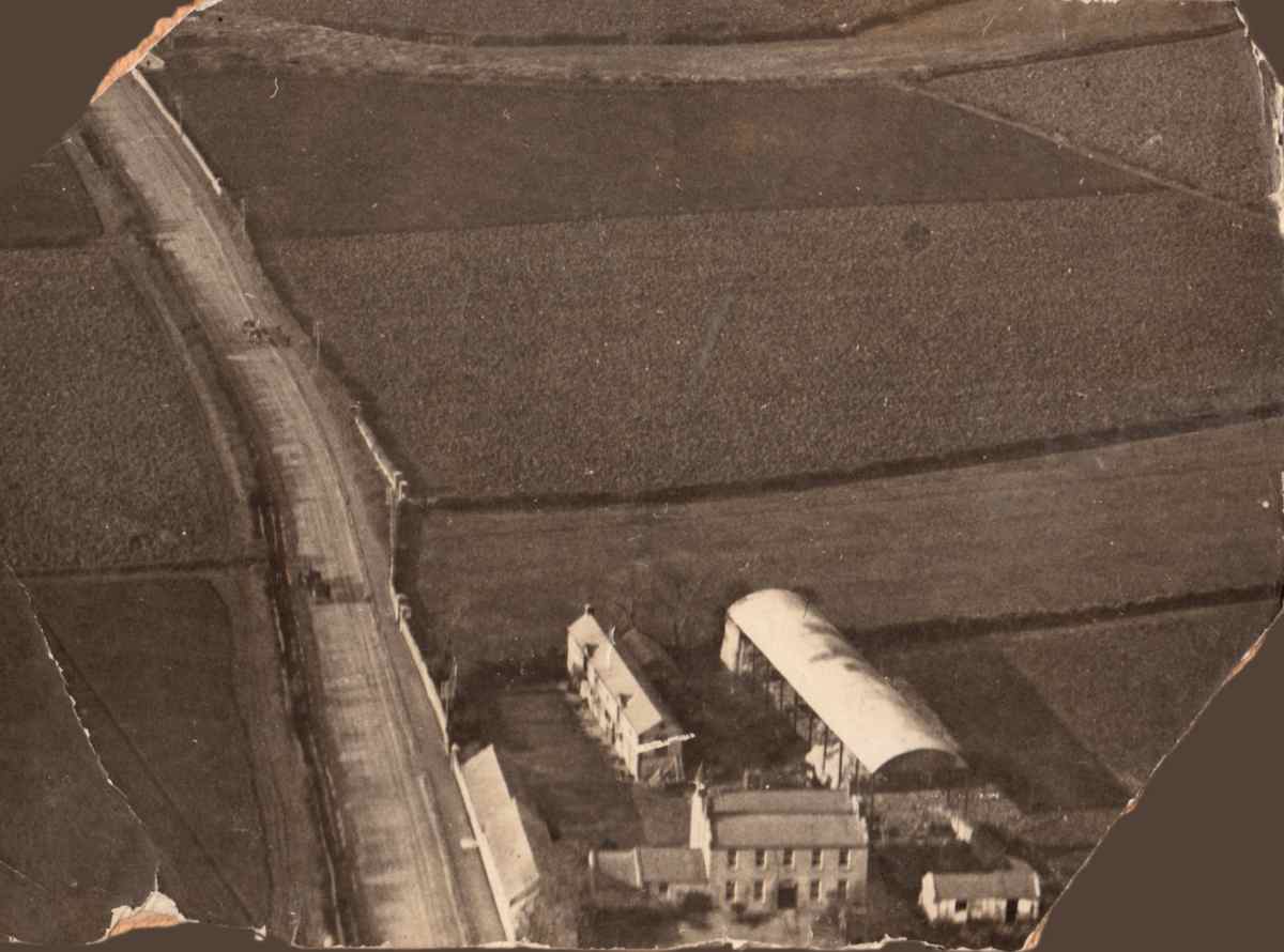
Wider shot of above aerial view from E, looking W.
This photo is clearly before the housing estate was built on these fields.
The housing estate is shown in the
map of c.1937 in
[Watchorn, 1985, pp.84-85].
So this is maybe 1920s.
Original owned by Wendy Reynolds.
See full size.
Undated. Nothing written on back.
Note this photo was posted to a
Crumlin group
without credit.
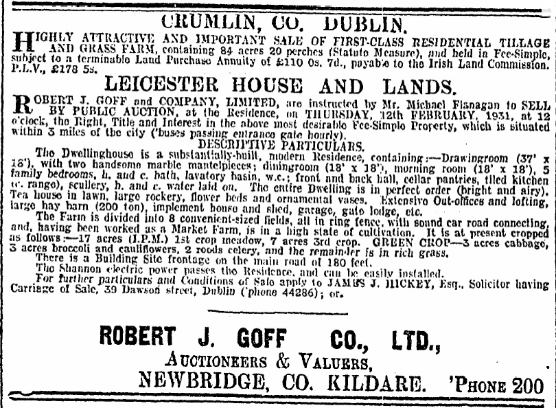
Leicester House for sale,
Irish Times,
January 31, 1931,
p.16.
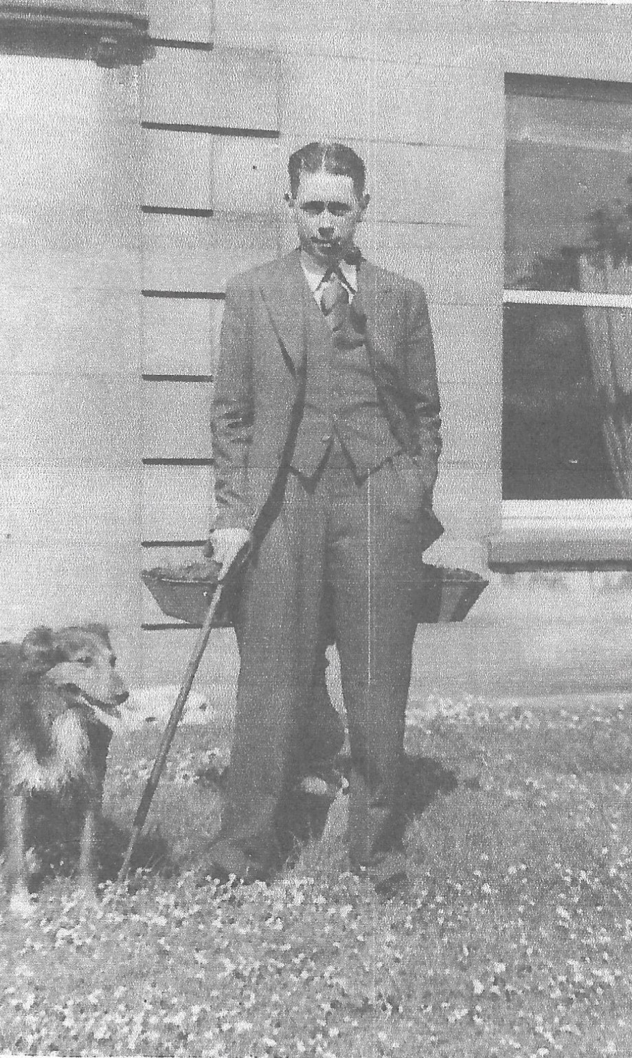
Joseph Noonan the younger, at Leicester House.
This is the front LHS corner.
Would be 1930s.
See full size.
Photo courtesy of Neil Noonan.
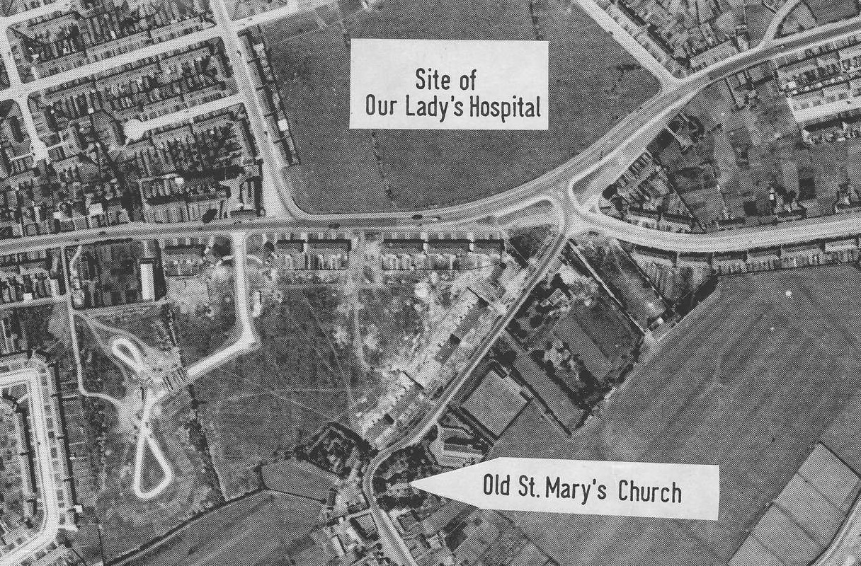
Aerial photo of Crumlin, 1940s.
There has been considerable housing development.
Leicester House is
visible at the junction of Drimnagh Road and Errigal Road.
To W side of site of future
Children's Hospital.
Building of the hospital started 1949 so this photo is before 1949.
From p.33 of Crumlin Heritage Audit Report.
See full size.

Leicester House.
Front side. Looking W.
After some housing development.
The road to the bottom is Errigal Rd.
The road to LHS is the Drimnagh Road.
Note the barn and the stables and the buildings at roadside.
Courtesy of
Crumlin & Walkinstown History Group.
See full size
and original.
See modern 3D view.

Leicester House.
Rear side. Looking E.
After some housing development.
The road to the top is Errigal Rd.
The road to RHS is the Drimnagh Road.
Note the barn and the stables and the buildings at roadside.
Courtesy of
Crumlin & Walkinstown History Group.
See full size
and original.
See modern 3D view.
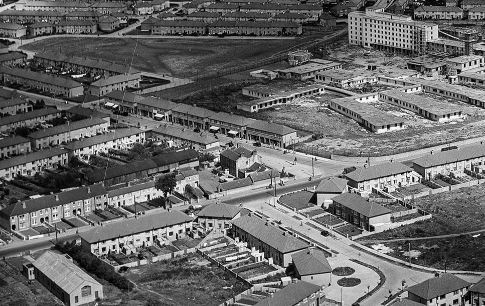
Leicester House, 1952.
View from S.
During the period when the Children's Hospital was being built (1949-1956).
Note the barn and the stables and the buildings at roadside.
From
The Old Drone: Norman Ashe Aerial Photographic Collection.
Norman Ashe photos are 1952-1954.
Also posted on Flickr by
"snapshotcass".
See full size.

Aerial photo of Crumlin, 1952.
View from E.
Leicester House is at the junction in centre.
Note the barn and the stables and the buildings at roadside.
From
The Old Drone: Norman Ashe Aerial Photographic Collection.
See full size.
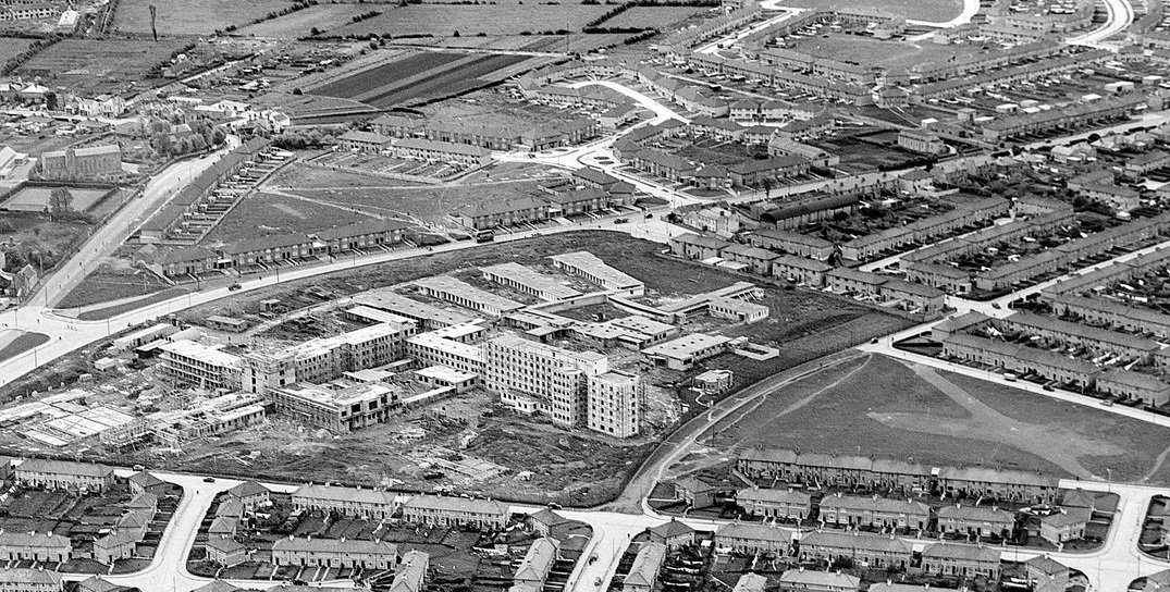
Aerial photo of Crumlin, 1952.
View from NE.
Leicester House is at the junction in centre.
Note the barn and the stables and the buildings at roadside.
From
The Old Drone: Norman Ashe Aerial Photographic Collection.
See full size.
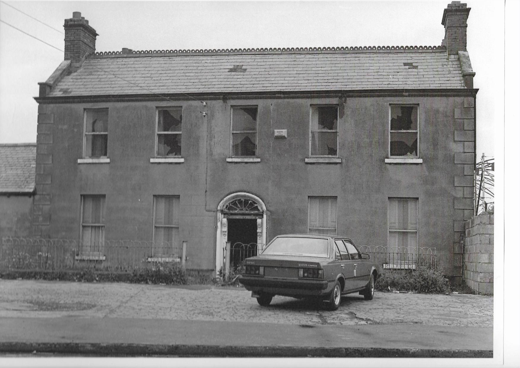
Leicester House, front.
Not long before demolition.
(The Toyota Carina diesel
dates this picture after 1982.)
Courtesy of
Crumlin & Walkinstown History Group.
See full size.
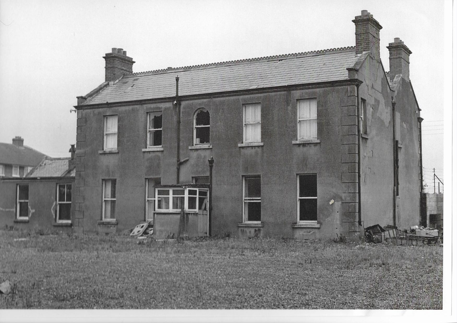
Leicester House, rear.
Not long before demolition.
Courtesy of
Crumlin & Walkinstown History Group.
See full size.
Please donate to support this site.
I have spent a great deal of time and money on this research.
Research involves travel and many expenses.
Some research "things to do"
are not done for years, because I do not have the money to do them.
Please Donate Here
to support the ongoing research and
to keep this website free.