Darby Donovan
is renting 58 acres at Gourbane in 1747.
Thomas Donovan
is farming at Gourbane in 1770.
See several properties
listed
at "Gourbane",
Kilmoylan par,
in
[Tithe Survey, 1833].
The families listed are Copps and Guiney
and Walsh.
They are renting from
Thomas Spring Rice, later 1st Baron Monteagle
(cr Baron in 1839).
The Mangan house at Gourbane did not exist in 1841
(according to OSI map).
Denis Mangan
married 1828 to Ellen Nolan
(descendant of Donovan).
They
moved to Gourbane
between 1845 and 1848.
Their daughter
Ellen Mangan
(bapt 1835)
lived here from then until she married in 1868.
Denis Mangan died here 1882.
John Mangan
inherited Gourbane.
Sighle Humphreys
remembered Gourbane as having "lovely flowers"
and a box hedge.
Denis Mangan
inherited Gourbane,
and sold it 1935.
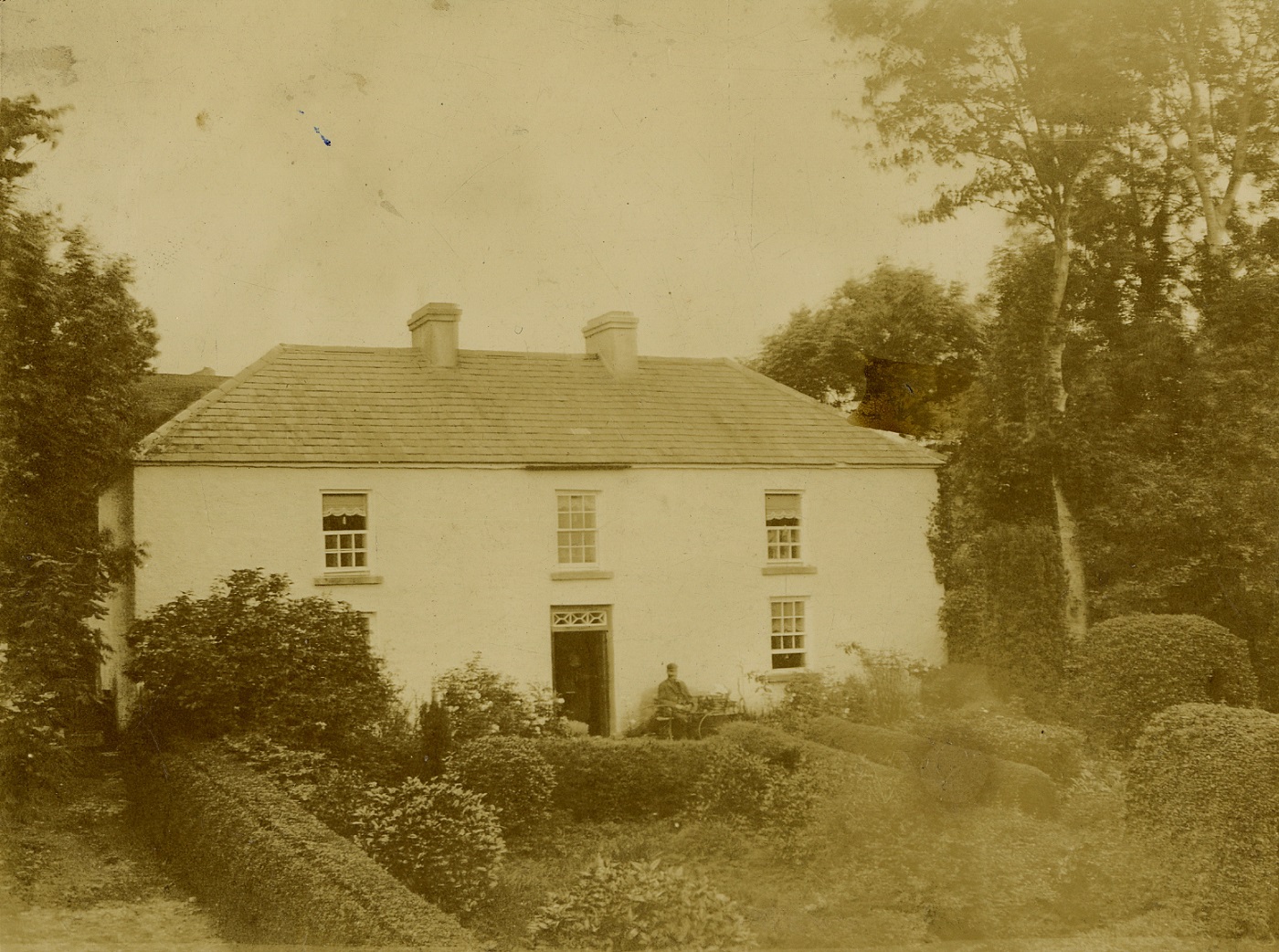
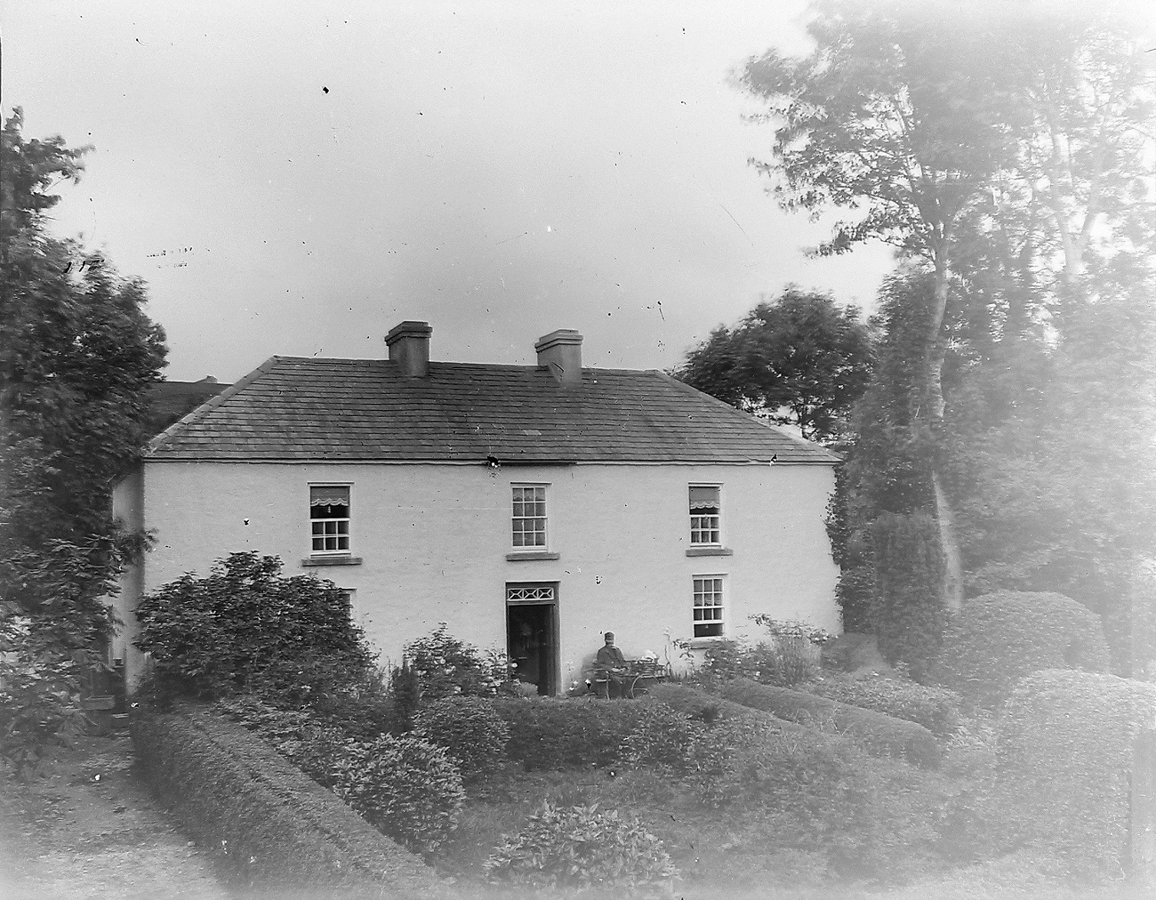
Gourbane.
From original glass negative of the above.
See larger
and full size.
Image 5694 in
Humphrys glass negatives.
Light-adjusted.
See original.
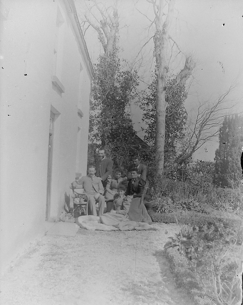
The front of Gourbane.
Sara Mangan
confirm this is Gourbane.
Note the fanlight
over the door is the same.
Looks like John Mangan
standing back LHS
and his wife to RHS.
John and his wife married 1892.
John's mother died 1893.
John's child born 1894.
Photo probably 1893-94.
See larger
and full size.
Image 6256 in
Humphrys glass negatives.
Flipped L-R.
Light-adjusted.
See original.
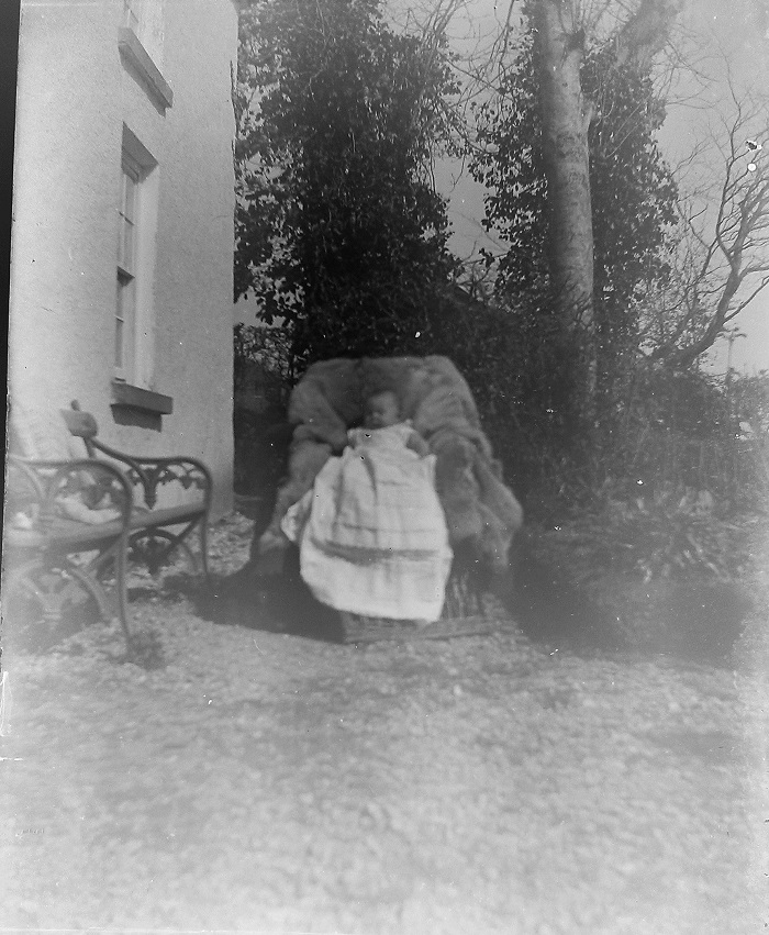
Another photo at the same spot.
Sara Mangan
confirm this is Gourbane.
The baby (since there is only one) is probably
Denis Mangan
(born 1894).
Photo probably 1894.
See larger
and full size.
Image 6410 in
Humphrys glass negatives.
Light-adjusted.
See original.

"Gourbane Quarter" (12)
in
"Lower Shannitt" (Lower Shanid)
on
[Map of Mount Trenchard estate, 1770].
Gourbane is held in 1770 by "Thomas Donovan", "arable & good dairy pasture".
N is to the right (note location of Shanagolden).

Site of Gourbane on
1829 to 1842 map,
showing no house there yet.
House location is red cross.
Map is 1841.

Denis Mangan
is listed as holding plot 3 in
[Griffiths Valuation, 1852].
The text shows that the house is in fact built (the map is slightly out of date).
The house location is around the "a".
See wider shot.

Gourbane on
1887 to 1913 map.

Gourbane on
modern map.
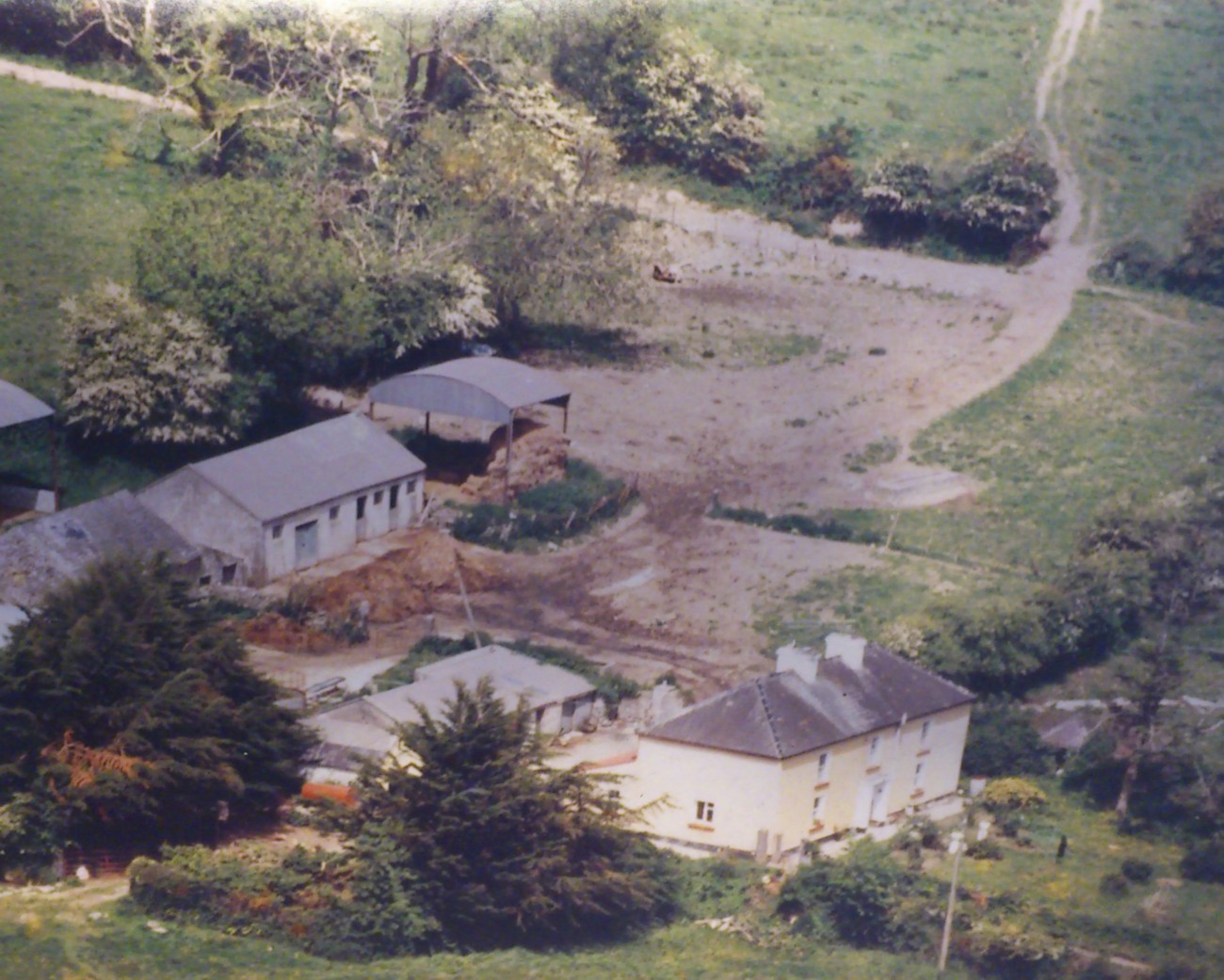
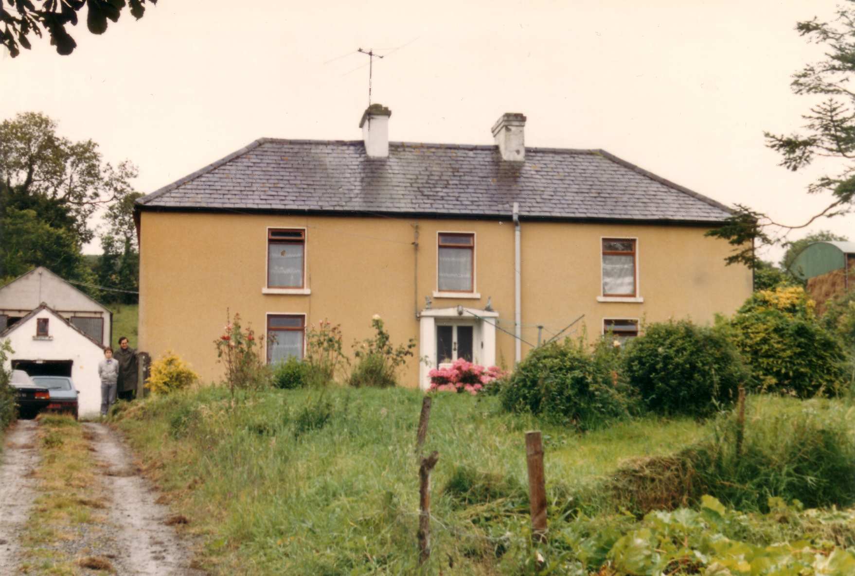
Gourbane.
Photo 1985.
See larger
and full size.
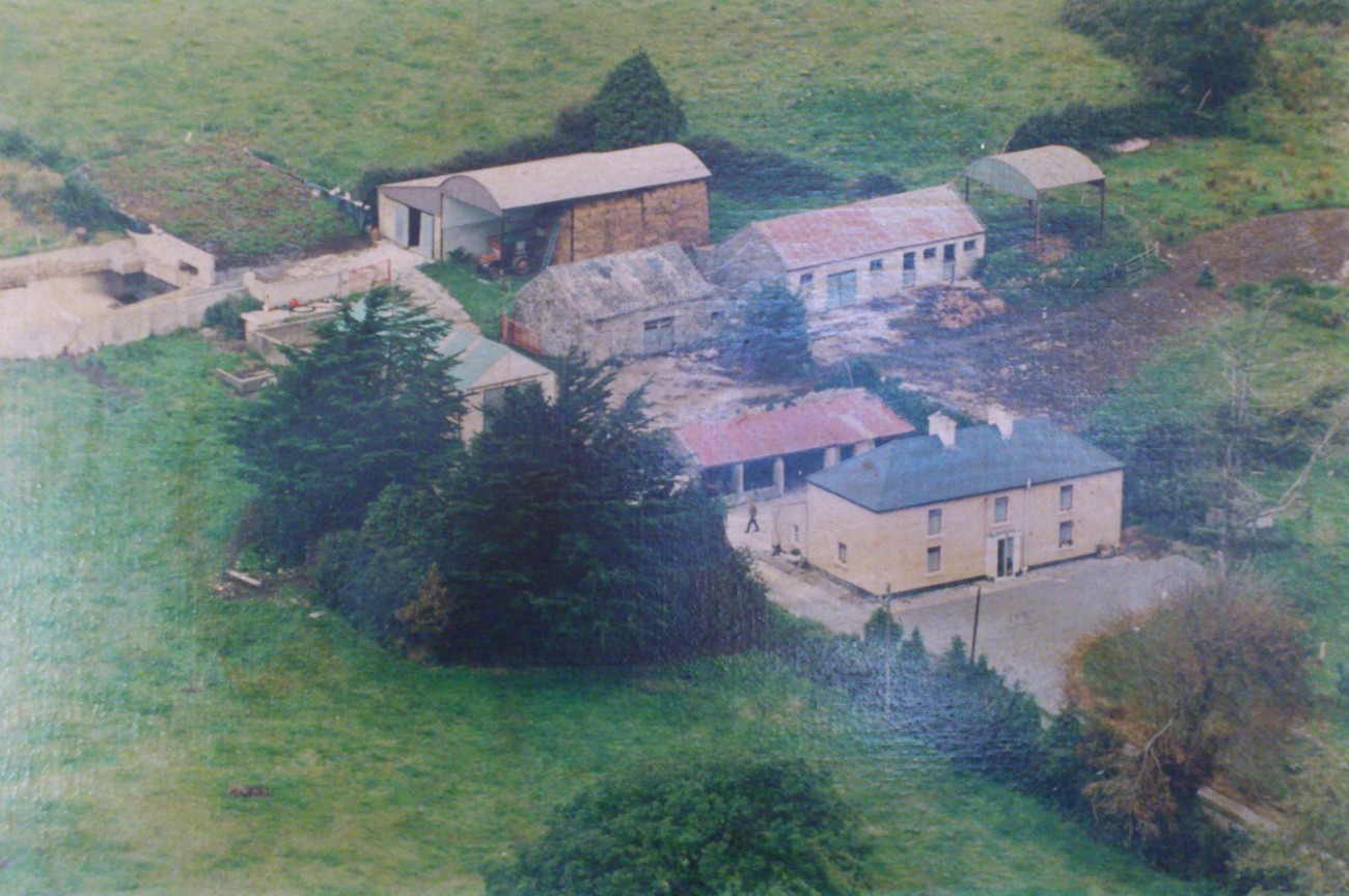
Gourbane, aerial shot, 1990.
See full size.
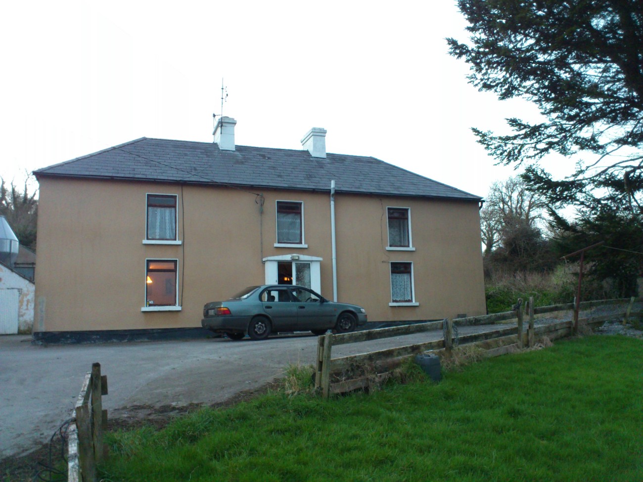
Gourbane. Photo 2013.
See full size
and other shot.
Please donate to support this site.
I have spent a great deal of time and money on this research.
Research involves travel and many expenses.
Some research "things to do"
are not done for years, because I do not have the money to do them.
Please Donate Here
to support the ongoing research and
to keep this website free.