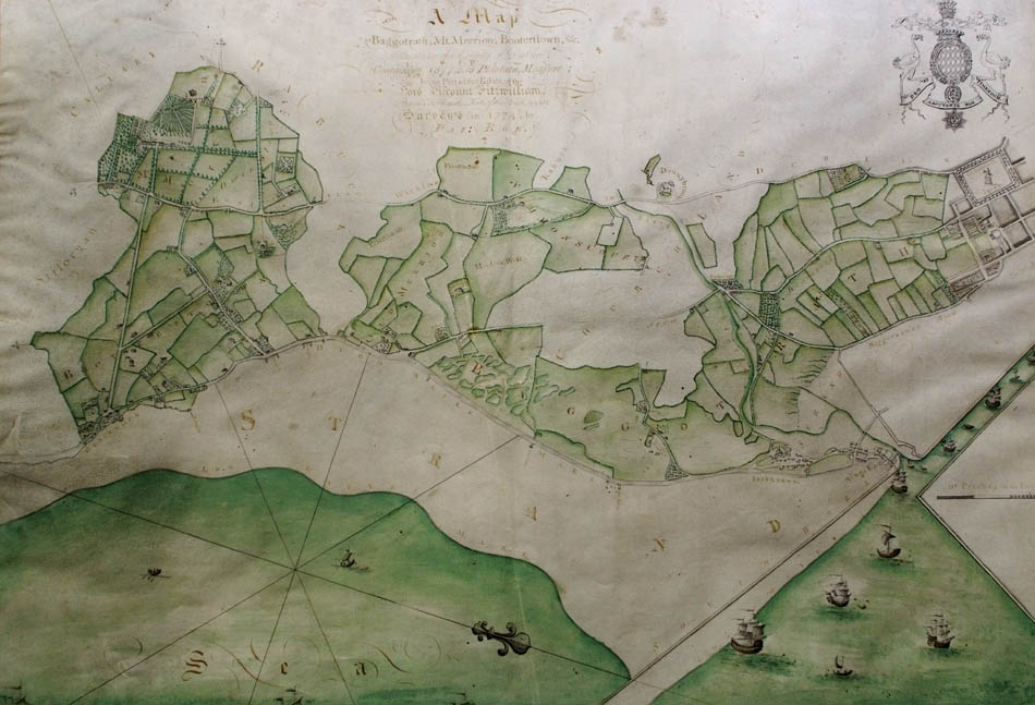
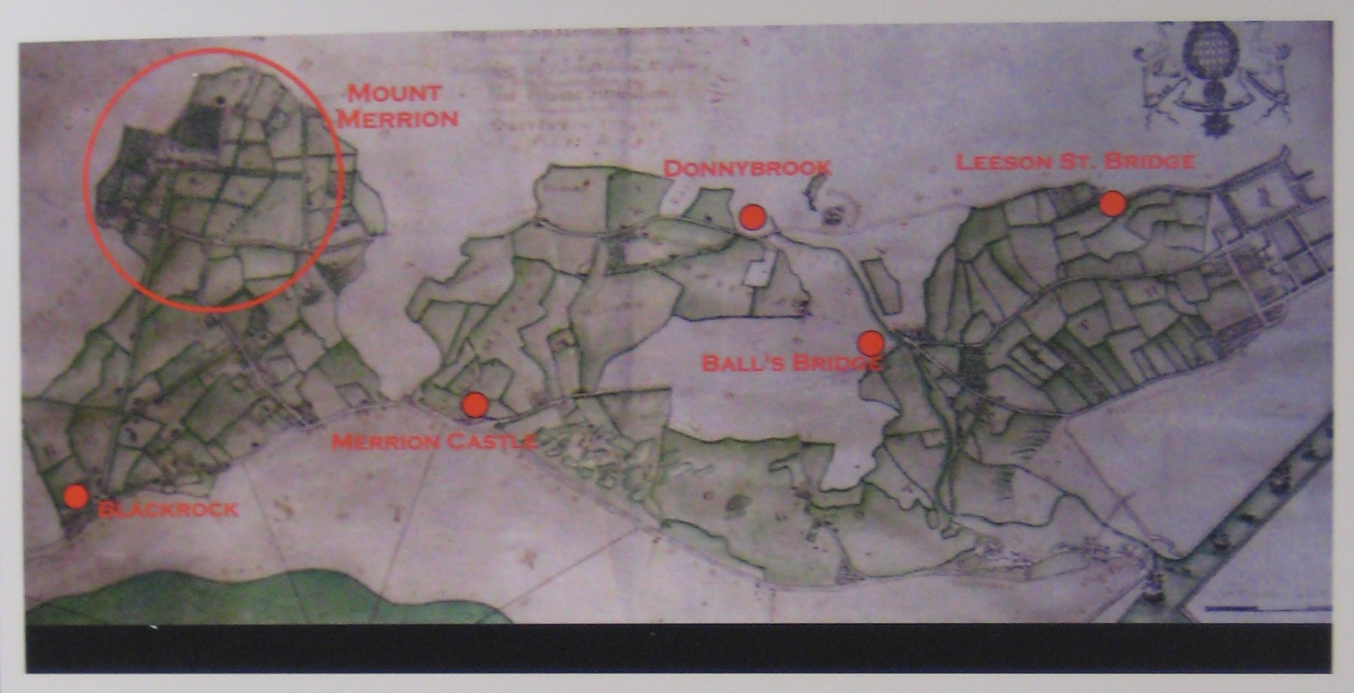
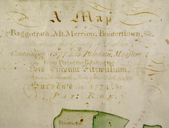
Pat Roe's map of the Fitzwilliam estate, 1774.
Orientation is strange. The sea is to the bottom.
Shows lands of Mount Merrion, Booterstown, Merrion, Simmonscourt, Baggotrath.
Most of South Dublin from Blackrock to St.Stephen's Green.
See marked locations.
See map title.
From Mount Merrion 300.
Used with permission.
Original in [Pembroke estate papers].
The Fitzwilliam estate
The vast estates of the
Fitzwilliam family
began accumulating
on the South side of Dublin city
in the mid-1300s.
Over the centuries they accumulated the lands, among others, of:
It was the
6th Viscount Fitzwilliam (succ 1743)
who began the massive development of the area, starting in the 1750s,
which soon turned it into Dublin's (indeed Ireland's) most desirable area.
This was continued by the
7th Viscount Fitzwilliam.
The Pembroke estate
The 7th Viscount Fitzwilliam left the vast Fitzwilliam estate
to his relative the
11th Earl of Pembroke
in 1816.
It thereafter became
known as the "Pembroke" Estate.
The Earls of Pembroke continued the development of the area.
The estate still exists in some form, though much reduced in size.
See the current Earl of Pembroke.
These vast estates extended through SE Co.Dublin
from Merrion Square in town
along the coast through Merrion out to Blackrock,
inland through Mount Merrion to Dundrum
and beyond to the Dublin mountains.
It was the largest family-owned estate in County Dublin,
and an absolute goldmine as the city exploded southwards from the late 18th century onwards.
Indeed cumulatively it was probably the most valuable estate in Ireland,
and is still the premium location in Dublin today.
Given that the
total value of all real estate in Ireland
today
is over
€ 1 trillion,
the value of all property on the Pembroke estate today
would be well over € 10 billion.
This whole area is also famous as Dublin 4,
denoting the address
(or commonly just used as shorthand for the mindset)
of Ireland's liberal intelligensia.
And Dublin 2, the premium office area in the city,
is much of the land inside the Canal, around the two Fitzwilliam squares.
A house called "Cherbury" on Booterstown Ave.
It is called "Herbert House" on
1829 to 1842 map.
Called "Cherbury" on
1887 to 1913 map.
Demolished 1977.
See [Pearson, 1998]
and
[Lyng, 2000].
The house was at the site of the present
Cherbury Mews
(see map).
Also here are Cherbury Court and Cherbury Gardens.
The Pembroke Estate of Dublin city covered much of the area above on modern map.
Click to toggle map/satellite view.
Click to zoom in/out.
Drag to move.
From
Google Maps.
See close-ups of
Merrion Square
and
Fitzwilliam Square
and
Herbert Park.
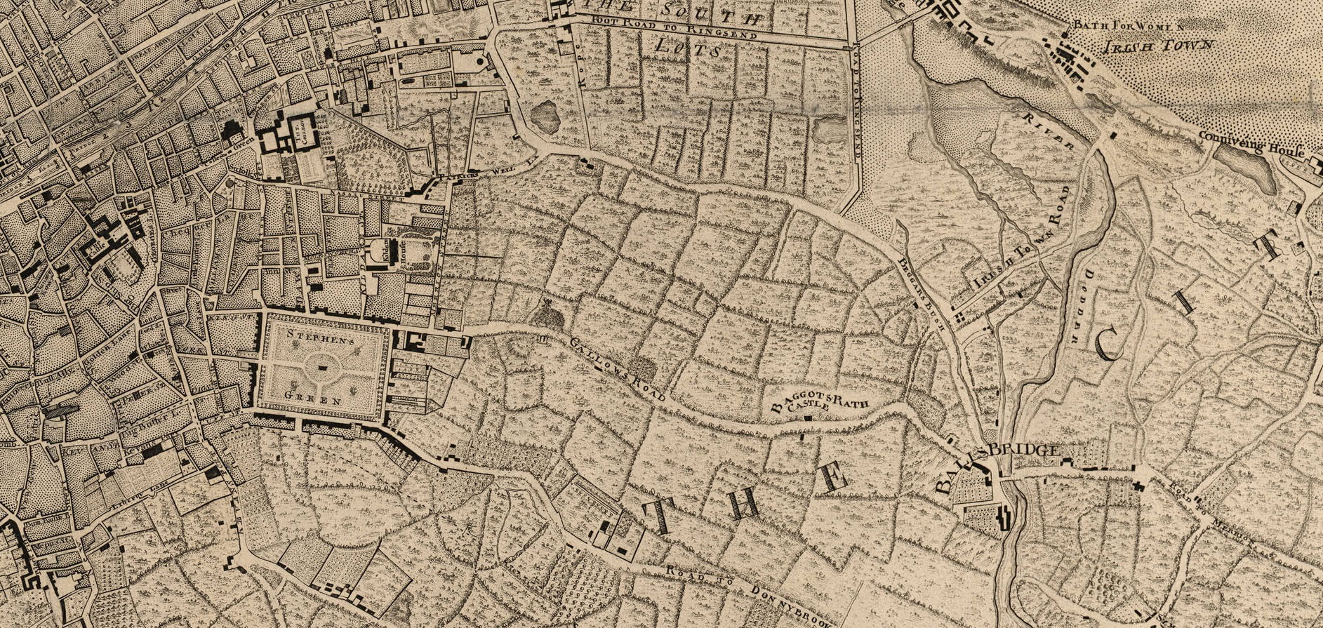
The city end of Pat Roe's 1774 map of the Fitzwilliam estate.
Rotated so N is up. Stephen's Green visible on left.
Compare with modern map
of Dublin.
Shows that the Fitzwilliam lands of Baggotrath were the entire area between
Grand Canal St / Shelbourne Rd (top) and Leeson St / Donnybrook road (bottom).
The road in the middle is Baggot St / Pembroke Rd.
Mount St / Northumberland Rd does not yet exist.
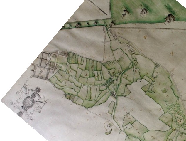
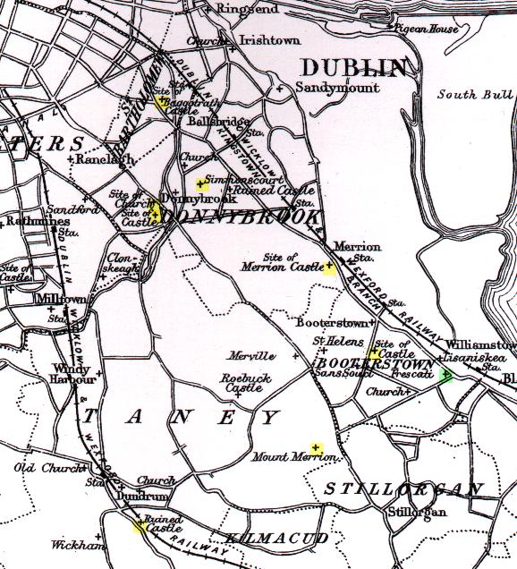
The Fitzwilliam territory of SE Dublin.
From [Ball, vol.2, 1903].
This is rather inaccurate: Baggotrath
should be a good bit nearer to the Canal. Dundrum Castle
should be on the opposite side of the road.
And Frescati
should be on the opposite side of Mt Merrion Ave.
"I can understand that the consortium of belted earls
and their ladies and left-wing intellectuals
who can afford the time to stand and contemplate in ecstasy
the unparalleled man-made beauty of the two corners of Hume Street
and St. Stephen's Green
may well feel that the amateurish efforts of Mother Nature
in the Wicklow Mountains are unworthy of their attention."
- Kevin Boland,
Minister for Local Government,
defending the destruction of many of the buildings of Georgian Dublin, 1970.
Also expressing an official line of dislike of much of Ireland's
actual surviving architecture,
and a harking back to rural nature
and a perhaps imaginary Celtic past.
The worst vandalism on Georgian SE Dublin
was when the ESB
demolished half a block of houses along the vista from
Fitzwilliam Place to Holles St Hospital in 1965.
Neil Blaney,
Minister for Local Government,
pushed through the destruction against protest.
The 16th Earl of Pembroke,
who had just sold the freehold in 1964,
had wanted to save the houses,
and afterwards he donated half of the proceeds of the sale to the
Irish Georgian Society.
Despite this destruction, the area is remarkably intact today.
The ESB somewhat made up for their sins by restoring a Georgian house,
29 Lower Fitzwilliam Street,
which was open to the public.
However, this has since closed.
The ugly 1960s
ESB building
was itself replaced, but by another ugly modern building.
An even worse vandalism was narrowly averted:
In 1930
the Catholic church purchased Merrion Square
from the Pembroke Estate
and planned to build a cathedral
on the site.
But luckily this plan was eventually scrapped.
There is a Pembroke pew
in St. Stephen's Church
(the "Pepper Pot church", or the "Pepper canister",
built 1821)
on
Mount Street Crescent, Dublin.
Donation Drive
Please donate to support this site.
I have spent a great deal of time and money on this research.
Research involves travel and many expenses.
Some research "things to do"
are not done for years, because I do not have the money to do them.
Please Donate Here
to support the ongoing research and
to keep this website free.
